Photo Credits (5)
About Myrtle Falls
Myrtle Falls is a small, lesser-known cascade in the northern Minnesota / Ontario border region near the towns of Soudan, Tower and Ely (coordinates: 48.4118, -92.1873). It appears to be a modest, forested waterfall on a small stream or tributary rather than a large, developed park site. Visitor information is sparse; details below are conservative and include notes where information could not be independently verified.
Why This Waterfall Exists
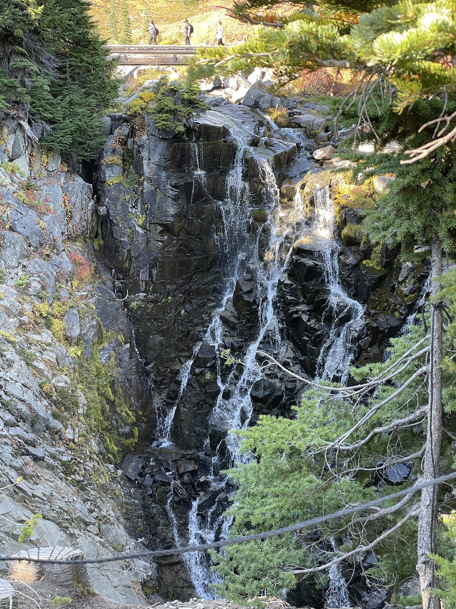
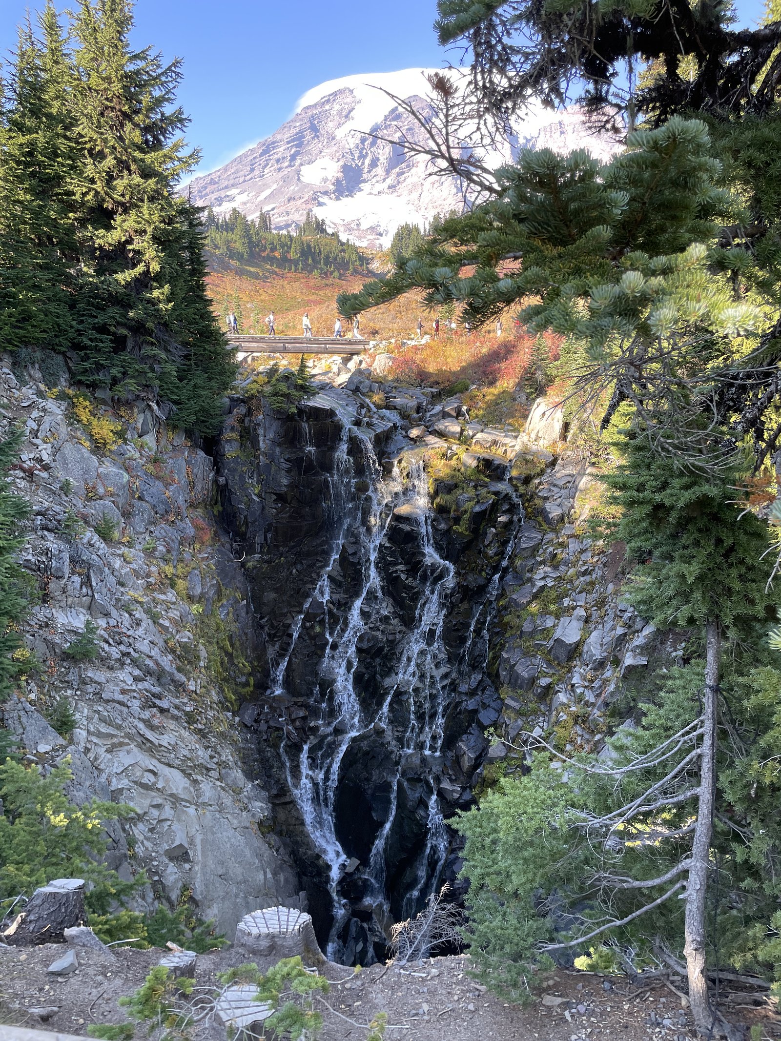
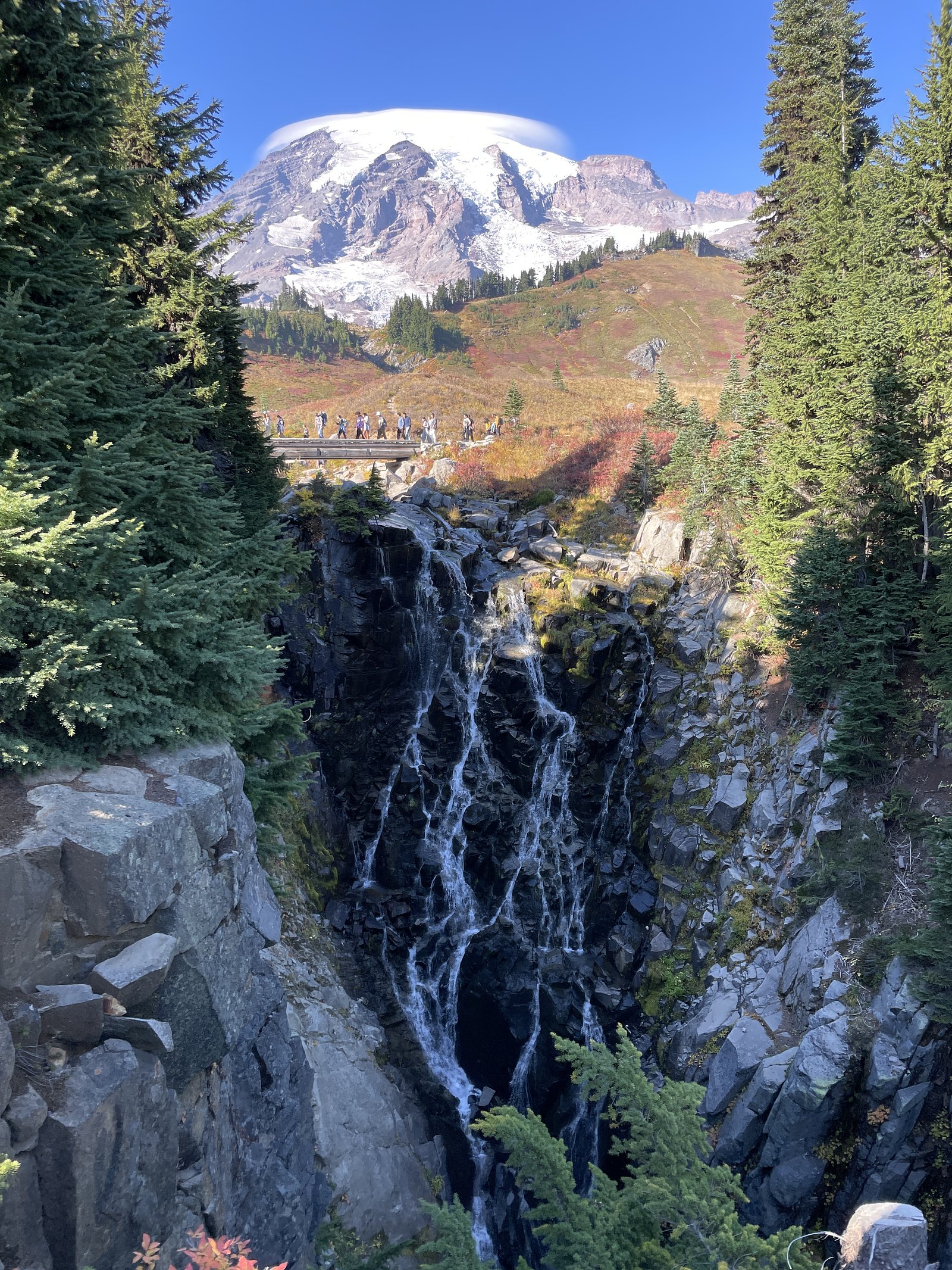
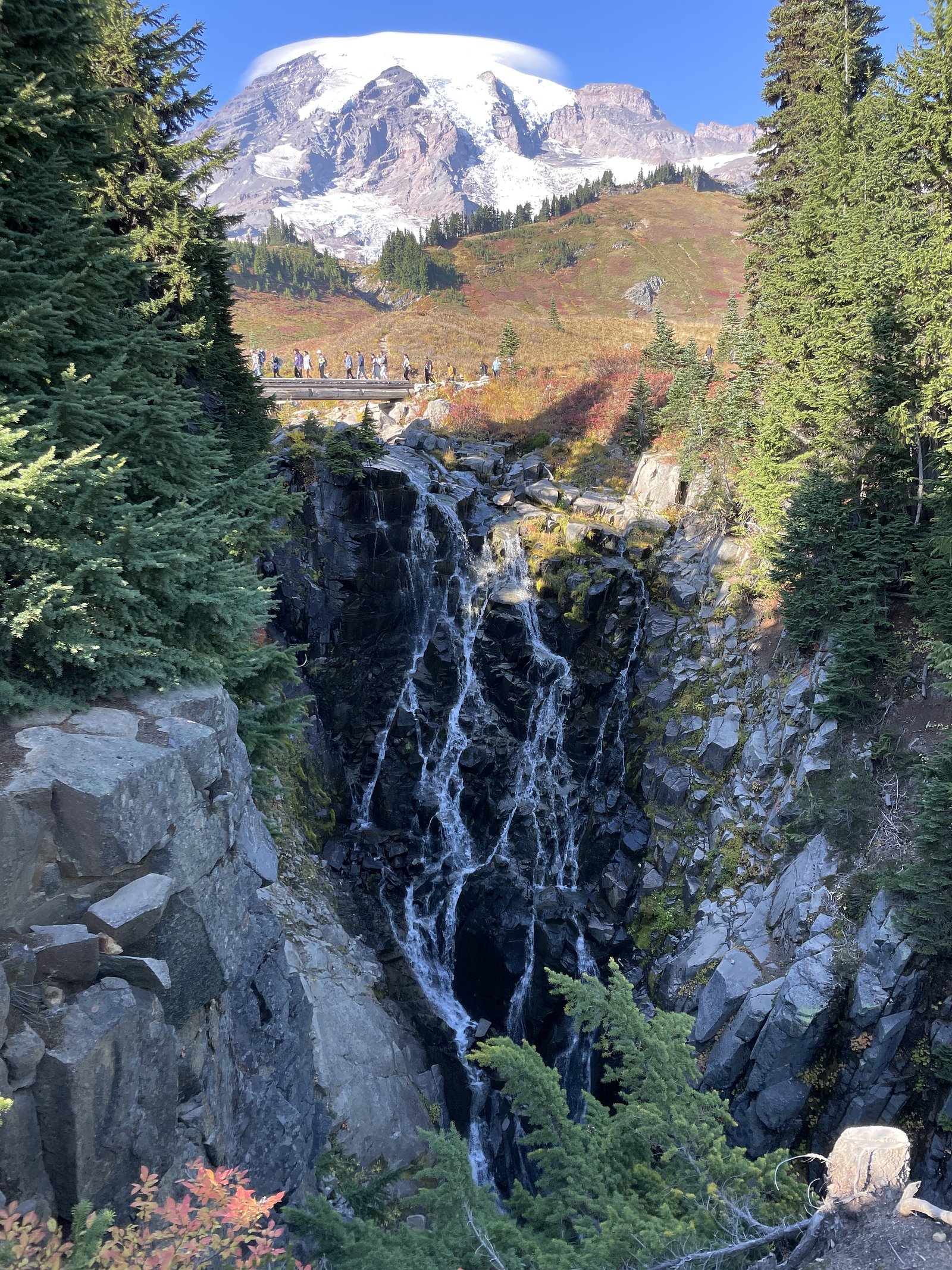
Myrtle Falls flows over hard metamorphic rock, primarily marble and iron formation, laid down over 2.5-3.2 billion years ago. The softer siltstone and mudstone erodes faster than the resistant marble and iron formation, creating a ledge that the water plunges over.
Trail & Hike Details
Trail Description
There is no widely published, maintained trail description for Myrtle Falls at the given coordinates. Access appears to be via informal paths or short scrambles from a nearby road or pullout. Expect uneven forest floor, roots, possible wet or boggy sections, and short steep approaches to the stream bank. If a small footpath exists, it may be user-created and minimally maintained.
What to Expect
A small forested cascade on a narrow stream. Flow is likely seasonal, higher during spring snowmelt and after heavy rains, lower in late summer. The setting is typical northern boreal/mixed forest (spruce, fir, birch, aspen). There may be slippery rocks, moss, and steep banks near the water; no formal viewing platforms, railings, or facilities are expected. Cell service may be intermittent in this region.
Accessibility
Accessibility is likely limited. Expect uneven, unmaintained terrain and short steep approaches to water, probably not wheelchair or stroller accessible.
Frequently Asked Questions
🐶 Are Dogs Allowed at Myrtle Falls?
❌ Dogs are not allowed
Are There Any Fees or Permits Required?
🆖 No fees required
🏊 Is There Swimming at Myrtle Falls?
❌ Swimming is not allowed
When to Visit
Spring (late March–May) for highest water flow after snowmelt; early summer for greener forest and fewer mosquitoes if conditions allow; fall for fall foliage. Winter can produce ice features but access is more hazardous and may require snowshoes or skis.
Seasonal Access
The best time to visit is Spring, Summer, and Fall. Winter access may be limited. Check with the managing park or local authority for current conditions.
Safety Information
Hazards include slippery rocks, steep or unstable banks, seasonal high flows, cold water, hypothermia risk, poor cell coverage, and potentially rough or gated access roads. Use caution around edges, avoid climbing on wet rocks, and do not attempt to swim if you are unsure of conditions. Check local road conditions and weather forecasts before visiting.
Current Water Conditions
89.8 m³/s
Current discharge — how much water is flowing
Lower than usual for this time of year
Based on 103 years of record
360.89 m
Water depth at gauge
7-Day Discharge Trend
What does this mean for your visit?
Flow is lower than usual for this time of year.
About This Gauge
7-Day Flow Outlook
Based on the WSC gauge NAMAKAN RIVER AT OUTLET OF LAC LA CROIX (3 km away).
Today
Low
90 m³/s
5/10Tomorrow
Low
95 m³/s
4/10Tue
Moderate
97 m³/s
5/10Wed
Low
89 m³/s
5/10Thu
Low
93 m³/s
4/10Fri
Low
88 m³/s
5/10Sat
Low
82 m³/s
5/10Best window: Today — low flow, cloudy (trip score 5/10).
Best time of year: this gauge typically runs highest from early May to early August, peaking in May.
How we calculate this
This is a transparent outlook, not a precise forecast. We take the waterfall's current flow strength (how it ranks against its historical normal for today, from the nearest WSC stream gauge), carry that ranking forward along the gauge's seasonal curve, and nudge it for forecast rain. Confidence is highest for the next day or two and falls further out. Always check official conditions and your own judgment before visiting — high flows can be dangerous.
Know when to go.
Get a free email alert when waterfalls near Atikokan hit peak flow. We only send when conditions are worth the trip — no weekly newsletters, no spam.
Weather Forecast
Location & Access
Getting There
General approach: use local county or forest roads from Soudan, Tower or Ely toward the coordinates (48.4118, -92.1873). Expect narrow gravel or forest roads. There does not appear to be a formally developed trailhead or visitor center specifically for this waterfall. Visitors should consult local forest service maps or a GPS app and confirm landownership before parking on or crossing private roads.
Get Directions on Google MapsParking
Likely limited to a roadside pullout or informal parking; no formal lot or facilities are known. Park off the roadway well clear of traffic and be respectful of private driveways or posted gates. Information on nearby official parking was not available and may vary by exact access route.
Elevation
355 metres above sea level
Coordinates
48.411757° N, -92.187255° W
Visitor Tips & Gear
• Verify access and landownership before visiting; some roads may cross private land or gated forest roads. • Wear sturdy, waterproof boots and bring insect repellent (mosquitoes/black flies common in spring/summer). • Stay off wet rocks and avoid getting close to the lip or edge, banks can be unstable. • Leave no trace: pack out trash and avoid disturbing vegetation or stream banks. • Check local ranger district or county resources for road conditions, unpaved roads can be impassable after heavy rain or during spring thaw.
Where to Stay
Browse vacation cabins and private rentals nearby
Unique outdoor stays — tents, yurts, and treehouses
Rent a campervan or RV for your waterfall road trip
Some links are affiliate links. We may earn a commission at no extra cost to you.
Nearby Campground
Quetico Site 17
12.4 km away
Additional Information
Nearby Attractions
Nearby regional attractions include the Soudan Underground Mine State Park (near Soudan) and general Boundary Waters / Ely-area recreation opportunities. Exact proximity to official parks depends on approach route; verify on local maps.
Wildlife
Typical northern Minnesota/northwestern Ontario-edge wildlife: white-tailed deer, black bear, beaver, otter, various waterfowl and songbirds. Mosquitoes and black flies are common in spring/summer. Observe wildlife from a distance and secure food properly.
Cities near Myrtle Falls
Nearby Waterfalls
Writing about Myrtle Falls? Embed this waterfall on your site for free.