
Photo Credits (5)
Difficulty
Moderate
Trail Type
Out And Back
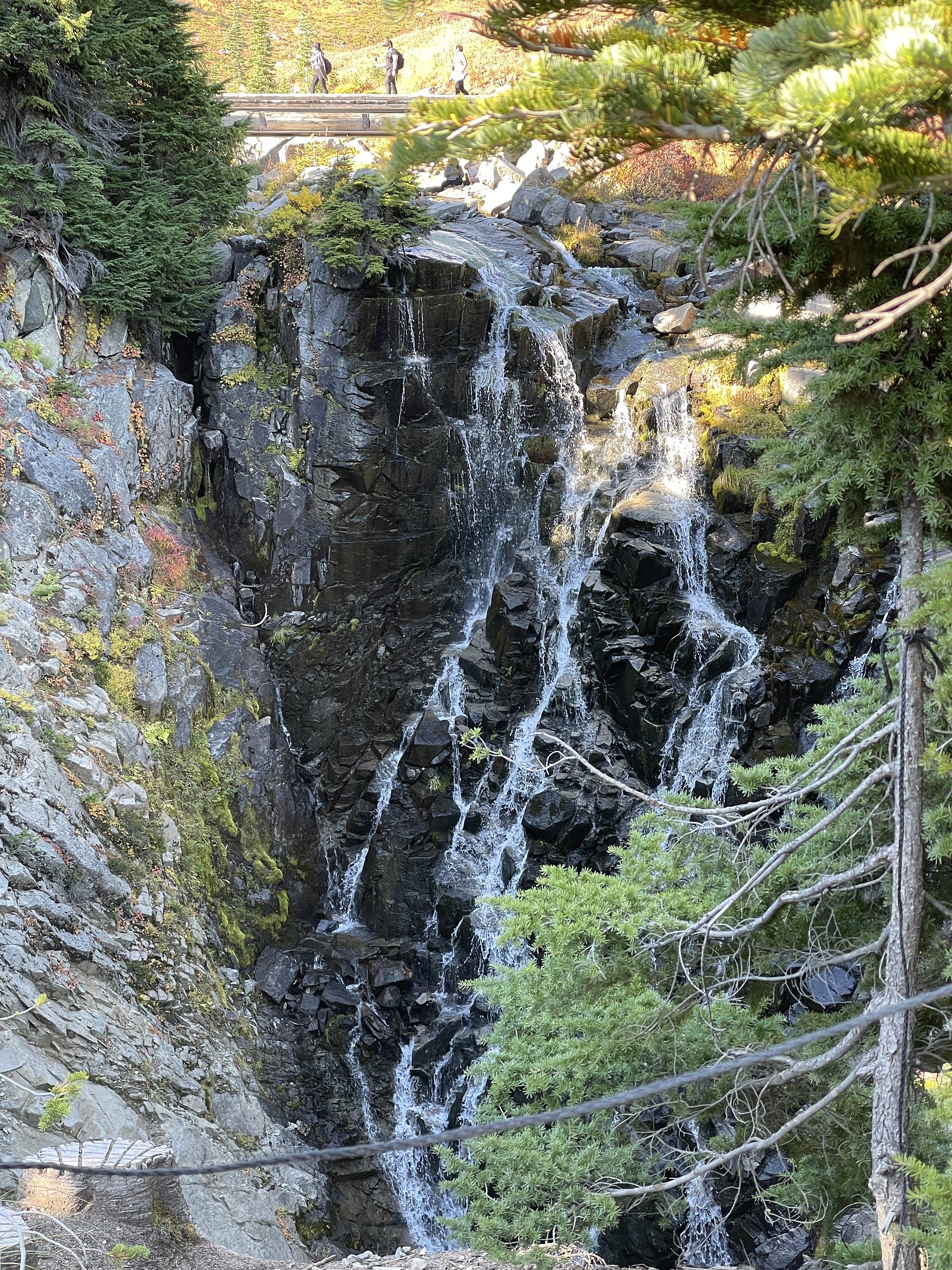
About Ivy Falls
Ivy Falls is a small, wooded cascade located in the boreal/upper-mixed forest north of Soudan/Tower/Ely (coordinates 48.4146, -92.1757). The falls appear as a short drop and series of rapids on a smaller stream; flow is typically highest in spring and after heavy rains and can be much lower in late summer. The site is remote and feels like a backcountry stop rather than a developed park attraction. Jurisdiction and official naming appear inconsistent in online visitor reports, so some specifics (exact height, official trail name) may be uncertain.
Why This Waterfall Exists
Ivy Falls flows over hard metamorphic rock, primarily marble and iron formation, laid down over 2.5-3.2 billion years ago. The softer siltstone and mudstone erodes faster than the resistant marble and iron formation, creating a ledge that the water plunges over.
Trail & Hike Details
Trail Description
Expect a short forest approach on an unmaintained or lightly maintained trail: mixed roots, rocks, and potentially muddy or wet sections. The trail may descend toward the stream with uneven footing and some small rock-hopping near the water. There are unlikely to be constructed viewing platforms or guardrails. Trail length and elevation gain are inconsistently reported; many visitors describe a brief hike from a roadside pull-off (often under 2 miles round trip), but surfaces can be rough.
What to Expect
A modest cascade/series of drops in a forested setting with moss, ferns, and mixed hardwood/conifer trees. Flow is seasonal, best in spring melt and after rains; lower in late summer. Expect limited facilities, minimal signage, and potentially limited cell coverage. Wildlife typical of the region (deer, moose, black bear signs, beaver, numerous birds). Insects (black flies, mosquitoes) can be significant in spring and early summer.
Accessibility
The trail is not wheelchair accessible. Uneven terrain and elevation changes require steady footing.
Frequently Asked Questions
🐶 Are Dogs Allowed at Ivy Falls?
❌ Dogs are not allowed
Are There Any Fees or Permits Required?
🆖 No fees required
🏊 Is There Swimming at Ivy Falls?
❌ Swimming is not allowed
When to Visit
Spring (high water and robust flow) or fall (leaf color) are best for scenic interest. Summer can be pleasant for warm weather visits but flows may be reduced. Winter visits are possible but expect ice, snow, and icy approaches; use appropriate traction and care.
Seasonal Access
The best time to visit is Spring, Summer, Fall, and Winter. Check with the managing park or local authority for current conditions.
Safety Information
Hazards include: slippery rocks and mud near the falls, steep or unstable banks, cold and fast-moving water, ticks and biting insects, limited or no cell service, and variable road conditions to the trailhead (unpaved/seasonal roads). Check weather and road conditions, wear appropriate footwear, and do not approach the edge of drops. If visiting in winter, expect ice, deep snow, and icy approaches, use traction devices and have winter navigation experience.
Current Water Conditions
89.8 m³/s
Current discharge — how much water is flowing
Lower than usual for this time of year
Based on 103 years of record
360.89 m
Water depth at gauge
7-Day Discharge Trend
What does this mean for your visit?
Flow is lower than usual for this time of year.
About This Gauge
7-Day Flow Outlook
Based on the WSC gauge NAMAKAN RIVER AT OUTLET OF LAC LA CROIX (4 km away).
Today
Low
90 m³/s
5/10Tomorrow
Low
95 m³/s
4/10Tue
Moderate
97 m³/s
5/10Wed
Low
89 m³/s
5/10Thu
Low
93 m³/s
4/10Fri
Low
88 m³/s
5/10Sat
Low
82 m³/s
5/10Best window: Today — low flow, cloudy (trip score 5/10).
Best time of year: this gauge typically runs highest from early May to early August, peaking in May.
How we calculate this
This is a transparent outlook, not a precise forecast. We take the waterfall's current flow strength (how it ranks against its historical normal for today, from the nearest WSC stream gauge), carry that ranking forward along the gauge's seasonal curve, and nudge it for forecast rain. Confidence is highest for the next day or two and falls further out. Always check official conditions and your own judgment before visiting — high flows can be dangerous.
Know when to go.
Get a free email alert when waterfalls near Atikokan hit peak flow. We only send when conditions are worth the trip — no weekly newsletters, no spam.
Weather Forecast
Location & Access
Getting There
Approximate coordinates: 48.4146, -92.1757. The falls are reached via forest/secondary roads north of Soudan and Tower and west/northwest of Ely. Expect unpaved forest roads and short spur trails; directions and exact approach vary between trip reports. A high-clearance vehicle may be useful for some FSRs. Check with the nearest ranger district or local visitor information before heading out.
Get Directions on Google MapsParking
Parking is informal and likely consists of a small pull-off or roadside space; there is unlikely to be an official parking lot, vault toilet, or developed facilities. Spaces may be limited and uneven. Park well off the roadway to avoid blocking traffic.
Elevation
366 metres above sea level
Coordinates
48.414602° N, -92.175724° W
Visitor Tips & Gear
1) Check local ranger district or visitor center for access updates and road conditions before you go. 2) Wear sturdy boots, approach can be slippery and rooty. 3) Bring bug spray in spring/summer; expect ticks. 4) Leave no trace, pack out garbage. 5) Be cautious near the water, rocks and logs are slippery and sudden drops/currents may be present. 6) Cell service may be limited; bring a map/GPS and tell someone your plans.
Where to Stay
Browse vacation cabins and private rentals nearby
Unique outdoor stays — tents, yurts, and treehouses
Rent a campervan or RV for your waterfall road trip
Some links are affiliate links. We may earn a commission at no extra cost to you.
Nearby Campground
Quetico Site 17
12 km away
Additional Information
Nearby Attractions
Soudan Underground Mine State Park (south), Lake Vermilion state recreation areas and fishing access, the town of Ely (visitor services and outfitters), Boundary Waters Canoe Area Wilderness access points. Distances to these vary; verify exact routing and distances based on your start point.
Wildlife
Typical northern Minnesota fauna: white-tailed deer, moose (possible), black bear (presence of bears reported in the region), beaver, otter, common boreal/forest birds and songbirds. Take standard wildlife precautions (store food, be bear-aware).
Cities near Ivy Falls
Nearby Waterfalls
Writing about Ivy Falls? Embed this waterfall on your site for free.