Photo Credits (5)
Difficulty
Drive Up
Trail Length
0.2 km
Trail Type
Out And Back
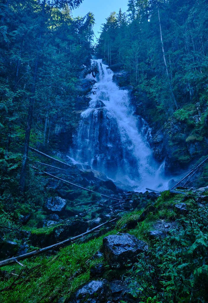
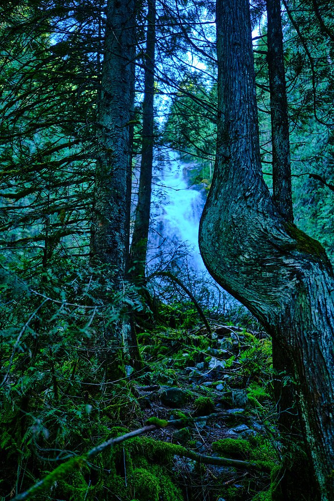
About Kay Falls
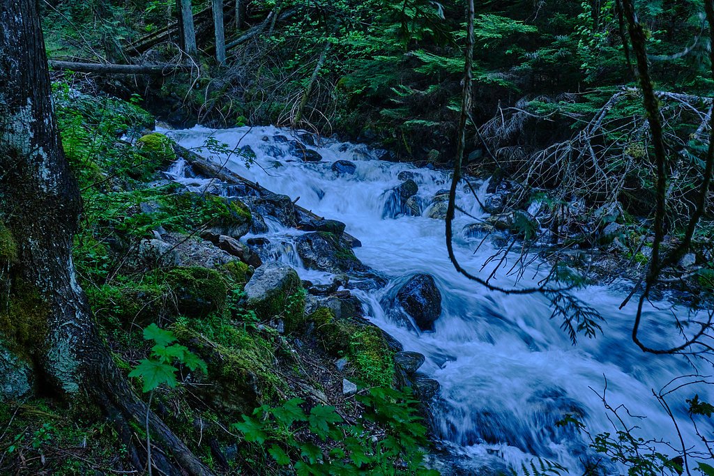
Kay Falls is a forested cascade located in the Columbia Mountains near Revelstoke, BC (approx. 19.2 miles / 31 km from Revelstoke). The falls sit on a tributary in a steep, tree-lined canyon. There does not appear to be a developed viewpoint or maintained trail to a formal overlook; reaching good vantage points may require route-finding, scrambling, and travel on unmaintained forest/industrial roads. Flow level is seasonal and typically highest in spring during snowmelt.
Why This Waterfall Exists
Kay Falls flows over metamorphic rock laid down about 252 million to 2.5 billion years ago. Over time, the stream has worn through these layers at different rates, creating the step that forms the waterfall.
Trail & Hike Details
The Approach
No hiking required. Kay Falls is accessible by vehicle with a roadside viewing area.
Trail Description
There does not appear to be a widely maintained or signed trail to Kay Falls. Reaching the falls may require driving on unpaved forest service or logging roads followed by route-finding through forest, bushwhack sections, and potentially steep, loose terrain near the creek. Expect limited tread, fallen trees, and steep approaches to the canyon rim or creek level. Navigation skills and off-trail hiking experience are strongly recommended.
What to Expect
A remote, forested cascade in a narrow canyon. Seasonal flows can vary from modest in late summer to vigorous during spring snowmelt. The area is likely densely forested with alpine/forest understory, steep banks, and unstable rock near the waterline. Cell coverage is likely limited. There are no visitor facilities or developed viewpoints.
Accessibility
This waterfall is viewable from a vehicle-accessible area. No hiking is required.
Frequently Asked Questions
🐶 Are Dogs Allowed at Kay Falls?
❌ Dogs are not allowed
Are There Any Fees or Permits Required?
🆖 No fees required
🏊 Is There Swimming at Kay Falls?
❌ Swimming is not allowed
When to Visit
Late spring (snowmelt) for highest flows and most dramatic water volume; early to mid-summer for easier access as roads clear; early fall for lower flows and fall colors. Winter access is likely difficult or impossible without specialized snow travel gear and knowledge.
Seasonal Access
The best time to visit is Spring, Summer, and Fall. Winter access may be limited. Check with the managing park or local authority for current conditions.
Safety Information
Primary hazards include remote location with limited cell service, unstable or slippery rock near the falls, steep drop-offs, fast cold water, potential flashy flows during spring rains or sudden snowmelt, rough unpaved access roads, and active logging traffic in the area. Travel with a partner when possible, tell someone your plans, and be prepared for rapidly changing mountain weather. If you are not experienced with off-trail navigation or scrambling, consider a guided outing or choosing a more developed waterfall elsewhere.
Current Water Conditions
42.3 m³/s
Current discharge — how much water is flowing
About average for this time of year
Based on 67 years of record
1.74 m
Water depth at gauge
7-Day Discharge Trend
What does this mean for your visit?
Flow is about average for this time of year.
About This Gauge
This gauge is on a nearby waterway and may not reflect exact conditions at the falls.
7-Day Flow Outlook
Based on the WSC gauge EAGLE RIVER NEAR MALAKWA (14 km away).
Today
Moderate
42 m³/s
6/10Tomorrow
Moderate
40 m³/s
6/10Tue
Moderate
41 m³/s
6/10Wed
Moderate
38 m³/s
6/10Thu
Moderate
36 m³/s
6/10Fri
Moderate
39 m³/s
5/10Sat
Moderate
34 m³/s
6/10Best window: Today — moderate flow, cloudy (trip score 6/10).
Best time of year: this gauge typically runs highest from late April to late July, peaking in June.
How we calculate this
This is a transparent outlook, not a precise forecast. We take the waterfall's current flow strength (how it ranks against its historical normal for today, from the nearest WSC stream gauge), carry that ranking forward along the gauge's seasonal curve, and nudge it for forecast rain. Confidence is highest for the next day or two and falls further out. Always check official conditions and your own judgment before visiting — high flows can be dangerous.
Know when to go.
Get a free email alert when waterfalls near Revelstoke hit peak flow. We only send when conditions are worth the trip — no weekly newsletters, no spam.
Weather Forecast
Location & Access
Getting There
Approximate coordinates: 50.9739, -118.6067. The falls are in a backcountry area near Revelstoke; access typically involves driving secondary/forest service or logging roads off the main highways and then hiking or scrambling cross-country. Use detailed maps/GPS and local road-condition reports. Expect limited or no signage for a trailhead.
Get Directions on Google MapsParking
No formal parking lot is known. Visitors may need to use informal pullouts along forest service/logging roads. Parking availability and legality may vary; exercise caution and avoid blocking gates or private access.
Elevation
517 metres above sea level
Coordinates
50.973890° N, -118.606687° W
Visitor Tips & Gear
1) Confirm road and logging activity conditions locally before heading out; forest service/logging roads can be rough and gated. 2) Use a 4WD or high-clearance vehicle if you plan to drive on unpaved access roads, but verify current road conditions first. 3) Carry a reliable map/GPS and know how to navigate off-trail. 4) Wear good traction footwear; expect slippery rocks and wet moss. 5) Bring bear spray and practice wildlife safety. 6) Do not approach unstable cliff edges; avoid entering fast, cold water. 7) Pack out all trash and follow Leave No Trace principles.
Where to Stay
Browse vacation cabins and private rentals nearby
Unique outdoor stays — tents, yurts, and treehouses
Rent a campervan or RV for your waterfall road trip
Some links are affiliate links. We may earn a commission at no extra cost to you.
Nearby Campground
Noahs Ark Resort
5.8 km away
Additional Information
Nearby Attractions
Revelstoke townsite (amenities), Mount Revelstoke National Park, Revelstoke Mountain Resort, and the Columbia River corridor are regionally notable attractions. Use Revelstoke as a logistics base for supplies and road/condition info.
Wildlife
Area may support black bears, deer, small mammals, and a variety of birds. Expect typical mountain-forest wildlife; practicing bear and wildlife safety is advised. Ticks may be present in brushy areas in warmer months.
Cities near Kay Falls
Nearby Waterfalls
Writing about Kay Falls? Embed this waterfall on your site for free.