
Photo Credits (5)
Difficulty
Drive Up
Trail Length
0.2 km
Trail Type
Out And Back
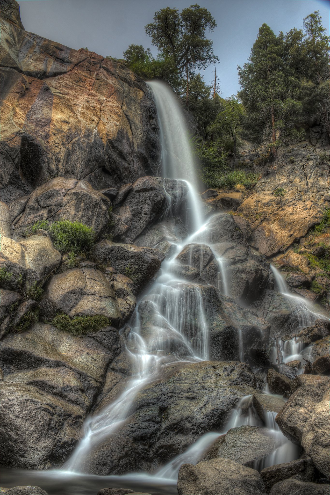
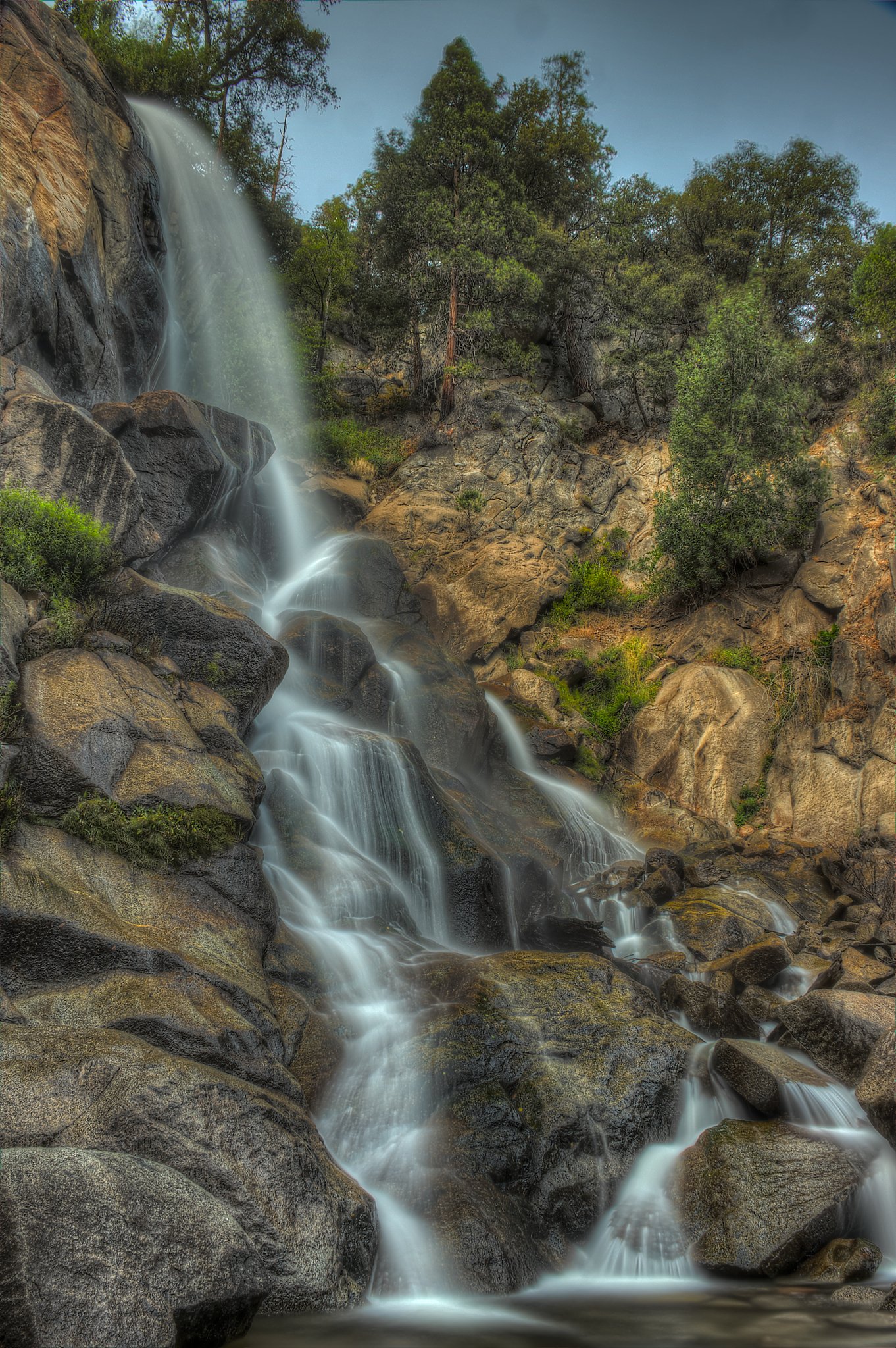
About Grizzly Falls
Grizzly Falls (at coordinates 49.9381, -121.9063) is a waterfall in interior British Columbia. Specific published measurements and official park documentation for this named feature are limited. It appears to be a forested-stream cascade reachable from backcountry or forest-service roads rather than a developed provincial-park viewpoint. Visitors should treat descriptions as approximate and verify local conditions before travel.
Why This Waterfall Exists
Grizzly Falls flows over hard intrusive rock laid down about 66-101 million years ago. These resistant rocks form a durable ledge that water cannot easily wear away, creating the falls where softer material downstream has already eroded.
Trail & Hike Details
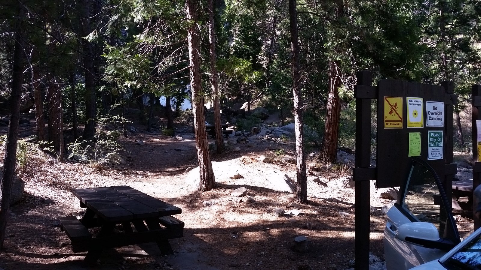
The Approach
No hiking required. Grizzly Falls is accessible by vehicle with a roadside viewing area.
Trail Description
Published trail descriptions are scarce. Expect an informal path or short scramble from a roadside pullout or forest-road turnaround through mixed-conifer forest and over uneven terrain to reach the creek and falls. Trails may be braided, muddy, or steep in places. There may be no maintained boardwalks, railings, or signage; route-finding and basic backcountry navigation skills could be required.
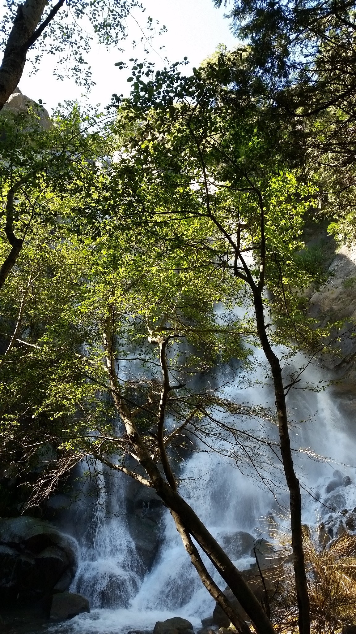
What to Expect
A natural cascade in a forested setting with variable water flow depending on season and recent precipitation/snowmelt. The approach may include rough, unmaintained roads and a short hike over roots, rocks, and potentially steep banks. Cell coverage may be intermittent. Facilities and services (toilets, potable water, interpretive signage) are unlikely. Wildlife (including bears) and biting insects may be present.
Accessibility
This waterfall is viewable from a vehicle-accessible area. No hiking is required.
Frequently Asked Questions
🐶 Are Dogs Allowed at Grizzly Falls?
❌ Dogs are not allowed
Are There Any Fees or Permits Required?
🆖 No fees required
🏊 Is There Swimming at Grizzly Falls?
❌ Swimming is not allowed
When to Visit
Late spring to early summer generally offers higher flows from snowmelt and rain, producing a more impressive waterfall. Late summer and early fall may have lower flows; winter access can be difficult or hazardous due to snow, ice, and road closures.
Seasonal Access
The best time to visit is Spring, Summer, and Fall. Winter access may be limited. Check with the managing park or local authority for current conditions.
Safety Information
Hazards may include: unstable or slippery banks and rocks near the water; strong currents or cold plunge pools; falling or loose rock on steep approaches; poor or no cell service; variable road conditions on forest service roads (washouts, deep ruts); wildlife encounters (bears); seasonal hazards such as snow, ice, or wildfire closures. Always plan conservatively, check conditions before travel, and carry appropriate safety gear.
Current Water Conditions
36.6 m³/s
Current discharge — how much water is flowing
Lower than usual for this time of year
Based on 50 years of record
1.33 m
Water depth at gauge
7-Day Discharge Trend
What does this mean for your visit?
Flow is lower than usual for this time of year.
About This Gauge
7-Day Flow Outlook
Based on the WSC gauge NAHATLATCH RIVER BELOW TACHEWANA CREEK (4 km away).
Today
Low
37 m³/s
6/10Tomorrow
Low
38 m³/s
5/10Tue
Low
37 m³/s
5/10Wed
Low
38 m³/s
5/10Thu
Low
38 m³/s
5/10Fri
Low
38 m³/s
5/10Sat
Low
39 m³/s
4/10Best window: Today — low flow, sunny (trip score 6/10).
Best time of year: this gauge typically runs highest from early May to early August, peaking in June.
How we calculate this
This is a transparent outlook, not a precise forecast. We take the waterfall's current flow strength (how it ranks against its historical normal for today, from the nearest WSC stream gauge), carry that ranking forward along the gauge's seasonal curve, and nudge it for forecast rain. Confidence is highest for the next day or two and falls further out. Always check official conditions and your own judgment before visiting — high flows can be dangerous.
Weather Forecast
Location & Access
Getting There
The falls are in a remote interior-BC setting (coords 49.9381, -121.9063). Access likely requires travel on unpaved forest or resource roads and a short walk; a high-clearance or 4x4 vehicle may be needed for some sections. Expect limited or no signage and minimal infrastructure. Confirm access with local land managers or recent trip reports before visiting.
Get Directions on Google MapsParking
There may be informal roadside parking at an access pullout or small parking area near a trailhead; official parking facilities are unlikely. Park clear of gates, private property, and blocking the road. If unsure, treat parking availability as limited.
Elevation
338 metres above sea level
Coordinates
49.938140° N, -121.906318° W
Visitor Tips & Gear
• Check recent trip reports or contact regional natural-resources/park authorities for current access and road conditions before you go. • Use a high-clearance vehicle if traveling forest service roads; avoid low-clearance cars on rough roads. • Leave no trace: pack out all trash and avoid disturbing vegetation and stream banks. • Do not rely on cell service; bring a map, GPS device, and tell someone your plan. • Be cautious on wet rocks and near the water’s edge, slippery surfaces and undercut banks are common. • Consider carrying bear spray and know how to use it; make noise while hiking in dense forest.
Where to Stay
Browse vacation cabins and private rentals nearby
Unique outdoor stays — tents, yurts, and treehouses
Rent a campervan or RV for your waterfall road trip
Some links are affiliate links. We may earn a commission at no extra cost to you.
Nearby Campground
Squakum Creek Campsite
11.9 km away
Additional Information
Nearby Attractions
Other natural attractions in the broader interior-BC region may include provincial parks, hiking trails, and river valleys. Specific nearby named attractions are not confirmed for this coordinate; consult regional tourism or park resources for verified points of interest.
Wildlife
The area may host black bears and potentially grizzly bears, deer, small mammals, birds, and insects. Use standard wildlife-safety practices: store food securely, make noise on trails, and carry bear deterrents where appropriate.
Nearby Waterfalls
Writing about Grizzly Falls? Embed this waterfall on your site for free.