Photo Credits (1)
About Énorme chute
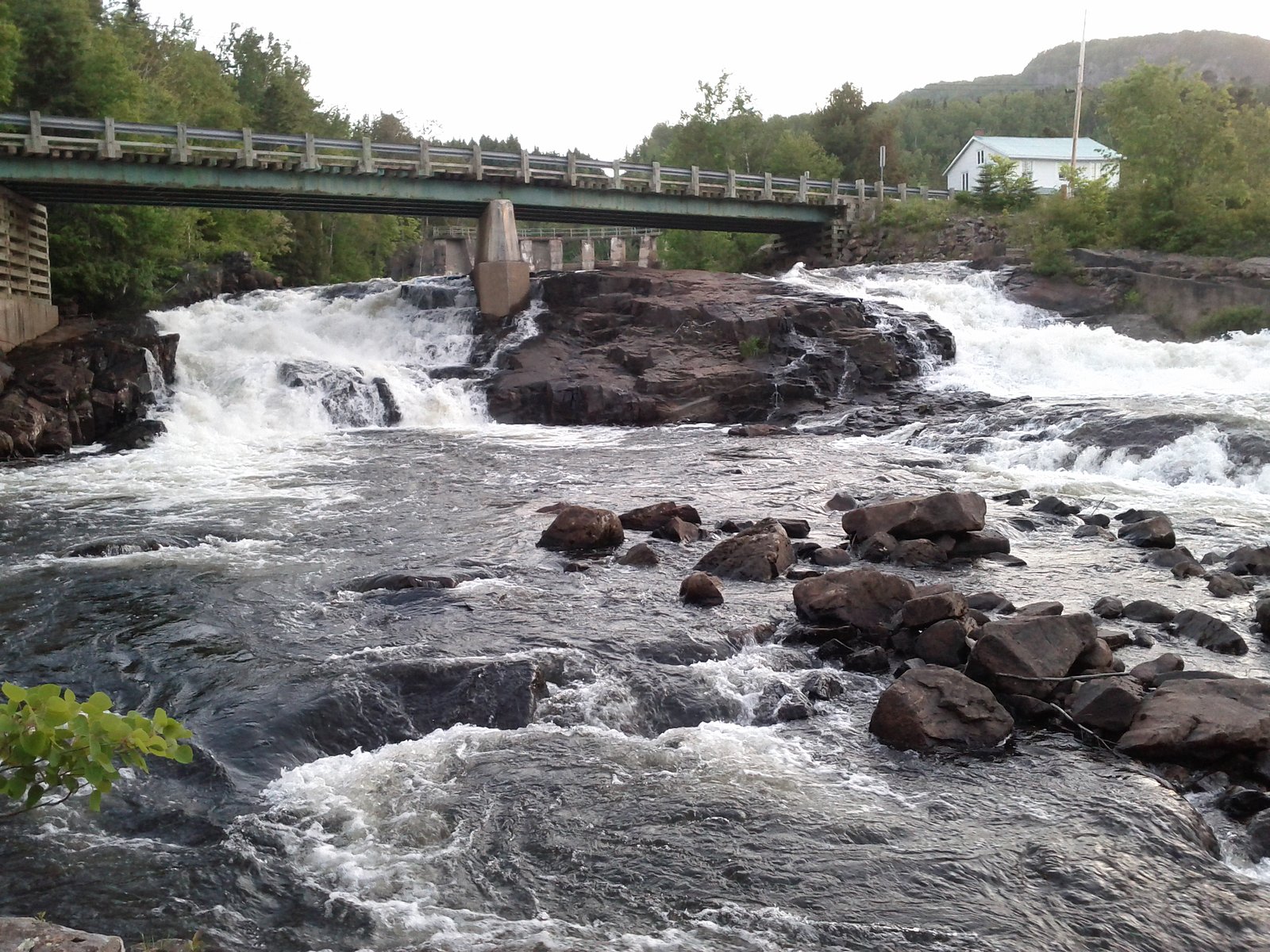
Énorme chute is a forested, riverside waterfall site in Quebec (coords 48.1444, -70.0382). The name suggests a large, dramatic drop but publicly available, detailed trail and technical descriptions are limited. The falls are located in a rural area of Quebec roughly between Rivière‑du‑Loup (≈36.6 miles) and Chicoutimi (≈58.4 miles). Expect a natural, wooded setting with limited developed infrastructure; flow and exact appearance can vary seasonally. Visitors should verify the local access route and conditions before traveling.
Why This Waterfall Exists
Énorme chute flows over hard crystalline rock, primarily gneiss, laid down over 1.0-1.6 billion years ago. These resistant rocks form a durable ledge that water cannot easily wear away, creating the falls where softer material downstream has already eroded.
Trail & Hike Details
Trail Description
Detailed, reliably sourced trail descriptions for Énorme chute are not readily available. Based on the rural location and typical Quebec forested waterfall settings, trails (if present) may be unmaintained footpaths with roots, rocks, and uneven surfaces. Approach routes may involve short creek crossings, steep banks near the stream, or walking on unpaved roads. Because route details vary and may change seasonally, confirm the trail route with a recent local source before attempting the visit.
What to Expect
Expect a natural riverscape in a forested setting with limited infrastructure (likely no railings, boardwalks, or viewing platforms unless noted locally). Water flow can be strong in spring (snowmelt) and after heavy rain; reduced flow is possible in late summer or drought. In winter the falls may form ice features but approaching can be hazardous due to ice and snow. Cell coverage may be spotty, and signage may be minimal or absent.
Accessibility
No verified accessibility features are documented. Expect natural, uneven terrain with likely limited or no accessibility accommodations. Not wheelchair accessible unless a specific local facility is provided.
Frequently Asked Questions
🐶 Are Dogs Allowed at Énorme chute?
❌ Dogs are not allowed
Are There Any Fees or Permits Required?
🆖 No fees required
🏊 Is There Swimming at Énorme chute?
❌ Swimming is not allowed
When to Visit
Spring (snowmelt) for peak flow and dramatic water volume; early summer and fall for more comfortable temperatures and scenery. Winter can offer impressive ice formations but may be hazardous and less accessible, visit only with appropriate winter gear and local knowledge.
Seasonal Access
The best time to visit is Spring, Summer, Fall, and Winter. Check with the managing park or local authority for current conditions.
Safety Information
Hazards may include slippery wet rock, loose or eroding banks, steep dropoffs, strong currents near the falls, cold water temperatures, and winter ice hazards. Cell service may be limited. Avoid getting too close to cliff edges, supervise children closely, and do not assume water is safe for swimming. If access crosses private land or forestry roads, be aware of vehicle traffic and logging activity. Check local conditions before visiting and err on the side of caution.
7-Day Flow Outlook
Based on the WSC gauge PETIT SAGUENAY (RIVIERE) A 1 KM DU RUISSEAU DECHARGE DU LAC DAVID (6 km away).
Best time of year: this gauge typically runs highest from mid April to late June, peaking in May.
How we calculate this
This is a transparent outlook, not a precise forecast. We take the waterfall's current flow strength (how it ranks against its historical normal for today, from the nearest WSC stream gauge), carry that ranking forward along the gauge's seasonal curve, and nudge it for forecast rain. Confidence is highest for the next day or two and falls further out. Always check official conditions and your own judgment before visiting — high flows can be dangerous.
Know when to go.
Get a free email alert when waterfalls near Rivière-du-Loup hit peak flow. We only send when conditions are worth the trip — no weekly newsletters, no spam.
Weather Forecast
Location & Access
Getting There
Énorme chute is located at approximately 48.1444, -70.0382 in rural Quebec. The waterfall lies roughly 36.6 miles from Rivière‑du‑Loup and 58.4 miles from Chicoutimi (distances provided for context). Access is likely via secondary or forestry roads; exact public trailhead locations are not well documented in major trail databases. Visitors should consult local tourism offices, municipal maps, or recent trip reports (AllTrails/community sources) for the current access route and any private‑land restrictions.
Get Directions on Google MapsParking
No confirmed formal parking lot is documented. Parking may be limited to roadside pullouts or small informal areas near an access trail. Park legally and avoid blocking roads or driveways. If in doubt, contact local authorities or tourism offices for guidance.
Elevation
135 metres above sea level
Coordinates
48.144416° N, -70.038162° W
Visitor Tips & Gear
• Check recent trip reports or contact local tourism/municipal offices for current access information and any private‑land restrictions. • Wear sturdy, waterproof footwear with good traction; expect mud, roots, and slippery rocks. • Bring a map, offline directions, and let someone know your plans if venturing into remote areas. • Be cautious near edges, wet rock, loose soil, and steep banks are common hazards. • Respect any private property signs and stay on marked routes when present. • Carry insect repellent in summer and check for ticks after hiking.
Where to Stay
Browse vacation cabins and private rentals nearby
Unique outdoor stays — tents, yurts, and treehouses
Rent a campervan or RV for your waterfall road trip
Some links are affiliate links. We may earn a commission at no extra cost to you.
Nearby Campground
Village-Vacances Petit-Saguenay
11.6 km away
Additional Information
Nearby Attractions
Regional centers noted by distance include Rivière‑du‑Loup and Chicoutimi. There may be local parks, river recreation areas, or provincial/national parks within driving distance, check regional tourism resources for current nearby attractions.
Wildlife
Typical Quebec forest and river corridor wildlife may be present: white‑tailed deer, moose, beaver, small mammals, and black bear in some areas. Insect activity (mosquitoes, blackflies) can be high in spring and summer. Take standard wildlife precautions.
Cities near Énorme chute
Nearby Waterfalls
Writing about Énorme chute? Embed this waterfall on your site for free.