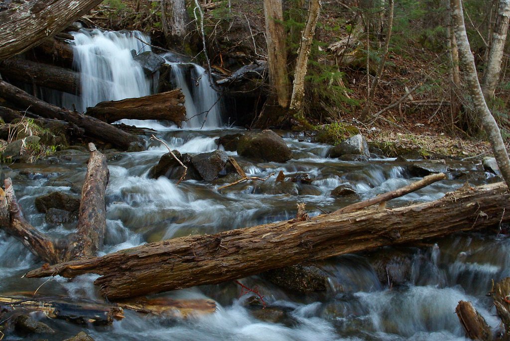
Dunbar Falls
New Brunswick • 3 m
By Armen Suny · Last verified Jun 2026
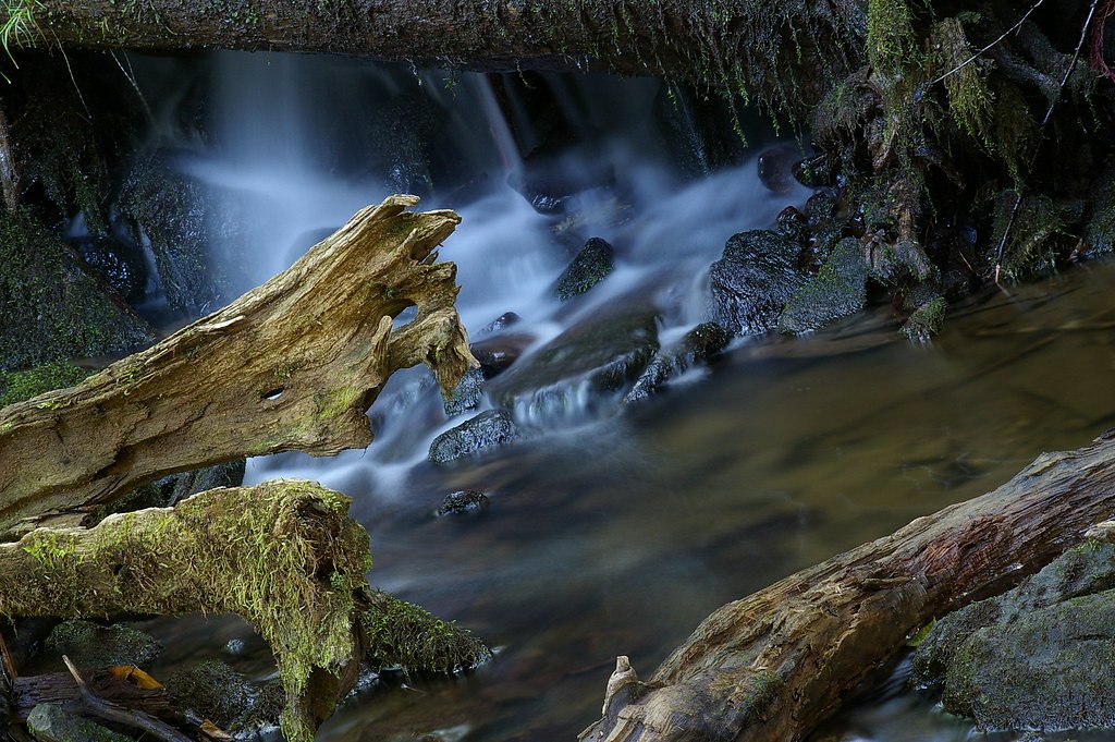
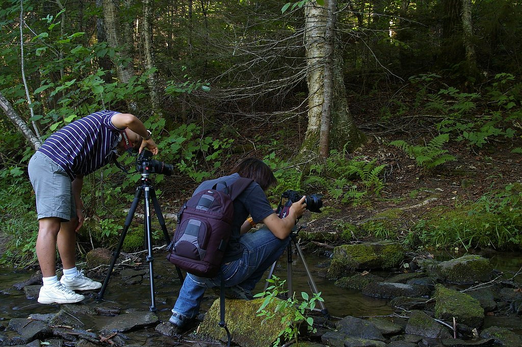
Photo Credits (4)
Difficulty
Easy
Trail Length
1.4 km
Trail Type
Out And Back
Elevation Gain
40 m
About Dunbar Falls
Dunbar Falls is a small, forested waterfall feature located in western New Brunswick (coordinates: 46.1448, -66.6242), roughly 12.9 miles from Fredericton and about 62.3 miles from Vanceboro. Public information about this specific named falls is limited; it appears to be a modest, natural cascade in a wooded setting rather than a developed park attraction. Visitors should treat available details as approximate and confirm local access before traveling.
The Setting
Dunbar Falls sits at 47 metres in the coastal lowlands of New Brunswick. The falls drop 3 metres.
Why This Waterfall Exists
Dunbar Falls flows over layered sedimentary rock laid down about 299-359 million years ago. Over time, the stream has worn through these layers at different rates, creating a 9-foot drop that forms the waterfall.
Nearby Falls Worth Visiting
Lower Dunbar Falls (1 m) lies 0.5 kilometres to the southeast.
Trail & Hike Details
The Approach
The easy 1.4-km out-and-back trail gains 40 metres of elevation on the way to the falls.
Trail Description
Public trail details are not well-documented. The approach to the falls may involve a short unmaintained footpath through mixed forest and uneven terrain; expect tree roots, rocks, and possibly muddy sections. There may be little or no signage, and trails (if present) may be informal. If visiting, follow GPS coordinates, watch for private property boundaries, and be prepared for route-finding on natural terrain.
What to Expect
The falls drop a gentle 3 metres over layered sedimentary rock.
Accessibility
The trail is short and relatively flat, but the surface may be uneven. Contact the managing agency for accessibility details.
Frequently Asked Questions
🐶 Are Dogs Allowed at Dunbar Falls?
❌ Dogs are not allowed
Are There Any Fees or Permits Required?
🆖 No fees required
🏊 Is There Swimming at Dunbar Falls?
❌ Swimming is not allowed
When to Visit
Spring (high flow) for fullest water volume; late spring–early summer for more comfortable temperatures and good flow; fall for foliage colors. Winter can offer icy/frozen scenery but may require winter travel skills and presents additional hazards (ice, hidden hazards, cold water).
Seasonal Access
The best time to visit is Spring, Summer, Fall, and Winter. Check with the managing park or local authority for current conditions.
Safety Information
Hazards to be aware of: slippery rocks and steep banks near the falls, variable water flow (spring freshet can create strong currents), cold water temperatures, lack of lifeguards or rescue services, limited or no cell coverage in some areas, and typical backcountry hazards (weather changes, ticks, biting insects). If property boundaries are unclear, you may be trespassing, confirm land status before crossing. Always tell someone your plans and expected return time.
Current Water Conditions
7.9 m³/s
Current discharge — how much water is flowing
Lower than usual for this time of year
Based on 63 years of record
17.82 m
Water depth at gauge
7-Day Discharge Trend
What does this mean for your visit?
Flow is lower than usual for this time of year.
About This Gauge
7-Day Flow Outlook
Based on the WSC gauge NASHWAAK RIVER AT DURHAM BRIDGE (2 km away).
Today
Moderate
8.6 m³/s
5/10Tomorrow
Moderate
7.6 m³/s
6/10Tue
Low
7.0 m³/s
5/10Wed
Moderate
6.9 m³/s
5/10Thu
Moderate
8.7 m³/s
5/10Fri
Moderate
8.1 m³/s
6/10Sat
Moderate
7.9 m³/s
5/10Best window: Tomorrow — moderate flow, cloudy (trip score 6/10).
Best time of year: this gauge typically runs highest from late March to early June, peaking in April.
How we calculate this
This is a transparent outlook, not a precise forecast. We take the waterfall's current flow strength (how it ranks against its historical normal for today, from the nearest WSC stream gauge), carry that ranking forward along the gauge's seasonal curve, and nudge it for forecast rain. Confidence is highest for the next day or two and falls further out. Always check official conditions and your own judgment before visiting — high flows can be dangerous.
Know when to go.
Get a free email alert when waterfalls near Fredericton hit peak flow. We only send when conditions are worth the trip — no weekly newsletters, no spam.
Weather Forecast
Location & Access
Getting There
Location: 46.1448, -66.6242. Nearest major center is Fredericton (approx. 13 miles). Exact public access points, official trailhead, and approach route are not well documented in widely available sources. Visitors should use the provided coordinates in a reliable GPS or mapping app to plan an approach. Access may be via local forest roads, secondary roads, or informal trails; some sections may cross private land. Check with local municipal offices, provincial parks, or landowner signage where applicable before entering.
Get Directions on Google MapsParking
No official parking lot is documented. Parking may be informal (roadside pullout) or limited; do not block driveways or gates. If you cannot confirm official parking, plan to park off the road in a safe, visible location and obey local signage.
Elevation
47 metres above sea level
Coordinates
46.144788° N, -66.624199° W
Visitor Tips & Gear
1) Confirm access ahead of time with local authorities or landowners if ownership is unclear. 2) Wear sturdy, grippy footwear for slippery, uneven ground. 3) Carry a map, compass or GPS and a charged phone; cell coverage may be spotty. 4) Leave no trace, pack out what you pack in. 5) Be cautious near water and on wet rocks; do not assume safe footing. 6) Check spring freshet conditions and avoid visiting during high, fast flows. 7) Use insect repellent in warm months and check for ticks afterward.
As an Amazon Associate, we earn from qualifying purchases.
For this easy 1.4 km trail, lightweight trail shoes and a water bottle are usually sufficient. Icy conditions are common in winter — traction cleats are a smart addition.

Columbia Watertight II Rain Jacket
Packs into its own pocket, seam-sealed, and keeps you dry from spray and surprise rain.

Polarized Sunglasses (Knockaround)
Cuts glare off the water so you actually see the falls — and your photos turn out better too.

Earth Pak Waterproof Dry Bag
Keeps your phone and gear dry when waterfall mist soaks everything else.

Waterproof Phone Pouch (AiRunTech)
Cheap insurance — take photos right next to the falls without killing your phone.

Kahtoola MICROspikes
Cult-favorite traction cleats that grip ice and wet rock — essential for winter waterfall hikes.

JOBY GorillaPod Starter Kit
Wraps around railings and rocks for long-exposure waterfall shots — no flat surface needed.
Where to Stay
Browse vacation cabins and private rentals nearby
Unique outdoor stays — tents, yurts, and treehouses
Rent a campervan or RV for your waterfall road trip
Some links are affiliate links. We may earn a commission at no extra cost to you.
Nearby Campground
River's Edge Campground
1.5 km away
Additional Information
Nearby Attractions
Nearest city: Fredericton (approx. 13 miles) which offers parks, riverfront trails, and cultural sites. Mactaquac area and provincial outdoor recreation sites are in the broader region, but verify distances and access before planning combined visits.
Wildlife
Typical southern New Brunswick wildlife may be present: white-tailed deer, beaver, small mammals, waterfowl, songbirds, and potentially moose or black bear in less developed areas. Insects such as mosquitoes and black flies are common in warm months; ticks are present in the region.
Cities near Dunbar Falls
Nearby Waterfalls
Writing about Dunbar Falls? Embed this waterfall on your site for free.