Devil's Hill Waterfall II
Nova Scotia • 5 m
By Armen Suny · Last verified Jun 2026
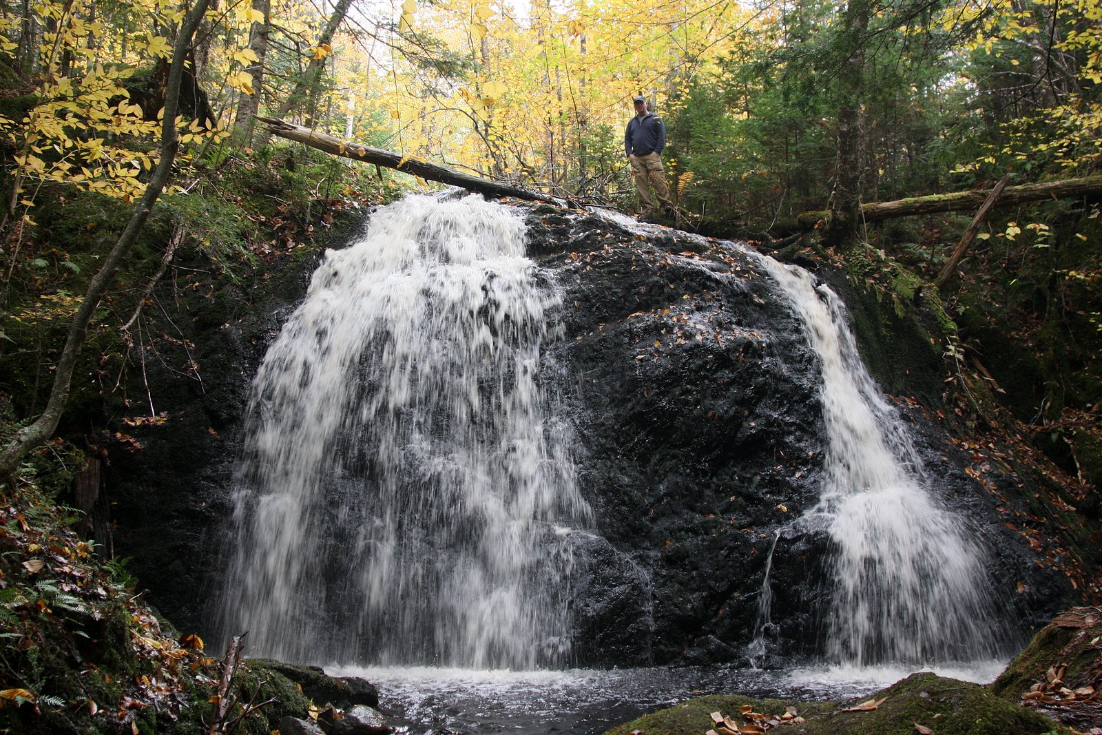
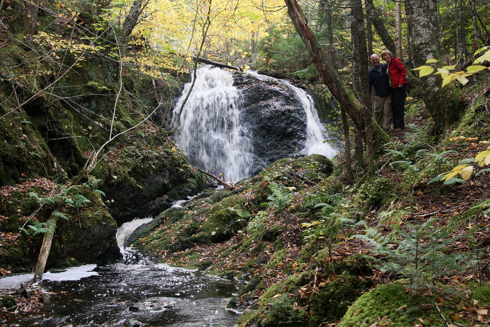
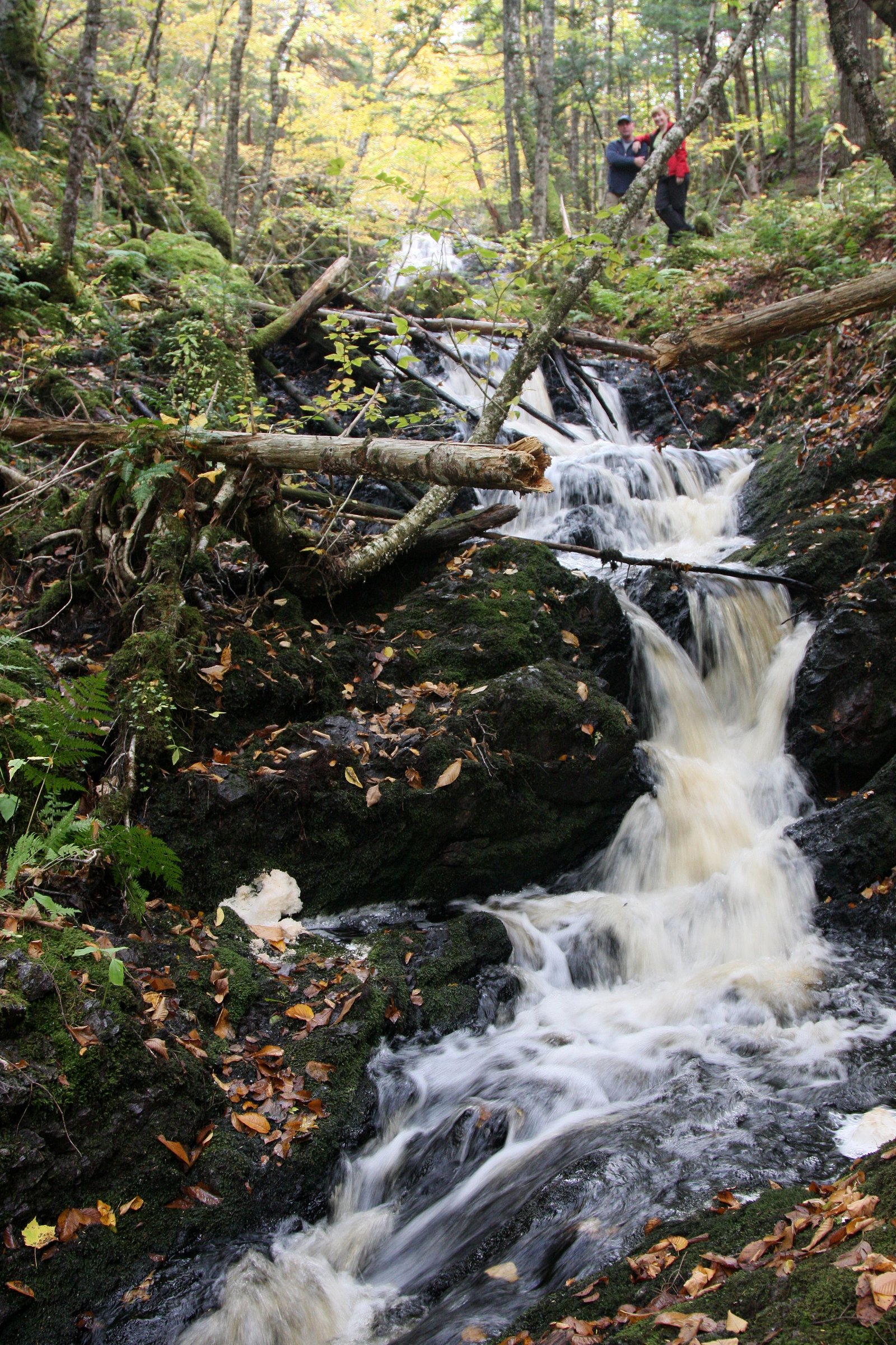
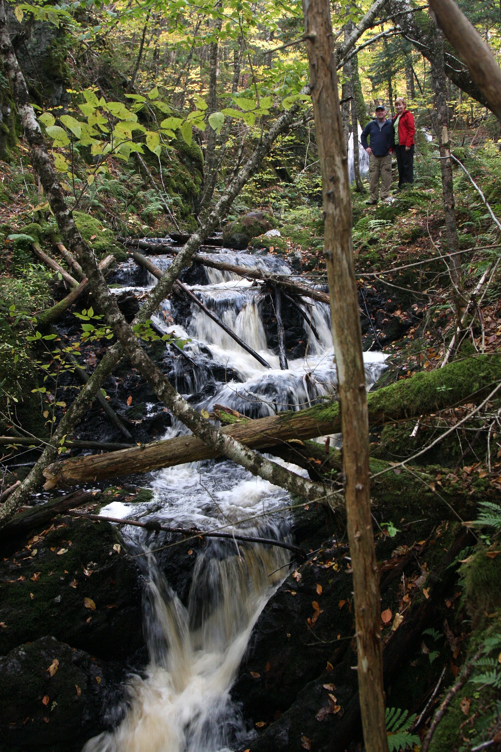
Photo Credits (5)
Difficulty
Easy
Trail Length
2.7 km
Trail Type
Out And Back
Elevation Gain
56 m
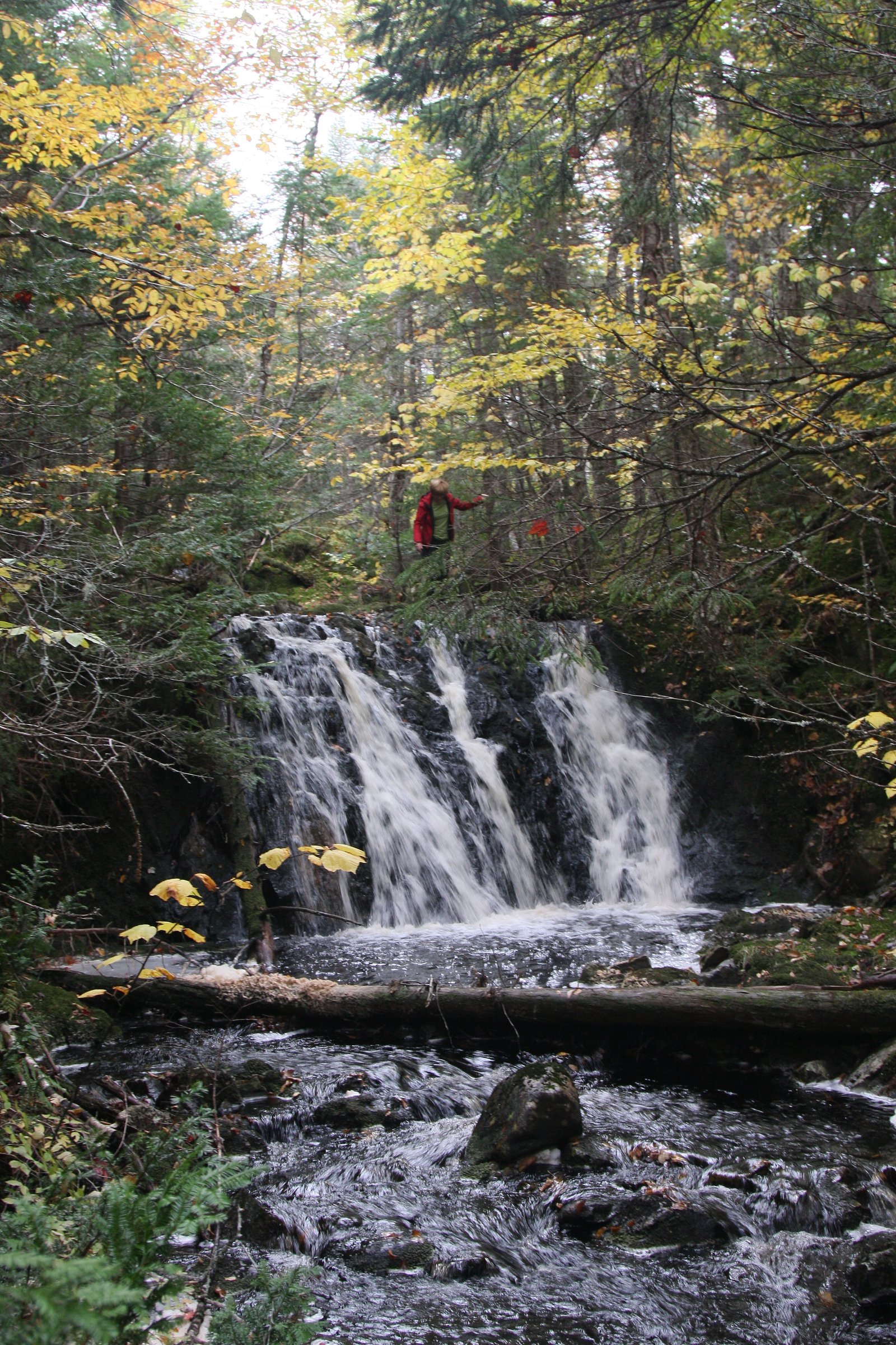
About Devil's Hill Waterfall II
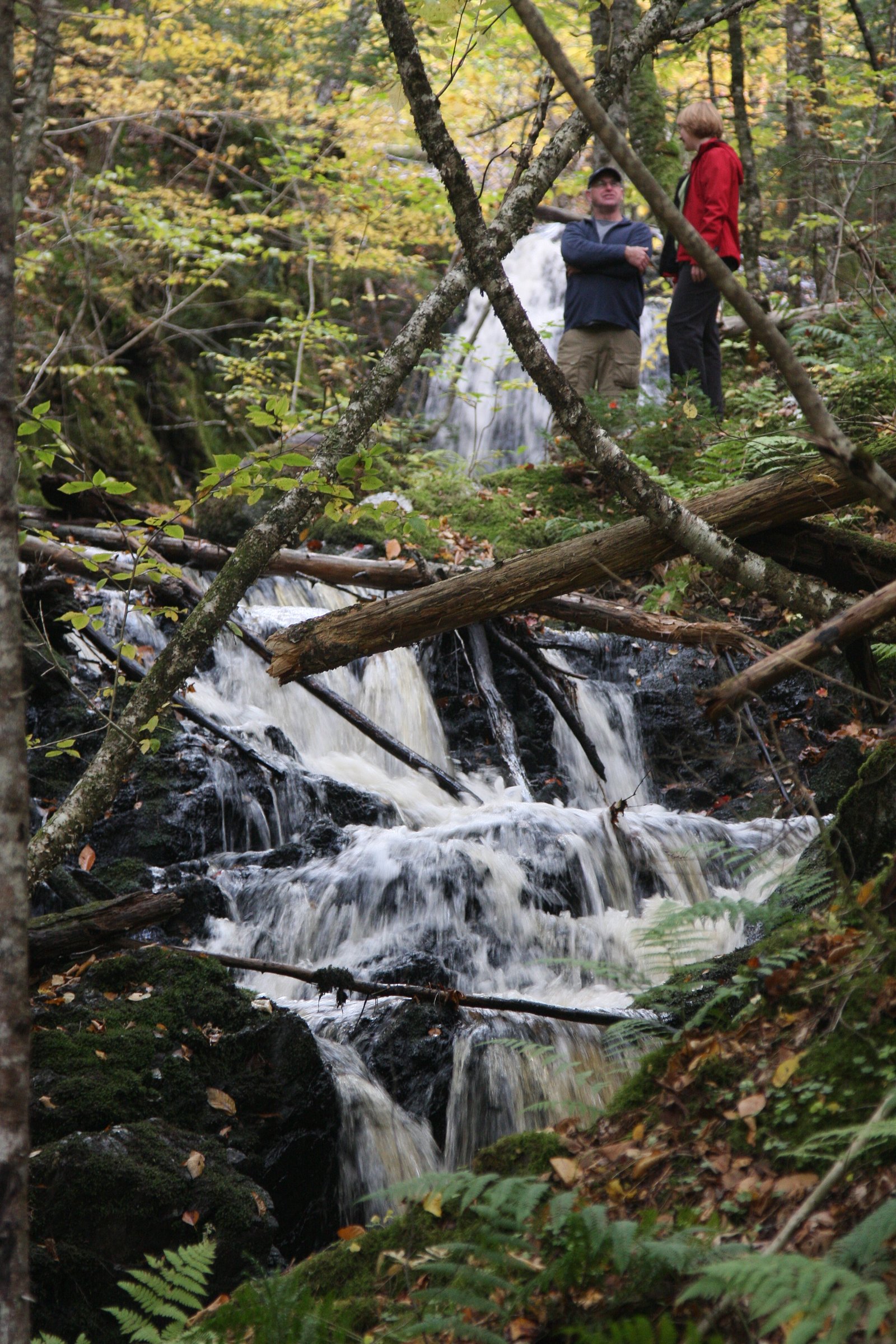
Devil's Hill Waterfall II is a small, likely multi-step cascade on Cape Breton Island near Sydney and Baddeck, Nova Scotia. The fall appears in a forested setting with rocky banks and may be best viewed from a short trail and an informal viewpoint; conditions and exact features (single plunge vs. a series of drops) vary with seasonal flow. This site is relatively remote and appears to be lesser-known compared with larger regional attractions, so expect minimal infrastructure.
The Setting
Devil's Hill Waterfall II sits at 45 metres in the coastal lowlands of Nova Scotia. The falls drop 5 metres.
Why This Waterfall Exists
Devil's Hill Waterfall II flows over hard volcanic rock laid down about 539 million to 1.0 billion years ago. These resistant rocks form a durable ledge that water cannot easily wear away, creating a 16-foot drop where softer material downstream has already eroded.
Nearby Falls Worth Visiting
Devil's Hill Waterfall I (12 m) lies 0.2 kilometres to the southwest.
Trail & Hike Details
The Approach
The easy 2.7-km out-and-back trail gains 56 metres of elevation on the way to the falls.
Trail Description
The approach is likely a short forested path from a roadside pullout. Trails may be narrow, rooty and rocky, with short steep sections or scrambles to reach the best viewpoints. Expect uneven footing and potentially muddy or eroded sections after rain. There is unlikely to be a maintained boardwalk or formal viewing platform.
What to Expect
The falls drop a gentle 5 metres over hard volcanic rock.
Accessibility
The trail is not wheelchair accessible. Uneven terrain and elevation changes require steady footing.
Frequently Asked Questions
🐶 Are Dogs Allowed at Devil's Hill Waterfall II?
❌ Dogs are not allowed
Are There Any Fees or Permits Required?
🆖 No fees required
🏊 Is There Swimming at Devil's Hill Waterfall II?
❌ Swimming is not allowed
When to Visit
Late spring (snowmelt and higher flows) for the fullest cascade; early summer for accessible trails and good weather; fall for foliage colors. Winter visits may offer ice features but are more hazardous (ice, snow, limited access).
Seasonal Access
The best time to visit is Spring, Summer, and Fall. Winter access may be limited. Check with the managing park or local authority for current conditions.
Safety Information
Hazards include slippery wet rocks, steep or unstable banks, high water and strong currents after heavy rain, cold water temperatures, and limited cell coverage in some areas. Do not attempt to climb near the edge of drops or stand on wet rocks. Use caution during freeze–thaw periods when ice can form and create hazardous conditions. If unsure about conditions, err on the side of caution and avoid risky approaches.
Current Water Conditions
0.0 m³/s
Current discharge — how much water is flowing
About average for this time of year
Based on 47 years of record
0.71 m
Water depth at gauge
7-Day Discharge Trend
What does this mean for your visit?
Flow is about average for this time of year.
About This Gauge
This gauge is on a nearby waterway and may not reflect exact conditions at the falls.
7-Day Flow Outlook
Based on the WSC gauge MACASKILLS BROOK NEAR BIRCH GROVE (16 km away).
Today
Moderate
0.0 m³/s
4/10Tomorrow
Moderate
0.0 m³/s
8/10Tue
Moderate
0.0 m³/s
6/10Wed
Moderate
0.0 m³/s
5/10Thu
Moderate
0.0 m³/s
6/10Fri
Moderate
0.0 m³/s
6/10Sat
Moderate
0.0 m³/s
5/10Best window: Tomorrow — moderate flow, mainly sunny (trip score 8/10).
Best time of year: this gauge typically runs highest from late March to early May, peaking in April.
How we calculate this
This is a transparent outlook, not a precise forecast. We take the waterfall's current flow strength (how it ranks against its historical normal for today, from the nearest WSC stream gauge), carry that ranking forward along the gauge's seasonal curve, and nudge it for forecast rain. Confidence is highest for the next day or two and falls further out. Always check official conditions and your own judgment before visiting — high flows can be dangerous.
Know when to go.
Get a free email alert when waterfalls near Sydney hit peak flow. We only send when conditions are worth the trip — no weekly newsletters, no spam.
Weather Forecast
Location & Access
Getting There
Approximate coordinates: 45.978, -60.0289. The waterfall is about 14.2 miles from Sydney and about 36.5 miles from Baddeck (distances provided as road distance estimates). Access is typically via local secondary roads on Cape Breton Island; expect narrow, possibly unpaved access roads near the immediate site. Use a reliable GPS or mapping app and check recent local trip reports for the best access route.
Get Directions on Google MapsParking
Parking is likely limited to a small pullout or informal roadside parking. There may be no official parking lot or signage. Park well off the road and avoid blocking traffic; if unsure, plan for a short roadside walk.
Elevation
45 metres above sea level
Coordinates
45.978005° N, -60.028891° W
Visitor Tips & Gear
• Wear sturdy, closed-toe footwear with good traction, rocks and paths can be slippery. • Use caution near edges; banks and rocks can be unstable. • Bring insect repellent in spring/summer. • Park well off the road and avoid blocking lanes. • Carry a map or GPS; do not rely solely on mobile signal. • Pack out all trash and follow Leave No Trace principles. • Check recent trip reports or local resources for current access conditions, especially after storms or during mud season.
As an Amazon Associate, we earn from qualifying purchases.
This easy 2.7 km hike is straightforward — comfortable trail shoes and plenty of water should do. Sun exposure on the trail makes good sun protection a must in summer.

Polarized Sunglasses (Knockaround)
Cuts glare off the water so you actually see the falls — and your photos turn out better too.

Columbia Watertight II Rain Jacket
Packs into its own pocket, seam-sealed, and keeps you dry from spray and surprise rain.

Earth Pak Waterproof Dry Bag
Keeps your phone and gear dry when waterfall mist soaks everything else.

Waterproof Phone Pouch (AiRunTech)
Cheap insurance — take photos right next to the falls without killing your phone.

JOBY GorillaPod Starter Kit
Wraps around railings and rocks for long-exposure waterfall shots — no flat surface needed.

Osprey Daylite Daypack
Light, organized, and just the right size for a day hike — fits water, snacks, and layers.
Where to Stay
Browse vacation cabins and private rentals nearby
Unique outdoor stays — tents, yurts, and treehouses
Rent a campervan or RV for your waterfall road trip
Some links are affiliate links. We may earn a commission at no extra cost to you.
Nearby Campground
Lakeview Treasures Campground
3.1 km away
Additional Information
Nearby Attractions
Regional points of interest include Sydney (historic waterfront and services), Baddeck (Alexander Graham Bell National Historic Site and access to Bras d'Or Lake), and other Cape Breton attractions. Depending on exact location, larger attractions such as Cape Breton Highlands National Park and Fortress of Louisbourg are regionally accessible but are not immediate neighbors.
Wildlife
Typical Cape Breton wildlife may be present: white-tailed deer, moose (in rural areas), black bear, foxes, and various songbirds and waterfowl. Insects such as blackflies and mosquitoes are common in warmer months.
Cities near Devil's Hill Waterfall II
Nearby Waterfalls
Writing about Devil's Hill Waterfall II? Embed this waterfall on your site for free.