Devil's Hill Waterfall I
Nova Scotia • 12 m
By Armen Suny · Last verified Jun 2026

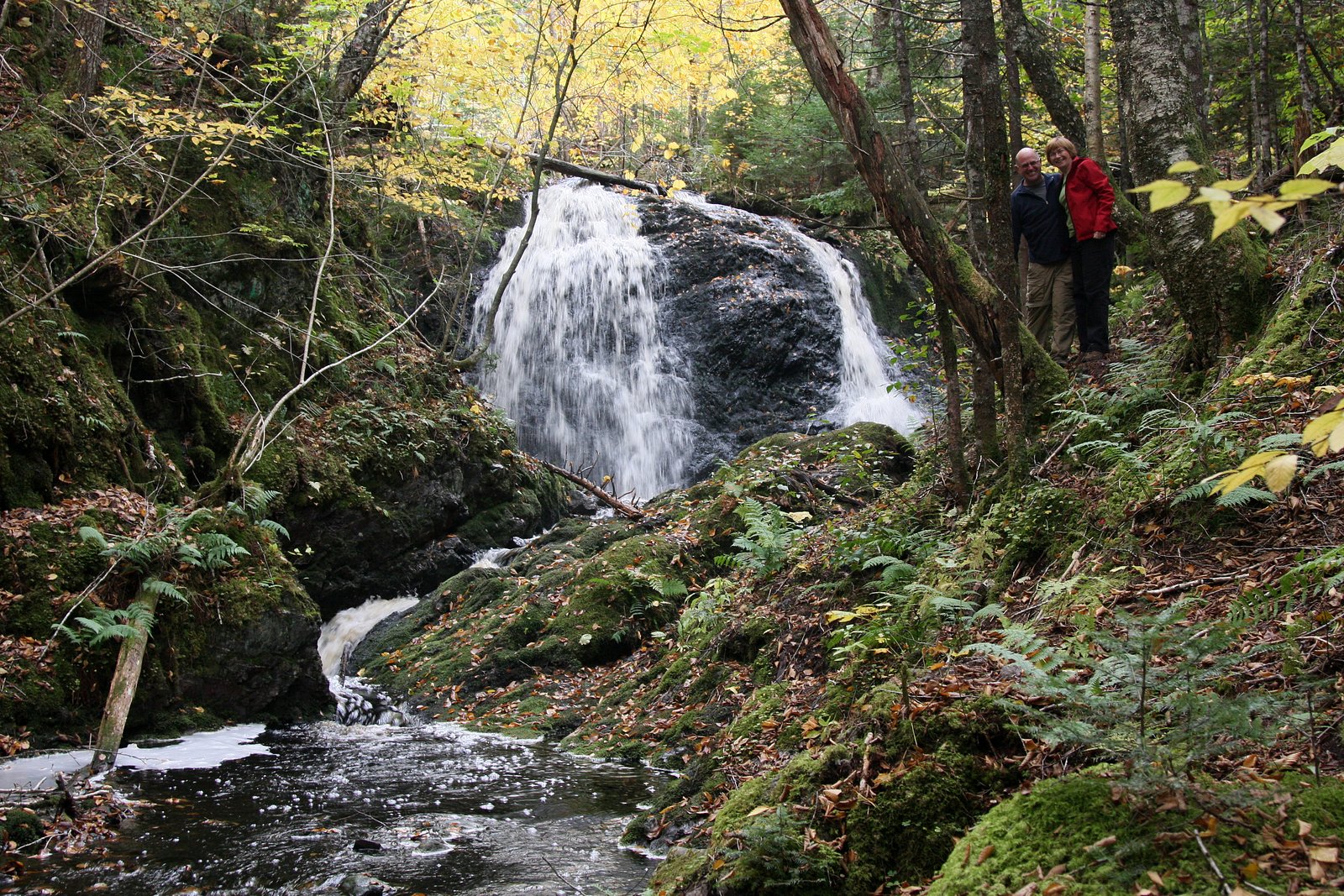
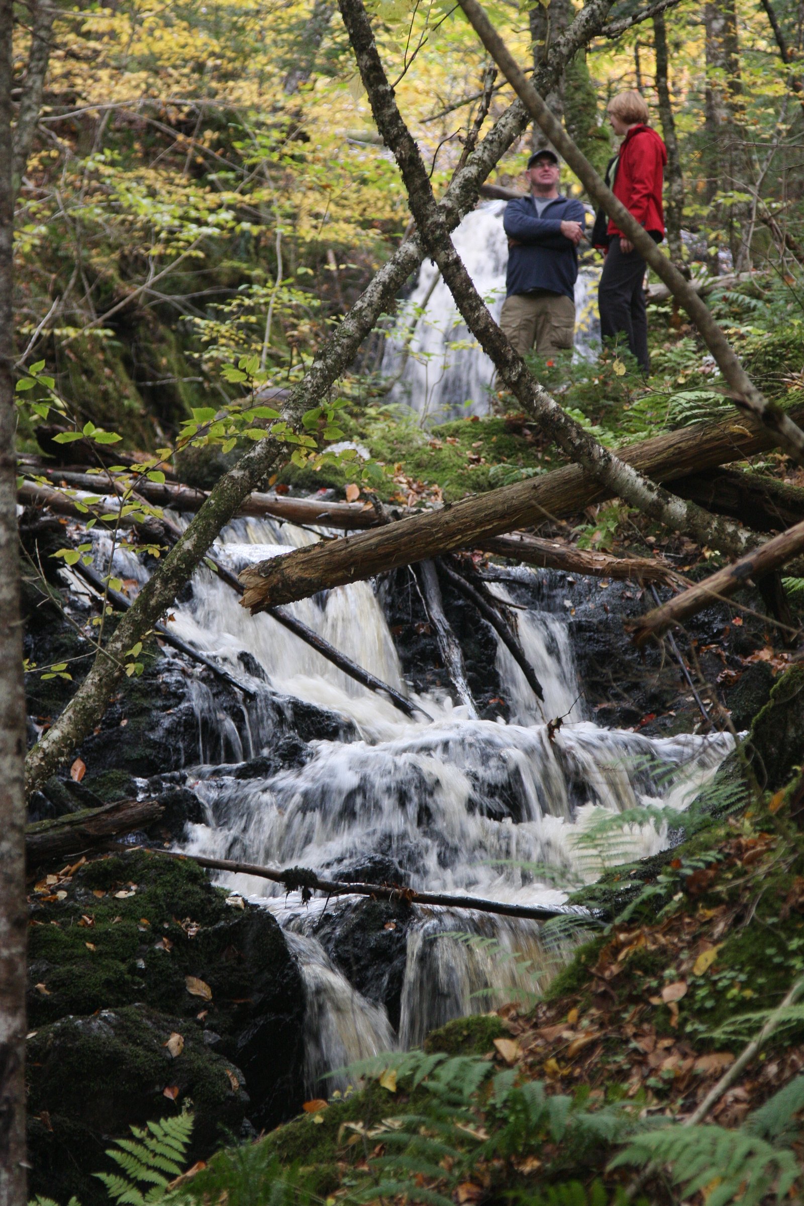
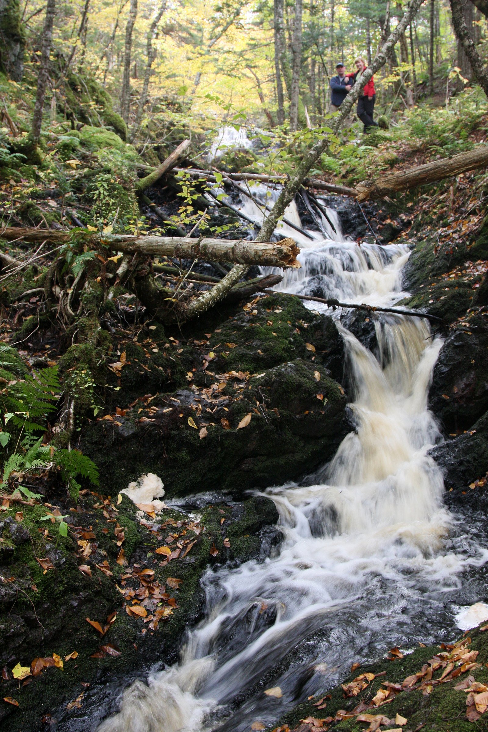

Photo Credits (5)
Difficulty
Moderate
Trail Length
2.7 km
Trail Type
Out And Back
Elevation Gain
56 m
About Devil's Hill Waterfall I
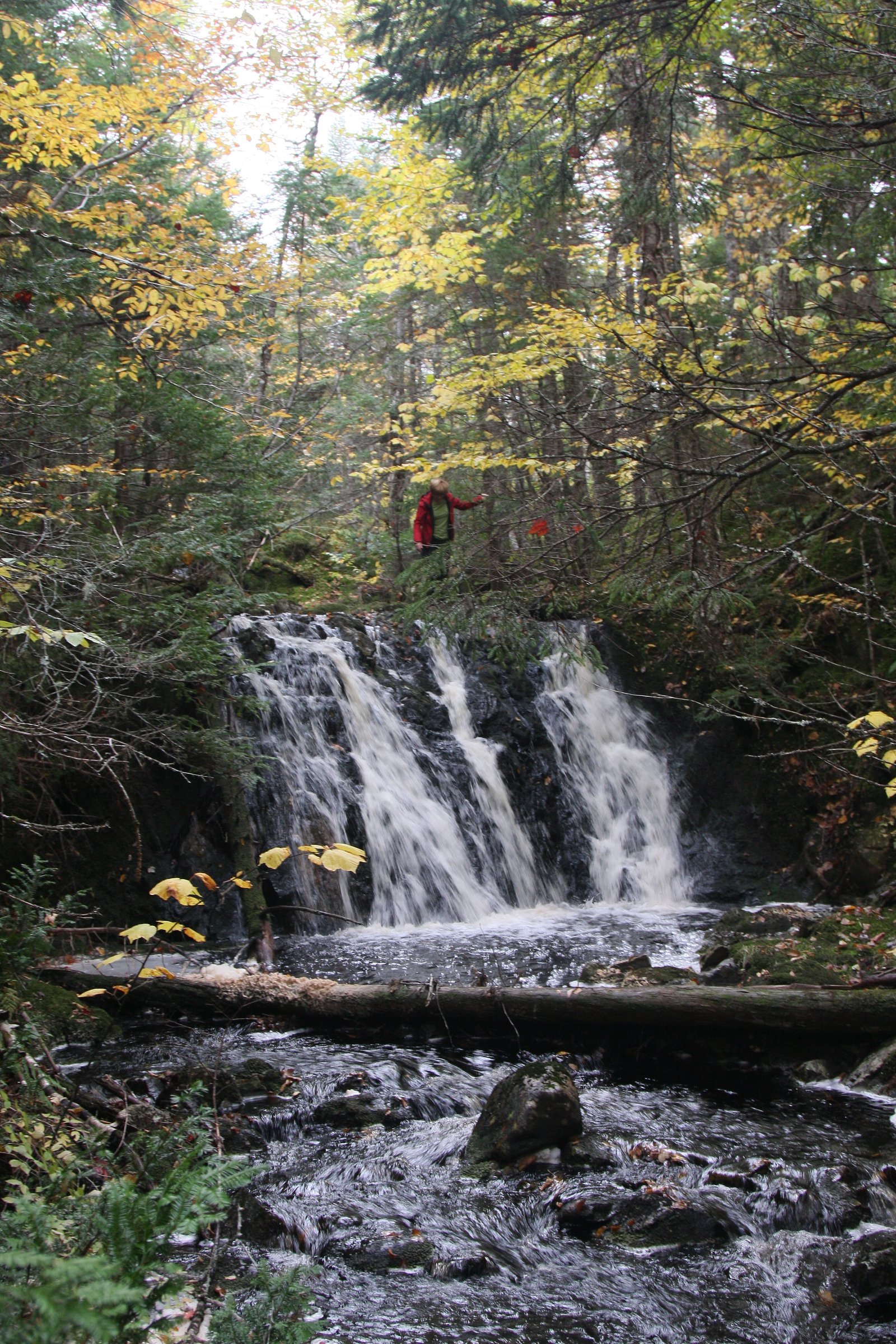
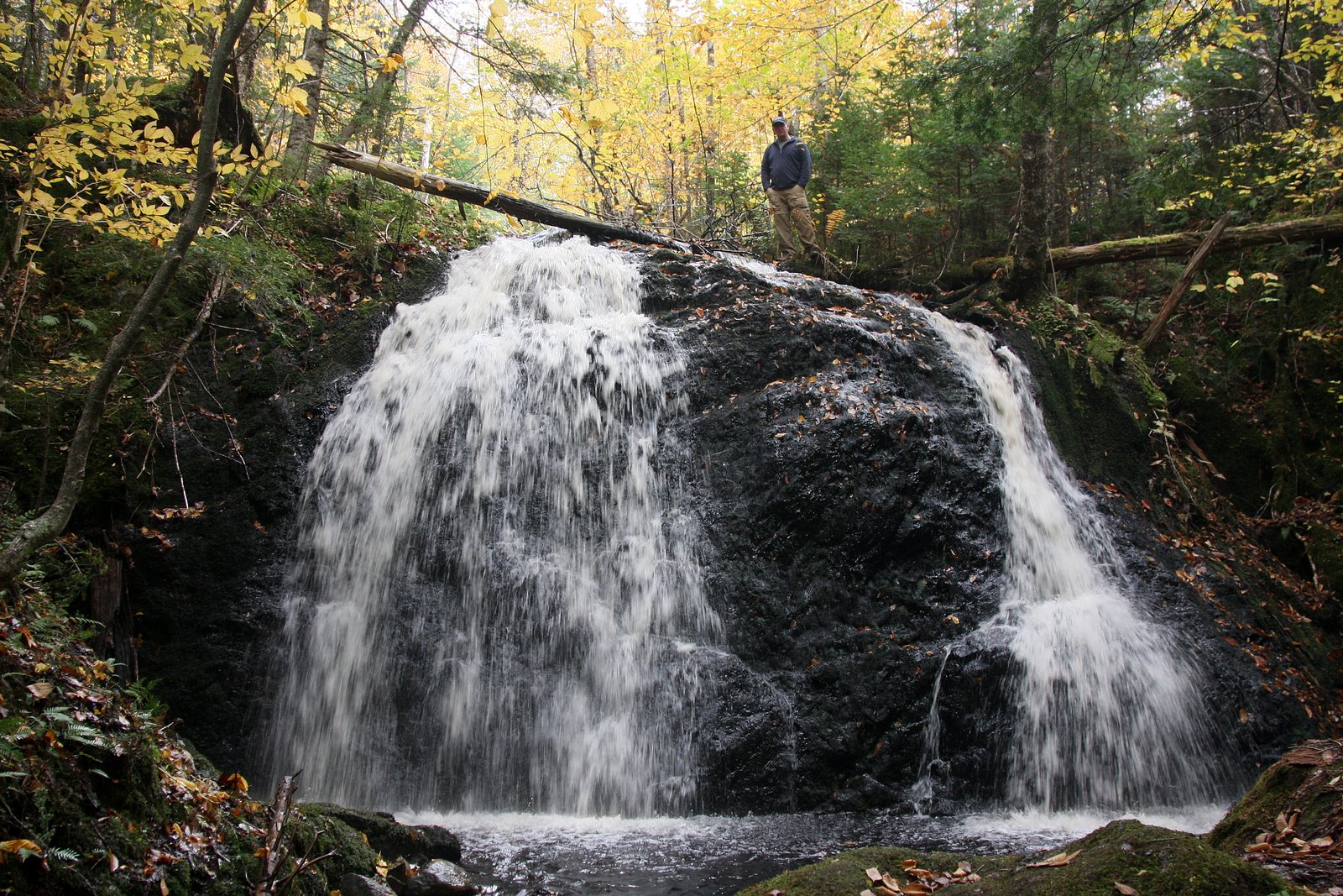
Devil's Hill Waterfall I is a forested, likely small-to-moderate cascade on Cape Breton Island near the community of Sydney, Nova Scotia. The falls sit in a wooded setting typical of the region, mixed Acadian forest, mossy rocks and a narrow stream channel. Water flow is typically higher in spring and after heavy rain and lower in late summer. Specific published measurements and an official trail description are not readily available, so details below are conservative and may vary by season and recent local conditions.
The Setting
Devil's Hill Waterfall I sits at 54 metres in the coastal lowlands of Nova Scotia. The falls drop 12 metres.
Why This Waterfall Exists
Devil's Hill Waterfall I flows over hard volcanic rock laid down about 539 million to 1.0 billion years ago. These resistant rocks form a durable ledge that water cannot easily wear away, creating a 41-foot drop where softer material downstream has already eroded.
Nearby Falls Worth Visiting
Devil's Hill Waterfall II (5 m) lies 0.2 kilometres to the northeast.
Trail & Hike Details
The Approach
The moderate 2.7-km out-and-back trail gains 56 metres of elevation on the way to the falls.
Trail Description
There is no widely published, official trail guide for Devil's Hill Waterfall I. Visiting typically involves following a short, informal path from a nearby roadside parking area through mixed forest to the stream and falls. Expect uneven footing: roots, rocks, and possibly muddy or wet sections near the water. Trails in the area may be unmarked and can become indistinct close to the falls. Use caution near slopes and stream banks.
What to Expect
The falls drop 12 metres over hard volcanic rock.
Accessibility
The trail is not wheelchair accessible. Uneven terrain and elevation changes require steady footing.
Frequently Asked Questions
🐶 Are Dogs Allowed at Devil's Hill Waterfall I?
❌ Dogs are not allowed
Are There Any Fees or Permits Required?
🆖 No fees required
🏊 Is There Swimming at Devil's Hill Waterfall I?
❌ Swimming is not allowed
When to Visit
Late spring (snowmelt and spring rains) for the fullest flow; early fall for cooler weather and foliage color. Summer is fine for drier and warmer visits but flow may be reduced. Winter access may be possible but expect snow/ice and require appropriate winter gear; avoid icy banks.
Seasonal Access
The best time to visit is Spring, Summer, Fall, and Winter. Check with the managing park or local authority for current conditions.
Safety Information
Hazards may include slippery rocks, unstable stream banks, steep or hidden drop-offs, cold water, and variable water flow after storms. There may be little or no cell service and no emergency services on-site. Always tell someone your plans, carry a map, wear appropriate footwear, avoid getting too close to the edge, supervise children closely, and do not attempt technical approaches or climbing without proper experience and equipment.
Current Water Conditions
0.0 m³/s
Current discharge — how much water is flowing
About average for this time of year
Based on 47 years of record
0.71 m
Water depth at gauge
7-Day Discharge Trend
What does this mean for your visit?
Flow is about average for this time of year.
About This Gauge
This gauge is on a nearby waterway and may not reflect exact conditions at the falls.
7-Day Flow Outlook
Based on the WSC gauge MACASKILLS BROOK NEAR BIRCH GROVE (16 km away).
Today
Moderate
0.0 m³/s
4/10Tomorrow
Moderate
0.0 m³/s
8/10Tue
Moderate
0.0 m³/s
6/10Wed
Moderate
0.0 m³/s
5/10Thu
Moderate
0.0 m³/s
6/10Fri
Moderate
0.0 m³/s
6/10Sat
Moderate
0.0 m³/s
5/10Best window: Tomorrow — moderate flow, mainly sunny (trip score 8/10).
Best time of year: this gauge typically runs highest from late March to early May, peaking in April.
How we calculate this
This is a transparent outlook, not a precise forecast. We take the waterfall's current flow strength (how it ranks against its historical normal for today, from the nearest WSC stream gauge), carry that ranking forward along the gauge's seasonal curve, and nudge it for forecast rain. Confidence is highest for the next day or two and falls further out. Always check official conditions and your own judgment before visiting — high flows can be dangerous.
Know when to go.
Get a free email alert when waterfalls near Sydney hit peak flow. We only send when conditions are worth the trip — no weekly newsletters, no spam.
Weather Forecast
Location & Access
Getting There
Coordinates: 45.9773, -60.0292. The falls are on Cape Breton Island, roughly 14.3 miles from Sydney and about 36.5 miles from Baddeck by road. Access typically involves driving on local roads or forestry/seasonal roads; the last stretch may be an informal pullout or short unmarked trail. Expect limited signage. Visitors should use a reliable map/GPS and local guidance when approaching the coordinates.
Get Directions on Google MapsParking
Parking is likely informal (small pullout or roadside space). There may not be an official lot or restroom facilities. Vehicles should be parked clear of the travelway and respect local signage or private property.
Elevation
54 metres above sea level
Coordinates
45.977298° N, -60.029238° W
Visitor Tips & Gear
• Wear sturdy footwear with good traction; rocks near the water will be slippery. • Bring insect repellent (black flies and mosquitoes in spring/summer) and tick prevention. • Leave no trace: pack out all trash and avoid damaging vegetation. • Do not climb on wet or moss-covered rocks near the falls; banks may be unstable. • If the approach uses a forestry or seasonal road, check current road conditions and local access rules before driving. • Check local maps/GIS or contact regional parks/municipal offices if you need confirmation about access or parking.
As an Amazon Associate, we earn from qualifying purchases.
With 2.7 km and 56 m of elevation gain, sturdy boots and trekking poles will help on this moderate trail. Icy conditions are common in winter — traction cleats are a smart addition.

Columbia Watertight II Rain Jacket
Packs into its own pocket, seam-sealed, and keeps you dry from spray and surprise rain.

Polarized Sunglasses (Knockaround)
Cuts glare off the water so you actually see the falls — and your photos turn out better too.

Earth Pak Waterproof Dry Bag
Keeps your phone and gear dry when waterfall mist soaks everything else.

Waterproof Phone Pouch (AiRunTech)
Cheap insurance — take photos right next to the falls without killing your phone.

Timberland Euro Sprint Mid Waterproof
Trusted waterproof boot with premium leather and grippy rubber sole — reliable on rocky, wet trails.

TrailBuddy Trekking Poles
Lightweight aluminum, cork grips, and flip-locks that actually hold — a best-seller for good reason.
Where to Stay
Browse vacation cabins and private rentals nearby
Unique outdoor stays — tents, yurts, and treehouses
Rent a campervan or RV for your waterfall road trip
Some links are affiliate links. We may earn a commission at no extra cost to you.
Nearby Campground
Lakeview Treasures Campground
3.2 km away
Additional Information
Nearby Attractions
The falls are within driving distance of Sydney (about 14 miles) and Baddeck (about 36 miles). Regional attractions on Cape Breton Island include Bras d'Or Lake, coastal viewpoints and, further afield, the Cabot Trail and Cape Breton Highlands National Park. Exact access and travel times will depend on local roads.
Wildlife
Typical Cape Breton wildlife may be present: white-tailed deer, moose (in some areas), black bear, foxes, coyotes, various songbirds and raptors. Insects such as black flies, mosquitoes and ticks are common in warm months. Maintain distance from larger wildlife and secure food.
Cities near Devil's Hill Waterfall I
Nearby Waterfalls
Writing about Devil's Hill Waterfall I? Embed this waterfall on your site for free.