Difficulty
Drive Up
Trail Length
0.2 km
Trail Type
Out And Back
About Chutes Maubèches
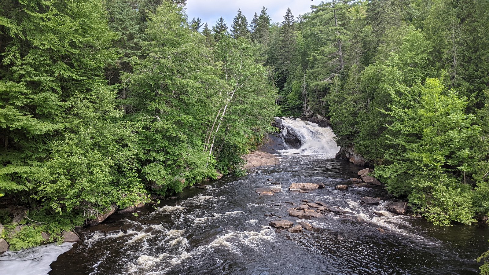
Chutes Maubèches is a natural waterfall site in Quebec (coordinates 46.5982, -73.4025). The falls are a rocky cascade typical of the region's small river systems and are visited for short hikes, photography and seasonal flow variations. Precise published information about development (boardwalks, viewing platforms) and exact height is limited; visitors should expect a relatively undeveloped, natural site that may require walking over uneven terrain to reach good viewpoints.
Why This Waterfall Exists
Chutes Maubèches flows over hard crystalline rock laid down over 1.4-1.8 billion years ago. These resistant rocks form a durable ledge that water cannot easily wear away, creating the falls where softer material downstream has already eroded.
Trail & Hike Details
The Approach
No hiking required. Chutes Maubèches is accessible by vehicle with a roadside viewing area.
Trail Description
Published trail information is limited. Reports from similar small waterfall sites in Quebec suggest a short, sometimes unmarked path from the parking/pullout to viewpoints. Trails may be rocky, narrow and include short steep sections near the riverbank. Expect minimal infrastructure (few or no guardrails, steps or boardwalks) and variable signage.
What to Expect
A modest natural cascade set in mixed forest typical of southern/central Quebec. Flow is highest in spring (snowmelt) and after heavy rains, and lower in late summer. Vegetation includes greenwood forest and understory plants; terrain near the water is rocky and may be slippery. There may be no formal viewing platform; some visitors find multiple vantage points by walking along the riverbank. Seasonal insects (black flies, mosquitoes) can be numerous in spring and early summer.
Accessibility
This waterfall is viewable from a vehicle-accessible area. No hiking is required.
Frequently Asked Questions
🐶 Are Dogs Allowed at Chutes Maubèches?
❌ Dogs are not allowed
Are There Any Fees or Permits Required?
🆖 No fees required
🏊 Is There Swimming at Chutes Maubèches?
❌ Swimming is not allowed
When to Visit
Spring (high water and dramatic flows) and fall (color) are typically the most attractive times. Summer provides warmer weather but sometimes lower flow. Winter can offer ice formations but access may be difficult or hazardous without proper winter gear.
Seasonal Access
The best time to visit is Spring, Summer, Fall, and Winter. Check with the managing park or local authority for current conditions.
Safety Information
Hazards include slippery and unstable rocks near the water, strong currents, variable water depth, cold water temperatures, seasonal ice, and limited or no barriers at viewpoints. Wear good footwear, keep a safe distance from the edge, supervise children closely, and avoid cliff edges. Check weather and recent visitor reports for trail conditions. In winter, ice can be thin and dangerous. If uncertain about route or conditions, do not proceed.
7-Day Flow Outlook
Based on the WSC gauge LOUP (RIVIERE DU) A 0,3 KM EN AVAL DU RUISSEAU CARUFEL (17 km away).
Best time of year: this gauge typically runs highest from early April to late June, peaking in April.
How we calculate this
This is a transparent outlook, not a precise forecast. We take the waterfall's current flow strength (how it ranks against its historical normal for today, from the nearest WSC stream gauge), carry that ranking forward along the gauge's seasonal curve, and nudge it for forecast rain. Confidence is highest for the next day or two and falls further out. Always check official conditions and your own judgment before visiting — high flows can be dangerous.
Know when to go.
Get a free email alert when waterfalls near Joliette hit peak flow. We only send when conditions are worth the trip — no weekly newsletters, no spam.
Weather Forecast
Location & Access
Getting There
The falls are located at approximately 46.5982 N, -73.4025 W, roughly within the region between Joliette (≈29 miles), Shawinigan-Sud (≈31 miles) and Trois-Rivières (≈48 miles). Access is typically by local municipal roads; expect secondary paved or gravel roads near the site. Use the coordinates in a mapping app for the most direct route. Local signage, small access roads or unmarked pullouts may lead to the trailhead or viewing area.
Get Directions on Google MapsParking
Parking appears to be limited and informal in many cases (small municipal lot or roadside pullout). There may not be a staffed or paved parking lot; avoid blocking driveways or private property. During busy times or high water events, roadside parking can be restricted.
Elevation
394 metres above sea level
Coordinates
46.598159° N, -73.402458° W
Visitor Tips & Gear
• Use the exact coordinates in your GPS to locate the site. • Wear sturdy, closed-toe shoes with good traction; rocks and roots can be slippery. • Respect private property and posted signs, some access routes may cross or border private land. • Bring insect repellent in spring/early summer. • Avoid getting too close to the edge, currents and wet rocks are hazardous. • Check local municipal or park websites for any access advisories before travel.
Where to Stay
Browse vacation cabins and private rentals nearby
Unique outdoor stays — tents, yurts, and treehouses
Rent a campervan or RV for your waterfall road trip
Some links are affiliate links. We may earn a commission at no extra cost to you.
Nearby Campground
Camping du Lac-au-Sorcier
5.9 km away
Additional Information
Nearby Attractions
Nearby regional towns include Joliette, Shawinigan-Sud and Trois-Rivières, which offer parks, museums and services. There may be local trails, small provincial or municipal parks in the broader region, check regional tourism resources for up-to-date listings.
Wildlife
Typical Quebec forest wildlife may be present: white-tailed deer, various songbirds, small mammals, and during some seasons insects such as black flies and mosquitoes. Be aware of ticks in warmer months.
Cities near Chutes Maubèches
Nearby Waterfalls
Writing about Chutes Maubèches? Embed this waterfall on your site for free.