
Photo Credits (2)
Difficulty
Moderate
Trail Length
1.9 km
Trail Type
Out And Back
Elevation Gain
85 m
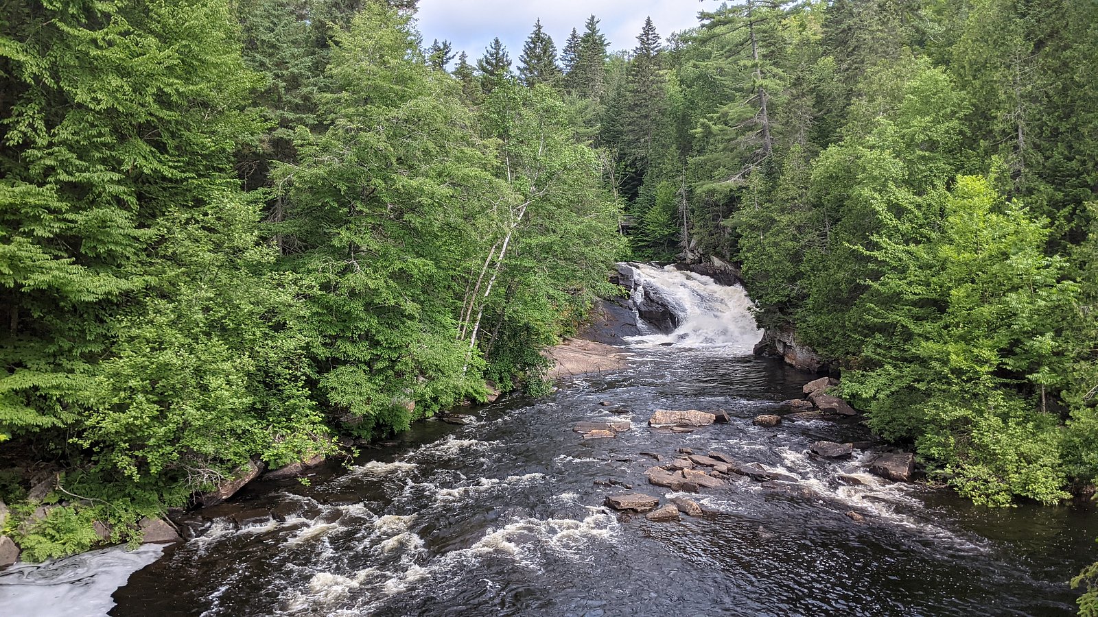
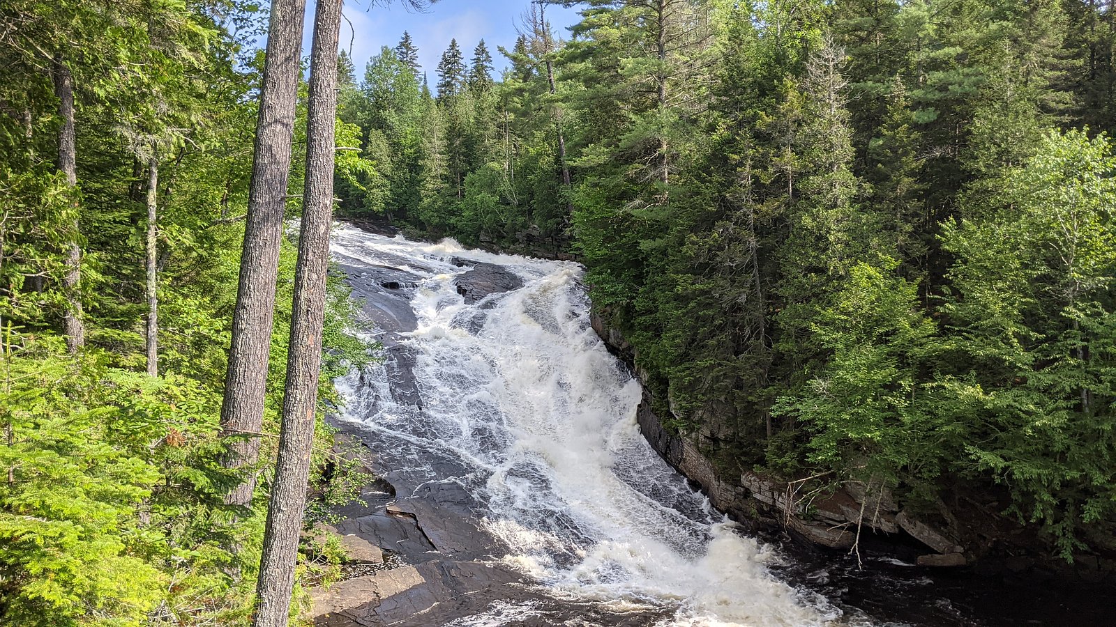
About Chutes du Calvaire
Chutes du Calvaire is a natural waterfall site in Quebec, Canada (coordinates: 46.4599, -73.3806). It is described in regional guides as a scenic cascade popular with local visitors. Flow and appearance are typically strongest in spring (snowmelt) and after heavy rain; summer and fall offer lower flows and leaf-color views. Specifics about official facilities, exact trailhead names, and measured height vary between sources, so visitors should verify local signage or municipal tourism resources before traveling.
Why This Waterfall Exists
Chutes du Calvaire flows over hard crystalline rock, primarily gneiss, laid down over 1.0-1.6 billion years ago. These resistant rocks form a durable ledge that water cannot easily wear away, creating the falls where softer material downstream has already eroded.
Trail & Hike Details
The Approach
The moderate 1.9-km out-and-back trail gains 85 metres of elevation on the way to the falls.
Trail Description
Trail details vary by source and may be short, informal footpaths down to the falls or municipal-short trails. Surfaces can include packed earth, roots, and rock; some approaches may require negotiating steep or uneven sections. There may be viewpoints from above and rough, unmaintained routes closer to the water. Specific trail length, elevation gain, and official route names are not confidently known for this site, confirm with local trail maps or visitor centers before your visit.
What to Expect
Expect a natural waterfall setting with rocky banks and variable water flow. Spring typically brings the highest flows; in summer the flow can be reduced. There may be no formal facilities (restrooms, visitor center) and limited signage. Rocks near the falls are often wet and slippery. In winter the falls may be partially or fully frozen and surrounding trails can be icy. Expect limited cell service in some spots and the possibility of mud after rain.
Accessibility
The trail is not wheelchair accessible. Uneven terrain and elevation changes require steady footing.
Frequently Asked Questions
🐶 Are Dogs Allowed at Chutes du Calvaire?
❌ Dogs are not allowed
Are There Any Fees or Permits Required?
🆖 No fees required
🏊 Is There Swimming at Chutes du Calvaire?
❌ Swimming is not allowed
When to Visit
Early morning or weekdays for fewer visitors. Spring (late March–May) for highest flow and dramatic water; late summer and early fall for easier hiking and foliage. Winter offers ice features but also increased hazards from ice and cold; only attempt winter visits with appropriate experience and gear.
Seasonal Access
The best time to visit is Spring, Summer, Fall, and Winter. Check with the managing park or local authority for current conditions.
Safety Information
Hazards: slippery and unstable rocks, fast or cold water, steep and uneven trails, changing weather, and potential limited cell service. In winter, expect ice and avalanche or cornice hazards on exposed slopes. Do not approach the water’s edge or climb on wet rocks. Supervise children closely. If visiting in remote conditions, let someone know your plans and expected return time.
7-Day Flow Outlook
Based on the WSC gauge MASTIGOUCHE (RIVIERE) EN AVAL DU LAC SAINTE-ROSE (7 km away).
Best time of year: this gauge typically runs highest from early April to early June, peaking in April.
How we calculate this
This is a transparent outlook, not a precise forecast. We take the waterfall's current flow strength (how it ranks against its historical normal for today, from the nearest WSC stream gauge), carry that ranking forward along the gauge's seasonal curve, and nudge it for forecast rain. Confidence is highest for the next day or two and falls further out. Always check official conditions and your own judgment before visiting — high flows can be dangerous.
Know when to go.
Get a free email alert when waterfalls near Joliette hit peak flow. We only send when conditions are worth the trip — no weekly newsletters, no spam.
Weather Forecast
Location & Access
Getting There
The waterfall is located in the general region east of Joliette and north of Trois-Rivières (approximate distances: Joliette ~23.4 miles, Shawinigan-Sud ~30.0 miles, Trois-Rivières ~40.5 miles). Use the coordinates (46.4599, -73.3806) in a GPS or mapping app to find the nearest access point. Local roads may be two-lane rural routes; check seasonal road conditions before travel.
Get Directions on Google MapsParking
There may be limited roadside parking or a small local parking area near the trailhead. Official parking details and capacity are not confirmed, expect simple, unpaved or municipal parking and obey signage. If you need accessible parking or confirmed lot availability, contact the local municipality or regional tourism office ahead of time.
Elevation
259 metres above sea level
Coordinates
46.459859° N, -73.380606° W
Visitor Tips & Gear
1) Wear sturdy, grippy footwear suitable for uneven, wet terrain. 2) Check recent local reports or municipal tourism sites for access updates before you go. 3) Stay on established trails and away from the water’s edge, slippery rocks and undercut banks are common hazards. 4) Bring water, snacks, and a small first-aid kit. 5) Pack out all trash and follow Leave No Trace principles. 6) If photographing the falls, be careful near edges and avoid risky positions.
As an Amazon Associate, we earn from qualifying purchases.
With 1.9 km and 85 m of elevation gain, sturdy boots and trekking poles will help on this moderate trail. Icy conditions are common in winter — traction cleats are a smart addition.

Columbia Watertight II Rain Jacket
Packs into its own pocket, seam-sealed, and keeps you dry from spray and surprise rain.

Polarized Sunglasses (Knockaround)
Cuts glare off the water so you actually see the falls — and your photos turn out better too.

Earth Pak Waterproof Dry Bag
Keeps your phone and gear dry when waterfall mist soaks everything else.

Waterproof Phone Pouch (AiRunTech)
Cheap insurance — take photos right next to the falls without killing your phone.

Timberland Euro Sprint Mid Waterproof
Trusted waterproof boot with premium leather and grippy rubber sole — reliable on rocky, wet trails.

TrailBuddy Trekking Poles
Lightweight aluminum, cork grips, and flip-locks that actually hold — a best-seller for good reason.
Where to Stay
Browse vacation cabins and private rentals nearby
Unique outdoor stays — tents, yurts, and treehouses
Rent a campervan or RV for your waterfall road trip
Some links are affiliate links. We may earn a commission at no extra cost to you.
Nearby Campground
Lac-aux-Sables
3.3 km away
Additional Information
Nearby Attractions
Regional attractions may include local municipal parks and the greater Mauricie area (Parc national de la Mauricie is in the wider region near Shawinigan). Larger towns nearby include Joliette, Shawinigan-Sud, and Trois-Rivières for services, food, and lodging.
Wildlife
Typical regional wildlife may include songbirds, forest birds, white-tailed deer, small mammals, and possibly black bear in more remote forested areas. Be aware of and store food securely if camping or picnicking.
Cities near Chutes du Calvaire
Nearby Waterfalls
Writing about Chutes du Calvaire? Embed this waterfall on your site for free.