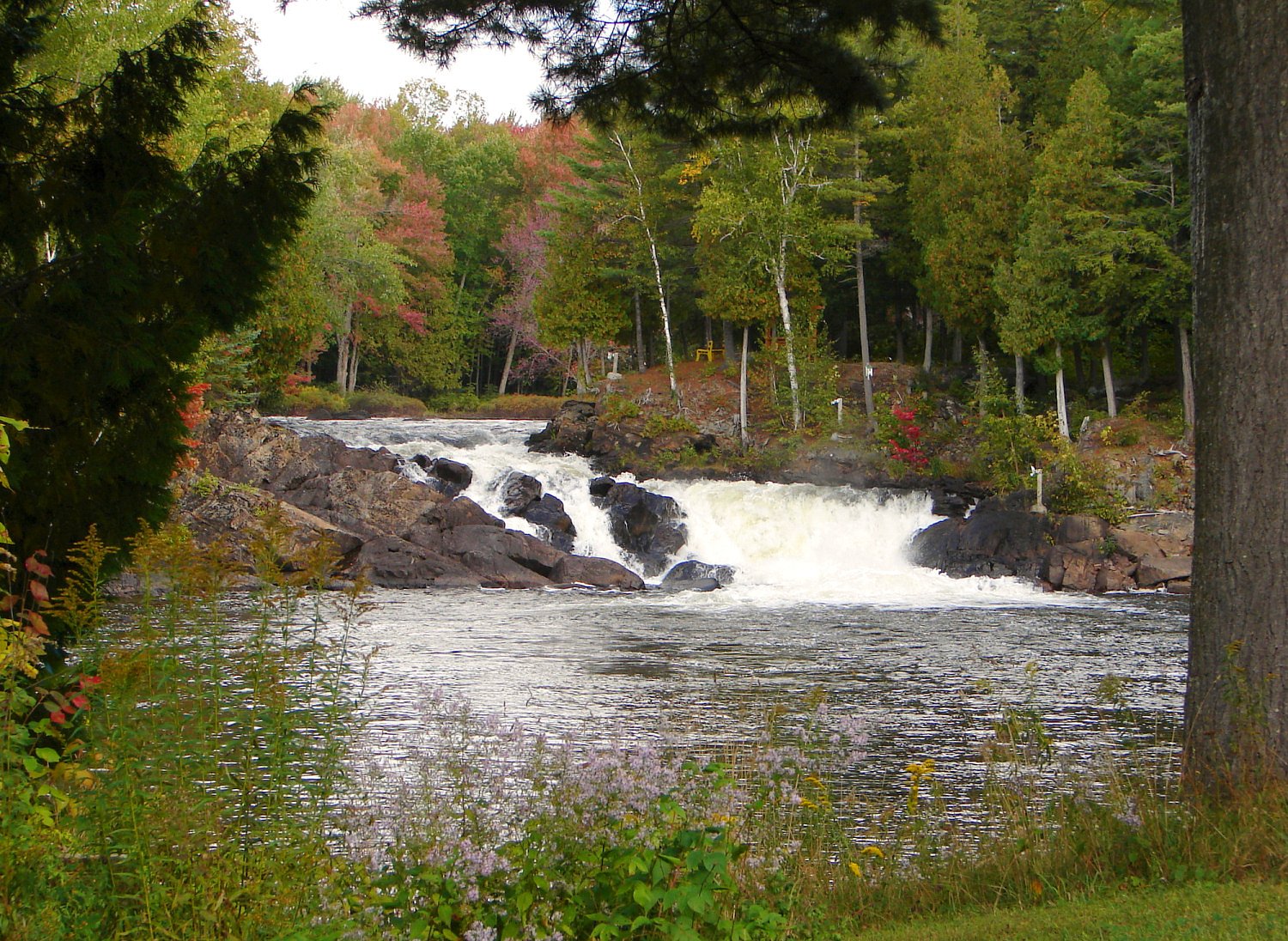
About Chutes Lockbow
Chutes Lockbow is a waterfall feature located in western Quebec (coordinates 45.8666, -75.0801), roughly 48.2 miles from Ottawa and about 51.2 miles from Mont-Laurier. Precise published information about the falls (official name variants, exact height, or the named river/stream) is limited in common trail databases. The site appears to be a small cascade or chute on a local stream and is likely most impressive during spring melt and after heavy rains. Visitors should be prepared for a low‑infrastructure, possibly roadside or short‑trail experience rather than a developed park site.
Why This Waterfall Exists
Chutes Lockbow flows over hard banded metamorphic rock, primarily gneiss, laid down over 1.4-1.6 billion years ago. These resistant rocks form a durable ledge that water cannot easily wear away, creating the falls where softer material downstream has already eroded.
Trail & Hike Details
Trail Description
Detailed trail descriptions are not available from major public trail resources. Access may be a short walk from a roadside pullout or a briefly steep scramble down to the water; alternatively the feature may be directly visible from a nearby road or parking spot. Terrain is likely natural (rocky banks, tree cover) and can be slippery when wet or icy. Because official trail signage and maintained paths are not confirmed, expect unmarked approaches and bring a map/GPS.
What to Expect
A relatively rural, low‑infrastructure waterfall experience. Expect: seasonal variability in flow (high in spring, lower in late summer), rocky and potentially steep shoreline, limited facilities (no restrooms, picnic tables, or lifeguards), limited or no cell service in remote stretches. Terrain may include wet rock, roots, and mud. In winter the falls may be partly frozen and icy.
Accessibility
The site is likely not accessible for wheelchairs or people with limited mobility due to unpaved/uneven terrain, natural steps/rocks, and lack of developed trails or boardwalks. Accessibility improvements are not confirmed.
Frequently Asked Questions
🐶 Are Dogs Allowed at Chutes Lockbow?
❌ Dogs are not allowed
Are There Any Fees or Permits Required?
🆖 No fees required
🏊 Is There Swimming at Chutes Lockbow?
❌ Swimming is not allowed
When to Visit
Spring (late March–May) for highest water flow and dramatic cascades; fall for foliage and cooler hiking conditions. Summer is suitable for easy access but flows may be lower. Winter can offer ice formations but requires winter hiking skills and caution around frozen water.
Seasonal Access
The best time to visit is Spring, Summer, Fall, and Winter. Check with the managing park or local authority for current conditions.
Safety Information
Hazards to be aware of: slippery and unstable rocks near the water, fast or cold currents (especially during spring melt), sudden water level changes after heavy rain, limited or no cell phone reception, ticks and biting insects in warmer months, and winter ice instability. Do not approach cliff edges or attempt to climb wet rock faces. If conditions are remote, tell someone your plans and expected return time.
7-Day Flow Outlook
Based on the WSC gauge SUFFOLK (RUISSEAU) A 0,2 KM EN AMONT DU PONT-ROUTE A CHENEVILLE (5 km away).
Best time of year: this gauge typically runs highest from late March to late May, peaking in April.
How we calculate this
This is a transparent outlook, not a precise forecast. We take the waterfall's current flow strength (how it ranks against its historical normal for today, from the nearest WSC stream gauge), carry that ranking forward along the gauge's seasonal curve, and nudge it for forecast rain. Confidence is highest for the next day or two and falls further out. Always check official conditions and your own judgment before visiting — high flows can be dangerous.
Know when to go.
Get a free email alert when waterfalls near Ottawa hit peak flow. We only send when conditions are worth the trip — no weekly newsletters, no spam.
Weather Forecast
Location & Access
Getting There
Coordinates: 45.8666, -75.0801. From Ottawa the location is approximately a 1–1.5 hour drive (about 48.2 miles / ~77.6 km) northeast; from Mont‑Laurier roughly 51.2 miles (~82.4 km). Access likely uses secondary or local provincial roads; expect some gravel or logging roads near the site. Exact turnoffs and access points are not confirmed; consult local maps or authorities before travel.
Get Directions on Google MapsParking
No confirmed formal parking lot. Parking may be a small pullout or roadside space; space may be limited and could be on unpaved shoulders. If arriving by car, use caution when parking and avoid blocking roads or private driveways.
Elevation
196 metres above sea level
Coordinates
45.866602° N, -75.080097° W
Visitor Tips & Gear
• Check recent trip reports or local land manager information before you go. • Wear sturdy, grippy footwear and expect slippery rocks near the water. • Bring a map or use the provided coordinates for navigation; do not rely only on mobile signal. • Respect private property, if the approach crosses private land, obtain permission. • Observe water safety: currents can be stronger than they appear; avoid swimming unless there is a designated, safe area. • Leave no trace: pack out trash and avoid disturbing vegetation and wildlife.
Where to Stay
Browse vacation cabins and private rentals nearby
Unique outdoor stays — tents, yurts, and treehouses
Rent a campervan or RV for your waterfall road trip
Some links are affiliate links. We may earn a commission at no extra cost to you.
Nearby Campground
Camping 4 vents
0.9 km away
Additional Information
Nearby Attractions
Nearest larger centres: Ottawa (~48.2 miles) and Mont‑Laurier (~51.2 miles). The area is part of Quebec's rural Outaouais/Laurentian region, which offers other natural attractions (provincial parks, lakes and forests) though specific nearby park names for this exact coordinate are not confirmed here.
Wildlife
Expect typical regional wildlife: white‑tailed deer, beaver, various waterfowl, songbirds, and potentially moose or black bear in more remote patches. Take normal wildlife precautions (store food securely, keep distance).
Cities near Chutes Lockbow
Nearby Waterfalls
Writing about Chutes Lockbow? Embed this waterfall on your site for free.