
Photo Credits (1)
About Chutes à Joubert
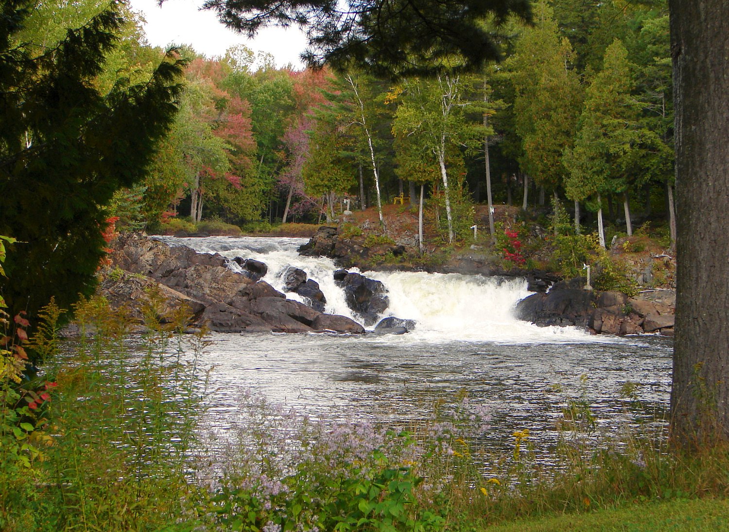
Les chutes à Joubert, formerly named les chutes à Neveu, are freshwater waterfalls located in the municipality of Ripon in Québec, administered by the municipalité régionale de comté de Papineau, in the administrative region of l'Outaouais, Canada.
Why This Waterfall Exists
Chutes à Joubert flows over hard banded metamorphic rock, primarily gneiss, laid down over 1.4-1.6 billion years ago. These resistant rocks form a durable ledge that water cannot easily wear away, creating the falls where softer material downstream has already eroded.
Trail & Hike Details
Trail Description
Detailed, authoritative trail descriptions are not readily available for Chutes à Joubert. Reports suggest a short walk from a roadside or small parking area to viewpoints, potentially on unmarked or minimally maintained paths. Trails may be uneven, rocky, and close to wet/steep edges. Expect primitive footing rather than developed boardwalks or paved viewing platforms.
What to Expect
A natural, forested setting with the waterfall and likely a stream or river channel. There may be limited facilities (no restrooms, no visitor center) and few or no formal safety barriers. In spring the flow is typically higher; summer and fall offer easier hiking conditions and fall colors. Winter may present ice-covered rocks and frozen cascades but also hazardous footing.
Accessibility
No confirmed accessibility infrastructure (paved viewpoints, ramps) is reported. Expect natural, uneven trails and potentially steep or rocky approaches; site is likely not wheelchair accessible.
Frequently Asked Questions
🐶 Are Dogs Allowed at Chutes à Joubert?
❌ Dogs are not allowed
Are There Any Fees or Permits Required?
🆖 No fees required
🏊 Is There Swimming at Chutes à Joubert?
❌ Swimming is not allowed
When to Visit
Spring for highest water flow; late spring/early summer for fewer seasonal closures and comfortable weather; fall for foliage and scenic colors. Winter visits are possible but expect icy conditions and limited access, only for experienced, well-prepared visitors.
Seasonal Access
The best time to visit is Spring, Summer, Fall, and Winter. Check with the managing park or local authority for current conditions.
Safety Information
Hazards may include slippery rocks and trails, steep or unguarded drops, fast or cold water, variable trail footing, seasonal high water/flashiness after rains, ticks/black flies in warm months, and limited cell coverage. Wear appropriate footwear, keep a safe distance from water and edges, supervise children closely, and do not attempt to climb slippery rock faces. If visiting in winter, use traction devices and be prepared for icy conditions. In case of emergency, call local emergency services and provide the coordinates (45.7913, -75.0894) if possible.
7-Day Flow Outlook
Based on the WSC gauge PETITE NATION (RIVIERE DE LA) AU PONT A 1,6 KM EN AMONT DE RIPON (0 km away).
Best time of year: this gauge typically runs highest from late March to mid June, peaking in April.
How we calculate this
This is a transparent outlook, not a precise forecast. We take the waterfall's current flow strength (how it ranks against its historical normal for today, from the nearest WSC stream gauge), carry that ranking forward along the gauge's seasonal curve, and nudge it for forecast rain. Confidence is highest for the next day or two and falls further out. Always check official conditions and your own judgment before visiting — high flows can be dangerous.
Know when to go.
Get a free email alert when waterfalls near Ottawa hit peak flow. We only send when conditions are worth the trip — no weekly newsletters, no spam.
Weather Forecast
Location & Access
Getting There
Drive from Ottawa roughly northeast for about 40–50 miles (approx. 1–1.5 hours depending on route and traffic) to the coordinates 45.7913, -75.0894. Exact turnoffs and signage may be limited; use up-to-date mapping/GPS and local resources. Expect rural roads; some approaches may include paved secondary roads and short gravel or dirt spurs.
Get Directions on Google MapsParking
Parking information is not well documented. There may be a small roadside pullout or informal parking near the trailhead; do not block private driveways or roadways. If visiting a managed park or conservation area nearby, use official parking areas. Confirm parking rules locally.
Elevation
161 metres above sea level
Coordinates
45.791327° N, -75.089352° W
Visitor Tips & Gear
• Confirm directions and local access rules before you go; cell coverage may be spotty. • Wear sturdy, closed-toe footwear with good traction, rocks around waterfalls are slippery. • Stay behind any posted barriers and keep a safe distance from edges. • Bring water and layers; conditions can change quickly. • Pack out what you bring in; no trash services may be available. • If you plan to park on a shoulder, ensure your vehicle does not obstruct traffic or private property. • Check for seasonal hazards (ice in winter, high flows in spring) and insects (black flies, mosquitoes) in warm months.
Where to Stay
Browse vacation cabins and private rentals nearby
Unique outdoor stays — tents, yurts, and treehouses
Rent a campervan or RV for your waterfall road trip
Some links are affiliate links. We may earn a commission at no extra cost to you.
Nearby Campground
Camping Au Petit Lac-Simon
2.2 km away
Additional Information
Nearby Attractions
The site is within the broader Outaouais/Quebec region; Ottawa and Gatineau Park lie within the greater area and offer many visitor services and additional hiking opportunities. For specific nearby parks or named attractions, consult local tourism resources or regional park authorities to confirm distances and accessibility.
Wildlife
Typical wildlife for Quebec mixed-wood forests may be present, including white-tailed deer, beavers, small mammals, and a variety of forest birds. Black bears and moose are possible in some rural parts of Quebec; practice standard wildlife safety precautions (store food, keep distance).
Cities near Chutes à Joubert
Nearby Waterfalls
Writing about Chutes à Joubert? Embed this waterfall on your site for free.