Photo Credits (5)
Difficulty
Drive Up
Trail Length
0.2 km
Trail Type
Out And Back
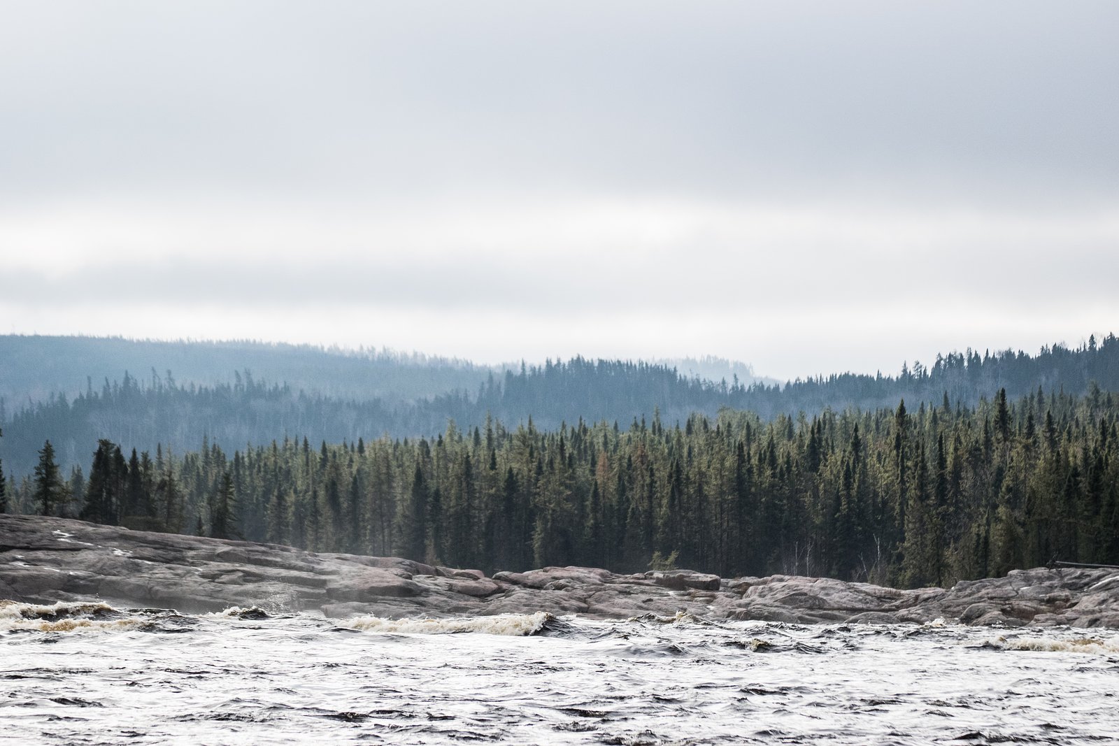
About Chutes de la Chaudière
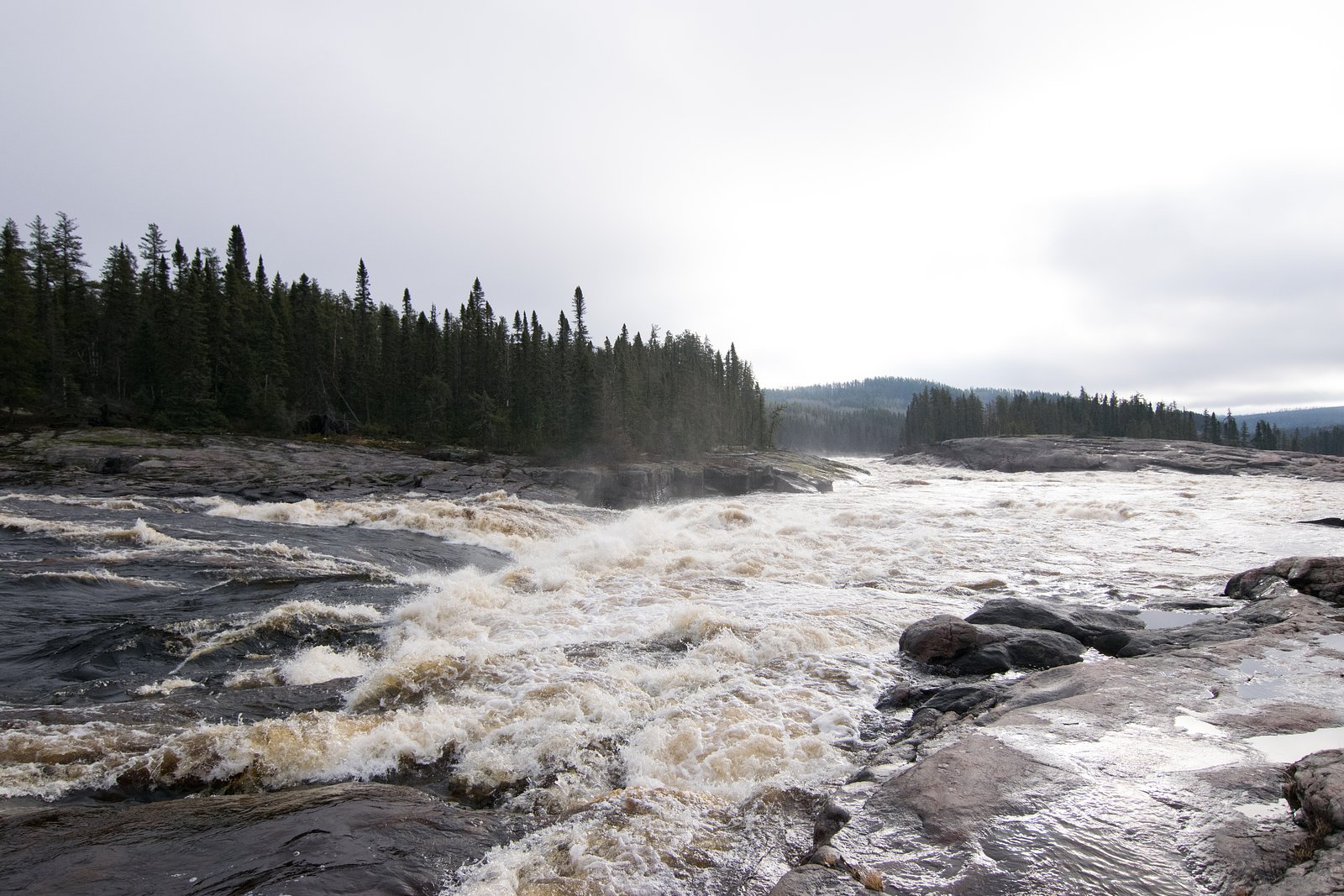
Chutes de la Chaudière near Dolbeau (coordinates ~48.982, -73.0692) is a woodland cascade in the Saguenay–Lac-Saint-Jean region of Quebec. It is a scenic natural waterfall that typically has its highest flows in spring runoff and after heavy rain. Multiple waterfalls in Quebec share the name “Chaudière,” so local signage or maps should be consulted to confirm you have the correct site. Specific infrastructure (viewing platforms, railings, signage) may vary or be limited; visitors should plan for natural, possibly rugged terrain.
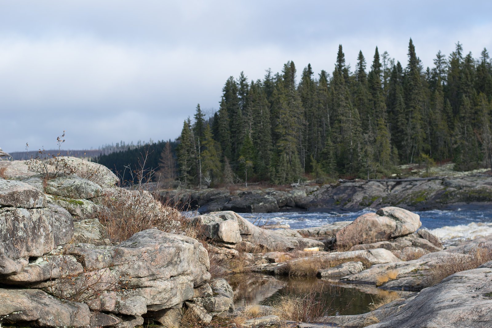
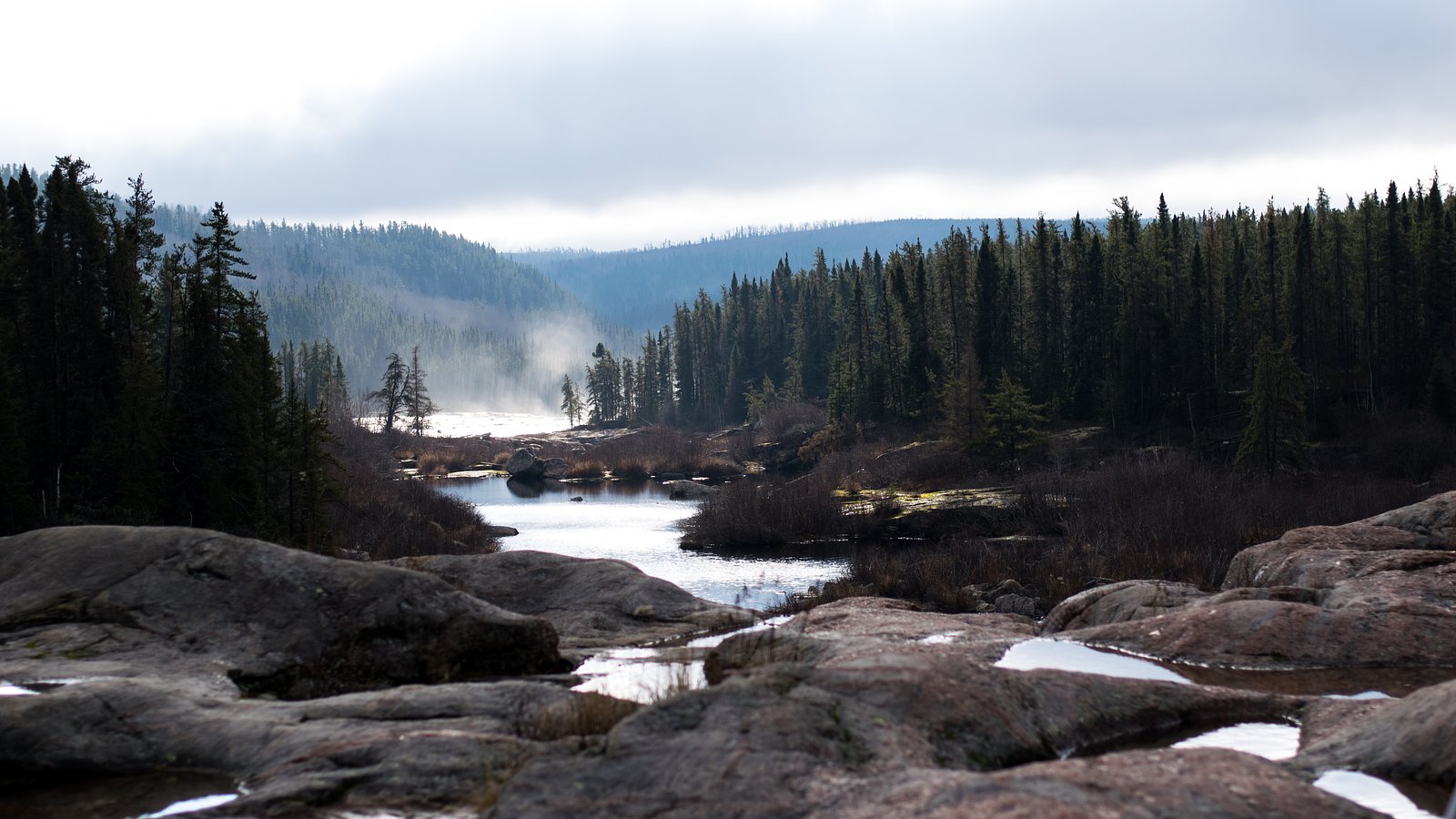
The Setting
Chutes de la Chaudière sits at 226 metres within Proposed rivière Ashuapmushuan Aquatic Reserve, in the foothills of Quebec.
Why This Waterfall Exists
Chutes de la Chaudière flows over hard crystalline rock, primarily charnockite, laid down over 1.0-2.5 billion years ago. These resistant rocks form a durable ledge that water cannot easily wear away, creating the falls where softer material downstream has already eroded.
Trail & Hike Details
The Approach
No hiking required. Chutes de la Chaudière is accessible by vehicle with a roadside viewing area.
Trail Description
Trails to rural Quebec waterfalls are often short but can be uneven, with roots, rocks, mud, and occasional steep sections down to the water. There may be informal social trails rather than fully developed boardwalks. Expect limited wayfinding; bring a map or GPS. In winter, trails may be icy or snow-covered and require winter traction devices. Because of variability in local management, specific trail length, and infrastructure for this site are not confirmed here.
What to Expect
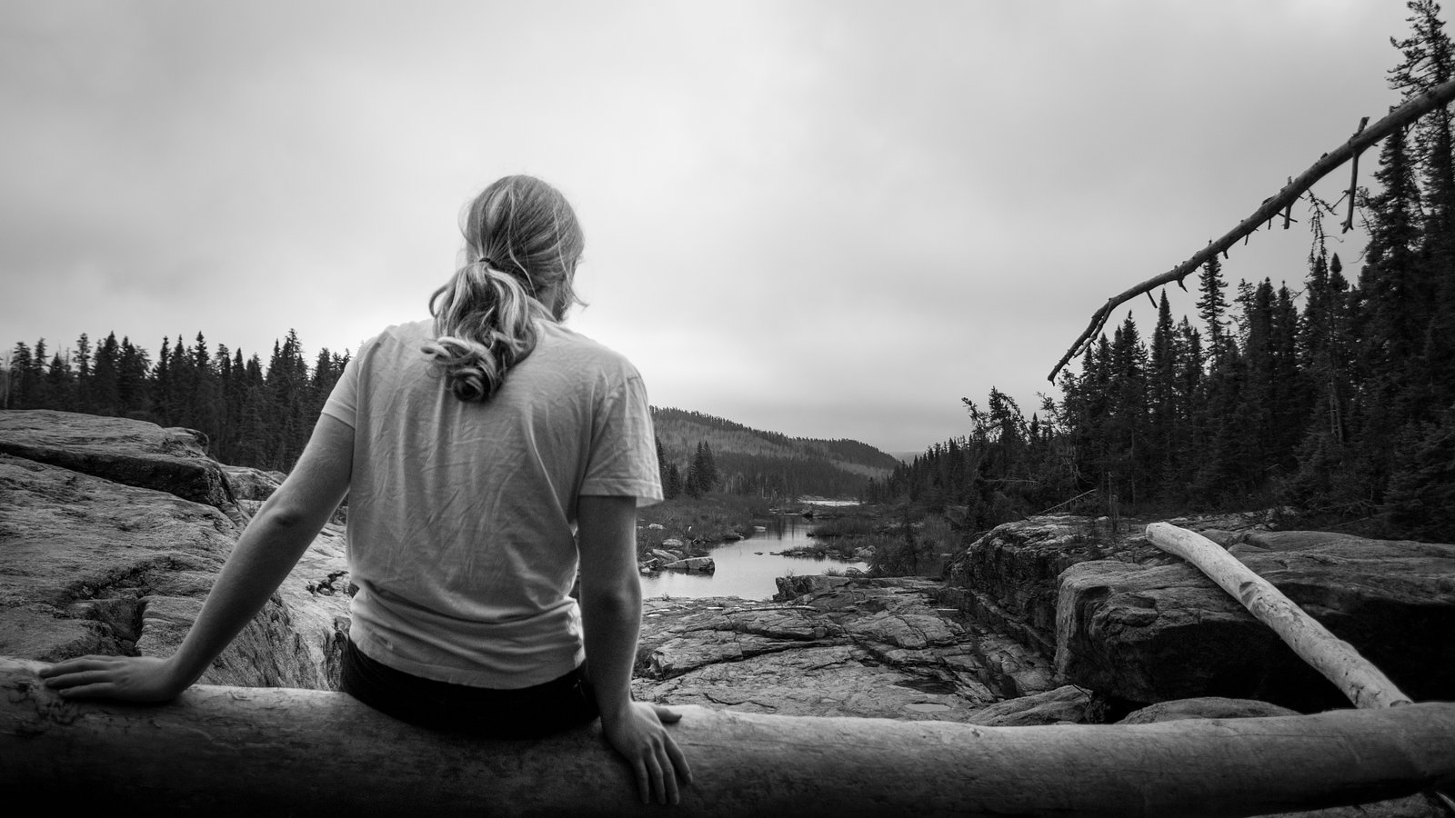
A natural forested setting with the waterfall framed by bedrock and mixed boreal/deciduous trees. Spring and early summer bring higher flows; late summer can be lower. Facilities (restrooms, picnic tables, trash service) may be minimal or absent. Cell service can be spotty in rural areas. Insects (black flies, mosquitoes) can be heavy in late spring/early summer. Winter creates ice formations but also increases slip hazards.
Accessibility
This waterfall is viewable from a vehicle-accessible area. No hiking is required.
Frequently Asked Questions
🐶 Are Dogs Allowed at Chutes de la Chaudière?
❌ Dogs are not allowed
Are There Any Fees or Permits Required?
🆖 No fees required
🏊 Is There Swimming at Chutes de la Chaudière?
❌ Swimming is not allowed
When to Visit
Spring (late March–June) for highest water flow and dramatic runoff. Fall for foliage color and lower crowds. Summer for warmer weather and easier access. Winter can offer striking frozen scenery but has increased hazards from ice and snow; only attempt with proper winter gear.
Seasonal Access
The best time to visit is Spring, Summer, Fall, and Winter. Check with the managing park or local authority for current conditions.
Safety Information
Hazards can include slippery and unstable rock near the falls, strong currents, sudden water-level changes during rain or spring melt, steep drop-offs, ticks and biting insects, and limited cell service. Do not approach cliff edges or climb on wet rocks. In winter, ice can be brittle and dangerous, do not assume frozen surfaces are safe. Always tell someone your plans and expected return time when visiting remote sites.
7-Day Flow Outlook
Based on the WSC gauge ROUGE (RIVIERE) EN AMONT DU PONCEAU SUR LA ROUTE 373 (47 km away).
Best time of year: this gauge typically runs highest from early April to early June, peaking in April.
How we calculate this
This is a transparent outlook, not a precise forecast. We take the waterfall's current flow strength (how it ranks against its historical normal for today, from the nearest WSC stream gauge), carry that ranking forward along the gauge's seasonal curve, and nudge it for forecast rain. Confidence is highest for the next day or two and falls further out. Always check official conditions and your own judgment before visiting — high flows can be dangerous.
Know when to go.
Get a free email alert when waterfalls near Dolbeau hit peak flow. We only send when conditions are worth the trip — no weekly newsletters, no spam.
Weather Forecast
Location & Access
Getting There
Access is by road from the surrounding regional highway network; the site is in the Saguenay–Lac-Saint-Jean area. The user-supplied reference notes the falls are approximately 41.0 miles from Dolbeau (use local maps/GPS to confirm route). Expect rural roads; some final approach roads may be gravel. Verify directions with local tourist offices or municipal maps before travel.
Get Directions on Google MapsParking
Small roadside pullouts or an informal parking area may be present near trailheads. Parking availability and capacity are likely limited; park legally and avoid blocking gates or driveways. If unsure, check local municipal or tourism sources for the most current parking information.
Elevation
226 metres above sea level
Coordinates
48.982037° N, -73.069150° W
Land Management
Managed by Ministère de l'Environnement, de la Lutte contre les changements climatiques, de la Faune et des Parcs, Direction des aires protégées
Visitor Tips & Gear
• Confirm exact location and roadway conditions before you go; rural roads can be rough. • Wear sturdy footwear and expect muddy, rocky, or steep sections. • Stay back from edges, wet rock is very slippery and edges can be unstable. • Bring insect repellent in spring/summer and traction devices in winter. • Pack out all trash and respect private property; many access points cross or adjoin privately owned land. • Check local tourist office or municipality for up-to-date access, parking, or seasonal advisories.
Where to Stay
Browse vacation cabins and private rentals nearby
Unique outdoor stays — tents, yurts, and treehouses
Rent a campervan or RV for your waterfall road trip
Some links are affiliate links. We may earn a commission at no extra cost to you.
Nearby Campground
Camping Lac-du-Milieu
26.6 km away
Additional Information
Nearby Attractions
Saguenay–Lac-Saint-Jean region attractions (general): Saguenay Fjord viewpoints, regional parks, local trails, small lakes and rivers, and towns such as Dolbeau–Mistassini. Verify distances and directions locally.
Wildlife
Typical regional wildlife may include moose, white-tailed deer, black bear, beaver, fox, and a variety of songbirds and waterfowl. Use standard wildlife safety practices (store food, keep distance).
Cities near Chutes de la Chaudière
Other waterfalls named Chutes de la Chaudière
1 other waterfall shares this name across Canada.
Writing about Chutes de la Chaudière? Embed this waterfall on your site for free.