
Photo Credits (5)
Difficulty
Easy
Trail Length
1.9 km
Trail Type
Loop
Elevation Gain
68 m
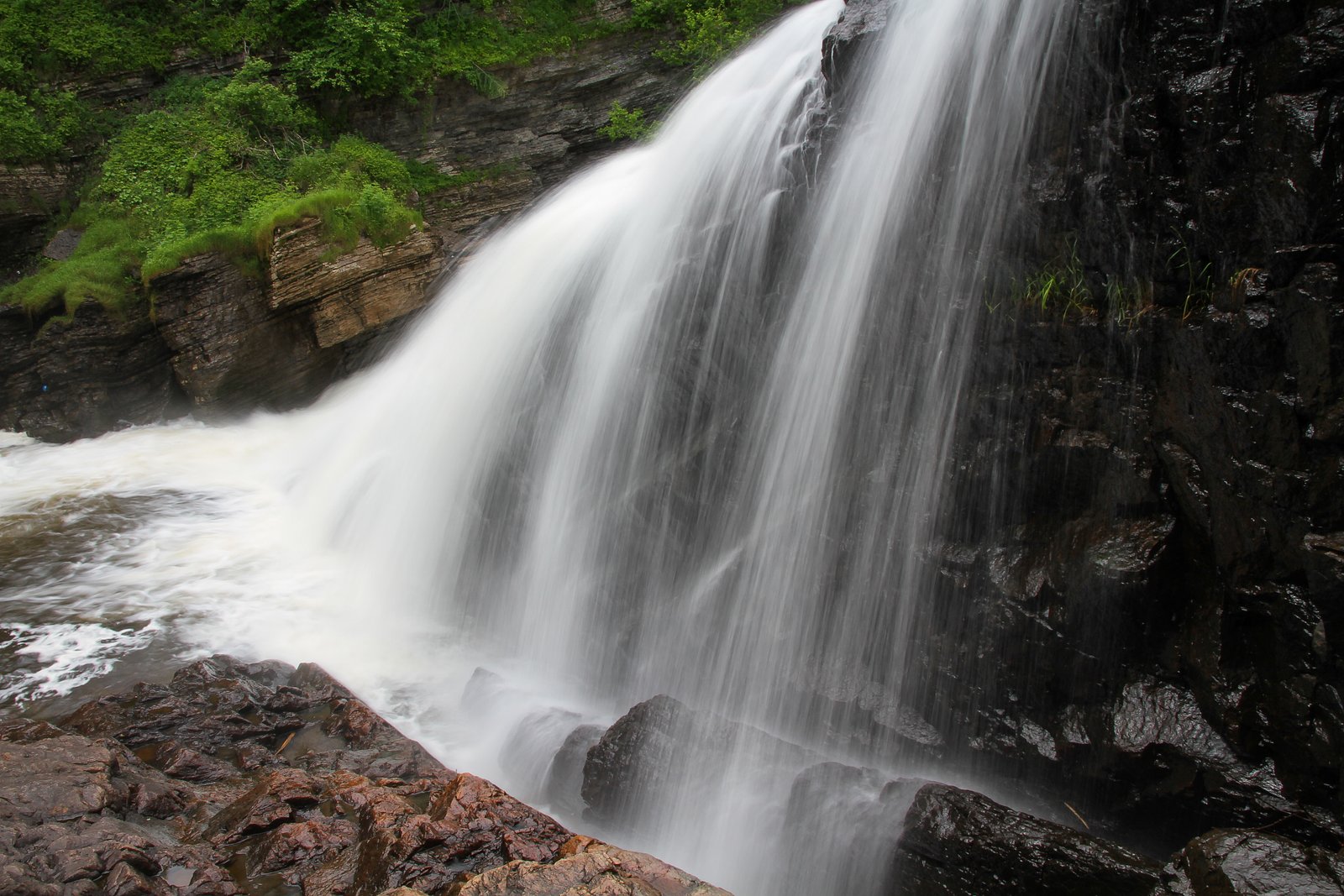
About Chutes de la Chaudière
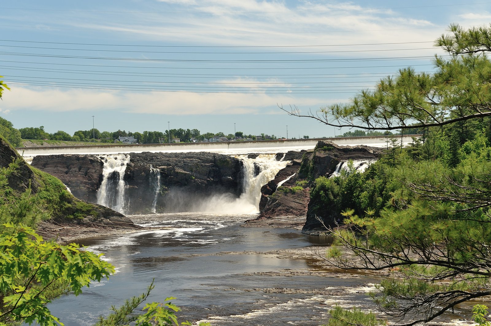
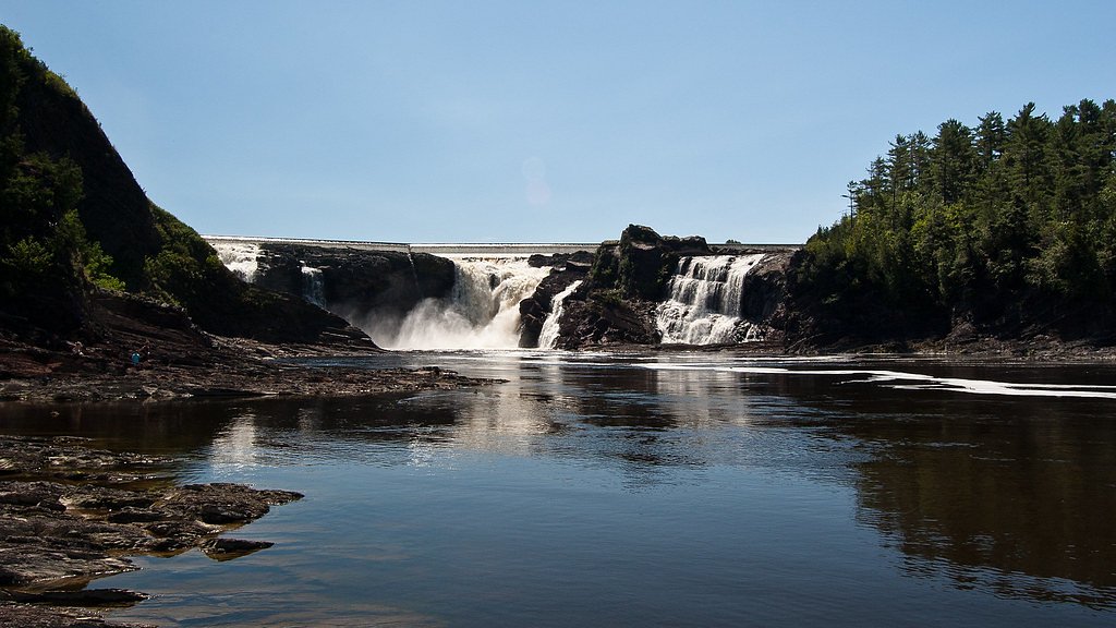
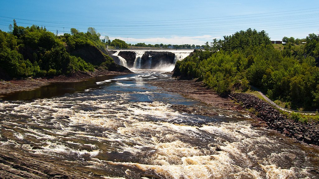
Chaudière Falls is a 35-meter-high (115 ft) waterfall in Lévis, Quebec, along the Chaudière River. It is part of the regional Parc des Chutes-de-la-Chaudière, which features a 113-metre-long (371 ft) suspension footbridge standing 23 metres over the river. There are walking and bicycle trails along the river.
The Setting
Chutes de la Chaudière sits at 37 metres in the coastal lowlands of Quebec. At 35 metres, it is among the taller waterfalls in Quebec.
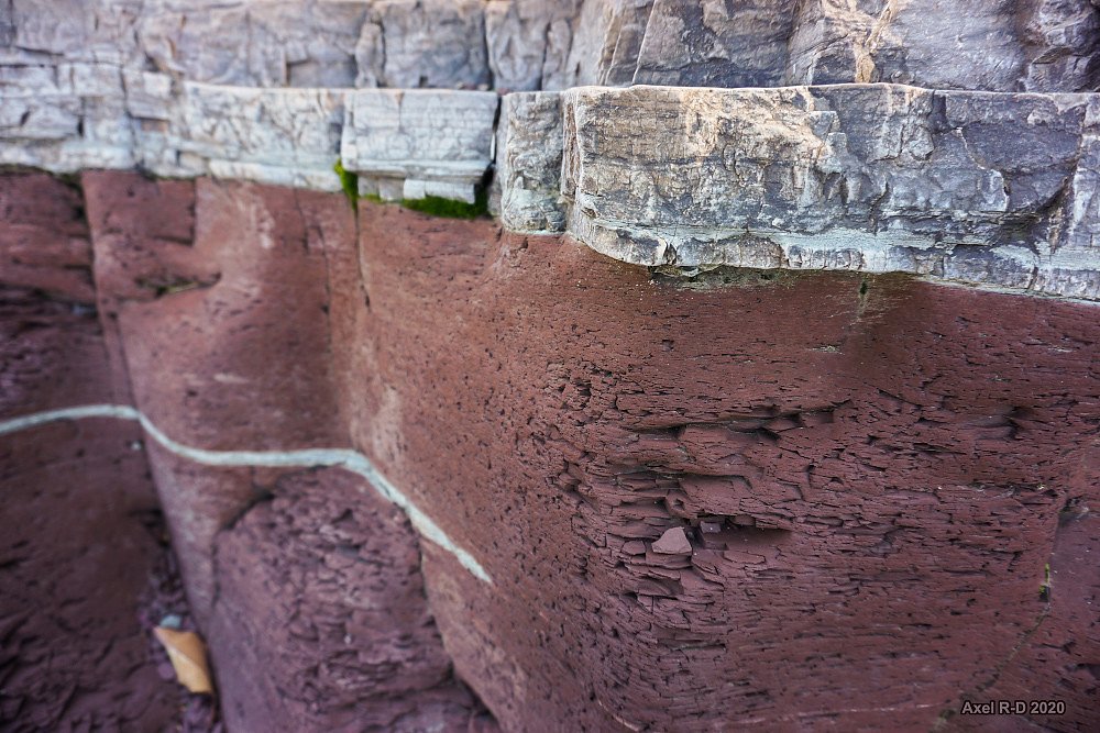
Why This Waterfall Exists
Chutes de la Chaudière flows over layered sedimentary rock laid down about 485-539 million years ago. Over time, the stream has worn through these layers at different rates, creating a 114-foot drop that forms the waterfall.
Nearby Falls Worth Visiting
Chute Kabir Kouba (28 m) lies 16.6 kilometres to the northwest.
Trail & Hike Details
The Approach
The easy 1.9-km loop trail gains 68 metres of elevation on the way to the falls.
Trail Description
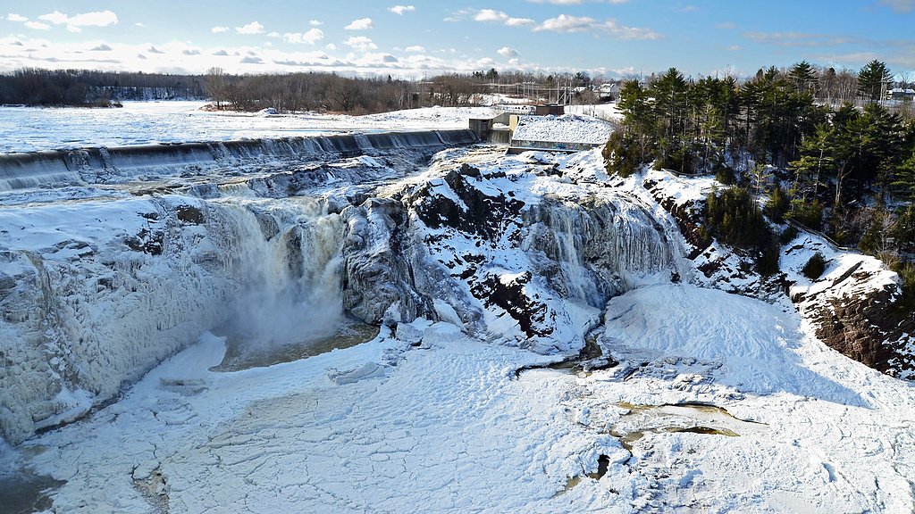
Short paved paths and boardwalks lead from the parking area to several viewing platforms overlooking the gorge and falls. A pedestrian suspension bridge spans part of the river and provides additional vantage points. Trails are short and suitable for most visitors; surfaces may be uneven in places and can be icy in winter.
What to Expect
The falls cascade 35 metres over layered sedimentary rock.
Accessibility
The trail is not wheelchair accessible. Uneven terrain and elevation changes require steady footing.
Frequently Asked Questions
🐶 Are Dogs Allowed at Chutes de la Chaudière?
❌ Dogs are not allowed
Are There Any Fees or Permits Required?
🆖 No fees required
🏊 Is There Swimming at Chutes de la Chaudière?
❌ Swimming is not allowed
When to Visit
Late spring (snowmelt) for highest flows and dramatic water volume. Early morning on weekdays reduces crowds. Fall for foliage color. Winter visits are scenic but may have limited access or icy surfaces.
Seasonal Access
The best time to visit is Spring, Summer, Fall, and Winter. Check with the managing park or local authority for current conditions.
Safety Information
There are steep cliffs, fast-moving water, and slippery rocks, do not climb barriers or enter the water. Seasonal ice, strong currents in spring, and falling spray can create hazardous footing. Keep children and pets under close supervision, follow posted signs and park rules, and avoid getting too close to the edge. Emergency services are available through local authorities; cell coverage is generally available but may vary.
7-Day Flow Outlook
Based on the WSC gauge BEAURIVAGE (RIVIERE) A SAINTE-ETIENNE (6 km away).
Best time of year: this gauge typically runs highest from late March to late May, peaking in April.
How we calculate this
This is a transparent outlook, not a precise forecast. We take the waterfall's current flow strength (how it ranks against its historical normal for today, from the nearest WSC stream gauge), carry that ranking forward along the gauge's seasonal curve, and nudge it for forecast rain. Confidence is highest for the next day or two and falls further out. Always check official conditions and your own judgment before visiting — high flows can be dangerous.
Know when to go.
Get a free email alert when waterfalls near Québec hit peak flow. We only send when conditions are worth the trip — no weekly newsletters, no spam.
Weather Forecast
Location & Access
Getting There
The falls are located near Lévis on the Chaudière River, approximately 5–6 miles south of downtown Québec City (coordinates ~46.7148, -71.2826). From Québec City take one of the bridges across the St. Lawrence (Pont de Québec or Pont Pierre-Laporte) to Lévis and follow municipal signs to Parc des Chutes-de-la-Chaudière / Chaudière River viewpoints. Local roads and Route 132 provide access; consult local maps or the City of Lévis website for exact directions and current access notes.
Get Directions on Google MapsParking
There is parking associated with the park and viewpoint areas; spaces may be limited at peak times. Check municipal park pages for the latest parking info and any paid/permit rules. Park close to official lots and marked access points rather than roadside pullouts.
Elevation
37 metres above sea level
Coordinates
46.714796° N, -71.282563° W
Visitor Tips & Gear
Stay on marked trails and viewing platforms, there are steep drop-offs and slippery rock along the gorge. Supervise children closely. Wear good footwear (non-slip) and bring a windbreaker if you plan to stand near spray. In spring and after heavy rain expect higher water levels and stronger currents. Check municipal park pages for bridge/boardwalk closures and any special event restrictions. If visiting in winter, be prepared for icy conditions and dress warmly.
As an Amazon Associate, we earn from qualifying purchases.
This easy 1.9 km hike is straightforward — comfortable trail shoes and plenty of water should do. Icy conditions are common in winter — traction cleats are a smart addition.

Columbia Watertight II Rain Jacket
Packs into its own pocket, seam-sealed, and keeps you dry from spray and surprise rain.

Polarized Sunglasses (Knockaround)
Cuts glare off the water so you actually see the falls — and your photos turn out better too.

Earth Pak Waterproof Dry Bag
Keeps your phone and gear dry when waterfall mist soaks everything else.

Waterproof Phone Pouch (AiRunTech)
Cheap insurance — take photos right next to the falls without killing your phone.

Kahtoola MICROspikes
Cult-favorite traction cleats that grip ice and wet rock — essential for winter waterfall hikes.

JOBY GorillaPod Starter Kit
Wraps around railings and rocks for long-exposure waterfall shots — no flat surface needed.
Where to Stay
Browse vacation cabins and private rentals nearby
Unique outdoor stays — tents, yurts, and treehouses
Rent a campervan or RV for your waterfall road trip
Some links are affiliate links. We may earn a commission at no extra cost to you.
Nearby Campground
Camping Bernières
4.7 km away
Additional Information
Nearby Attractions
Old Québec (Vieux-Québec), Lévis waterfront and ferry crossing to Québec City, local riverside trails and municipal parks in Lévis. Check local tourism resources for current attractions and seasonal events.
Wildlife
Typical regional wildlife near the river includes waterfowl and songbirds; small mammals may be present in adjacent woodlands. Expect ticks in brushy areas in warm months and normal urban wildlife interactions.
Cities near Chutes de la Chaudière
Nearby Waterfalls
Other waterfalls named Chutes de la Chaudière
1 other waterfall shares this name across Canada.
Writing about Chutes de la Chaudière? Embed this waterfall on your site for free.