
Photo Credits (5)
Difficulty
Moderate
Trail Length
4.7 km
Trail Type
Out And Back
Elevation Gain
155 m
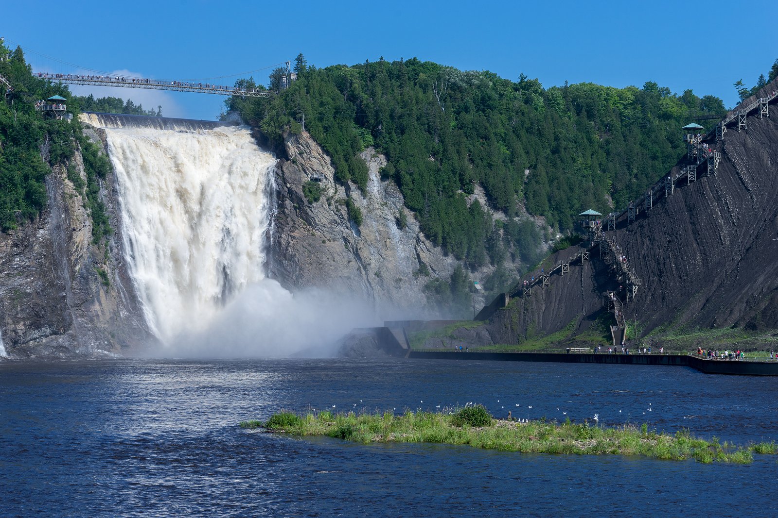
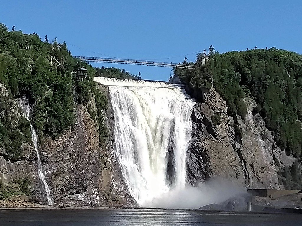
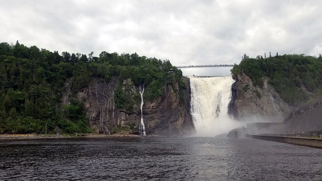
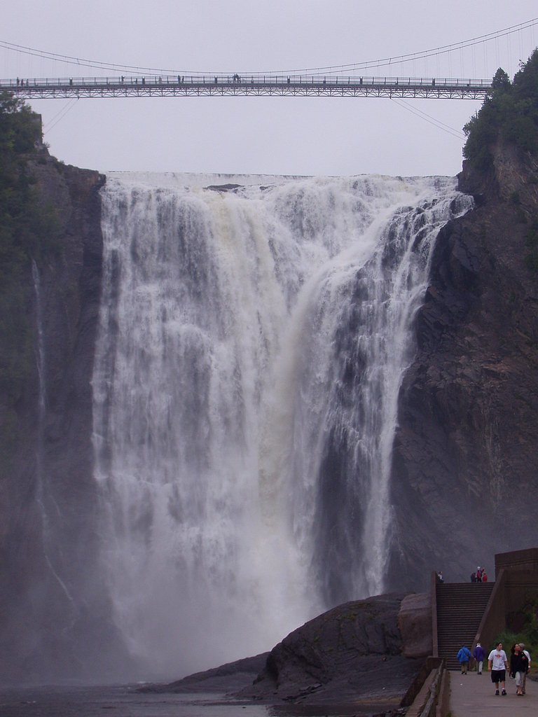
About Chute Montmorency
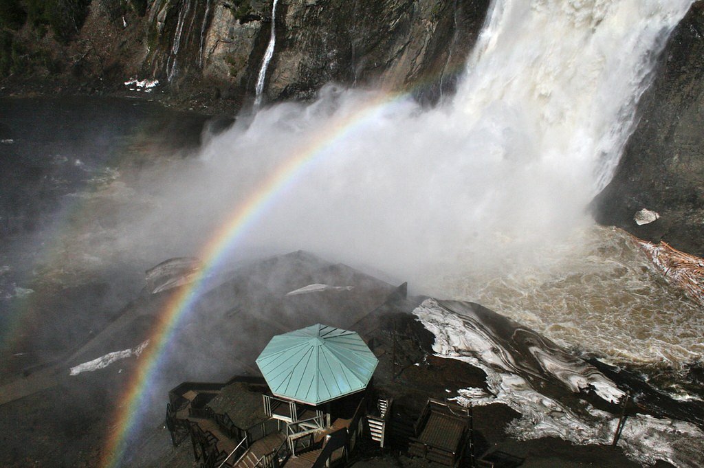
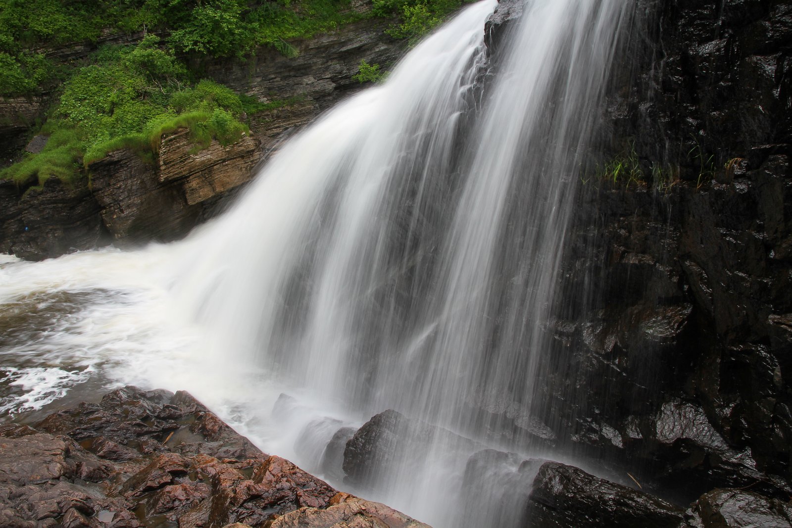
The Montmorency Falls is a large waterfall on the Montmorency River in Quebec, Canada.
The Setting
Chute Montmorency sits at 93 metres in the coastal lowlands of Quebec. At 83 metres, it is among the taller waterfalls in Quebec.
Why This Waterfall Exists
Chute Montmorency flows over layered sedimentary rock laid down about 252-539 million years ago. Over time, the stream has worn through these layers at different rates, creating a 272-foot drop that forms the waterfall.
Nearby Falls Worth Visiting
Chute Kabir Kouba (28 m) lies 16.3 kilometres to the west.
Trail & Hike Details
The Approach
The moderate 4.7-km out-and-back trail gains 155 metres of elevation on the way to the falls.
Trail Description
Short paved paths and boardwalks lead from the parking/visitor area to multiple overlooks above the falls. A suspension footbridge spans the river at the crest providing dramatic views. Stairs descend to a lower viewpoint closer to the base; this route includes many steps and uneven surfaces. Trails around the top and immediate viewpoints are short, well-maintained and suitable for most visitors, though some routes include steep staircases to reach the lower observation area.
What to Expect
The falls plunge 83 metres over layered sedimentary rock.
Accessibility
The trail is not wheelchair accessible. Uneven terrain and elevation changes require steady footing.
Frequently Asked Questions
🐶 Are Dogs Allowed at Chute Montmorency?
❌ Dogs are not allowed
Are There Any Fees or Permits Required?
🆖 No fees required
🏊 Is There Swimming at Chute Montmorency?
❌ Swimming is not allowed
When to Visit
Spring for highest flows (snowmelt) and dramatic water volume; summer for warm weather, full access to facilities and green surroundings; fall for good foliage color; winter for frozen falls and ice-formation photography (but expect limited accessibility and icy conditions).
Seasonal Access
The best time to visit is Spring, Summer, Fall, and Winter. Check with the managing park or local authority for current conditions.
Safety Information
Hazards include slippery surfaces (wet rock, ice), cliff edges and steep drop-offs, strong currents in the river, cold water and variable weather. Stay behind railings and marked barriers, supervise children closely, and use winter traction devices when conditions are icy. If using the stairway to the base, expect many steps and possibly uneven footing. Check weather and park advisories before visiting.
7-Day Flow Outlook
Based on the WSC gauge MONTMORENCY (RIVIERE) A 0,6 KM EN AVAL DU BARRAGE DES MARCHES NATURELLES (0 km away).
Best time of year: this gauge typically runs highest from mid April to late June, peaking in May.
How we calculate this
This is a transparent outlook, not a precise forecast. We take the waterfall's current flow strength (how it ranks against its historical normal for today, from the nearest WSC stream gauge), carry that ranking forward along the gauge's seasonal curve, and nudge it for forecast rain. Confidence is highest for the next day or two and falls further out. Always check official conditions and your own judgment before visiting — high flows can be dangerous.
Know when to go.
Get a free email alert when waterfalls near Québec hit peak flow. We only send when conditions are worth the trip — no weekly newsletters, no spam.
Weather Forecast
Location & Access
Getting There
Located about 9 miles (≈14 km) northeast of downtown Québec. From the city follow signage for Parc de la Chute-Montmorency/Montmorency Falls; the park is accessible by car and by some local transit/tour operators. GPS coordinates near the main parking and visitor area are approximately 46.8908, -71.1477.
Get Directions on Google MapsParking
There is a dedicated park parking area near the visitor facilities. Parking is typically paid and can fill on busy summer and fall days; expect to walk a short distance from the lot to the main viewpoints.
Elevation
93 metres above sea level
Coordinates
46.890751° N, -71.147738° W
Visitor Tips & Gear
Arrive early in peak season to secure parking and avoid crowds. Bring a waterproof layer for spray near the crest. Purchase tickets/parking information in advance if offered by the park. If visiting winter ice formations, wear traction (microspikes) and warm clothing, many surfaces can be icy. Respect barriers and warning signs; do not climb over railings for photos.
As an Amazon Associate, we earn from qualifying purchases.
With 4.7 km and 155 m of elevation gain, sturdy boots and trekking poles will help on this moderate trail. Icy conditions are common in winter — traction cleats are a smart addition.

Columbia Watertight II Rain Jacket
Packs into its own pocket, seam-sealed, and keeps you dry from spray and surprise rain.

Polarized Sunglasses (Knockaround)
Cuts glare off the water so you actually see the falls — and your photos turn out better too.

Earth Pak Waterproof Dry Bag
Keeps your phone and gear dry when waterfall mist soaks everything else.

Waterproof Phone Pouch (AiRunTech)
Cheap insurance — take photos right next to the falls without killing your phone.

Timberland Euro Sprint Mid Waterproof
Trusted waterproof boot with premium leather and grippy rubber sole — reliable on rocky, wet trails.

TrailBuddy Trekking Poles
Lightweight aluminum, cork grips, and flip-locks that actually hold — a best-seller for good reason.
Where to Stay
Browse vacation cabins and private rentals nearby
Unique outdoor stays — tents, yurts, and treehouses
Rent a campervan or RV for your waterfall road trip
Some links are affiliate links. We may earn a commission at no extra cost to you.
Nearby Campground
Camping Beauport
2.3 km away
Additional Information
Nearby Attractions
Old Québec (Vieux-Québec), Citadelle de Québec, Île d'Orléans, Parc national de la Jacques-Cartier and historical sites in central Québec City are all within reasonable driving distance.
Wildlife
Typical regional wildlife includes birds (songbirds, raptors), small mammals and occasionally deer. Wildlife near developed viewpoints is usually unobtrusive; keep a respectful distance and do not feed animals.
Cities near Chute Montmorency
Nearby Waterfalls
Writing about Chute Montmorency? Embed this waterfall on your site for free.