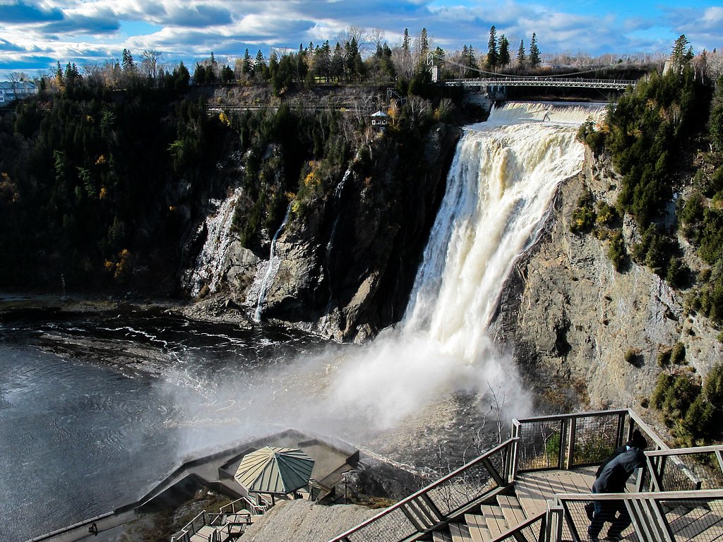
Photo Credits (3)
Difficulty
Easy
Trail Length
2.4 km
Trail Type
Loop
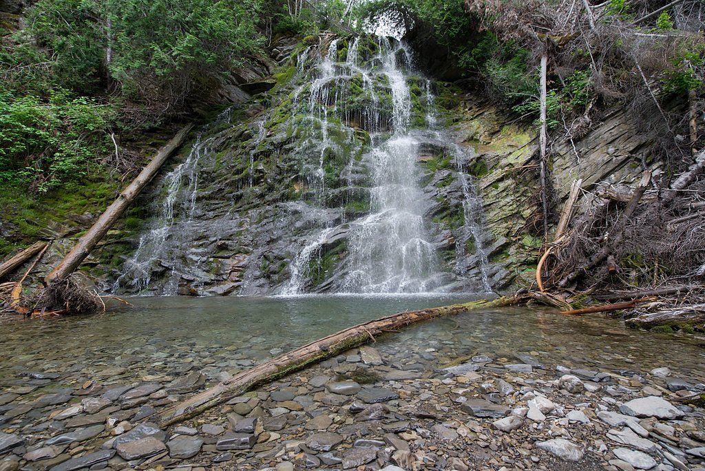
About Chute
Chute is a waterfall feature in the Estrie region of southern Quebec (coordinates 45.7019, -71.4707), located in a rural area northeast of Sherbrooke and near the US border towns noted. The name "Chute" is generic in French and may refer locally to a small-to-medium cascade on a minor stream or river. Flow and appearance are seasonal, typically highest in spring snowmelt and after heavy rains, and lower in late summer. Specifics about official park designation, signage, or interpretive facilities at this exact site are not confirmed and may be limited.
Why This Waterfall Exists
Chute flows over layered sedimentary rock laid down about 252-539 million years ago. Over time, the stream has worn through these layers at different rates, creating the step that forms the waterfall.
Trail & Hike Details
Trail Description
Trail information for this specific "Chute" location is not fully documented. Access is likely via a short unmarked footpath from a roadside pullout or small trailhead. Expect uneven natural surfaces with roots, rocks, and possible muddy sections after rain. Trails in this region often lack boardwalks or formal viewing platforms; scramble to river edges may be required for the best views. Follow social trails carefully to avoid erosion and respect any posted closures or private property boundaries.
What to Expect
A rural, possibly lightly developed waterfall site with natural, sometimes steep banks. Seasonal variability in water flow: high water in spring, lower flows in late summer. Limited or no amenities (no restrooms, no staffed visitor center). Mixed forest surroundings typical of southern Quebec: maple, birch, spruce, and fir. In winter the falls may be partially or fully frozen and icy conditions are common near the water.
Accessibility
The trail is not wheelchair accessible. Uneven terrain and elevation changes require steady footing.
Frequently Asked Questions
🐶 Are Dogs Allowed at Chute?
❌ Dogs are not allowed
Are There Any Fees or Permits Required?
🆖 No fees required
🏊 Is There Swimming at Chute?
❌ Swimming is not allowed
When to Visit
Late spring for peak flow and dramatic water volume; early fall for fall foliage colors combined with good water levels. Summer offers milder weather but lower flows; winter provides a frozen/icefall experience but is more hazardous and requires appropriate winter gear.
Seasonal Access
The best time to visit is Spring, Summer, Fall, and Winter. Check with the managing park or local authority for current conditions.
Safety Information
Hazards may include slippery rocks, steep or eroding banks, fast currents during spring melt or heavy rain, cold water temperatures, and limited cell coverage. Wear appropriate footwear, avoid climbing on wet rocks, supervise children closely, and do not attempt to cross fast-moving water. If visiting in winter, use caution for thin ice and increased slip/fall risk. Check local conditions and respect posted warnings or closures.
7-Day Flow Outlook
Based on the WSC gauge SAINT-FRANCOIS (RIVIERE) A 0,5 KM EN AVAL DE LA CENTRALE WEEDON (5 km away).
Best time of year: this gauge typically runs highest from early March to early May, peaking in April.
How we calculate this
This is a transparent outlook, not a precise forecast. We take the waterfall's current flow strength (how it ranks against its historical normal for today, from the nearest WSC stream gauge), carry that ranking forward along the gauge's seasonal curve, and nudge it for forecast rain. Confidence is highest for the next day or two and falls further out. Always check official conditions and your own judgment before visiting — high flows can be dangerous.
Know when to go.
Get a free email alert when waterfalls near Sherbrooke hit peak flow. We only send when conditions are worth the trip — no weekly newsletters, no spam.
Weather Forecast
Location & Access
Getting There
The site is reached via local and secondary roads off the main regional highways serving the Estrie area. Expect rural driving on paved and possibly short unpaved roads; detailed turn-by-turn directions should be obtained from a current map or navigation app using the provided coordinates (45.7019, -71.4707). Cell coverage may be intermittent in remote sections.
Get Directions on Google MapsParking
Parking may be informal (small roadside pullout or unmarked lot). Space is likely limited; park legally and avoid blocking driveways or gates. Official parking information is not confirmed.
Elevation
291 metres above sea level
Coordinates
45.701851° N, -71.470705° W
Visitor Tips & Gear
• Wear sturdy, closed-toe footwear with good traction; rocks and paths can be slippery. • Expect limited facilities, bring water, snacks, and carry out all trash. • Use caution near edges and on wet rocks; currents can be stronger than they appear. • Check local maps and confirm land access; some waterfalls in the region are on private land or in small municipal reserves. • Cell service may be limited, tell someone your plan if heading into remote areas. • Be aware of seasonal hazards: spring flood flows, thin ice in shoulder seasons, and winter avalanche/icefall hazards on steep banks. • Respect wildlife and keep dogs under control if allowed.
Where to Stay
Browse vacation cabins and private rentals nearby
Unique outdoor stays — tents, yurts, and treehouses
Rent a campervan or RV for your waterfall road trip
Some links are affiliate links. We may earn a commission at no extra cost to you.
Nearby Campground
Le camping du Parc du Lac-Aylmer
12.8 km away
Additional Information
Nearby Attractions
Sherbrooke (regional services and attractions) and natural areas in the Estrie region. Nearby well-known sites in the broader region may include Coaticook Gorge / Parc de la Gorge de Coaticook and Mount Orford (visitor services vary by site). Exact distances and accessibility should be confirmed on a map.
Wildlife
Typical southern Quebec wildlife: white-tailed deer, beavers and other small mammals, a variety of songbirds and waterfowl. Black bears and moose may occur regionally but are less common near populated areas; exercise usual wildlife precautions.
Cities near Chute
Other waterfalls named Chute
2 other waterfalls share this name across Canada.
Writing about Chute? Embed this waterfall on your site for free.