Photo Credits (2)
Difficulty
Moderate
Trail Length
7.4 km
Trail Type
Out And Back
Elevation Gain
556 m
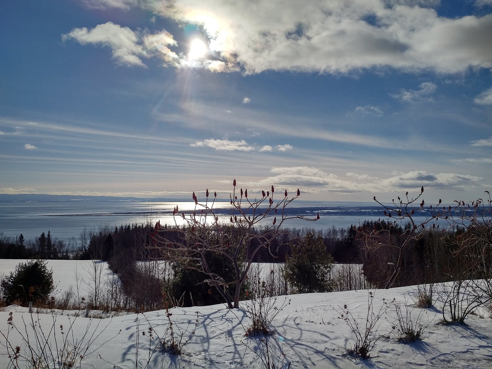
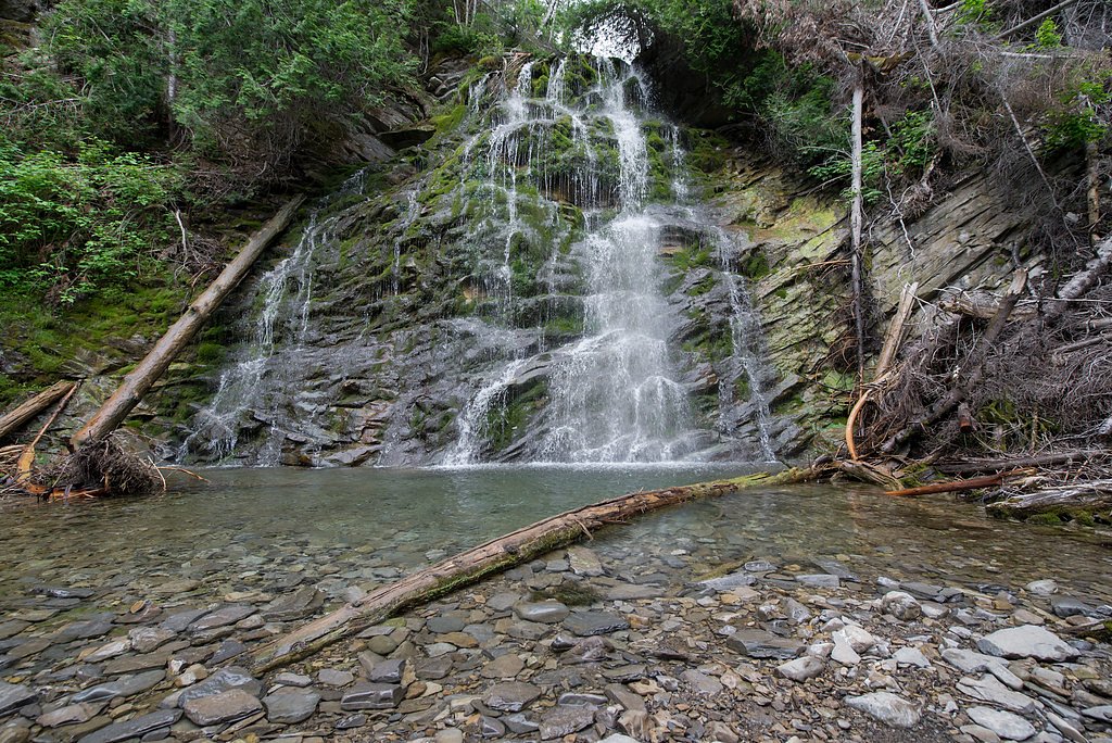
About Chute
Chute is a waterfall located at approximately 47.4693, -70.3754 in rural Quebec. It appears to be set in a forested, rocky stream corridor typical of eastern Quebec rivers and may be a small-to-medium cascade through exposed bedrock and a narrow gorge or chute. Specifics about official name, ownership, and exact measured height are not confirmed, visitors should treat available descriptions as approximate and local signage or maps as authoritative.
Why This Waterfall Exists
Chute flows over layered sedimentary rock laid down about 252-539 million years ago. Over time, the stream has worn through these layers at different rates, creating the step that forms the waterfall.
Nearby Falls Worth Visiting
Chute de La Rivière Jean Noël (20 m) lies 16.6 kilometres to the northeast.
Trail & Hike Details
The Approach
The moderate 7.4-km out-and-back trail gains 556 metres of elevation on the way to the falls.
Trail Description
Detailed, mapped trail information is not confirmed. Access may involve an unmarked or minimally developed footpath from a nearby road or pullout; terrain is likely uneven with roots, rocks, mud, and possible short scrambles to reach viewpoints. Trails in similar areas can be narrow and not well-maintained, expect primitive conditions unless visiting a site formally developed by a park agency.
What to Expect
Expect a natural, possibly small-to-medium waterfall in a wooded setting with exposed bedrock and potentially slippery surfaces. Flow will vary by season, higher in spring (snowmelt) and after heavy rains, lower in late summer or dry periods. There may be no facilities (toilets, trash cans, signage, or viewpoint railings). Wildlife such as birds, small mammals, and beavers are common in the region; larger mammals (deer, moose, black bear) may also occur.
Accessibility
The trail involves steep, uneven terrain with significant elevation change and is not accessible to mobility devices.
Frequently Asked Questions
🐶 Are Dogs Allowed at Chute?
❌ Dogs are not allowed
Are There Any Fees or Permits Required?
🆖 No fees required
🏊 Is There Swimming at Chute?
❌ Swimming is not allowed
When to Visit
Spring (late March–May) for highest flows and dramatic water volume; late spring to early fall for warmer weather and easier footing; fall for foliage color. Winter can produce ice formations and dramatic frozen falls but is more hazardous, ice can be unstable and access roads/trails may be closed or difficult to travel.
Seasonal Access
The best time to visit is Spring, Summer, Fall, and Winter. Check with the managing park or local authority for current conditions.
Safety Information
Hazards may include slippery and unstable rocks, fast or cold water, undercut banks, sudden changes in flow after rain, falling from cliff edges, limited cell coverage, and seasonal ice hazards. In winter, icefalls can be unstable and dangerous. Always assess conditions carefully, keep away from the top and base of fast-moving water, travel with a companion if possible, tell someone your plans, and avoid risky rock-hopping or standing on wet ledges. For rescues or emergencies, local response times in rural areas may be long, plan accordingly.
7-Day Flow Outlook
Based on the WSC gauge MALBAIE (RIVIERE) A CLERMONT (28 km away).
Best time of year: this gauge typically runs highest from mid April to early July, peaking in May.
How we calculate this
This is a transparent outlook, not a precise forecast. We take the waterfall's current flow strength (how it ranks against its historical normal for today, from the nearest WSC stream gauge), carry that ranking forward along the gauge's seasonal curve, and nudge it for forecast rain. Confidence is highest for the next day or two and falls further out. Always check official conditions and your own judgment before visiting — high flows can be dangerous.
Know when to go.
Get a free email alert when waterfalls near Rivière-du-Loup hit peak flow. We only send when conditions are worth the trip — no weekly newsletters, no spam.
Weather Forecast
Location & Access
Getting There
Use the provided coordinates (47.4693, -70.3754) in a GPS device or mapping app. The site is in a rural area; approach will likely be by secondary roads from the nearest towns (Rivière-du-Loup ~53 mi, Québec City ~70 mi). Final access may involve driving on local gravel or forest roads and a short walk off the road. Cell coverage may be spotty, download maps or save offline routes if possible.
Get Directions on Google MapsParking
No confirmed formal parking lot. Parking may be limited to a roadside pullout or informal space on a nearby access road. Park fully off the travel lane, obey local signage, and avoid blocking gates or private driveways. If you are uncertain about parking legality, consider asking local residents or authorities.
Elevation
259 metres above sea level
Coordinates
47.469337° N, -70.375431° W
Visitor Tips & Gear
• Use exact GPS coordinates and prepare for limited signage. • Wear sturdy, waterproof footwear with good traction; rocks will be slippery. • Bring insect repellent (black flies/mosquitoes can be abundant in spring/summer). • Carry water, snacks, and a basic first-aid kit. • Leave no trace, pack out all trash. • Keep a safe distance from cliff edges and fast water; wet rocks and undercut banks are hazardous. • Check local municipal or provincial resources before visiting if you need confirmed access rules or updates about closures.
As an Amazon Associate, we earn from qualifying purchases.
With 7.4 km and 556 m of elevation gain, sturdy boots and trekking poles will help on this moderate trail. Icy conditions are common in winter — traction cleats are a smart addition.

Columbia Watertight II Rain Jacket
Packs into its own pocket, seam-sealed, and keeps you dry from spray and surprise rain.

Polarized Sunglasses (Knockaround)
Cuts glare off the water so you actually see the falls — and your photos turn out better too.

Earth Pak Waterproof Dry Bag
Keeps your phone and gear dry when waterfall mist soaks everything else.

Waterproof Phone Pouch (AiRunTech)
Cheap insurance — take photos right next to the falls without killing your phone.

Timberland Euro Sprint Mid Waterproof
Trusted waterproof boot with premium leather and grippy rubber sole — reliable on rocky, wet trails.

TrailBuddy Trekking Poles
Lightweight aluminum, cork grips, and flip-locks that actually hold — a best-seller for good reason.
Where to Stay
Browse vacation cabins and private rentals nearby
Unique outdoor stays — tents, yurts, and treehouses
Rent a campervan or RV for your waterfall road trip
Some links are affiliate links. We may earn a commission at no extra cost to you.
Nearby Campground
Chalet et Camping du Ruisseau Rouge
6.1 km away
Additional Information
Nearby Attractions
Nearest larger centers are Rivière-du-Loup and Québec City (both noted in the location context). The broader region has river viewpoints, forested trails, and regional parks, confirm specific nearby parks or attractions using local tourism resources for the exact area around the coordinates.
Wildlife
Typical regional wildlife may include white-tailed deer, moose, black bear, beaver, fox, various songbirds, and waterfowl. Take standard precautions for wildlife: store food securely, keep distance, and avoid surprising larger animals.
Cities near Chute
Nearby Waterfalls
Other waterfalls named Chute
2 other waterfalls share this name across Canada.
Writing about Chute? Embed this waterfall on your site for free.