China Creek Falls
By Armen Suny · Last verified Jun 2026
Photo Credits (5)
Difficulty
Moderate
Trail Length
3.5 km
Trail Type
Out And Back
Elevation Gain
62 m
About China Creek Falls
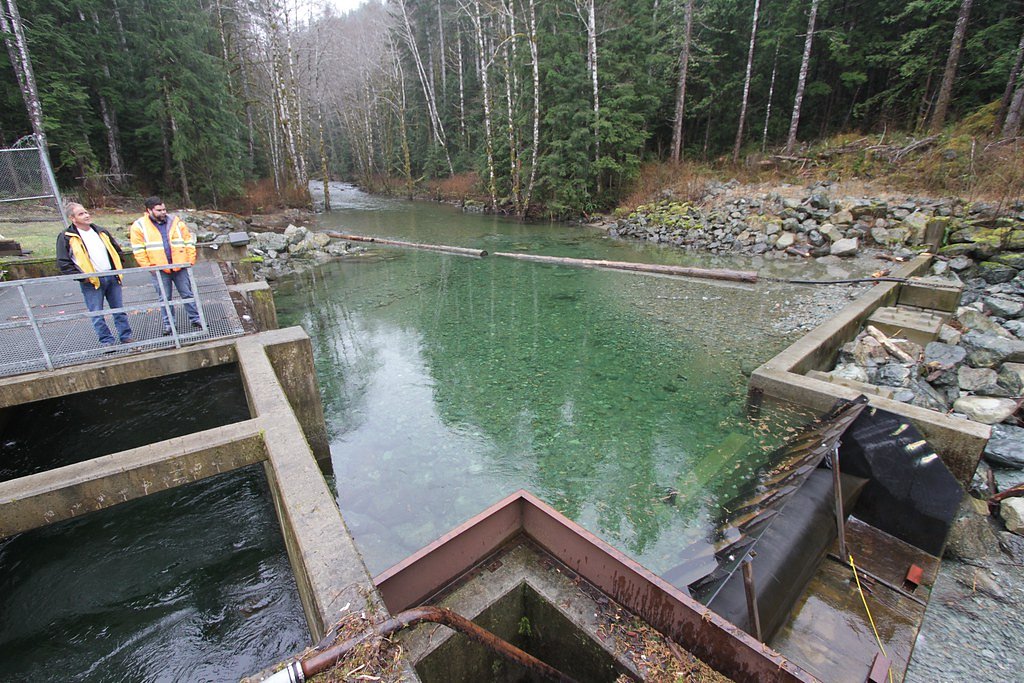
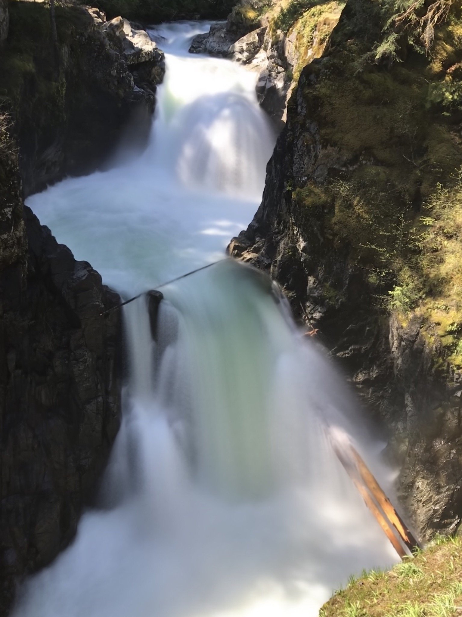
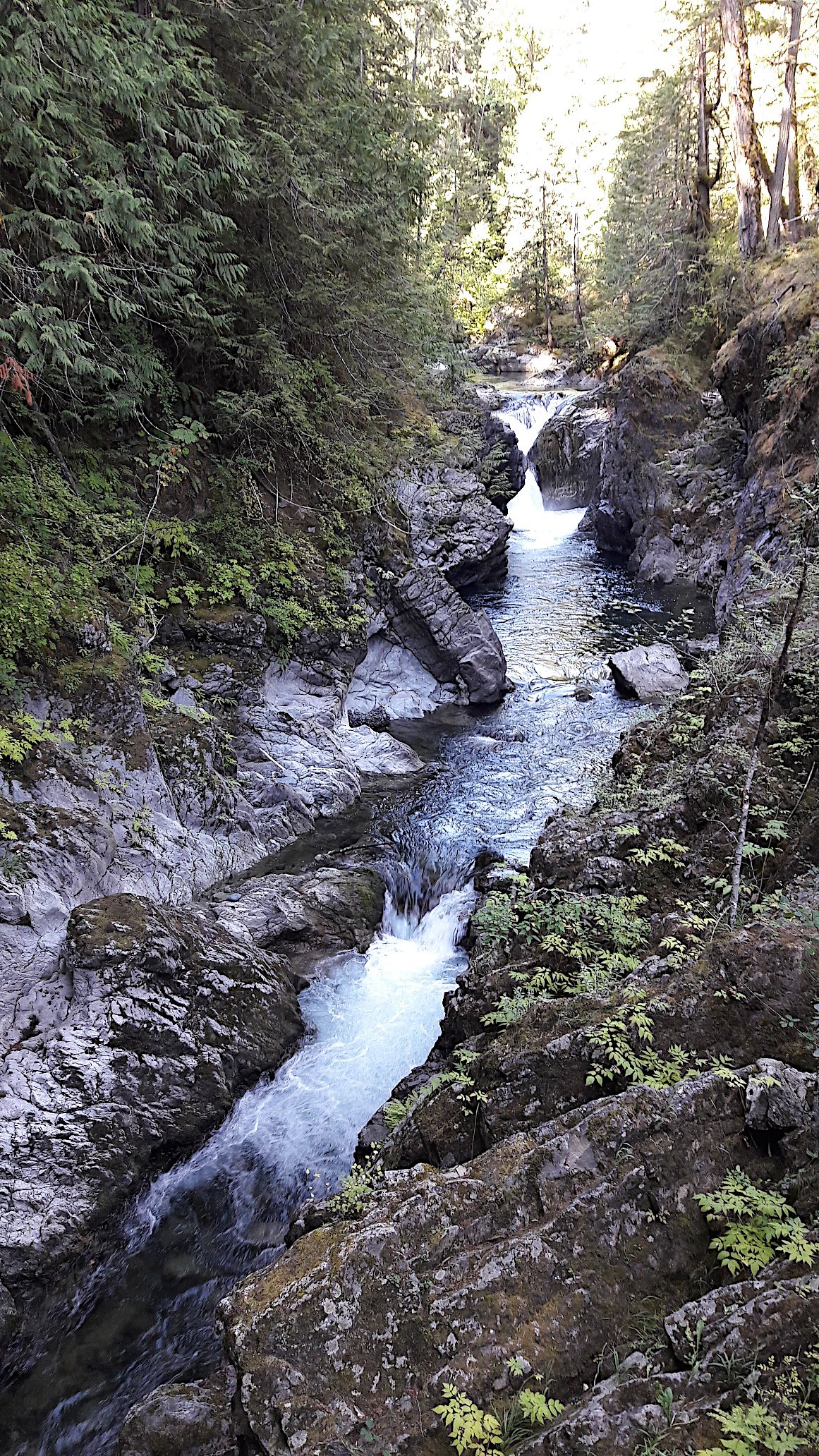
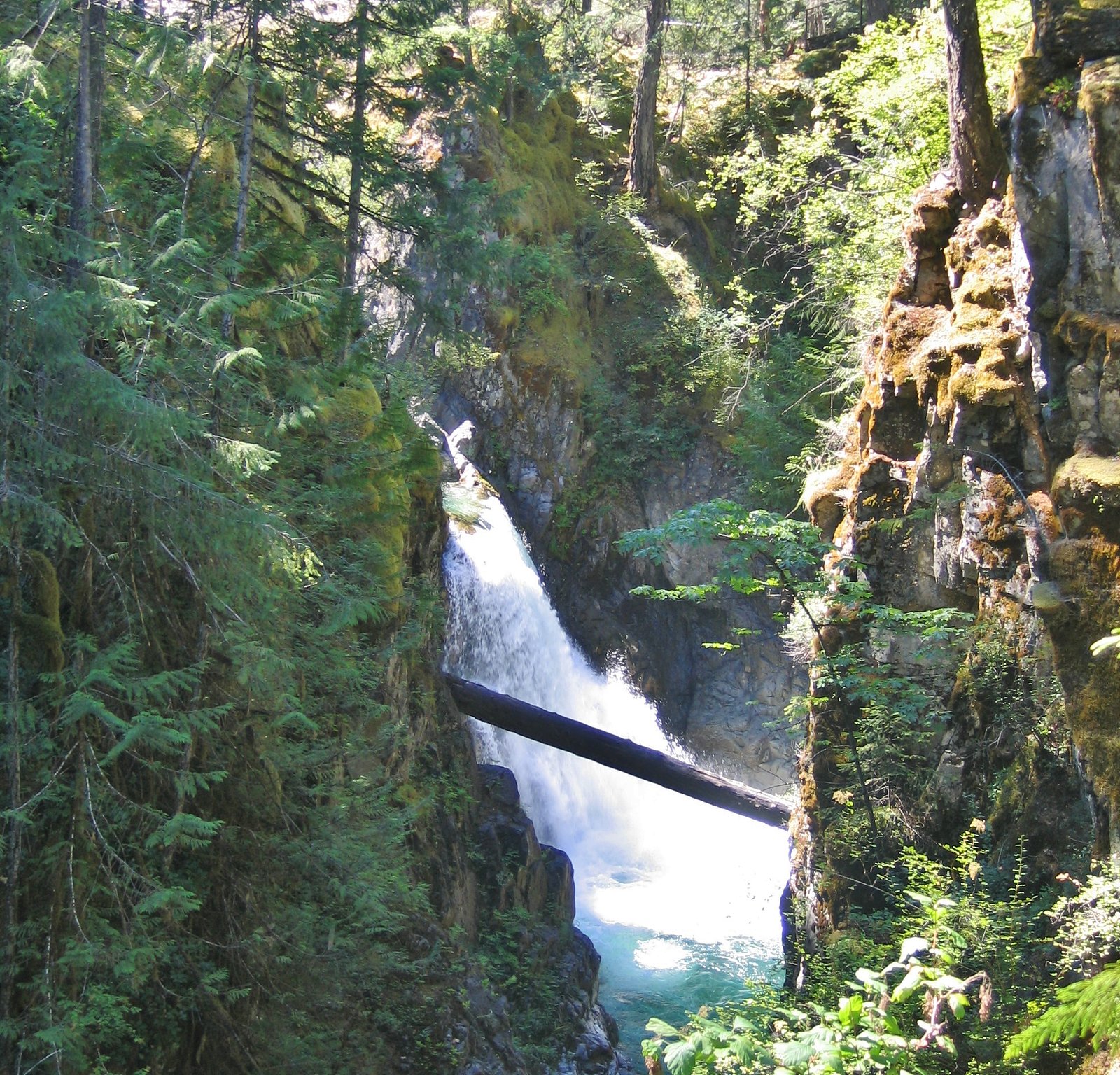
China Creek Falls is a forested, likely multi-tiered cascade on Vancouver Island near the eastern coast of central/northern Vancouver Island. The falls sit in a remote, heavily treed valley and are most often visited by people comfortable with unmarked or minimally maintained trails and logging-road access. Visitor reports indicate a natural, undeveloped setting with no formal infrastructure at the viewpoint. Precise published measurements and an official park listing appear limited; descriptions below err on the conservative side where details are uncertain.
Why This Waterfall Exists
China Creek Falls flows over hard volcanic rock laid down about 201-252 million years ago. These resistant rocks form a durable ledge that water cannot easily wear away, creating the falls where softer material downstream has already eroded.
Nearby Falls Worth Visiting
Upper Waterfall (17 m) lies 20.3 kilometres to the northeast. Also nearby: Little Qualicum Falls (17 m, 20.6 km) and Lower Waterfall (5 m, 20.4 km).
Trail & Hike Details
The Approach
The moderate 3.5-km out-and-back trail gains 62 metres of elevation on the way to the falls.
Trail Description
Trail access is commonly described as short but unmaintained: a rough spur or game trail from a parking or pullout that descends through mixed coastal forest to the creek and falls. Expect uneven footing, roots and rocks, and potentially steep or slippery sections near the water. The route may require route-finding and is not signed or developed as a formal park trail in most visitor reports.
What to Expect
A natural, undeveloped waterfall setting in coastal temperate forest. Flow levels can vary widely with season, higher in spring and after heavy rain, lower in late summer/drought. There are likely exposed rocks and small plunge or cascade sections rather than a single very tall drop. Little to no facilities, limited or no cell service, and minimal signage. Wildlife (black bears, cougars, deer, small mammals and forest birds) may be present in the area.
Accessibility
The trail is not wheelchair accessible. Uneven terrain and elevation changes require steady footing.
Frequently Asked Questions
🐶 Are Dogs Allowed at China Creek Falls?
❌ Dogs are not allowed
Are There Any Fees or Permits Required?
🆖 No fees required
🏊 Is There Swimming at China Creek Falls?
❌ Swimming is not allowed
When to Visit
Late spring to early summer for the fullest flows and good trail access; summer for easier road conditions and drier approaches; fall can offer good flows but wetter footing. Winter access may be difficult due to mud, logging road closures, or snow in higher elevations.
Seasonal Access
The best time to visit is Spring, Summer, Fall, and Winter. Check with the managing park or local authority for current conditions.
Safety Information
Hazards include slippery rocks and steep banks near the creek, seasonal high water and strong currents after rain or during snowmelt, unstable or eroding stream edges, limited or no cell service, and potential encounters with wildlife. Roads may be rough, gated, or closed for logging, check conditions beforehand. Always use caution near cliff edges and do not climb wet rocks. If you are unfamiliar with remote trail travel, consider going with someone who is experienced.
Current Water Conditions
16.4 m³/s
Current discharge — how much water is flowing
Much lower than usual for this time of year
Based on 44 years of record
1.33 m
Water depth at gauge
7-Day Discharge Trend
What does this mean for your visit?
Flow is well below normal for this time of year, so the waterfall may be a trickle.
About This Gauge
This gauge is on a nearby waterway and may not reflect exact conditions at the falls.
7-Day Flow Outlook
Based on the WSC gauge SOMASS RIVER NEAR ALBERNI (13 km away).
Today
Barely Flowing
16 m³/s
4/10Tomorrow
Barely Flowing
17 m³/s
5/10Tue
Barely Flowing
16 m³/s
4/10Wed
Barely Flowing
15 m³/s
4/10Thu
Barely Flowing
15 m³/s
4/10Fri
Barely Flowing
15 m³/s
4/10Sat
Barely Flowing
16 m³/s
3/10Best window: Tomorrow — barely flowing flow, sunny (trip score 5/10).
Best time of year: this gauge typically runs highest from early November to late December, peaking in November.
How we calculate this
This is a transparent outlook, not a precise forecast. We take the waterfall's current flow strength (how it ranks against its historical normal for today, from the nearest WSC stream gauge), carry that ranking forward along the gauge's seasonal curve, and nudge it for forecast rain. Confidence is highest for the next day or two and falls further out. Always check official conditions and your own judgment before visiting — high flows can be dangerous.
Know when to go.
Get a free email alert when waterfalls near Courtenay hit peak flow. We only send when conditions are worth the trip — no weekly newsletters, no spam.
Weather Forecast
Location & Access
Getting There
The falls are located on Vancouver Island (coordinates 49.1831, -124.75), with nearest larger communities being Courtenay, Nanaimo and Powell River (as reference points by distance). Access is typically via local/forestry roads and short spur trails off those roads. Expect unpaved roads and potential gated/seasonally closed logging roads; a high-clearance vehicle can be helpful. Use a detailed map (paper or GPS) and check recent trip reports or local land/forest service information before attempting access.
Get Directions on Google MapsParking
Parking is likely informal (roadside pullout or small unpaved lot). There are probably no developed facilities (no toilets, no maintained parking lot). Park only where allowed and avoid blocking gates or vegetation-management access.
Elevation
120 metres above sea level
Coordinates
49.183102° N, -124.750000° W
Visitor Tips & Gear
1) Check recent trip reports or contact local forest/park authorities for current road and trail conditions before you go. 2) Use a map, GPS coordinates and offline navigation, roads can be confusing and some are gated. 3) Wear sturdy footwear (waterproof boots recommended) and expect slippery rock near the falls. 4) Bring water, snacks, and a small first-aid kit. 5) Give wildlife space and store food securely; consider carrying bear spray where appropriate. 6) Do not rely on cell service; tell someone your plans and expected return time.
As an Amazon Associate, we earn from qualifying purchases.
With 3.5 km and 62 m of elevation gain, sturdy boots and trekking poles will help on this moderate trail. Icy conditions are common in winter — traction cleats are a smart addition.

Columbia Watertight II Rain Jacket
Packs into its own pocket, seam-sealed, and keeps you dry from spray and surprise rain.

Polarized Sunglasses (Knockaround)
Cuts glare off the water so you actually see the falls — and your photos turn out better too.

Earth Pak Waterproof Dry Bag
Keeps your phone and gear dry when waterfall mist soaks everything else.

Waterproof Phone Pouch (AiRunTech)
Cheap insurance — take photos right next to the falls without killing your phone.

Timberland Euro Sprint Mid Waterproof
Trusted waterproof boot with premium leather and grippy rubber sole — reliable on rocky, wet trails.

TrailBuddy Trekking Poles
Lightweight aluminum, cork grips, and flip-locks that actually hold — a best-seller for good reason.
Where to Stay
Browse vacation cabins and private rentals nearby
Unique outdoor stays — tents, yurts, and treehouses
Rent a campervan or RV for your waterfall road trip
Some links are affiliate links. We may earn a commission at no extra cost to you.
Nearby Campground
China Creek Campground and Marina
4.7 km away
Additional Information
Nearby Attractions
Nearby places of interest on central Vancouver Island may include the Comox Valley and Courtenay area, local beaches and coastal viewpoints, and provincial / regional parks in the broader region (check maps for nearby named parks or trails). Exact nearby attractions depend on the route taken to the falls.
Wildlife
Black bears, deer, small mammals, and a variety of forest birds are common in coastal Vancouver Island forests. Take standard wildlife precautions: store food securely, make noise while hiking to avoid surprising animals, and know how to respond to bear or cougar encounters.
Cities near China Creek Falls
Nearby Waterfalls
Writing about China Creek Falls? Embed this waterfall on your site for free.