Photo Credits (3)
Difficulty
Easy
Trail Length
0.3 km
Trail Type
Out And Back
Elevation Gain
6 m
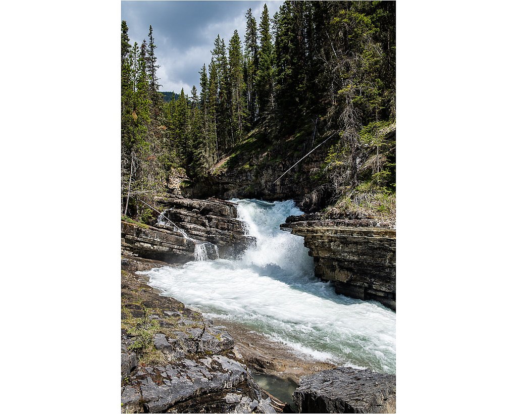
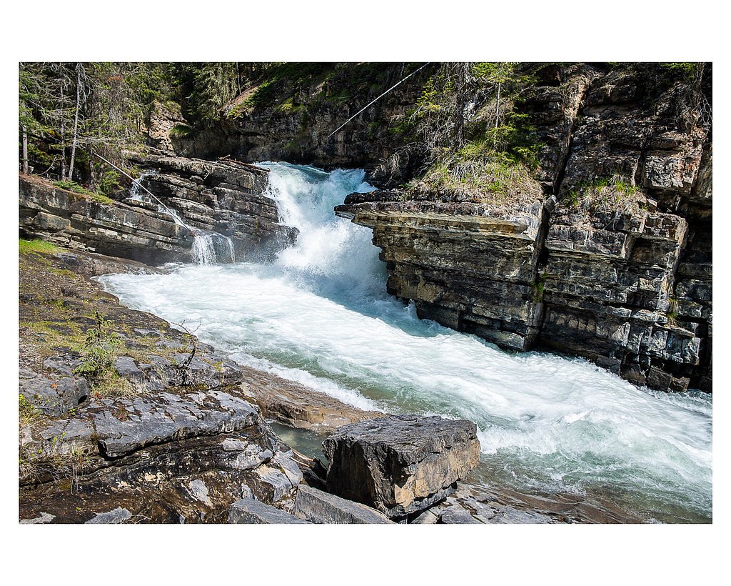
About Castle Falls
Castle Falls is a remote waterfall located near the Canada–United States border in southwestern Alberta (coordinates: 49.4443, -114.3223). The site is in a sparsely developed, forested region and appears to be reached via unpaved forest/logging roads and/or cross-country hiking. Public information on this specific falls is limited; visitors should expect limited infrastructure, little or no signage, and few maintained trails. Flow and appearance vary seasonally, highest flows are typically in spring from snowmelt and early summer; late summer and fall can be much lower. Because the location is close to the international border, visitors should take care not to inadvertently cross without proper documentation.
The Setting
Castle Falls sits at 1,301 metres within Castle Provincial Park, in the mountains of Alberta.
Why This Waterfall Exists
Castle Falls flows over Blairmore Group, a layered sedimentary rock layer deposited about 101-145 million years ago. These soft rocks erode readily, allowing the stream to carve a vertical drop into the landscape.
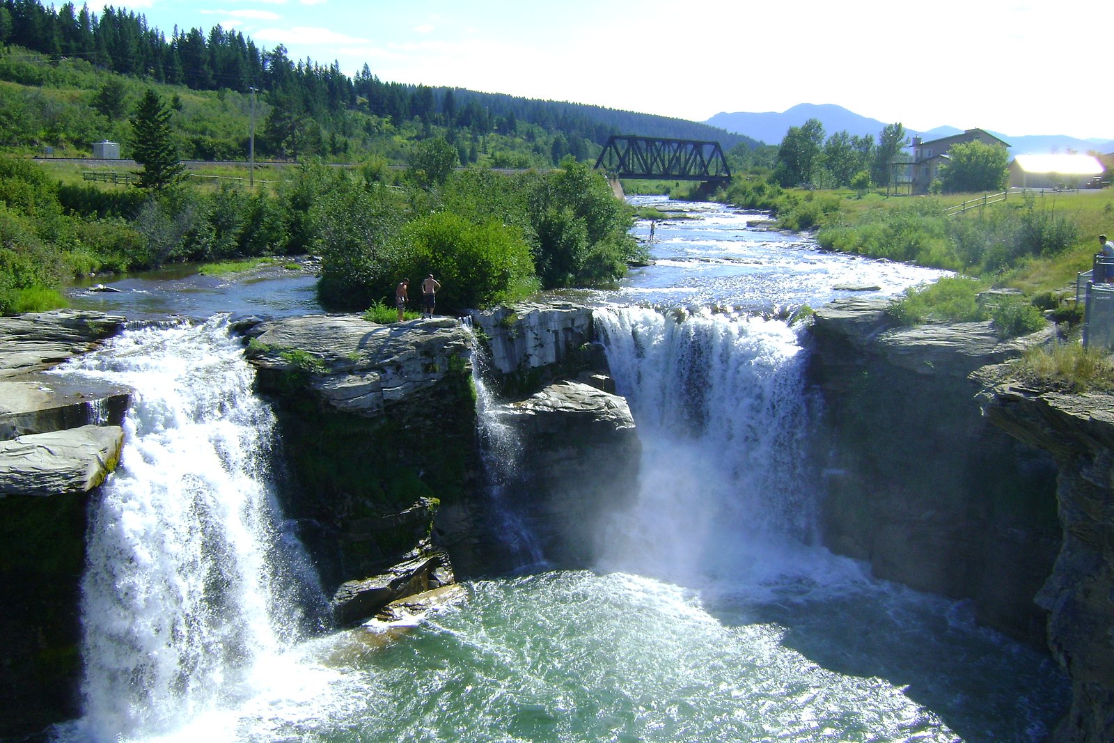
Nearby Falls Worth Visiting
Lundbreck Falls (12 m) lies 17.5 kilometres to the northeast.
Trail & Hike Details
The Approach
The easy 0.3-km out-and-back trail gains 6 metres of elevation on the way to the falls.
Trail Description
There is no widely published, maintained trail description for Castle Falls. Based on the remote setting, reaching a good viewpoint may require travel on unmaintained forest roads followed by an unmarked scramble or cross-country hike. Routefinding skills, a topographic map, and GPS are recommended. Expect uneven footing, downed woody debris, and potentially steep or slippery terrain near the water.
What to Expect
A remote, natural waterfall setting with minimal visitor infrastructure. Natural viewpoints may be limited and there are likely no handrails, interpretive signs, or formal viewing platforms. Seasonal streamflow varies; spring/early summer generally provides the most dramatic flow. Wildlife (including bears) and natural hazards (steep banks, slippery rocks, cold water) are possible. Cell reception may be unreliable or nonexistent.
Accessibility
The trail is short and relatively flat, but the surface may be uneven. Contact the managing agency for accessibility details.
Frequently Asked Questions
🐶 Are Dogs Allowed at Castle Falls?
❌ Dogs are not allowed
Are There Any Fees or Permits Required?
🆖 No fees required
🏊 Is There Swimming at Castle Falls?
❌ Swimming is not allowed
When to Visit
Late spring through early summer (snowmelt) for the highest flows and most dramatic appearance. Late summer and fall may have reduced flow; winter may present frozen falls and hazardous conditions, access by winter roads or trails may be difficult or impossible.
Seasonal Access
The best time to visit is Spring, Summer, Fall, and Winter. Check with the managing park or local authority for current conditions.
Safety Information
Hazards include remote location and limited cell service, steep and slippery banks around the falls, swift currents, cold water, and seasonal ice. Wildlife encounters (bears) are possible, carry and know how to use bear spray where appropriate. Roads to the area may be unmaintained; a high-clearance vehicle or 4WD may be necessary. The site is close to the international border, do not cross without proper documentation and confirm you remain on the correct side of the border.
Current Water Conditions
7.9 m³/s
Current discharge — how much water is flowing
About average for this time of year
Based on 58 years of record
1.85 m
Water depth at gauge
7-Day Discharge Trend
What does this mean for your visit?
Flow is about average for this time of year.
About This Gauge
7-Day Flow Outlook
Based on the WSC gauge CASTLE RIVER AT RANGER STATION (5 km away).
Today
Moderate
8.4 m³/s
8/10Tomorrow
Moderate
8.1 m³/s
6/10Tue
Moderate
7.5 m³/s
6/10Wed
Moderate
7.4 m³/s
6/10Thu
Moderate
7.2 m³/s
6/10Fri
Moderate
6.7 m³/s
6/10Sat
Moderate
6.4 m³/s
8/10Best window: Today — moderate flow, sunny (trip score 8/10).
Best time of year: this gauge typically runs highest from early May to early July, peaking in June.
How we calculate this
This is a transparent outlook, not a precise forecast. We take the waterfall's current flow strength (how it ranks against its historical normal for today, from the nearest WSC stream gauge), carry that ranking forward along the gauge's seasonal curve, and nudge it for forecast rain. Confidence is highest for the next day or two and falls further out. Always check official conditions and your own judgment before visiting — high flows can be dangerous.
Weather Forecast
Location & Access
Getting There
Located in a remote border region at 49.4443, -114.3223. Nearest named communities on the U.S. side include Polebridge (~35 mi), Fortine (~57 mi) and Eureka (~58 mi). Access is likely via unpaved forest or logging roads and then by foot; maps and GPS coordinates are recommended. Road quality may require high-clearance or 4WD and seasonal closures are possible. Confirm access with Alberta provincial land/park authorities or local ranger stations before attempting to visit.
Get Directions on Google MapsParking
No formal parking lot is known for this site. Expect limited or informal pullouts on unpaved roads; do not block gates or driveways. Park only where allowed and leave room for other vehicles.
Elevation
1,301 metres above sea level
Coordinates
49.444289° N, -114.322302° W
Land Management
Managed by Parks Division, Alberta Forestry and Parks
Visitor Tips & Gear
• Confirm access and road conditions with Alberta Parks or local authorities before you go. • Use a GPS with the provided coordinates and carry a topographic map; roads may be unmarked. • Do not attempt to cross the international border; carry proper identification. • Wear sturdy footwear and be prepared for wet, slippery terrain near the falls. • If visiting in bear country, carry bear spray, make noise while hiking, and know bear-safety procedures. • Pack out all trash and minimize impact. Do not create new trails or clear brush to forge new access.
As an Amazon Associate, we earn from qualifying purchases.
For this easy 0.3 km trail, lightweight trail shoes and a water bottle are usually sufficient. Icy conditions are common in winter — traction cleats are a smart addition.

Columbia Watertight II Rain Jacket
Packs into its own pocket, seam-sealed, and keeps you dry from spray and surprise rain.

Polarized Sunglasses (Knockaround)
Cuts glare off the water so you actually see the falls — and your photos turn out better too.

Earth Pak Waterproof Dry Bag
Keeps your phone and gear dry when waterfall mist soaks everything else.

Waterproof Phone Pouch (AiRunTech)
Cheap insurance — take photos right next to the falls without killing your phone.

Kahtoola MICROspikes
Cult-favorite traction cleats that grip ice and wet rock — essential for winter waterfall hikes.

JOBY GorillaPod Starter Kit
Wraps around railings and rocks for long-exposure waterfall shots — no flat surface needed.
Where to Stay
Browse vacation cabins and private rentals nearby
Unique outdoor stays — tents, yurts, and treehouses
Rent a campervan or RV for your waterfall road trip
Some links are affiliate links. We may earn a commission at no extra cost to you.
Nearby Campground
Castle Falls Campground
0.2 km away
Additional Information
Nearby Attractions
The area is near vast forested public lands and, on the U.S. side, portions of Glacier National Park (North Fork/upper Flathead region) and national forest lands. Local scenic backcountry routes, rivers, and trailheads may be in the region, confirm exact locations with regional visitor centers.
Wildlife
Typical regional wildlife may include black bear (and possibly grizzly in nearby ranges), moose, deer, elk, wolves, and smaller mammals and birds. Take appropriate precautions for large carnivores and ungulates.
Nearby Waterfalls
Writing about Castle Falls? Embed this waterfall on your site for free.