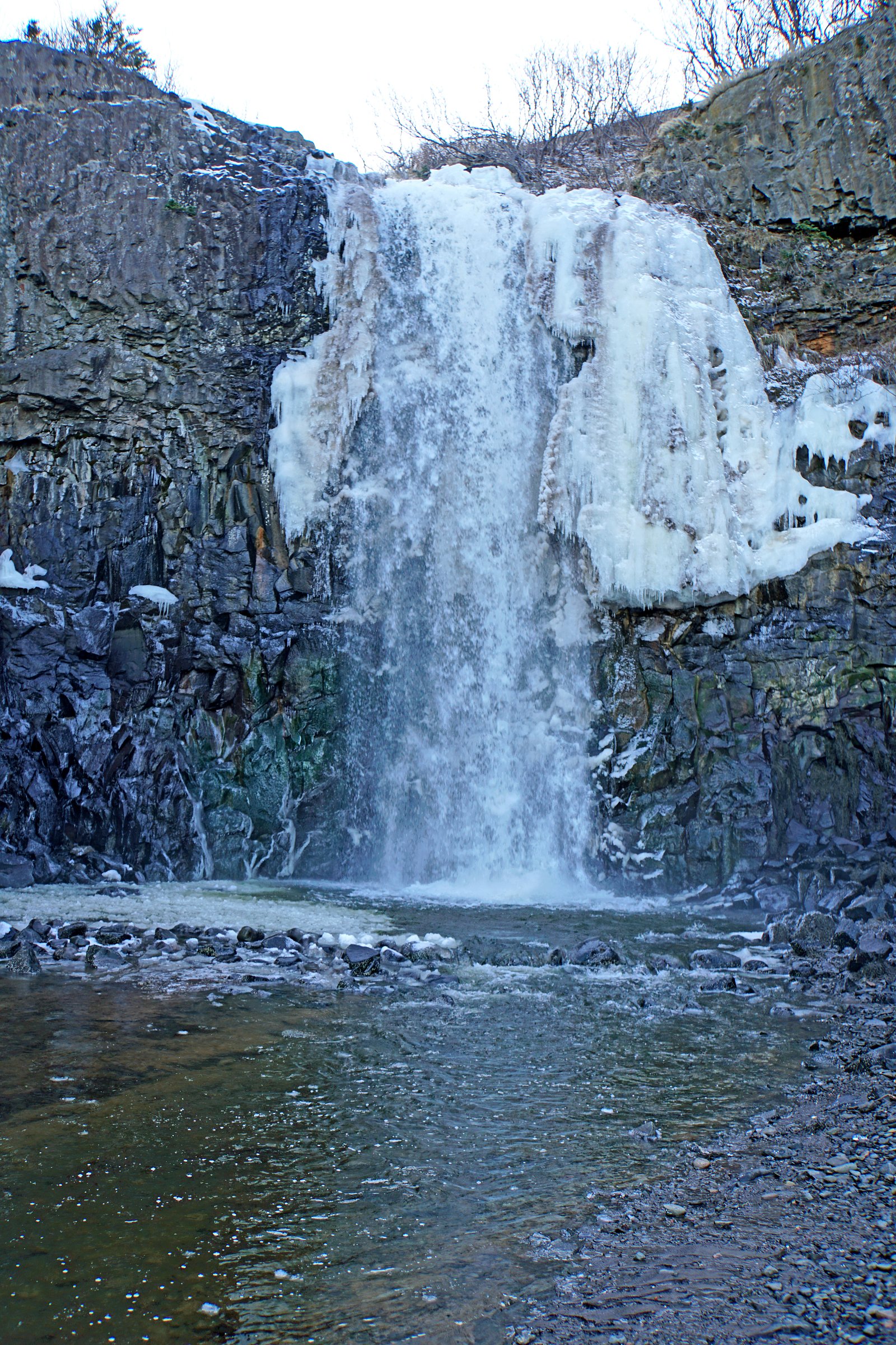
Baxter Harbour Falls
By Armen Suny · Last verified Jun 2026
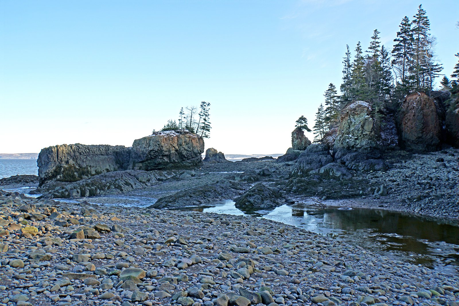
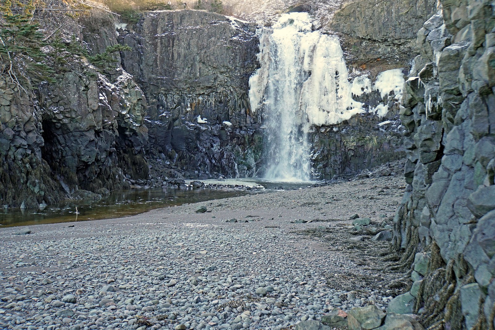
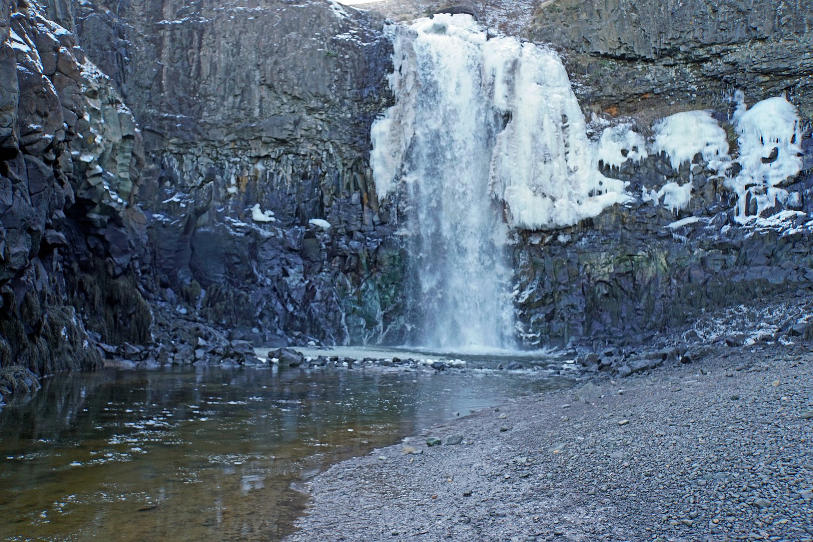
Photo Credits (5)
Difficulty
Drive Up
Trail Length
0.2 km
Trail Type
Out And Back
About Baxter Harbour Falls
Baxter Harbour Falls (coords 45.2302, -64.5126) is a small to medium forested waterfall in Nova Scotia. The falls are located in a rural setting and are typically reached by a short off‑road or roadside approach. Flow and appearance vary with season and recent precipitation; spring melt and heavy rains produce the highest flows. Specific published trail details are limited, so some access characteristics below are described conservatively and may vary on the ground.
Trail & Hike Details
The Approach
No hiking required. Baxter Harbour Falls is accessible by vehicle with a roadside viewing area.
Trail Description
There is limited published trail documentation for Baxter Harbour Falls. Approaches reported for similar rural Nova Scotia falls are typically short but unmaintained: expect an informal footpath, uneven terrain, roots, and rocks. The final approach may require crossing a small stream or scrambling over wet boulders close to the falls. Trails, if present, are likely unmarked and not maintained, so bring a map, GPS or use the provided coordinates.
What to Expect
Expect a natural, undeveloped waterfall setting with no facilities (no restrooms, signage, or maintained viewpoints). The surrounding area is likely mixed Acadian forest with typical Nova Scotia understory. Water depth and current vary by season; spring and after heavy rains bring the largest flows. Rocks near the stream will be slippery, and there may be limited safe footing near the falls.
Accessibility
This waterfall is viewable from a vehicle-accessible area. No hiking is required.
Frequently Asked Questions
🐶 Are Dogs Allowed at Baxter Harbour Falls?
❌ Dogs are not allowed
Are There Any Fees or Permits Required?
🆖 No fees required
🏊 Is There Swimming at Baxter Harbour Falls?
❌ Swimming is not allowed
When to Visit
Late spring (snowmelt) for highest flows; early summer for accessible trails and warmer weather; fall for lower flows but good foliage colors. Winter can offer frozen scenes but is more hazardous and may require specialized gear.
Seasonal Access
The best time to visit is Spring, Summer, and Fall. Winter access may be limited. Check with the managing park or local authority for current conditions.
Safety Information
• Expect slippery rocks, uneven terrain, and no guardrails, exercise caution near the water. • Water can be cold and currents stronger than they appear; do not underestimate risks of entering the water. • Access may cross private property, observe posted signs and obtain permission if required. • Weather can change quickly; check forecasts and avoid visiting alone in remote conditions. • In winter, ice and snow increase avalanche/fall risk on steep banks, use appropriate gear or avoid.
Current Water Conditions
0.2 m³/s
Current discharge — how much water is flowing
About average for this time of year
Based on 25 years of record
0.44 m
Water depth at gauge
7-Day Discharge Trend
What does this mean for your visit?
Flow is about average for this time of year.
About This Gauge
This gauge is on a nearby waterway and may not reflect exact conditions at the falls.
7-Day Flow Outlook
Based on the WSC gauge NORTH BROOK AT SHEFFIELD MILLS (9 km away).
Today
Moderate
0.2 m³/s
5/10Tomorrow
Moderate
0.2 m³/s
6/10Tue
Moderate
0.2 m³/s
6/10Wed
Moderate
0.2 m³/s
5/10Thu
Moderate
0.2 m³/s
6/10Fri
Moderate
0.2 m³/s
6/10Sat
Moderate
0.2 m³/s
5/10Best window: Tomorrow — moderate flow, cloudy (trip score 6/10).
Best time of year: this gauge typically runs highest from early March to late April, peaking in April.
How we calculate this
This is a transparent outlook, not a precise forecast. We take the waterfall's current flow strength (how it ranks against its historical normal for today, from the nearest WSC stream gauge), carry that ranking forward along the gauge's seasonal curve, and nudge it for forecast rain. Confidence is highest for the next day or two and falls further out. Always check official conditions and your own judgment before visiting — high flows can be dangerous.
Know when to go.
Get a free email alert when waterfalls near Windsor hit peak flow. We only send when conditions are worth the trip — no weekly newsletters, no spam.
Weather Forecast
Location & Access
Getting There
The waterfall sits near the provided coordinates (45.2302, -64.5126). The nearest larger communities noted are Windsor (~28.8 miles), Amherst (~42.1 miles) and Halifax (~67.0 miles). Expect to approach via secondary provincial roads and possibly short gravel drives; GPS coordinates are recommended for final navigation. Access may require driving down a short access road or parking on the shoulder and walking a short distance.
Get Directions on Google MapsParking
No formal parking lot is known for this site. Visitors should expect informal roadside or small pull‑out parking. Park safely off the road, avoid blocking driveways or gates, and respect private property, parking availability may be limited.
Elevation
1 metres above sea level
Coordinates
45.230178° N, -64.512643° W
Visitor Tips & Gear
• Use GPS coordinates and verify land access before parking; parts of the area may be private property. • Wear sturdy, waterproof footwear with good traction. • Stay off wet rocks and avoid getting too close to the edge, there may be no railings. • Consider bug spray in summer and dress in layers; conditions can be cool near water. • Carry out what you carry in, no trash facilities are expected. • If visiting in winter, expect icy and hazardous conditions; consider traction devices and check weather reports.
Where to Stay
Browse vacation cabins and private rentals nearby
Unique outdoor stays — tents, yurts, and treehouses
Rent a campervan or RV for your waterfall road trip
Some links are affiliate links. We may earn a commission at no extra cost to you.
Nearby Campground
Look Off Family Camping Park
8.7 km away
Additional Information
Nearby Attractions
Nearby towns referenced by distance include Windsor (~28.8 miles), Amherst (~42.1 miles) and Halifax (~67.0 miles). Other local coastal or river attractions may be available in the broader region; verify distances and access locally.
Wildlife
Typical regional wildlife may include songbirds, small mammals, white‑tailed deer, and occasional black bear. Be bear aware in season (store food securely and make noise on approach). Ticks and biting insects can be common in warmer months.
Cities near Baxter Harbour Falls
Nearby Waterfalls
Writing about Baxter Harbour Falls? Embed this waterfall on your site for free.