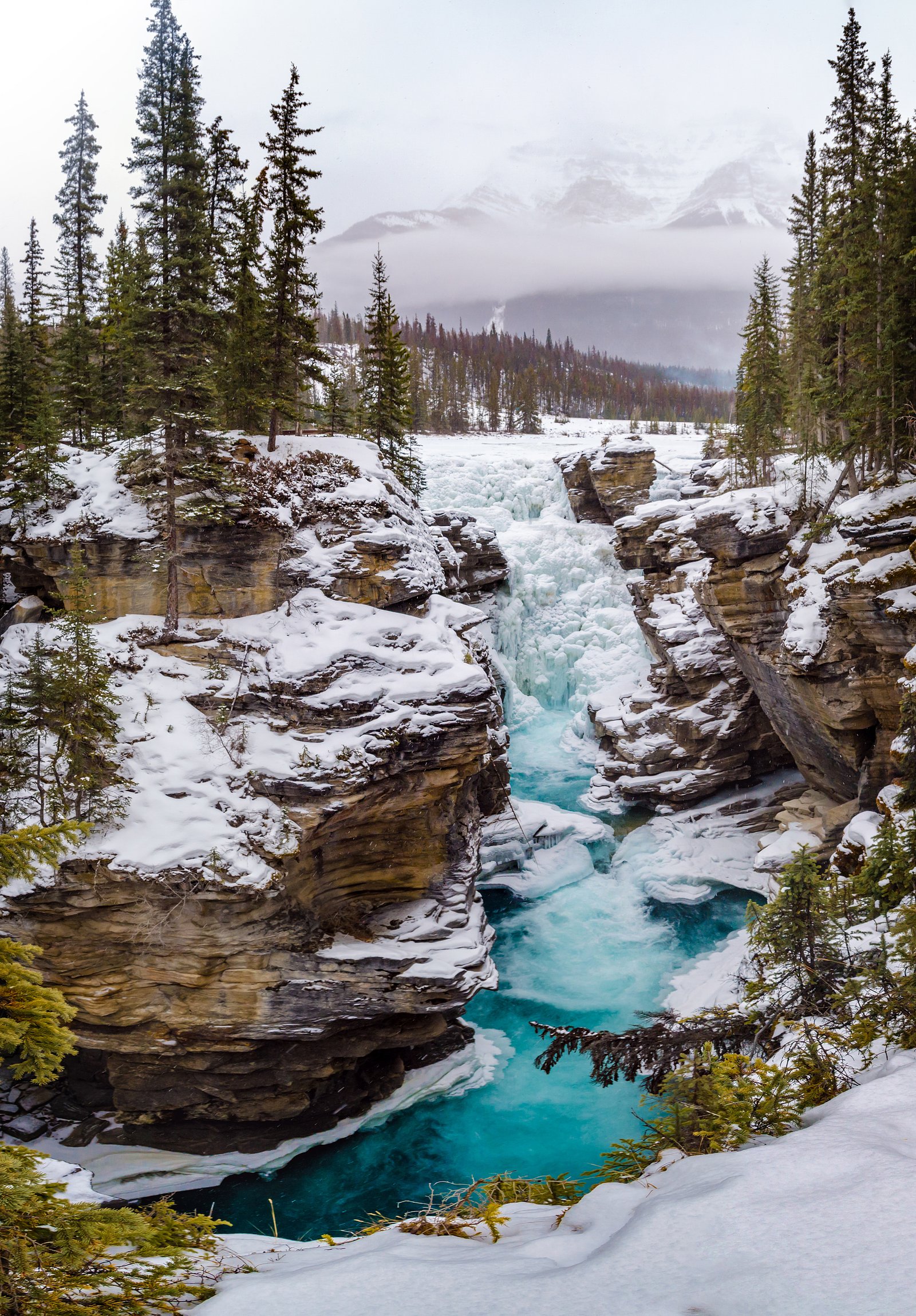
Athabasca Falls
Alberta • Jasper National Park • 23 m
By Armen Suny · Last verified Jun 2026
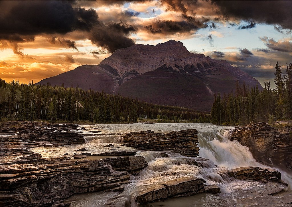
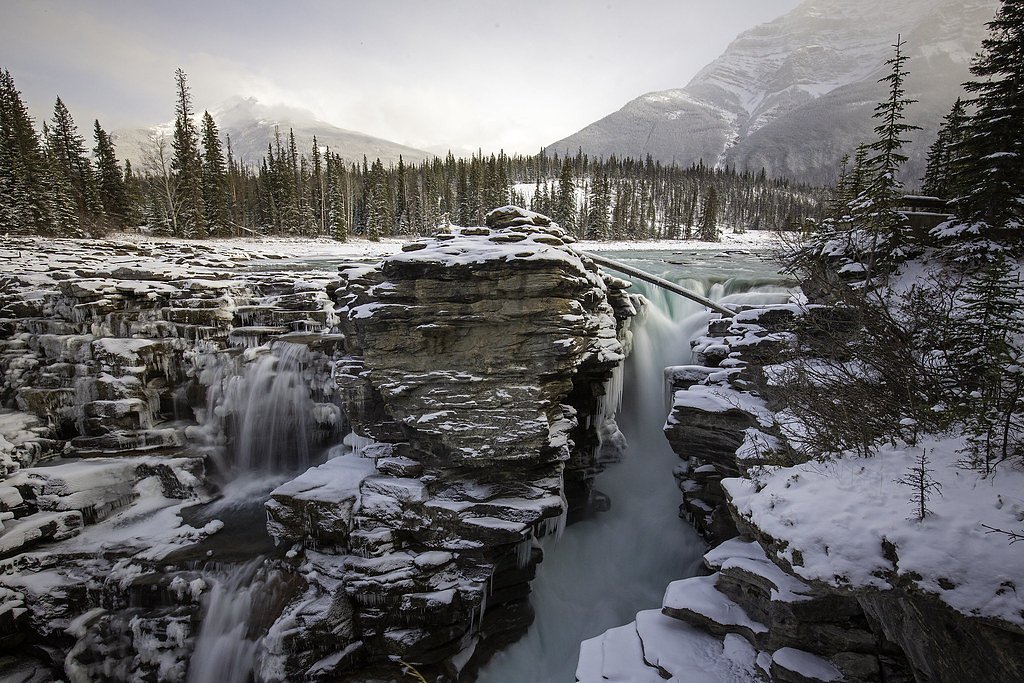
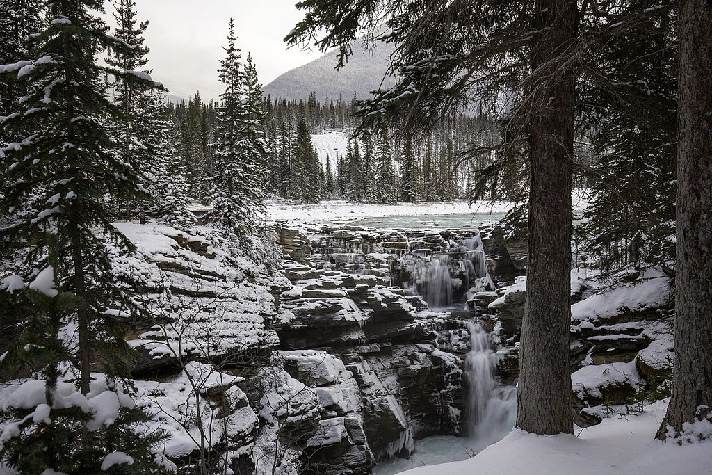
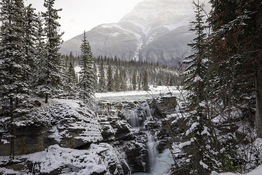

Photo Credits (5)
Difficulty
Easy
Trail Length
0.8 km
Trail Type
Out And Back
Elevation Gain
23 m
About Athabasca Falls
Athabasca Falls is a waterfall in Jasper National Park on the upper Athabasca River, approximately 30 kilometres (19 mi) south of the townsite of Jasper, Alberta, Canada, and just west of the Icefields Parkway.
The Setting
Athabasca Falls sits at 1,180 metres within Jasper National Park, in the mountains of Alberta. The falls drop 23 metres.
Why This Waterfall Exists
Athabasca Falls flows over layered sedimentary rock laid down about 485 million to 1.0 billion years ago. Over time, the stream has worn through these layers at different rates, creating a 75-foot drop that forms the waterfall.
Trail & Hike Details
The Approach
The easy 0.8-km out-and-back trail gains 23 metres of elevation on the way to the falls.
Trail Description
Short, well-maintained boardwalks and paved paths link a series of viewing platforms and stairways above and alongside the gorge. Most visitors follow the short route from the parking area to the upper viewing platforms and back. Some viewpoints require descending stairs; lower viewpoints may be steeper and include more steps. Trails are short and suitable for most visitors but can be slippery when wet or icy.
What to Expect
The falls drop 23 metres over layered sedimentary rock.
Accessibility
The trail is short and relatively flat, but the surface may be uneven. Contact the managing agency for accessibility details.
Frequently Asked Questions
🐶 Are Dogs Allowed at Athabasca Falls?
❌ Dogs are not allowed
Are There Any Fees or Permits Required?
🆖 No fees required
🏊 Is There Swimming at Athabasca Falls?
❌ Swimming is not allowed
When to Visit
Late spring (snowmelt) for highest flows and dramatic water; early morning or late afternoon for fewer crowds and softer light. Summer is busiest for accessibility; fall provides color and cooler temperatures. Winter offers icy, dramatic views but boardwalks can be slippery and some areas may be closed.
Seasonal Access
The best time to visit is Spring, Summer, Fall, and Winter. Check with Jasper National Park for current conditions.
Safety Information
High risk hazards include very strong currents, slippery surfaces on boardwalks and stairs, steep canyon edges, and cold water temperatures. Do not cross barriers or climb on rocks near the river. Supervise children closely. In winter, expect icy conditions, use traction aids if needed. Carry basic emergency gear and be aware of wildlife. Check Parks Canada alerts for closures or hazard warnings.
Current Water Conditions
Based on a Water Survey of Canada gauge 26.8 km away
31.0 m³/s
Current discharge — how much water is flowing
About average for this time of year
Based on 59 years of record
1.32 m
Water depth at gauge
7-Day Discharge Trend
What does this mean for your visit?
Flow is about average for this time of year.
About This Gauge
This gauge is on a regional waterway. Conditions at the falls may differ, especially after local rain.
7-Day Flow Outlook
Based on the WSC gauge MIETTE RIVER NEAR JASPER (27 km away).
Today
Strong
33 m³/s
8/10Tomorrow
Strong
33 m³/s
8/10Tue
Strong
32 m³/s
8/10Wed
Strong
30 m³/s
8/10Thu
Strong
29 m³/s
8/10Fri
Strong
27 m³/s
8/10Sat
Strong
27 m³/s
8/10Best window: Today — strong flow, rain showers (trip score 8/10).
Best time of year: this gauge typically runs highest from mid May to mid August, peaking in June.
How we calculate this
This is a transparent outlook, not a precise forecast. We take the waterfall's current flow strength (how it ranks against its historical normal for today, from the nearest WSC stream gauge), carry that ranking forward along the gauge's seasonal curve, and nudge it for forecast rain. Confidence is highest for the next day or two and falls further out. Always check official conditions and your own judgment before visiting — high flows can be dangerous.
Know when to go.
Get a free email alert when waterfalls near Jasper hit peak flow. We only send when conditions are worth the trip — no weekly newsletters, no spam.
Weather Forecast
Location & Access
Getting There
Located on the Icefields Parkway (Highway 93) roughly 19.1 miles (about 30.7 km) south of Jasper. Coordinates: 52.6644, -117.8835. From Jasper, drive south on Highway 93; the well-signed parking area is immediately adjacent to the falls.
Get Directions on Google MapsParking
On-site parking lot adjacent to the trailhead/viewing area. Parking fills early in summer; expect busy conditions mid-day. A Parks Canada park entry pass is required to enter Jasper National Park.
Elevation
1,180 metres above sea level
Coordinates
52.664419° N, -117.883516° W
Land Management
Managed by Parks Canada Agency
Visitor Tips & Gear
Arrive early or later in the afternoon to avoid peak crowds. Bring a waterproof layer and lens cloth for camera spray. Wear sturdy, non-slip shoes, boardwalks and stairs can be wet and icy. Stay behind barriers and on designated paths; do not climb down to the river or canyon edge. Purchase or display a Parks Canada park pass for Jasper National Park. Check current conditions and any warnings from Parks Canada before visiting.
As an Amazon Associate, we earn from qualifying purchases.
For this easy 0.8 km trail, lightweight trail shoes and a water bottle are usually sufficient. Icy conditions are common in winter — traction cleats are a smart addition.

Columbia Watertight II Rain Jacket
Packs into its own pocket, seam-sealed, and keeps you dry from spray and surprise rain.

Polarized Sunglasses (Knockaround)
Cuts glare off the water so you actually see the falls — and your photos turn out better too.

Earth Pak Waterproof Dry Bag
Keeps your phone and gear dry when waterfall mist soaks everything else.

Waterproof Phone Pouch (AiRunTech)
Cheap insurance — take photos right next to the falls without killing your phone.

Kahtoola MICROspikes
Cult-favorite traction cleats that grip ice and wet rock — essential for winter waterfall hikes.

JOBY GorillaPod Starter Kit
Wraps around railings and rocks for long-exposure waterfall shots — no flat surface needed.
Where to Stay
Browse vacation cabins and private rentals nearby
Unique outdoor stays — tents, yurts, and treehouses
Rent a campervan or RV for your waterfall road trip
Some links are affiliate links. We may earn a commission at no extra cost to you.
Nearby Campground
Whirlpool Group Campground
7.6 km away
Additional Information
Nearby Attractions
Columbia Icefield and Icefields Parkway viewpoints, Sunwapta Falls, Maligne Lake and Maligne Canyon, Jasper townsite.
Wildlife
Jasper National Park supports elk, deer, bighorn sheep, black and grizzly bears, coyotes, marmots and numerous bird species. Always keep a safe distance and follow Parks Canada wildlife guidelines.
Cities near Athabasca Falls
Nearby Waterfalls
Writing about Athabasca Falls? Embed this waterfall on your site for free.