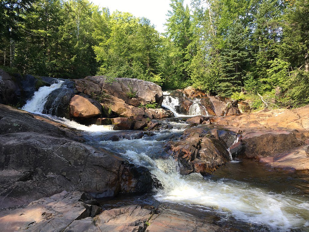
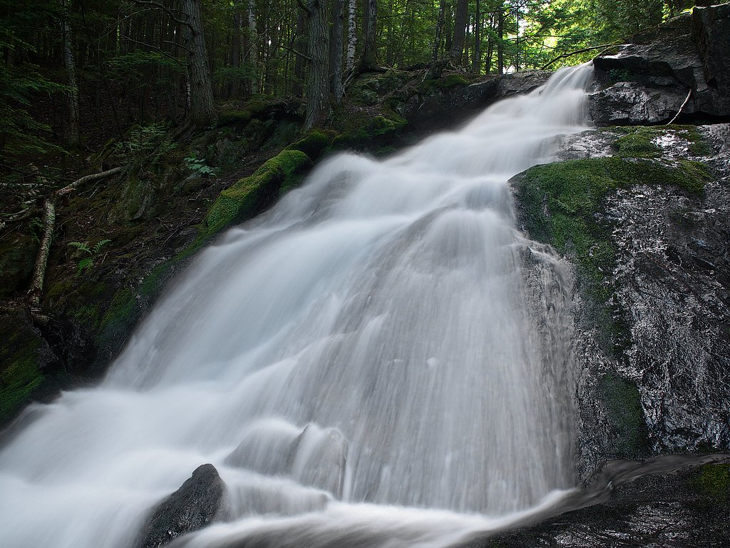
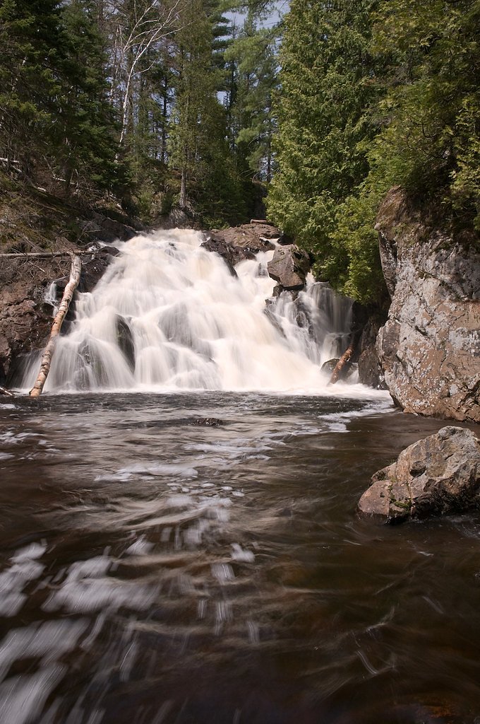
Yellow Dog River Falls
By Armen Suny · Last verified Mar 2026
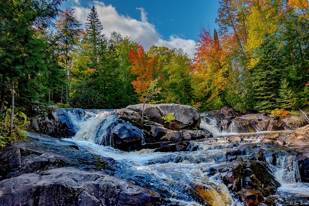
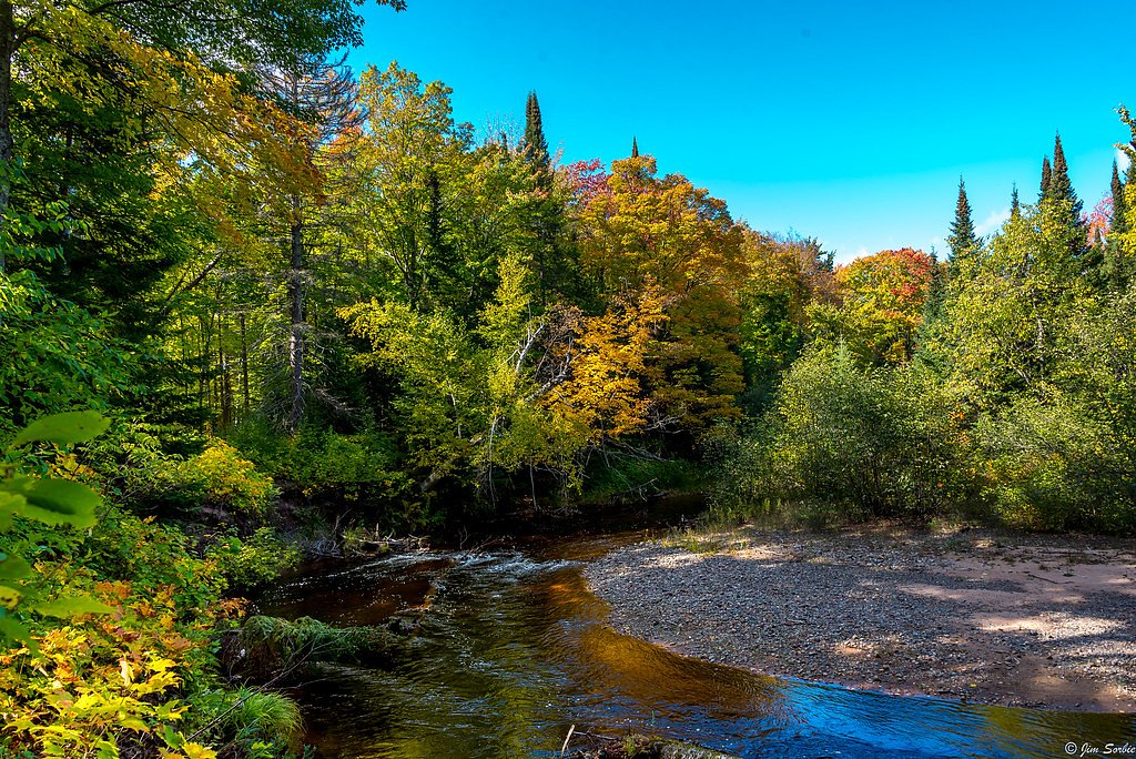
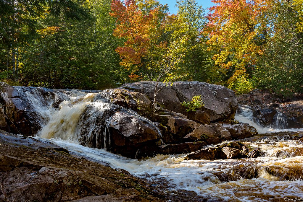
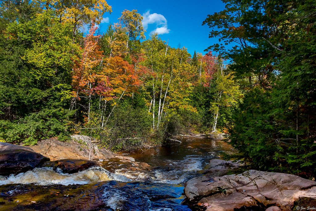
Photo Credits (5)
Difficulty
Moderate
Trail Length
2.4 miles
Trail Type
Out And Back
Elevation Gain
350 ft
About Yellow Dog River Falls
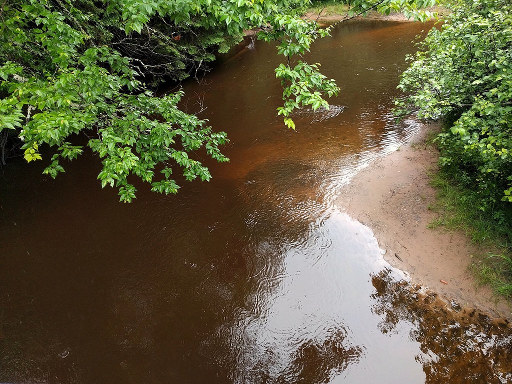
Yellow Dog River Falls is a peaceful, scenic cascade tucked into Michigan’s Upper Peninsula in Marquette County. The falls are part of the Yellow Dog River — a 31.6-mile watercourse with about 85 miles of tributaries that begins at the outflow from Bulldog Lake on the boundary of Baraga and Marquette counties. That headwater area lies in the Ottawa National Forest, and the river eventually empties into Lake Independence near Big Bay, contributing to the Lake Superior watershed. The result is a wild, wooded setting where the river tumbles over rocky ledges, making for excellent seasonal photography and a rewarding short outing. Access to the falls is often described as an easy-to-moderate exploration rather than a strenuous scramble, which makes it popular with day hikers who want a quick nature escape. The site’s mix of forest, rock, and water embodies the quiet, rugged character of the Upper Peninsula and pairs well with other outdoor pursuits in the Marquette County area.
The Setting
Yellow Dog River Falls sits at 869 feet along the East Branch Salmon Trout River, in the foothills of Michigan.
Trail & Hike Details
The Approach
The moderate 2.4-mile out-and-back trail gains 350 feet of elevation on the way to the falls.
Trail Description
The trail to Yellow Dog River Falls is a 2.4-mile out-and-back hike with approximately 350 feet of elevation gain and is rated moderate. The route winds through forested terrain toward the river and finishes at viewpoints where the water cascades over rock ledges. The provided data does not include an official USFS trail name or number, nor specific USFS surface/grade/class details; expect natural tread that can be uneven or muddy in wet conditions, so sturdy footwear and basic trail awareness are recommended.
What to Expect
Dogs are welcome.
Accessibility
The trail is not wheelchair accessible. Uneven terrain and elevation changes require steady footing.
Frequently Asked Questions
🐶 Are Dogs Allowed at Yellow Dog River Falls?
✅ Dogs are allowed
Are There Any Fees or Permits Required?
🆖 No fees required
🏊 Is There Swimming at Yellow Dog River Falls?
❌ Swimming is not allowed
When to Visit
Spring and early summer are ideal times to visit, as the water flow is typically strongest during these seasons. Fall offers beautiful foliage, while winter provides a unique view of the frozen falls.
Seasonal Access
The best time to visit is Spring, Summer, and Fall. Winter access may be limited.
Safety Information
The trail may be slippery, especially after rain. Visitors should exercise caution near the falls, as the rocks can be wet and unstable. Cell service is limited, so let someone know your plans before heading out.
Current Water Conditions
16 ft³/s
Current discharge — how much water is flowing
About average for this time of year
Based on 20 years of record
1.65 ft
Water depth at gauge
53°F
ColdBracing — limit time in water
7-Day Discharge Trend
What does this mean for your visit?
Flow is about average for this time of year. Water temperature is a bracing 53 degrees F, limit your time in the water. Mineral content is typical.
Water Quality
Conductance
Dissolved minerals in the water
About This Gauge
This gauge is on a nearby waterway and may not reflect exact conditions at the falls.
7-Day Flow Outlook
Based on the USGS gauge EAST BRANCH SALMON TROUT RIVER NEAR DODGE CITY, MI (13 km away).
Today
Moderate
16 cfs
9/10Tomorrow
Moderate
15 cfs
9/10Sun
Moderate
18 cfs
6/10Mon
Moderate
18 cfs
6/10Tue
Moderate
19 cfs
6/10Wed
Moderate
19 cfs
6/10Thu
Moderate
18 cfs
6/10Best window: Today — moderate flow, mostly sunny (trip score 9/10).
Best time of year: this gauge typically runs highest from mid March to mid May, peaking in April.
How we calculate this
This is a transparent outlook, not a precise forecast. We take the waterfall's current flow strength (how it ranks against its historical normal for today, from the nearest USGS stream gauge), carry that ranking forward along the gauge's seasonal curve, and nudge it for forecast rain. Confidence is highest for the next day or two and falls further out. Always check official conditions and your own judgment before visiting — high flows can be dangerous.
Know when to go.
Get a free email alert when waterfalls near Big Bay hit peak flow. We only send when conditions are worth the trip — no weekly newsletters, no spam.
Weather Forecast
Location & Access
Getting There
Yellow Dog River Falls is located near Big Bay, Michigan. To reach the falls, visitors typically drive along County Road 510 and then take a series of unpaved forest roads. The area is remote, so a high-clearance vehicle may be recommended.
Get Directions on Google MapsParking
There is a small parking area near the trailhead, but it may be limited in size. Visitors should plan accordingly, especially during peak seasons.
Elevation
869 feet above sea level
Coordinates
46.728611° N, -87.706389° W
Visitor Tips & Gear
Bring bug spray during the summer months, as mosquitoes can be prevalent. Be prepared for muddy conditions, especially after rain. Cell service may be limited in the area, so plan accordingly.
As an Amazon Associate, we earn from qualifying purchases.
With 2.4 miles and 350 ft of elevation gain, sturdy boots and trekking poles will help on this moderate trail. Sun exposure on the trail makes good sun protection a must in summer.

Polarized Sunglasses (Knockaround)
Cuts glare off the water so you actually see the falls — and your photos turn out better too.

Columbia Watertight II Rain Jacket
Packs into its own pocket, seam-sealed, and keeps you dry from spray and surprise rain.

Earth Pak Waterproof Dry Bag
Keeps your phone and gear dry when waterfall mist soaks everything else.

Waterproof Phone Pouch (AiRunTech)
Cheap insurance — take photos right next to the falls without killing your phone.

Timberland Euro Sprint Mid Waterproof
Trusted waterproof boot with premium leather and grippy rubber sole — reliable on rocky, wet trails.

TrailBuddy Trekking Poles
Lightweight aluminum, cork grips, and flip-locks that actually hold — a best-seller for good reason.
Where to Stay

Days Inn by Wyndham Marquette

Comfort Suites Marquette

Holiday Inn Marquette by IHG

My Place Hotel-Marquette, MI
Browse vacation cabins and private rentals nearby
Unique outdoor stays — tents, yurts, and treehouses
Rent a campervan or RV for your waterfall road trip
Some links are affiliate links. We may earn a commission at no extra cost to you.
Additional Information
Nearby Attractions
Other nearby attractions include Big Bay Point Lighthouse and the Huron Mountains.
Wildlife
The area is home to a variety of wildlife, including deer, birds, and occasionally black bears. Visitors should exercise caution and store food securely.
Cities near Yellow Dog River Falls
Nearby Waterfalls
Writing about Yellow Dog River Falls? Embed this waterfall on your site for free.