Workman Creek Falls
Arizona • 200 ft
By Armen Suny · Last verified Mar 2026
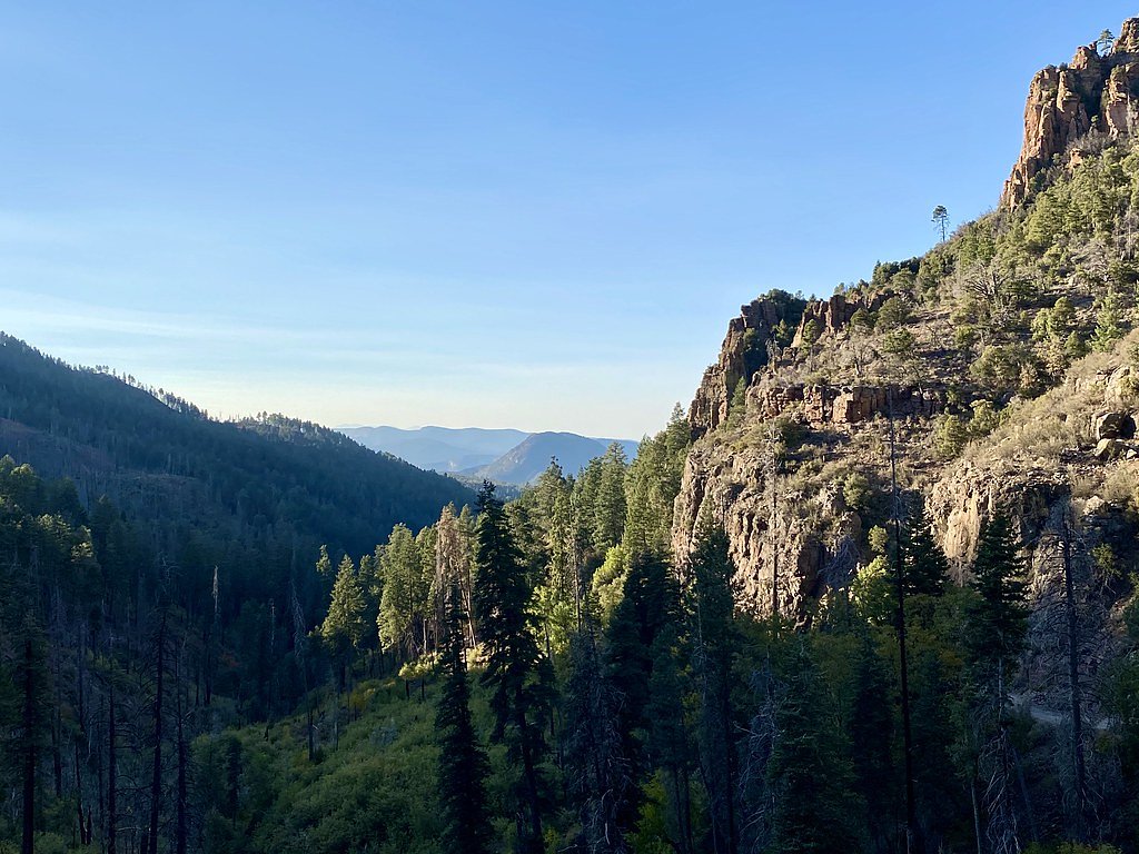
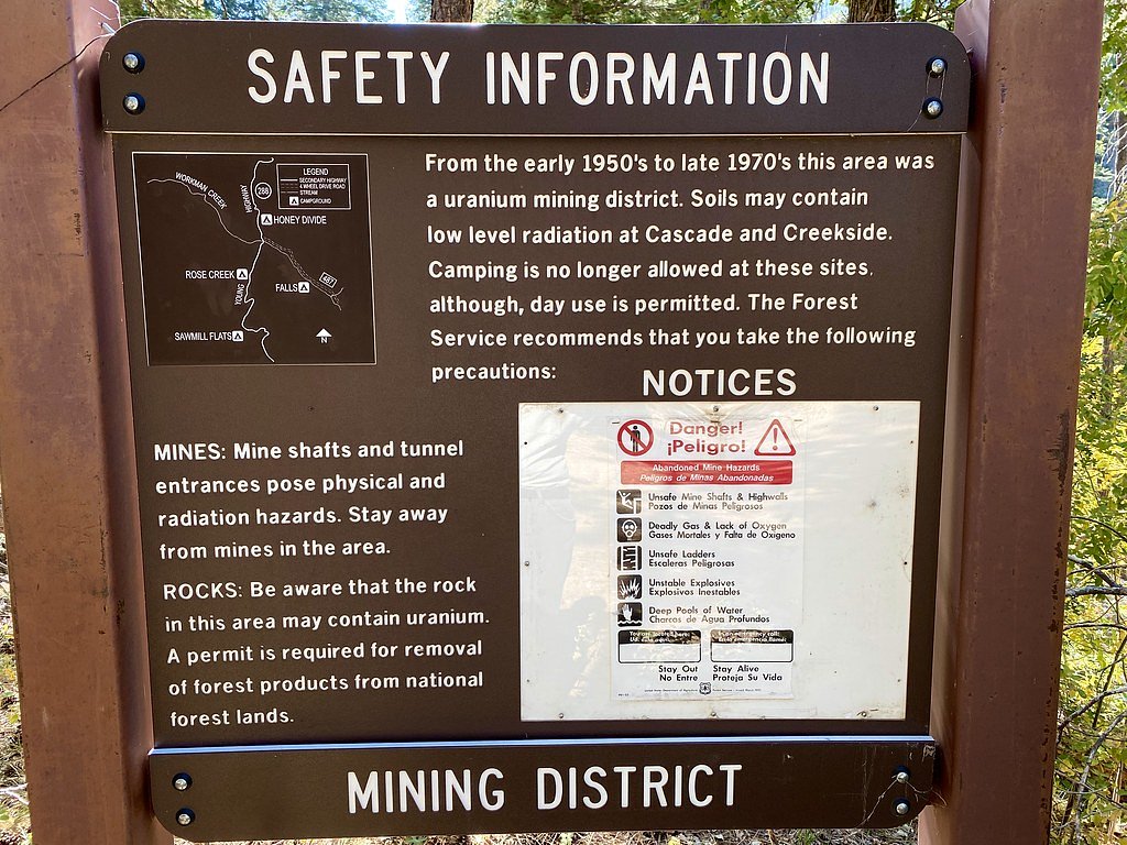
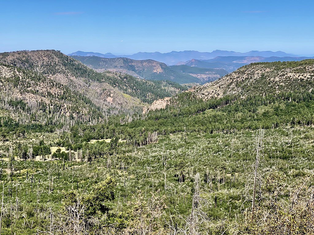
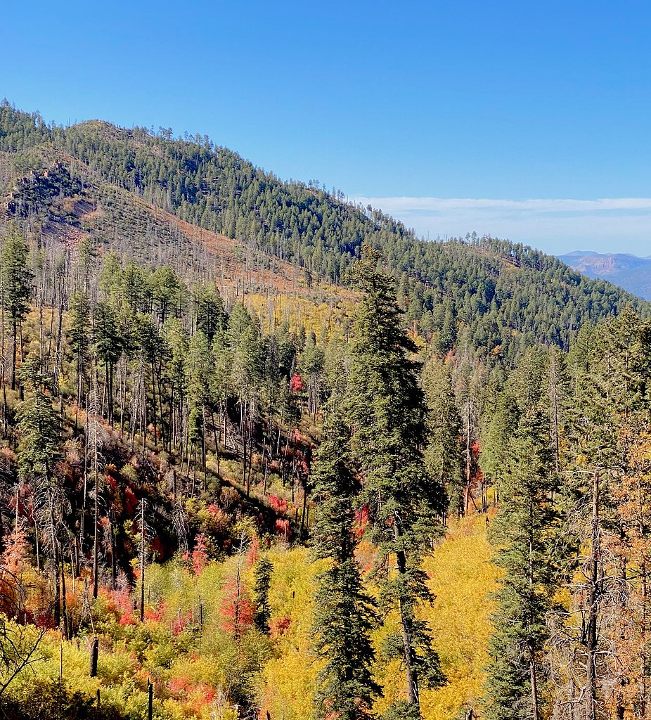
Photo Credits (5)
Difficulty
Moderate
Trail Length
2.4 miles
Trail Type
Out And Back
Elevation Gain
350 ft
About Workman Creek Falls
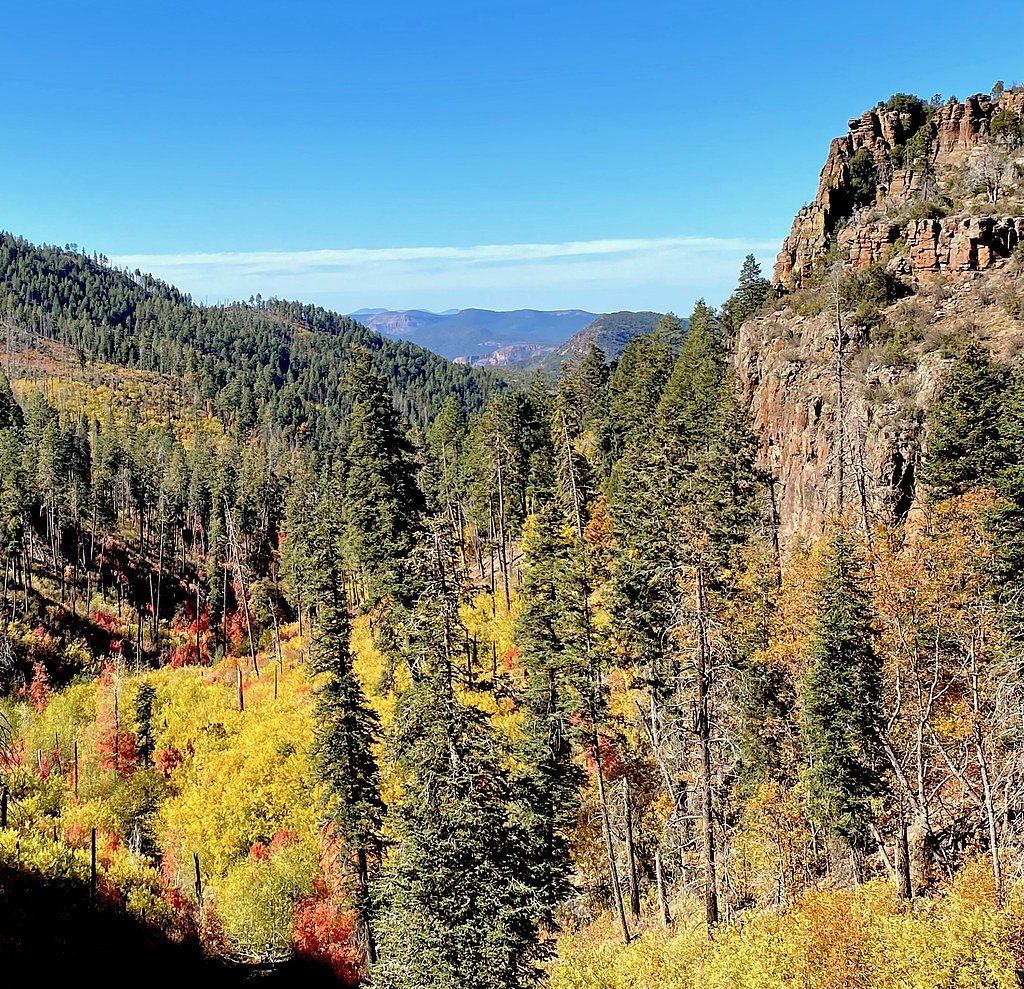
Workman Creek Falls is a picturesque waterfall located in the Tonto National Forest in Arizona. It cascades down a rocky cliff face and is surrounded by lush vegetation, offering a serene and scenic experience for visitors. The falls are accessible via a forest road, making it a popular destination for nature enthusiasts.
The Setting
Workman Creek Falls sits at 6,447 feet within Tonto National Forest, fed by the South Fork Parker Creek, in the high mountains of Arizona. At 200 feet, it is among the taller waterfalls in Arizona.
Height: 200 feet
Trail & Hike Details
The Approach
The moderate hike follows Parker Creek (#160), a 2.4-mile out-and-back trail over natural surface. Expect 350 feet of elevation gain with grades of 8-10%. The trail is moderately developed (Class 2).
USFS Trail
PARKER CREEK #160
Trail Class
Moderately Developed
Surface
Avg Grade
USFS Segment
0.55 miTrail Description
The trail to Workman Creek Falls is extremely short and more of a viewpoint walk from the parking area. Visitors can enjoy a close-up view of the falls without significant hiking. The area around the falls is rocky, so caution is advised.
What to Expect
The falls plunge 200 feet. Dogs are welcome.
Accessibility
The trail is not wheelchair accessible. Uneven terrain and elevation changes require steady footing.
Frequently Asked Questions
🐶 Are Dogs Allowed at Workman Creek Falls?
✅ Dogs are allowed
Are There Any Fees or Permits Required?
🆖 No fees required
🏊 Is There Swimming at Workman Creek Falls?
❌ Swimming is not allowed
When to Visit
Spring is the best time to visit, as the water flow is typically strongest due to snowmelt. Summer and fall are also good options, but water levels may be lower.
Seasonal Access
The best time to visit is Spring, Summer, and Fall. Access roads and trails may close during winter due to snow. Watch for flash flood warnings during monsoon season (July through September). Check with Tonto National Forest for seasonal road closures.
Safety Information
The rocks near the falls can be slippery, so exercise caution when exploring. Be prepared for changing weather conditions, and ensure your vehicle is suitable for unpaved roads.
Current Water Conditions
0 ft³/s
Current discharge — how much water is flowing
Much lower than usual for this time of year
Based on 39 years of record
0.93 ft
Water depth at gauge
7-Day Discharge Trend
What does this mean for your visit?
Flow is well below normal for this time of year, so the waterfall may be a trickle.
About This Gauge
7-Day Flow Outlook
Based on the USGS gauge SOUTH FORK PARKER CREEK NEAR ROOSEVELT, AZ (4 km away).
Today
Roaring
0 cfs
9/10Tomorrow
Roaring
0 cfs
6/10Thu
Roaring
0 cfs
9/10Fri
Roaring
0 cfs
9/10Sat
Roaring
0 cfs
6/10Sun
Roaring
0 cfs
6/10Mon
Roaring
0 cfs
6/10Best window: Today — roaring flow, sunny (trip score 9/10).
Best time of year: this gauge typically runs highest from late January to early April, peaking in March.
How we calculate this
This is a transparent outlook, not a precise forecast. We take the waterfall's current flow strength (how it ranks against its historical normal for today, from the nearest USGS stream gauge), carry that ranking forward along the gauge's seasonal curve, and nudge it for forecast rain. Confidence is highest for the next day or two and falls further out. Always check official conditions and your own judgment before visiting — high flows can be dangerous.
Know when to go.
Get a free email alert when waterfalls near Rock House hit peak flow. We only send when conditions are worth the trip — no weekly newsletters, no spam.
Weather Forecast
Location & Access
Getting There
Workman Creek Falls is located along Forest Road 487 in the Sierra Ancha Mountains within the Tonto National Forest. The falls can be reached by driving approximately 7 miles from the town of Young, Arizona. The road is unpaved and may require a high-clearance vehicle, especially during wet conditions.
Get Directions on Google MapsParking
There is a small parking area near the falls along Forest Road 487. Parking is limited, so arriving early is recommended.
Elevation
6,447 feet above sea level
Coordinates
33.818400° N, -110.930473° W
Land Management
Managed by USFS
Visitor Tips & Gear
Bring a high-clearance vehicle if visiting during or after rain, as the road can become muddy. Arrive early to secure parking, and wear sturdy shoes if you plan to explore the rocky area near the falls.
This trail sits at 6,447 ft above sea level
Elevated TrailUV radiation is roughly 26% stronger at this elevation than at sea level, and the dry air accelerates dehydration. Extra sun protection and fluids go a long way.
As an Amazon Associate, we earn from qualifying purchases.

Coppertone Sport SPF 50 Sunscreen
UV intensity jumps ~4% per 1,000 ft — at this elevation you can burn in half the time.

Sun Bum SPF 30 Lip Balm (3-Pack)
Lips have almost no natural UV protection and burn fast in thin, dry mountain air.

Liquid I.V. Electrolyte Packets
You lose moisture ~2x faster at elevation — electrolytes help you absorb water efficiently.

ROCKNIGHT Polarized UV400 Sunglasses
High-altitude glare off rock and water is intense — UV400 lenses block 99%+ of UVA/UVB.
As an Amazon Associate, we earn from qualifying purchases.
With 2.4 miles and 350 ft of elevation gain, sturdy boots and trekking poles will help on this moderate trail. Sun exposure on the trail makes good sun protection a must in summer.

Polarized Sunglasses (Knockaround)
Cuts glare off the water so you actually see the falls — and your photos turn out better too.

Columbia Watertight II Rain Jacket
Packs into its own pocket, seam-sealed, and keeps you dry from spray and surprise rain.

Earth Pak Waterproof Dry Bag
Keeps your phone and gear dry when waterfall mist soaks everything else.

Waterproof Phone Pouch (AiRunTech)
Cheap insurance — take photos right next to the falls without killing your phone.

Timberland Euro Sprint Mid Waterproof
Trusted waterproof boot with premium leather and grippy rubber sole — reliable on rocky, wet trails.

TrailBuddy Trekking Poles
Lightweight aluminum, cork grips, and flip-locks that actually hold — a best-seller for good reason.
Where to Stay

Roosevelt Resort Park

Ash Creek Canyon Mining Cabin Chrysotile Arizona

Upscale Desert Home Golf Pool Dining Hot Tub

The Lakehouse - A Peaceful Escape
Browse vacation cabins and private rentals nearby
Unique outdoor stays — tents, yurts, and treehouses
Rent a campervan or RV for your waterfall road trip
Some links are affiliate links. We may earn a commission at no extra cost to you.
Nearby Campground
REYNOLDS CREEK GROUP CAMPGROUND
4.6 miles away · 1 sites
Overview The Reynolds Creek Group Campground is a rustic and secluded, creek side camp located on the Pleasant Valley Ranger District in the Tonto National Forest. The primitive group camping area is nestled between towering ponderosa pine at an elevation of 5,250 feet and provides a great base camp for a wide range of recreational activities including, hiking, fishing, hunting, and nature photography. Recreation The site is located between the Salome and Sierra Ancha Wilderness Areas and adjacen
Book on Recreation.govNearby Hot Springs
Hot springs near Rock House, Arizona
Salt Banks
Salt Banks emerges at 78°F on the Fort Apache Reservation in Navajo County, flowing 13 degrees above the 65°F average annual te...

Roosevelt Dam Springs
Roosevelt Dam Springs emerges at 118°F just 37 feet from the scenic Apache Trail, making it one of Arizona's most accessible ho...

Warm Spring
Warm Spring emerges on the San Carlos Apache Reservation at 4,129 feet elevation near Canyon Day, located just 93 meters from t...
Unnamed Spring Gila County 2
This unnamed 83-degree thermal spring emerges on the Fort Apache Reservation near Canyon Day in Gila County at 4,339 feet eleva...
Pioneer Spring
Pioneer Spring emerges at 91°F in the desert mountains of Pinal County near Kearny, flowing 26 degrees above the 65°F average—o...
Spring
Spring flows at 75°F on the San Carlos Apache Reservation in Gila County near Globe, emerging 10 degrees above the 65°F average...
Looking for a soak after your hike? Explore more hot springs near Rock House, Arizona on SoakingSprings.
Explore Arizona springsAdditional Information
Nearby Attractions
Other attractions in the area include Aztec Peak, Reynolds Creek, and the Sierra Ancha Wilderness, which offers additional hiking and scenic views.
Wildlife
The area is home to diverse wildlife, including deer, birds, and small mammals. Visitors should also be aware of potential encounters with snakes or other desert wildlife.
Cities near Workman Creek Falls
Writing about Workman Creek Falls? Embed this waterfall on your site for free.