
Photo Credits (5)
Difficulty
Easy
Trail Length
1.6 miles
Trail Type
Out And Back
Elevation Gain
200 ft
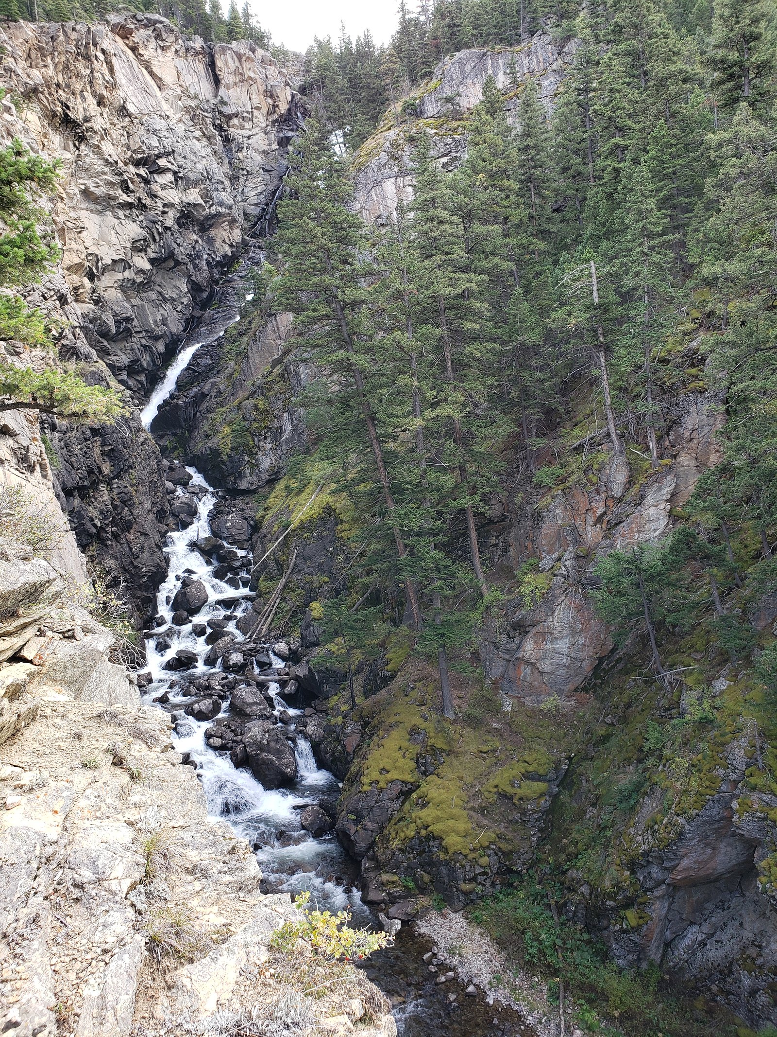
About Woodbine Falls
Woodbine Falls is a stunning waterfall located in the Custer Gallatin National Forest in Montana. It cascades down a rocky cliff face and is a popular destination for hikers and nature enthusiasts. The waterfall is accessible via a scenic trail that offers beautiful views of the surrounding forest and mountains.
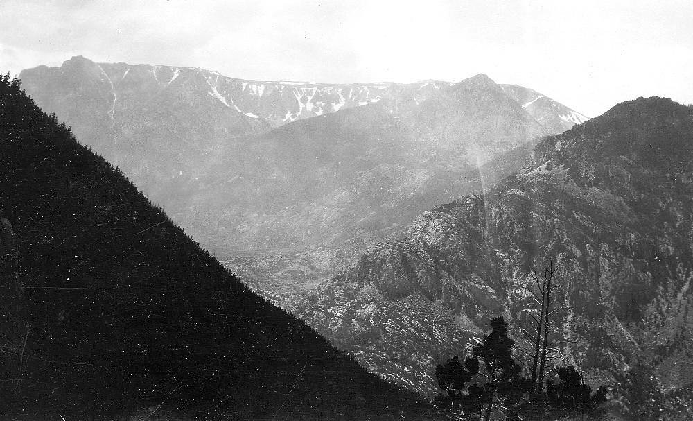
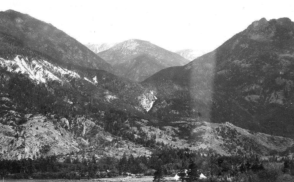
The Setting
Woodbine Falls sits at 5,830 feet within Custer National Forest, fed by the West Rosebud Creek, in the high mountains of Montana.
Trail & Hike Details
The Approach
The easy hike follows Woodbine Falls (#23), a 1.6-mile out-and-back trail over natural surface. Expect 200 feet of elevation gain. The trail is developed (Class 3).
USFS Trail
WOODBINE FALLS #23
Trail Class
Developed
Surface
USFS Segment
0.49 miTrail Description
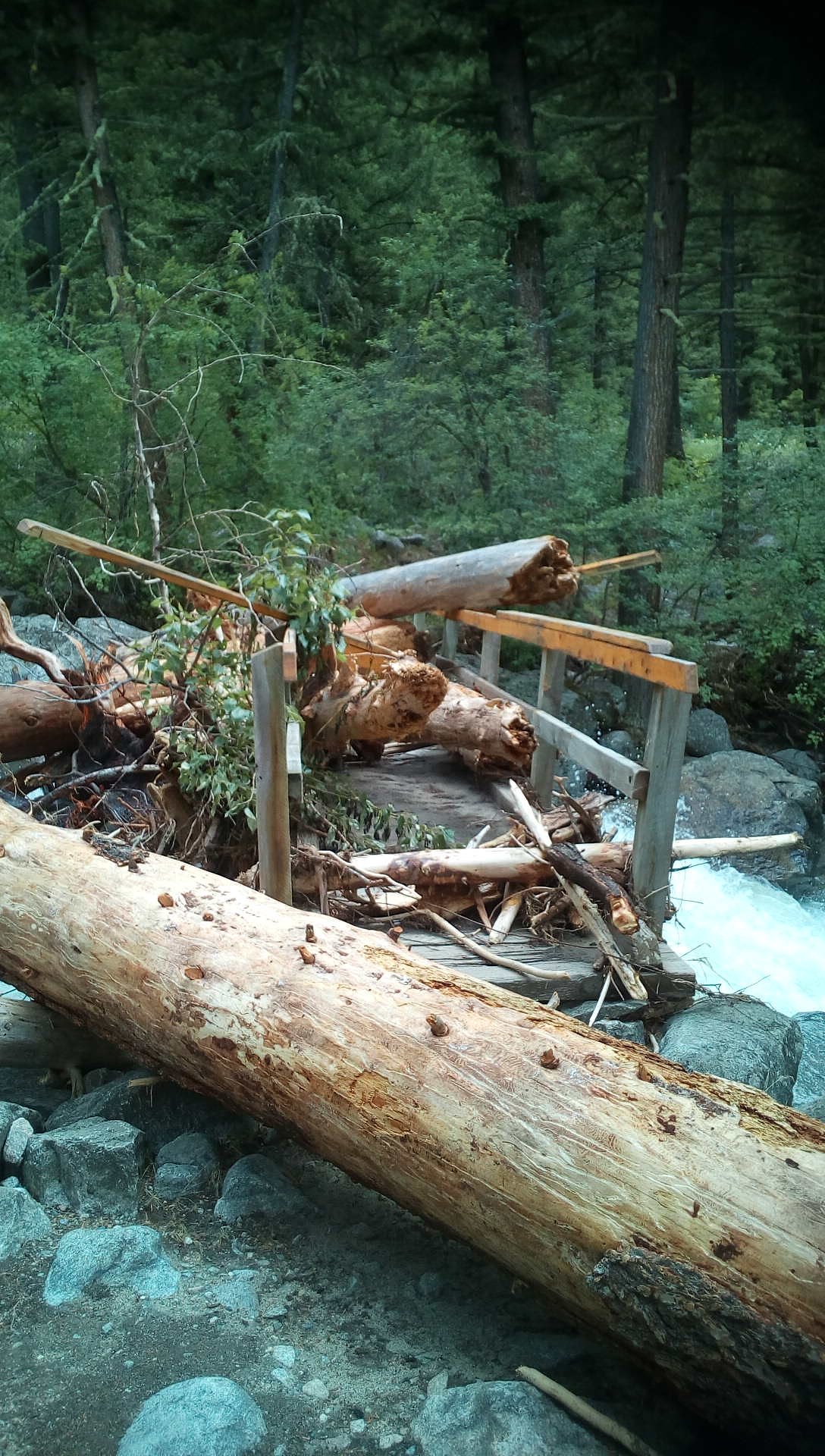
The trail to Woodbine Falls is a well-maintained path that winds through a forested area with gentle elevation gain. It is suitable for most visitors, including families with children. The trail offers scenic views of the surrounding landscape and leads to a viewing area near the base of the falls.
What to Expect
Dogs are welcome.
Accessibility
The trail is not wheelchair accessible. Uneven terrain and elevation changes require steady footing.
Frequently Asked Questions
🐶 Are Dogs Allowed at Woodbine Falls?
✅ Dogs are allowed
Are There Any Fees or Permits Required?
🆖 No fees required
🏊 Is There Swimming at Woodbine Falls?
❌ Swimming is not allowed
When to Visit
The best time to visit Woodbine Falls is during late spring through early fall when the trail is clear of snow and the waterfall flow is at its peak.
Seasonal Access
The best time to visit is Spring, Summer, and Fall. Access roads and trails may close during winter due to snow. Check with Custer National Forest for seasonal road closures.
Safety Information
Be cautious of slippery rocks near the falls. Check weather conditions before visiting, as the trail may be muddy or icy during certain times of the year. Carry bear spray and be aware of wildlife in the area.
Current Water Conditions
196 ft³/s
Current discharge — how much water is flowing
About average for this time of year
Based on 59 years of record
1.32 ft
Water depth at gauge
7-Day Discharge Trend
What does this mean for your visit?
Flow is about average for this time of year.
About This Gauge
This gauge is on a nearby waterway and may not reflect exact conditions at the falls.
7-Day Flow Outlook
Based on the USGS gauge West Rosebud Creek near Roscoe MT (17 km away).
Today
Moderate
223 cfs
6/10Tomorrow
Moderate
237 cfs
6/10Sun
Moderate
247 cfs
6/10Mon
Moderate
316 cfs
6/10Tue
Moderate
342 cfs
6/10Wed
Moderate
374 cfs
6/10Thu
Moderate
397 cfs
6/10Best window: Today — moderate flow, chance showers and thunderstorms (trip score 6/10).
Best time of year: this gauge typically runs highest from early June to early September, peaking in July.
How we calculate this
This is a transparent outlook, not a precise forecast. We take the waterfall's current flow strength (how it ranks against its historical normal for today, from the nearest USGS stream gauge), carry that ranking forward along the gauge's seasonal curve, and nudge it for forecast rain. Confidence is highest for the next day or two and falls further out. Always check official conditions and your own judgment before visiting — high flows can be dangerous.
Know when to go.
Get a free email alert when waterfalls near Nye hit peak flow. We only send when conditions are worth the trip — no weekly newsletters, no spam.
Weather Forecast
Location & Access
Getting There
Woodbine Falls is located near Nye, Montana, within the Custer Gallatin National Forest. The trailhead can be accessed via Woodbine Campground, which is off Nye Road (State Highway 419).
Get Directions on Google MapsParking
Parking is available at the Woodbine Campground, which serves as the starting point for the trail to the falls. Parking may be limited during peak seasons.
Elevation
5,830 feet above sea level
Coordinates
45.353552° N, -109.885457° W
Land Management
Managed by USFS
Visitor Tips & Gear
Arrive early during peak seasons to secure parking. Wear sturdy shoes, as the trail may have uneven sections. Bring water and a camera to capture the beautiful scenery.
This trail sits at 5,830 ft above sea level
Elevated TrailUV radiation is roughly 23% stronger at this elevation than at sea level, and the dry air accelerates dehydration. Extra sun protection and fluids go a long way.
As an Amazon Associate, we earn from qualifying purchases.

Coppertone Sport SPF 50 Sunscreen
UV intensity jumps ~4% per 1,000 ft — at this elevation you can burn in half the time.

Sun Bum SPF 30 Lip Balm (3-Pack)
Lips have almost no natural UV protection and burn fast in thin, dry mountain air.

Liquid I.V. Electrolyte Packets
You lose moisture ~2x faster at elevation — electrolytes help you absorb water efficiently.

ROCKNIGHT Polarized UV400 Sunglasses
High-altitude glare off rock and water is intense — UV400 lenses block 99%+ of UVA/UVB.
As an Amazon Associate, we earn from qualifying purchases.
This easy 1.6 miles hike is straightforward — comfortable trail shoes and plenty of water should do. Sun exposure on the trail makes good sun protection a must in summer.

Polarized Sunglasses (Knockaround)
Cuts glare off the water so you actually see the falls — and your photos turn out better too.

Columbia Watertight II Rain Jacket
Packs into its own pocket, seam-sealed, and keeps you dry from spray and surprise rain.

Earth Pak Waterproof Dry Bag
Keeps your phone and gear dry when waterfall mist soaks everything else.

Waterproof Phone Pouch (AiRunTech)
Cheap insurance — take photos right next to the falls without killing your phone.

JOBY GorillaPod Starter Kit
Wraps around railings and rocks for long-exposure waterfall shots — no flat surface needed.

Osprey Daylite Daypack
Light, organized, and just the right size for a day hike — fits water, snacks, and layers.
Where to Stay

10-7 River Cabin

Remote Mountainside Cabin By Stillwater River

Fish, Hike, Views: Boulder Beauty 'Gil's' Cabin!

Hike, Fish and Bike Mc Leod Home with Fire Pit
Browse vacation cabins and private rentals nearby
Unique outdoor stays — tents, yurts, and treehouses
Rent a campervan or RV for your waterfall road trip
Some links are affiliate links. We may earn a commission at no extra cost to you.
Nearby Campground
WOODBINE CAMPGROUND
0.5 miles away · 44 sites
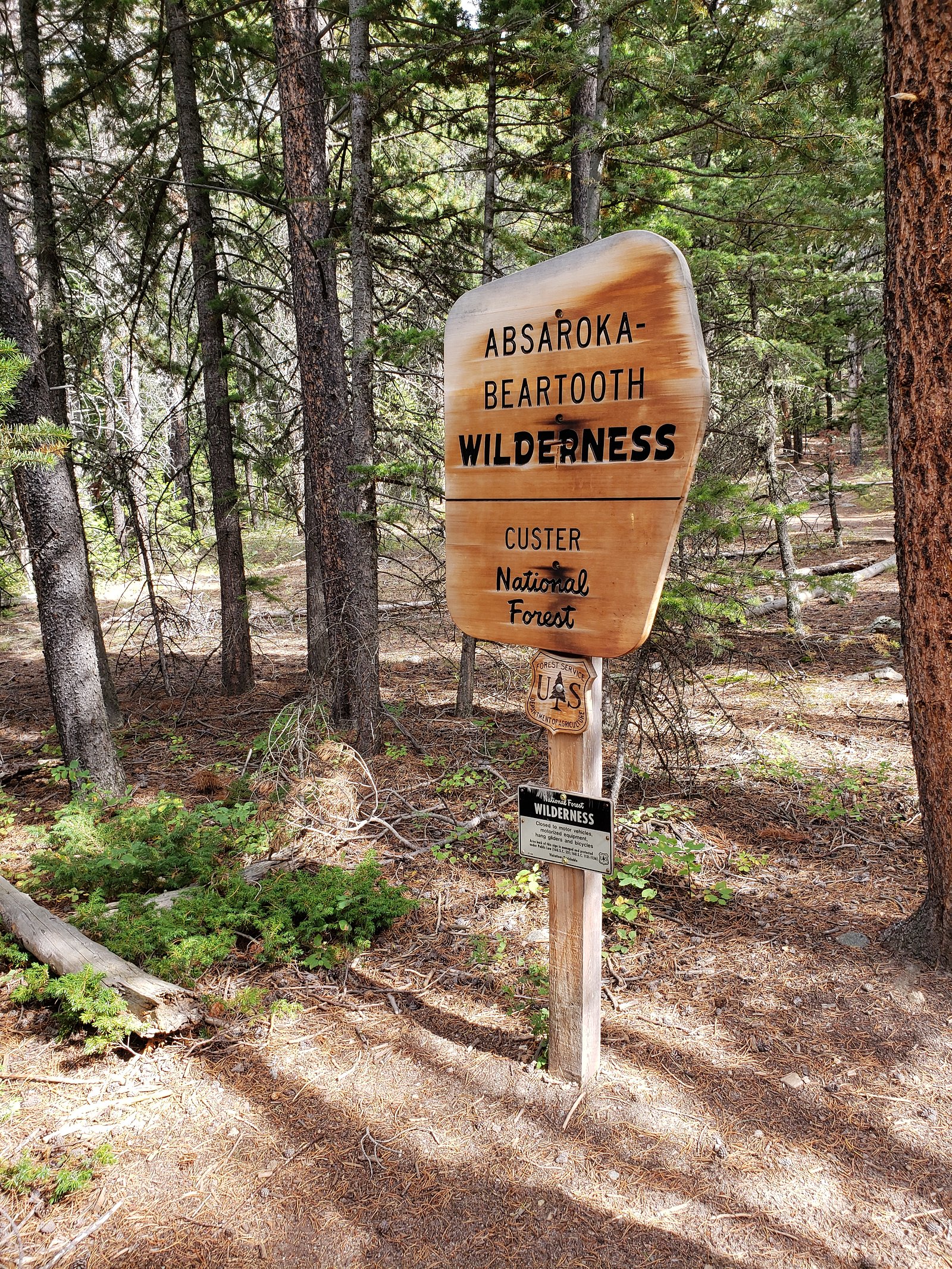
Overview Woodbine Campground is remotely located adjacent to the Absaroka-Beartooth Wilderness in southwestern Montana, about three hours from Yellowstone National Park via the scenic Beartooth Highway. Red Lodge, Montana is 57 miles east; Nye is 7 miles north. Recreation The Stillwater River and nearby streams and lakes offer great fishing opportunities for rainbow, brown and cutthroat trout. Hiking the Woodbine Falls Trail is a popular activity among campers. The 1.5-mile round-trip trail begin
Book on Recreation.govNearby Hot Springs
Hot springs near Nye, Montana
Anderson Springs
Anderson Springs flows at 77°F in Sweet Grass County, Montana, at 5,540 feet elevation along the East Boulder River drainage. U...

Chico Hot Springs
Chico Hot Springs produces 113°F water at 5,336 feet in Park County's Paradise Valley, 30 miles north of Yellowstone National P...
Hunters Hot Springs
Hunters Hot Springs discharges at 140°F in Sweet Grass County, Montana, at 4,386 feet elevation. The water is strongly alkaline...
Hot Springs
This warm spring emerges at 7,948 feet elevation in Yellowstone's northeastern wilderness, 11.5 miles from Northeast Entrance R...
Hot, On Lamar River
A warm spring emerges along the Lamar River at 6,777 feet elevation in Yellowstone's renowned wildlife corridor, approximately ...
Hot Springs
Perched at 8,683 feet in Yellowstone's alpine backcountry, this warm spring sits 12.2 miles from Hoodoo Basin Trail, making it ...
Looking for a soak after your hike? Explore more hot springs near Nye, Montana on SoakingSprings.
Explore Montana springsAdditional Information
Nearby Attractions
Nearby attractions include the Stillwater River, Woodbine Campground, and other hiking trails in the Custer Gallatin National Forest.
Wildlife
The area is home to a variety of wildlife, including deer, birds, and occasionally bears. Visitors should exercise caution and follow wildlife safety guidelines.
Cities near Woodbine Falls
Writing about Woodbine Falls? Embed this waterfall on your site for free.