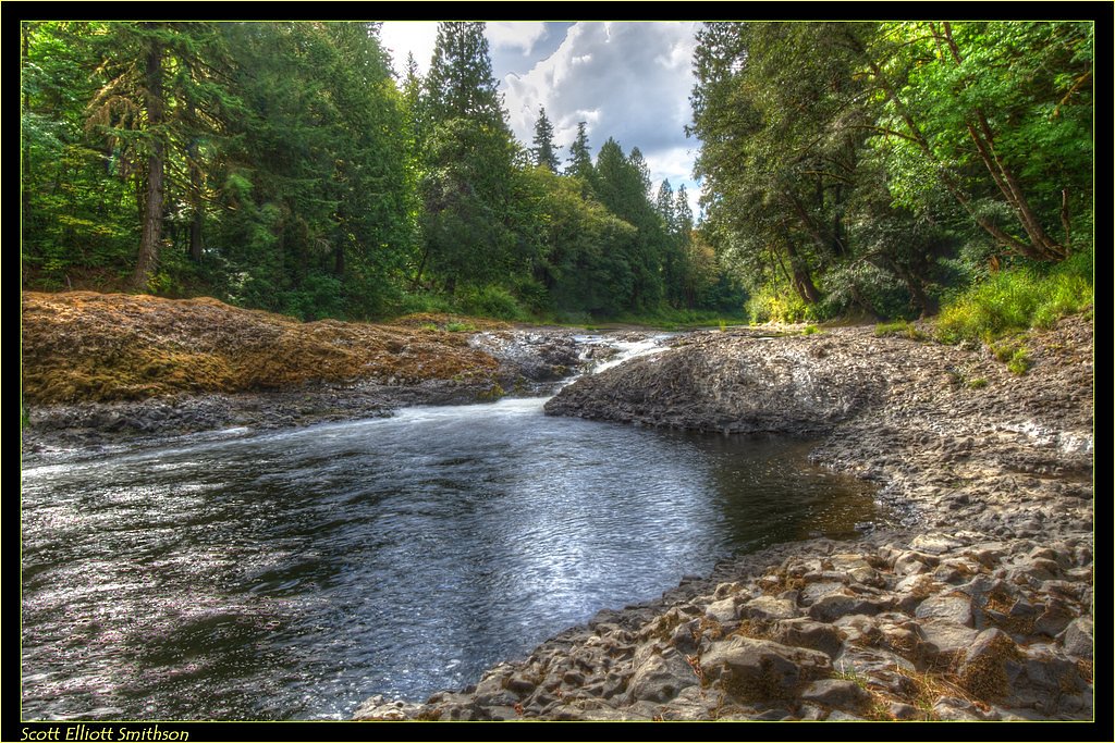
Willapa Falls
By Armen Suny · Last verified Sep 2026
LiDAR & 3D terrainPhoto Credits (1)
About Willapa Falls
Willapa Falls is a small but scenic waterfall located near the Willapa River in Washington. It is a lesser-known destination, offering a peaceful and serene environment for visitors. The falls are surrounded by lush greenery, making it a picturesque spot for nature enthusiasts.
The Setting
Willapa Falls sits at 486 feet along the Chehalis River, in the coastal lowlands of Washington.
Trail & Hike Details
Trail Description
There is limited information about the trail leading to Willapa Falls. It may involve a short walk or hike through forested areas, but details about the trail's condition, length, and difficulty are not well-documented.
What to Expect
Visitors can expect a quiet and natural setting with a small waterfall surrounded by dense vegetation. The area may be less developed, so amenities like restrooms or picnic areas are unlikely to be available.
Accessibility
Accessibility information is not available. The area may not be suitable for visitors with mobility challenges.
Frequently Asked Questions
🐶 Are Dogs Allowed at Willapa Falls?
❌ Dogs are not allowed
Are There Any Fees or Permits Required?
🆖 No fees required
🏊 Is There Swimming at Willapa Falls?
❌ Swimming is not allowed
When to Visit
Spring and early summer are ideal times to visit, as the waterfall may have higher flow due to seasonal rainfall. However, it can be visited year-round.
Seasonal Access
The best time to visit is Spring, Summer, Fall, and Winter.
Safety Information
Visitors should be cautious of slippery rocks and uneven terrain near the falls. During wet weather, trails may become muddy and more difficult to navigate. Always stay on designated paths and avoid getting too close to the water's edge.
Current Water Conditions
41 ft³/s
Current discharge — how much water is flowing
About average for this time of year
Based on 86 years of record
306.18 ft
Water depth at gauge
7-Day Discharge Trend
What does this mean for your visit?
Flow is about average for this time of year.
About This Gauge
This gauge is on a nearby waterway and may not reflect exact conditions at the falls.
7-Day Flow Outlook
Based on the USGS gauge CHEHALIS RIVER NEAR DOTY, WA (17 km away).
Today
Roaring
47 cfs
6/10Tomorrow
Roaring
49 cfs
8/10Sun
Roaring
46 cfs
9/10Mon
Roaring
46 cfs
9/10Tue
Roaring
48 cfs
6/10Wed
Roaring
56 cfs
6/10Thu
Roaring
52 cfs
6/10Best window: Sun — roaring flow, sunny (trip score 9/10).
Best time of year: this gauge typically runs highest from late November to late January, peaking in December.
How we calculate this
This is a transparent outlook, not a precise forecast. We take the waterfall's current flow strength (how it ranks against its historical normal for today, from the nearest USGS stream gauge), carry that ranking forward along the gauge's seasonal curve, and nudge it for forecast rain. Confidence is highest for the next day or two and falls further out. Always check official conditions and your own judgment before visiting — high flows can be dangerous.
Know when to go.
Get a free email alert when waterfalls near Lebam hit peak flow. We only send when conditions are worth the trip — no weekly newsletters, no spam.
Weather Forecast
The Terrain, Seen by LiDAR
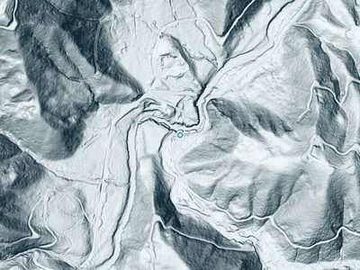
Aircraft-mounted lasers measured this ground to within inches. Trees and buildings are digitally stripped away, leaving the bare shape of the land the water has carved.
Here the descent is spread out: 1-meter lidar measures about 105 feet of drop through Willapa Falls, stretched along the creek rather than stacked in one wall. The brink sits at about 467 feet above sea level.
The ground changes about 115 feet in the 500 feet above the falls and 39 feet in the 500 feet below. Facing northwest, the falls stay mostly shaded, with soft, even light all day.
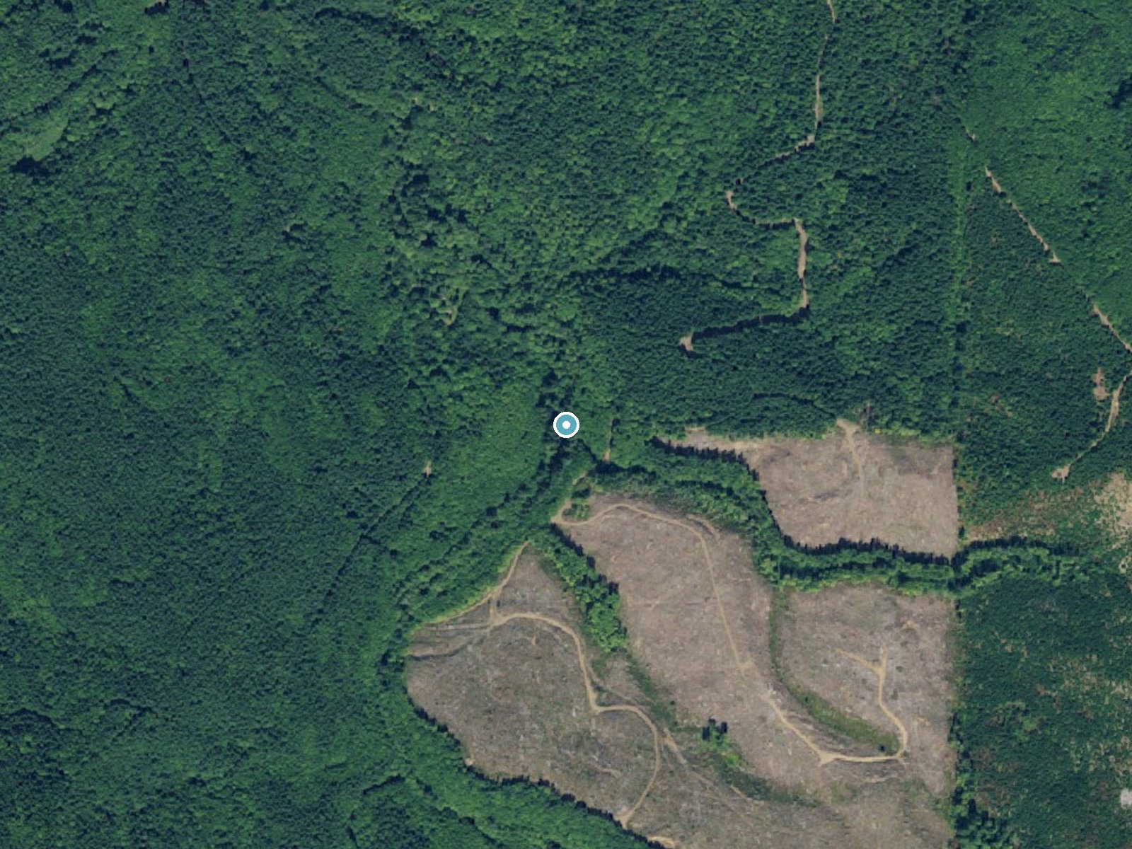
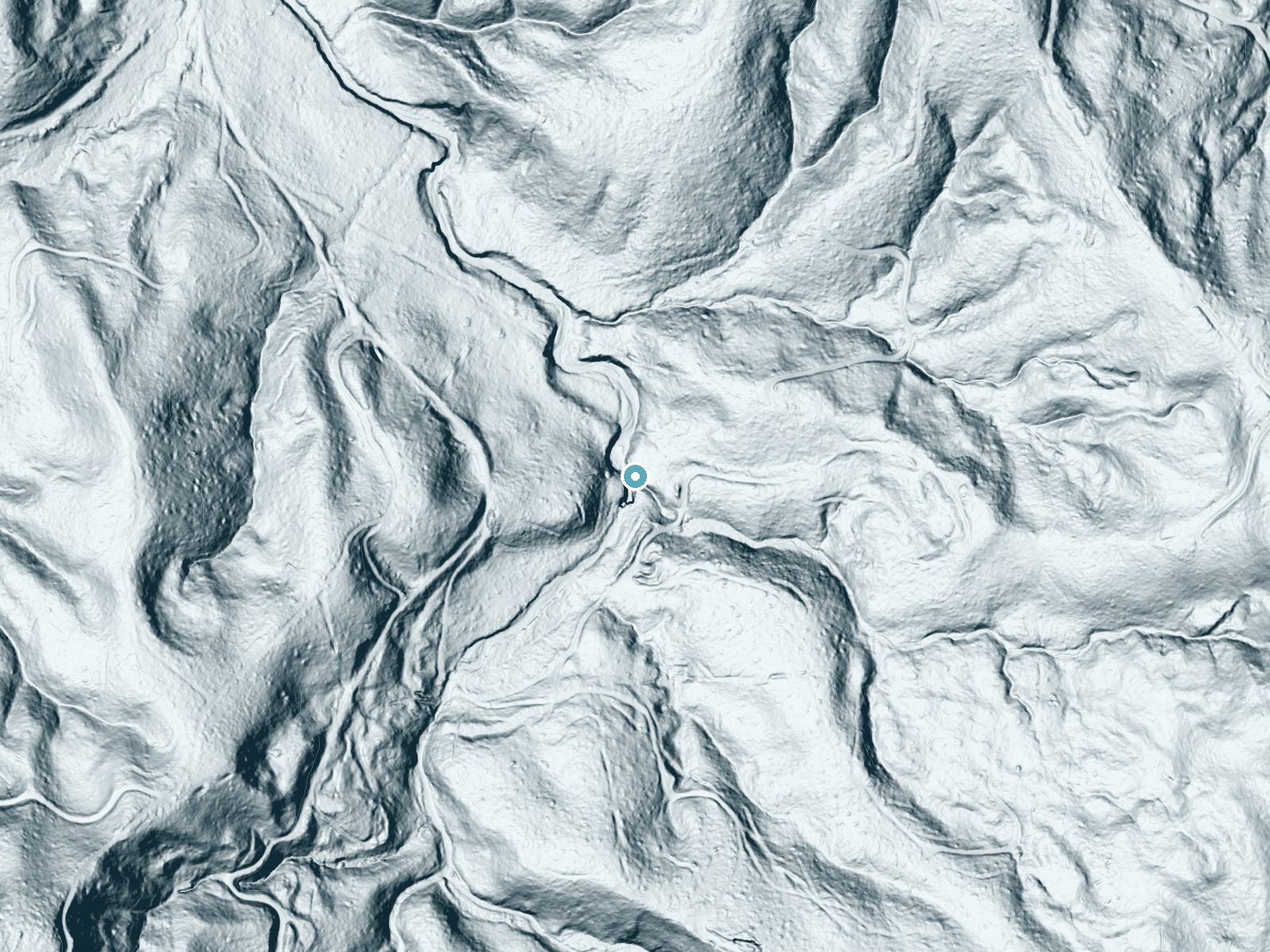
Drag to compare. The dot marks the waterfall. The frame is about a mile across.
- Ground elevation
- 467 feet
- Measured by 1-meter lidar
- Drop at the falls
- About 105 feet
- Change in ground height within ~250 feet of the falls
- Faces
- Northwest
- Mostly shaded, so the light stays soft and even all day.
A slice through the lidar ground surface, from above the falls to downstream (heading northwest).
Elevation data: USGS 3D Elevation Program. Aerial imagery: USGS The National Map. Public domain.
Location & Access
Getting There
Willapa Falls is located near the town of Raymond, Washington. Access is typically via local roads, and visitors should use GPS or maps to navigate to the area. Specific directions may vary depending on the starting point.
Get Directions on Google MapsParking
Parking availability is unclear, but visitors may need to park along nearby roads or in informal pullouts. There is no designated parking lot.
Elevation
486 feet above sea level
Coordinates
46.524946° N, -123.447227° W
Visitor Tips & Gear
Bring sturdy footwear as the terrain may be uneven or muddy. Check weather conditions before visiting, as rain can make trails slippery. Carry water and snacks, as there are no facilities nearby.
Where to Stay

Oceanview Inn at the Arch
Mermaid Inn

The Seaview Cottages
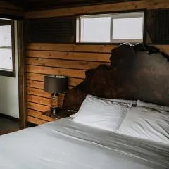
Pitchwood Inn
Browse vacation cabins and private rentals nearby
Unique outdoor stays — tents, yurts, and treehouses
Rent a campervan or RV for your waterfall road trip
Some links are affiliate links. We may earn a commission at no extra cost to you.
Additional Information
Nearby Attractions
The Willapa National Wildlife Refuge and the town of Raymond are nearby attractions worth exploring.
Wildlife
The area around Willapa Falls may feature local wildlife such as birds, deer, and small mammals. Visitors should respect the natural habitat.
Cities near Willapa Falls
Nearby Waterfalls
 LiDAR
LiDAR
Writing about Willapa Falls? Embed this waterfall on your site for free.