Whitmore Rapids
Arizona • Grand Canyon National Park
By Armen Suny · Last verified Mar 2026
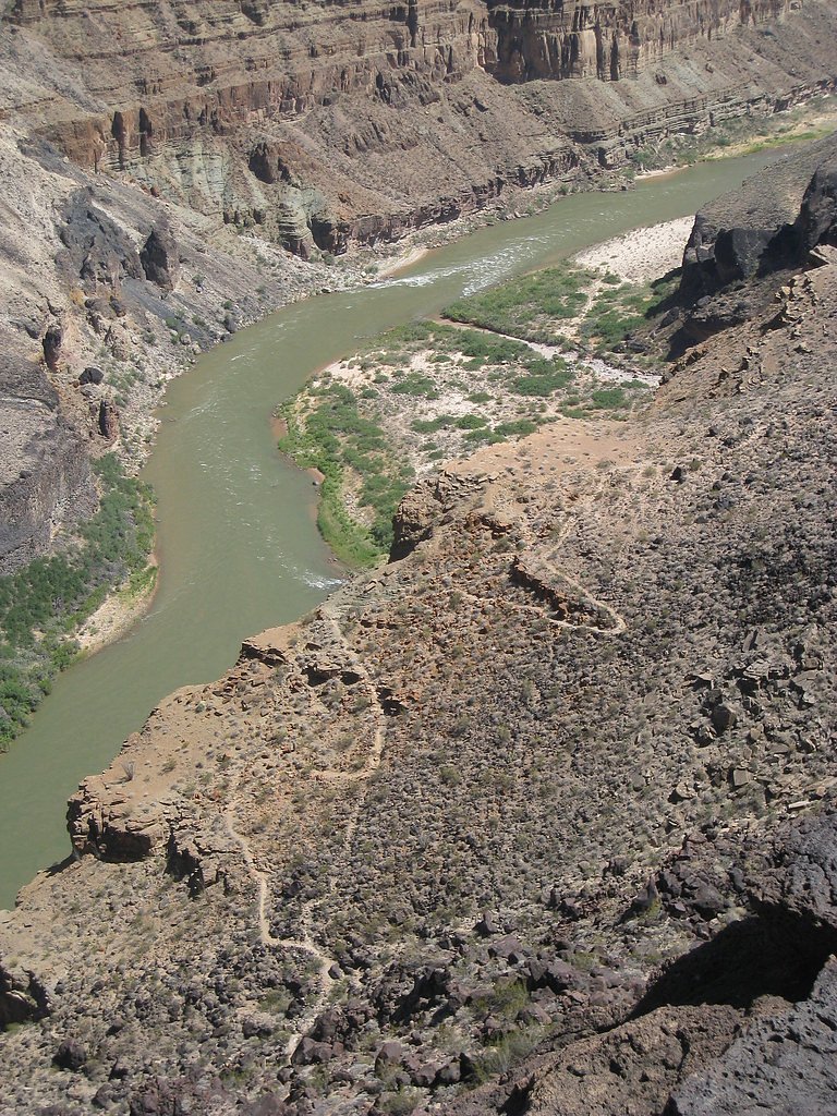
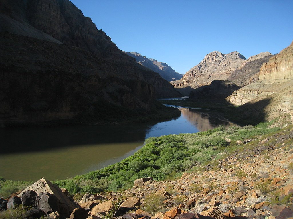
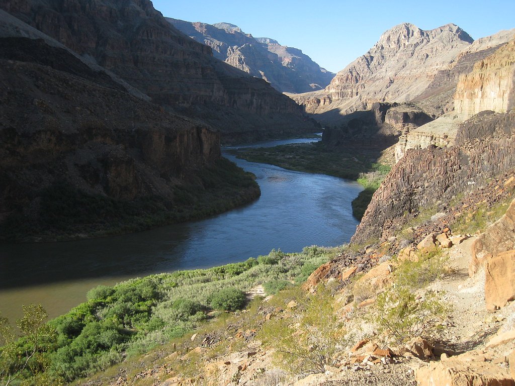
Photo Credits (4)
Difficulty
Hard
Trail Length
1.0 miles
Trail Type
Out And Back
Elevation Gain
600 ft
About Whitmore Rapids
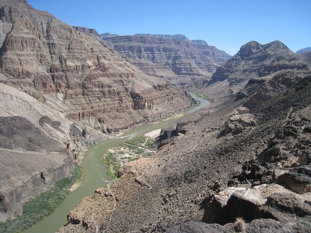
Whitmore Rapids is a dramatic stretch of whitewater on the Colorado River within the Grand Canyon, prized by river runners for its scenic canyon walls and punchy drops. Most visitors experience the rapids as part of multi‑day rafting trips through Grand Canyon National Park; from the river you get close-up views of the turbulence and the canyon’s layered rock faces. The setting feels remote and wild, making Whitmore Rapids a highlight on many guided expeditions downriver. If you’re looking at land access, the rapids lie adjacent to lands of the Hualapai Indian Reservation; the Hualapai Tribe is listed as the managing authority for nearby reservation lands (land unit: Hualapai Indian Reservation, manager: TRIB). Approaching on foot is uncommon for most visitors, so plan carefully and coordinate with river-operating outfitters or local authorities before attempting a rim-to-river route.
The Setting
Whitmore Rapids sits at 1,604 feet within Grand Canyon National Park, fed by the Havasu Creek, in the hills of Arizona.
Trail & Hike Details
The Approach
The hard 1.0-mile out-and-back trail gains 600 feet of elevation on the way to the falls.
Trail Description
Whitmore Wash Trail (route to the river) is a short but steep out-and-back descent from the North Rim: 1.0 mile one way with roughly 600 feet of elevation change (about an 11% average grade). The route is rated hard and is rugged, rocky and exposed—expect uneven footing and a steep grade that requires surefootedness and proper footwear. Because the climb back up gains that 600 feet, allow extra time and water; most people still encounter Whitmore Rapids via a guided rafting trip rather than hiking in from the rim.
What to Expect
Swimming is permitted.
Accessibility
The trail involves steep, uneven terrain with significant elevation change and is not accessible to mobility devices.
Frequently Asked Questions
🐶 Are Dogs Allowed at Whitmore Rapids?
❌ Dogs are not allowed
Are There Any Fees or Permits Required?
🤑 Fee: $0.00
Permit required
Permits are required for rafting trips and for hiking in the Grand Canyon backcountry. These can be obtained through the National Park Service or licensed rafting companies.
🏊 Is There Swimming at Whitmore Rapids?
✅ Swimming is allowed
When to Visit
Spring and fall are the best times to visit due to milder temperatures. Summer can be extremely hot, especially for hikers, while winter may bring cooler weather and less predictable river conditions.
Seasonal Access
The best time to visit is Spring, Summer, and Fall. Winter access may be limited. Watch for flash flood warnings during monsoon season (July through September). Check with Grand Canyon National Park for current conditions.
Safety Information
River conditions can be unpredictable, and the rapids should only be navigated with proper equipment and experience. Hikers should be prepared for extreme heat and rugged terrain. Always carry sufficient water and follow Leave No Trace principles.
Current Water Conditions
Based on a USGS gauge 26.9 miles away
64 ft³/s
Current discharge — how much water is flowing
Much lower than usual for this time of year
Based on 25 years of record
6.97 ft
Water depth at gauge
7-Day Discharge Trend
What does this mean for your visit?
Flow is well below normal for this time of year, so the waterfall may be a trickle.
About This Gauge
This gauge is on a regional waterway. Conditions at the falls may differ, especially after local rain.
7-Day Flow Outlook
Based on the USGS gauge HAVASU CREEK ABOVE THE MOUTH, NEAR SUPAI, AZ (43 km away).
Today
Barely Flowing
64 cfs
5/10Tomorrow
Barely Flowing
64 cfs
5/10Mon
Barely Flowing
64 cfs
5/10Tue
Barely Flowing
64 cfs
5/10Wed
Barely Flowing
64 cfs
5/10Thu
Barely Flowing
64 cfs
5/10Fri
Barely Flowing
64 cfs
5/10Best window: Today — barely flowing flow, sunny (trip score 5/10).
Best time of year: this gauge typically runs highest from early March to late March, peaking in August.
How we calculate this
This is a transparent outlook, not a precise forecast. We take the waterfall's current flow strength (how it ranks against its historical normal for today, from the nearest USGS stream gauge), carry that ranking forward along the gauge's seasonal curve, and nudge it for forecast rain. Confidence is highest for the next day or two and falls further out. Always check official conditions and your own judgment before visiting — high flows can be dangerous.
Know when to go.
Get a free email alert when waterfalls near Peach Springs hit peak flow. We only send when conditions are worth the trip — no weekly newsletters, no spam.
Weather Forecast
Location & Access
Getting There
Whitmore Rapids is accessible only via the Colorado River, typically as part of a guided rafting trip. The nearest land access point is Whitmore Wash, which can be reached by helicopter or a rugged trail from the North Rim of the Grand Canyon.
Get Directions on Google MapsParking
There is no parking directly at Whitmore Rapids. Visitors typically park at designated areas near the Grand Canyon or at helicopter landing zones if accessing via Whitmore Wash.
Elevation
1,604 feet above sea level
Coordinates
36.145538° N, -113.200486° W
Land Management
Managed by TRIB
Visitor Tips & Gear
If rafting, ensure you book with a reputable guide service well in advance, as permits and trips fill up quickly. Bring appropriate gear for sun protection and water safety. If hiking Whitmore Wash Trail, carry plenty of water and be prepared for challenging terrain.
As an Amazon Associate, we earn from qualifying purchases.
This challenging 1.0 miles trail gains 600 ft in elevation — come prepared with proper hiking boots and trekking poles. Sun exposure on the trail makes good sun protection a must in summer.

Sawyer Squeeze Water Filter
The backcountry standard — filters 99.9% of bacteria and weighs just 3 oz.

Polarized Sunglasses (Knockaround)
Cuts glare off the water so you actually see the falls — and your photos turn out better too.

Columbia Watertight II Rain Jacket
Packs into its own pocket, seam-sealed, and keeps you dry from spray and surprise rain.

Earth Pak Waterproof Dry Bag
Keeps your phone and gear dry when waterfall mist soaks everything else.

Waterproof Phone Pouch (AiRunTech)
Cheap insurance — take photos right next to the falls without killing your phone.

Timberland Euro Sprint Mid Waterproof
Trusted waterproof boot with premium leather and grippy rubber sole — reliable on rocky, wet trails.
Where to Stay
Browse vacation cabins and private rentals nearby
Unique outdoor stays — tents, yurts, and treehouses
Rent a campervan or RV for your waterfall road trip
Some links are affiliate links. We may earn a commission at no extra cost to you.
Nearby Campground
Mount Logan Wilderness Area
11.9 miles away · 0 sites
The 14,650-acre Mount Logan Wilderness Area lies 45 miles south of Colorado City, Arizona, just north of the Grand Canyon in Mohave County. Hiking, camping, scenic vistas, watching wildlife and hunting are some of the prime recreational opportunities found in this wilderness. One example is the Mt. Logan Summit and Hells Hole Overlook.Mt. Logan is an area of interesting volcanic activity. It includes basalt ledges, cinder cones, ponderosa pine forests, pinyon-juniper woodlands, and a large, color
Book on Recreation.govNearby Hot Springs
Hot springs near Peach Springs, Arizona

Lava Warm Springs
Lava Warm Springs flows at 90°F on the Hualapai Indian Reservation in Mohave County near Peach Springs, emerging 20 degrees war...
Pumpkin Spring
Pumpkin Spring emerges as a mineralized thermal feature in the Grand Canyon's depths, located on the Hualapai Indian Reservatio...
Pakoon Springs
Pakoon Springs flows at 86°F in the remote Arizona Strip country, emerging 18 degrees above the 68°F average at 2,300 feet elev...
Looking for a soak after your hike? Explore more hot springs near Peach Springs, Arizona on SoakingSprings.
Explore Arizona springsAdditional Information
Nearby Attractions
Whitmore Wash, Toroweap Overlook, Lava Falls Rapids
Wildlife
Bighorn sheep, lizards, birds of prey, and various fish species.
Cities near Whitmore Rapids
Nearby Waterfalls
Writing about Whitmore Rapids? Embed this waterfall on your site for free.