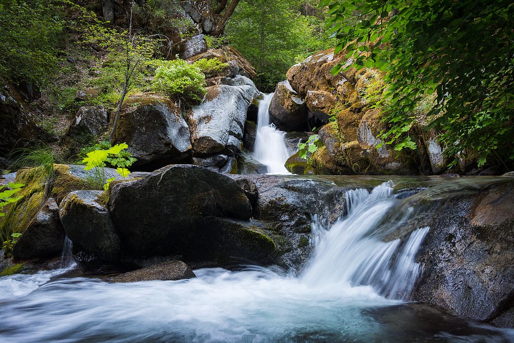
Whiskeytown Falls
California • 220 ft
By Armen Suny · Last verified Mar 2026
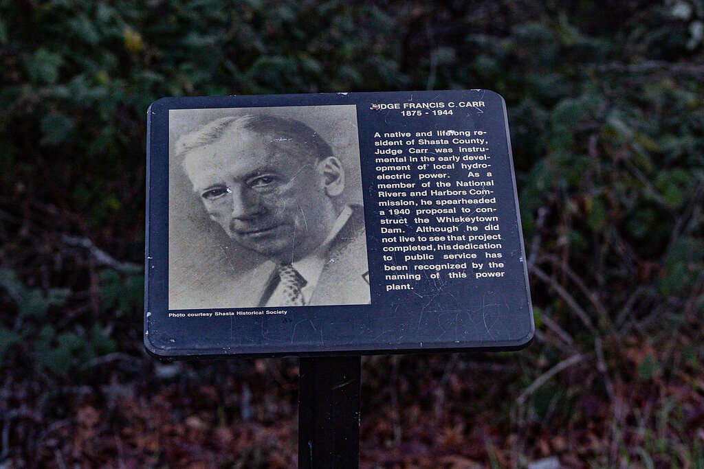
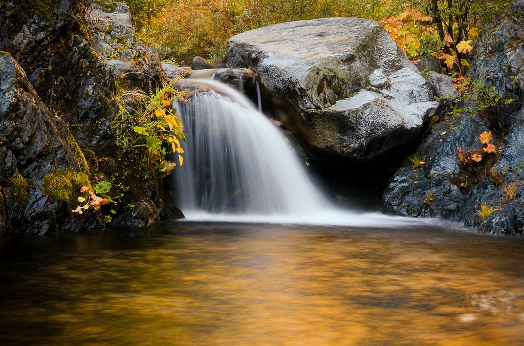
Photo Credits (5)
Difficulty
Moderate
Trail Length
3.4 miles
Trail Type
Out And Back
Elevation Gain
700 ft
About Whiskeytown Falls
Whiskeytown Falls is a dramatic three-tiered cascade that drops a total of 220 feet inside California’s Whiskeytown National Recreation Area. Nestled within the Whiskeytown–Shasta–Trinity NRA and managed by the National Park Service, the falls are tucked into a forested canyon and reward hikers with a series of plunging drops framed by mixed oak and conifer vegetation. Despite its size, Whiskeytown Falls remained largely unknown to the public until 2005 after being improperly mapped for decades, a bit of recent discovery that adds to the site’s appeal. The area is a popular moderate-day outing for visitors to the recreation area, and camping is close by — Crystal Creek Primitive Campground sits roughly 1.76 km from the trailhead, making the falls an easy stop for overnight trips. The viewpoint offers clear vistas of all three tiers, and the shaded trail through the canyon makes for a pleasant hike in most seasons.
The Setting
Whiskeytown Falls sits at 2,864 feet within Whiskeytown-Shasta-Trinity National Recreation Area, in the hills of California. At 220 feet, it is among the taller waterfalls in California.
Height: 220 feet
Trail & Hike Details
The Approach
The moderate 3.4-mile out-and-back trail gains 700 feet of elevation on the way to the falls.
Trail Description
Trail stats: 3.4 miles (out-and-back) with about 700 feet of elevation gain; rated moderate. The route follows a well-maintained footpath through dense forest with a steady uphill grade and some rocky sections underfoot. Expect a short, steeper scramble on the final approach to reach the main viewpoint of the falls. The trail is popular but still feels secluded in places; bring sturdy shoes and water, and note that nearby Crystal Creek Primitive Campground is less than 2 km from the trailhead if you plan to camp.
What to Expect
The falls plunge 220 feet. Dogs are welcome.
Accessibility
The trail is not wheelchair accessible. Uneven terrain and elevation changes require steady footing.
Frequently Asked Questions
🐶 Are Dogs Allowed at Whiskeytown Falls?
✅ Dogs are allowed
Are There Any Fees or Permits Required?
🤑 Fee: $25.00
🏊 Is There Swimming at Whiskeytown Falls?
❌ Swimming is not allowed
When to Visit
Spring and early summer are the best times to visit Whiskeytown Falls, as the water flow is strongest during this period. Fall offers beautiful foliage, while winter provides a quieter experience, though trail conditions may be muddy or icy.
Seasonal Access
The best time to visit is Spring, Summer, and Fall. Winter access may be limited. Check the National Park Service website for current conditions.
Safety Information
Be cautious of slippery rocks near the waterfall, especially after rain. Check for trail closures or restrictions due to wildfire risks or maintenance before visiting.
Current Water Conditions
551 ft³/s
Current discharge — how much water is flowing
About average for this time of year
Based on 64 years of record
14.21 ft
Water depth at gauge
51°F
WarmVery comfortable
7-Day Discharge Trend
What does this mean for your visit?
Flow is about average for this time of year. Water temperature is a bracing 51 degrees F, limit your time in the water.
About This Gauge
This gauge is on a nearby waterway and may not reflect exact conditions at the falls.
7-Day Flow Outlook
Based on the USGS gauge TRINITY R A LEWISTON CA (16 km away).
Today
Barely Flowing
551 cfs
5/10Tomorrow
Barely Flowing
553 cfs
5/10Mon
Barely Flowing
547 cfs
5/10Tue
Barely Flowing
543 cfs
5/10Wed
Barely Flowing
552 cfs
5/10Thu
Barely Flowing
550 cfs
5/10Fri
Barely Flowing
550 cfs
5/10Best window: Today — barely flowing flow, sunny (trip score 5/10).
Best time of year: this gauge typically runs highest from late April to late June, peaking in May.
How we calculate this
This is a transparent outlook, not a precise forecast. We take the waterfall's current flow strength (how it ranks against its historical normal for today, from the nearest USGS stream gauge), carry that ranking forward along the gauge's seasonal curve, and nudge it for forecast rain. Confidence is highest for the next day or two and falls further out. Always check official conditions and your own judgment before visiting — high flows can be dangerous.
Know when to go.
Get a free email alert when waterfalls near French Gulch hit peak flow. We only send when conditions are worth the trip — no weekly newsletters, no spam.
Weather Forecast
Location & Access
Getting There
Whiskeytown Falls is accessed via the James K. Carr Trailhead, located off Crystal Creek Road within the Whiskeytown National Recreation Area. Follow signs for the trailhead, which is about a 15-minute drive from the visitor center.
Get Directions on Google MapsParking
Parking is available at the James K. Carr Trailhead. Spaces may be limited during peak seasons, so arriving early is recommended.
Elevation
2,864 feet above sea level
Coordinates
40.626400° N, -122.669200° W
Land Management
Managed by NPS
Visitor Tips & Gear
Wear sturdy hiking shoes, as the trail can be rocky and uneven in places. Bring plenty of water, especially during warmer months, and consider packing a snack to enjoy at the falls. Arrive early to secure parking and avoid crowds.
As an Amazon Associate, we earn from qualifying purchases.
With 3.4 miles and 700 ft of elevation gain, sturdy boots and trekking poles will help on this moderate trail. Sun exposure on the trail makes good sun protection a must in summer.
America the Beautiful Annual Pass
Covers entrance fees at 2,000+ federal recreation sites — required at most National Parks.

Polarized Sunglasses (Knockaround)
Cuts glare off the water so you actually see the falls — and your photos turn out better too.

Columbia Watertight II Rain Jacket
Packs into its own pocket, seam-sealed, and keeps you dry from spray and surprise rain.

Earth Pak Waterproof Dry Bag
Keeps your phone and gear dry when waterfall mist soaks everything else.

Waterproof Phone Pouch (AiRunTech)
Cheap insurance — take photos right next to the falls without killing your phone.

Timberland Euro Sprint Mid Waterproof
Trusted waterproof boot with premium leather and grippy rubber sole — reliable on rocky, wet trails.

TrailBuddy Trekking Poles
Lightweight aluminum, cork grips, and flip-locks that actually hold — a best-seller for good reason.
Where to Stay

Comfort Suites Redding - Shasta Lake

Holiday Inn Redding by IHG

Home2 Suites By Hilton Redding

Holiday Inn Express Redding North by IHG
Browse vacation cabins and private rentals nearby
Unique outdoor stays — tents, yurts, and treehouses
Rent a campervan or RV for your waterfall road trip
Some links are affiliate links. We may earn a commission at no extra cost to you.
Nearby Campground
CRYSTAL CREEK PRIMITIVE CAMPGROUND
1.1 miles away · 2 sites
Overview This tent-only campground is located in the northwest corner of Whiskeytown National Recreation Area, 19 miles west of Redding, California, and three and a half hours north of Sacramento. Crystal Creek flows alongside each campsite. The campground stays relatively cool due to the creek and to the shade given by a canopy of fir, maple and pine. Three nearby trails lead to lovely waterfalls. The cool, clear waters of Whiskeytown Lake provide endless water activities. The picturesque mounta
Book on Recreation.govNearby Hot Springs
Hot springs near French Gulch, California
Stinking Springs
Stinking Springs flows at 101 degrees at 1,556 feet elevation in Tehama County near Rancho Tehama Reserve, providing water 39.6...
Tuscan Springs
Tuscan Springs flows at 86°F in Tehama County near Red Bluff, with borax-impregnated waters chemically similar to the famous sp...
Big Bend Hot Springs
Big Bend Hot Springs surges at a scalding 180 degrees Fahrenheit from volcanic terrain at just 1,644 feet elevation, creating o...
Big Bend, California
Big Bend sits along a dramatic curve of the Pit River in Shasta County at 1,720 feet elevation, occupying territory historicall...
Hunt Hot Spring
Hunt Hot Spring produces 136-degree water from the forested slopes near McCloud in Siskiyou County at just 1,712 feet elevation...
Looking for a soak after your hike? Explore more hot springs near French Gulch, California on SoakingSprings.
Explore California springsAdditional Information
Nearby Attractions
Other nearby attractions include Brandy Creek Falls, Boulder Creek Falls, and the Whiskeytown Lake for swimming, kayaking, and picnicking.
Wildlife
The area is home to a variety of wildlife, including deer, squirrels, and numerous bird species. Be cautious of ticks and snakes during warmer months.
Cities near Whiskeytown Falls
Nearby Waterfalls

Writing about Whiskeytown Falls? Embed this waterfall on your site for free.