Difficulty
Moderate
Trail Length
2.4 miles
Trail Type
Out And Back
Elevation Gain
350 ft
About Waiʻilikahi Falls
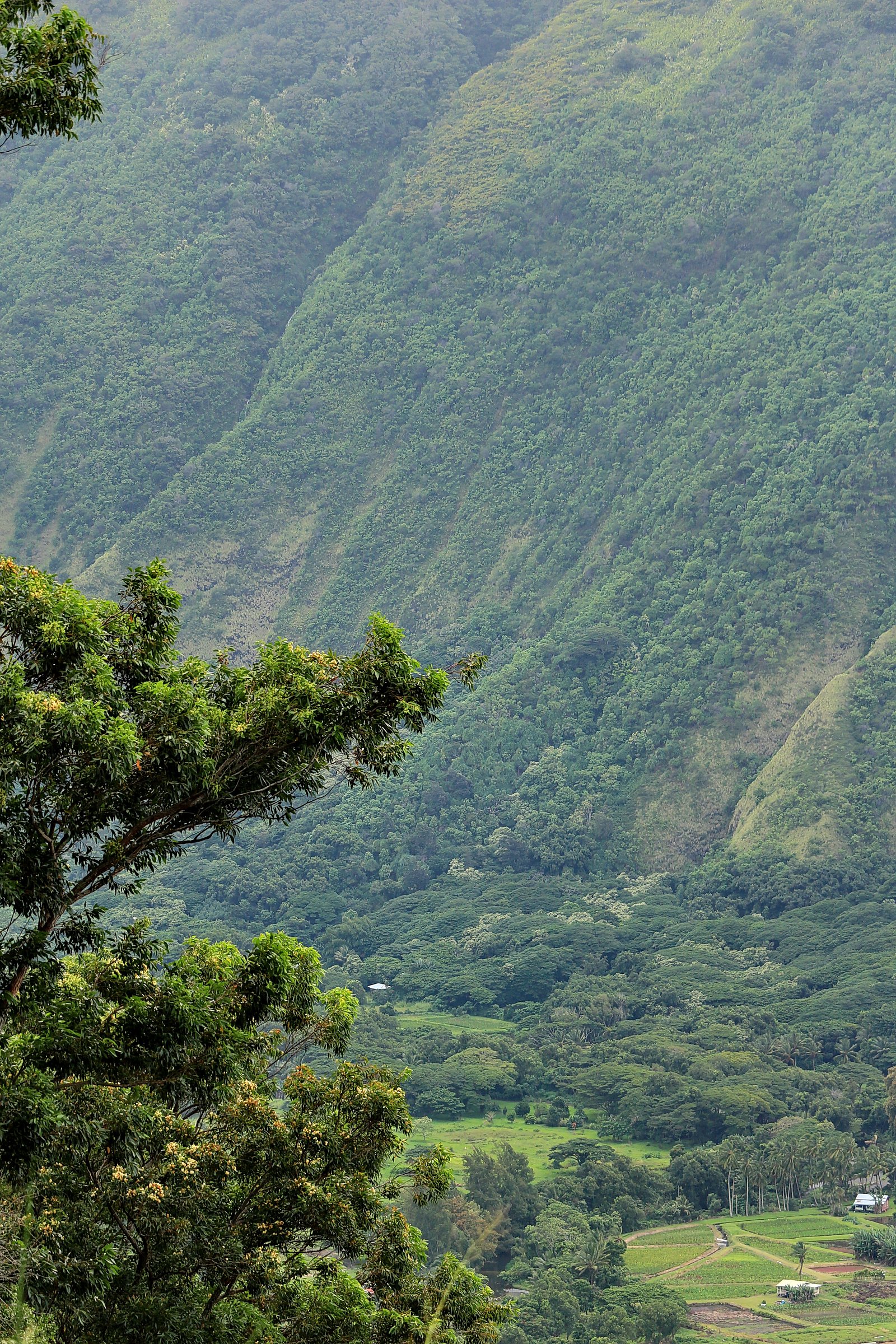
Waiʻilikahi Falls sits deep in the remote Waimanu Valley on the northeast coast of Hawaiʻi island, a spot long prized for its seclusion and dramatic scenery. The cascade plunges through a lush amphitheater of tropical vegetation, offering a rewarding payoff after the valley’s rugged approach. The falls and surrounding shoreline are part of the Waimanu Estuarine Research Reserve — designated as an SCA and managed by SPR — so visitors should treat the area with extra care to preserve its pristine character. Waimanu Valley itself is one of the island’s most remote valleys and, besides the main Waimanu Stream, contains other noteworthy features such as Waihīlau Falls on a nearby tributary (Wikipedia).
The Setting
Waiʻilikahi Falls sits at 89 feet within Waimanu Estuarine Research Reserve, fed by the Kawainui Stream, in the coastal lowlands of Hawaii.
Trail & Hike Details
The Approach
The moderate 2.4-mile out-and-back trail gains 350 feet of elevation on the way to the falls.
Trail Description
Access to Waiʻilikahi Falls is most commonly via the Muliwai Trail into Waimanu Valley. The official approach is an out-and-back route of about 2.4 miles (one-way details vary) with roughly 350 feet of elevation change; guide difficulty is considered moderate. The hike begins with a steep climb out of Waipiʻo Valley, then traverses rugged terrain and dense forest with multiple stream crossings before descending into the floor of Waimanu Valley. From the valley floor you’ll need to navigate through thick vegetation to reach the base of the falls. Specific USFS trail surface, grade, or class data are not provided here, so expect an unmarked, natural tread and variable footing; good footwear, river-crossing awareness, and preparation for backcountry conditions are recommended.
What to Expect
Swimming is permitted.
Accessibility
The trail is not wheelchair accessible. Uneven terrain and elevation changes require steady footing.
Frequently Asked Questions
🐶 Are Dogs Allowed at Waiʻilikahi Falls?
❌ Dogs are not allowed
Are There Any Fees or Permits Required?
🤑 Fees are required
Permit required
A camping permit is required to stay overnight in Waimanu Valley. Permits can be obtained through the Hawaii Department of Land and Natural Resources (DLNR).
🏊 Is There Swimming at Waiʻilikahi Falls?
✅ Swimming is allowed
When to Visit
The best time to visit is during the dry season (May to October) when trail conditions are more favorable and river crossings are safer.
Seasonal Access
The best time to visit is Spring, Summer, Fall, and Winter. Heavy rains during wet season (November through March) bring higher flow but can make trails slippery.
Safety Information
The trail is challenging and includes steep sections, river crossings, and potentially slippery terrain. Flash floods can occur in the valley, especially during heavy rains. Visitors should check weather conditions and be prepared for emergencies.
Current Water Conditions
7 ft³/s
Current discharge — how much water is flowing
About average for this time of year
Based on 61 years of record
1.52 ft
Water depth at gauge
7-Day Discharge Trend
What does this mean for your visit?
Flow is about average for this time of year.
About This Gauge
7-Day Flow Outlook
Based on the USGS gauge Kawainui Stream nr Kamuela, HI (6 km away).
Today
Roaring
8 cfs
6/10Tomorrow
Roaring
8 cfs
6/10Fri
Roaring
7 cfs
6/10Sat
Roaring
9 cfs
6/10Sun
Roaring
9 cfs
6/10Mon
Roaring
10 cfs
6/10Tue
Roaring
9 cfs
6/10Best window: Today — roaring flow, chance rain showers (trip score 6/10).
Best time of year: this gauge typically runs highest from mid June to late July, peaking in July.
How we calculate this
This is a transparent outlook, not a precise forecast. We take the waterfall's current flow strength (how it ranks against its historical normal for today, from the nearest USGS stream gauge), carry that ranking forward along the gauge's seasonal curve, and nudge it for forecast rain. Confidence is highest for the next day or two and falls further out. Always check official conditions and your own judgment before visiting — high flows can be dangerous.
Know when to go.
Get a free email alert when waterfalls near Kukuihaele hit peak flow. We only send when conditions are worth the trip — no weekly newsletters, no spam.
Weather Forecast
Location & Access
Getting There
Waiʻilikahi Falls is located in the Waimanu Valley, which can be accessed by hiking the challenging Muliwai Trail from Waipiʻo Valley. The trail is approximately 9 miles one way and includes steep switchbacks and river crossings. Alternatively, the valley can be reached by boat or kayak, though this requires careful planning and favorable ocean conditions.
Get Directions on Google MapsParking
Parking is available at the Waipiʻo Valley Lookout, but space is limited. Visitors should arrive early to secure a spot.
Elevation
89 feet above sea level
Coordinates
20.132777° N, -155.646861° W
Land Management
Managed by SPR
Visitor Tips & Gear
Plan for a multi-day trip if hiking, as the trail is long and strenuous. Bring plenty of water, food, and camping gear if staying overnight in Waimanu Valley. Check weather conditions before your trip, as heavy rains can make the trail dangerous and river crossings impassable.
As an Amazon Associate, we earn from qualifying purchases.
With 2.4 miles and 350 ft of elevation gain, sturdy boots and trekking poles will help on this moderate trail. Icy conditions are common in winter — traction cleats are a smart addition.

Columbia Watertight II Rain Jacket
Packs into its own pocket, seam-sealed, and keeps you dry from spray and surprise rain.

Earth Pak Waterproof Dry Bag
Keeps your phone and gear dry when waterfall mist soaks everything else.

Waterproof Phone Pouch (AiRunTech)
Cheap insurance — take photos right next to the falls without killing your phone.

Timberland Euro Sprint Mid Waterproof
Trusted waterproof boot with premium leather and grippy rubber sole — reliable on rocky, wet trails.

TrailBuddy Trekking Poles
Lightweight aluminum, cork grips, and flip-locks that actually hold — a best-seller for good reason.

Kahtoola MICROspikes
Cult-favorite traction cleats that grip ice and wet rock — essential for winter waterfall hikes.
Where to Stay

The Westin Hapuna Beach Resort

Fairway Villas Waikoloa by OUTRIGGER

Palm Villas 2 Bed/2 Bath Loft #F22

Hilton Waikoloa Village
Browse vacation cabins and private rentals nearby
Unique outdoor stays — tents, yurts, and treehouses
Rent a campervan or RV for your waterfall road trip
Some links are affiliate links. We may earn a commission at no extra cost to you.
Nearby Hot Springs
Hot springs near Kukuihaele, Hawaii

Steam Vents
Steam vents at 13,426 feet on Mauna Loa represent some of Hawaii's most remote geothermal features, requiring a substantial hik...
Steam Vents
These steam vents occupy the high alpine zone at 12,526 feet on Mauna Loa, where volcanic heat creates dramatic fumarolic activ...

Steam Vents
Steam vents emerge where volcanic heat meets restricted military lands on Hawaii's Big Island. These fumaroles sit at 4,003 fee...
Akins Spring
Akins Spring flows 84°F water on Hawaii's Big Island, 11 degrees warmer than the tropical 73°F ambient, requiring a short walk ...
Steam Vents
Steam Vents represent superheated geothermal manifestations on Hawaii's Big Island where steam escapes through volcanic bedrock...
Looking for a soak after your hike? Explore more hot springs near Kukuihaele, Hawaii on SoakingSprings.
Explore Hawaii springsAdditional Information
Nearby Attractions
Waipiʻo Valley, Hiʻilawe Falls, and the Kohala Coast.
Wildlife
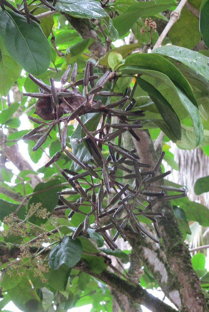
The area is home to native Hawaiian birds, insects, and plants. Visitors may also encounter wild pigs in the valley.
Cities near Waiʻilikahi Falls
Nearby Waterfalls
Writing about Waiʻilikahi Falls? Embed this waterfall on your site for free.