
Victor Falls
Washington • 70 ft
By Armen Suny · Last verified Sep 2026
LiDAR & 3D terrainDifficulty
Easy
Trail Length
0.1 miles
Trail Type
Out And Back
About Victor Falls
Victor Falls is a scenic, 70-foot single-drop cascade tucked into a forested ravine in Bonney Lake, Washington. The falls plunge through mossy rocks and old-growth trees, making it a favorite spot for photographers and anyone seeking a quick, restorative dose of Pacific Northwest forest and water. The setting is peaceful yet accessible, framed by the park’s native evergreens and fern understory. The falls lie within Victor Falls Park — a city-managed land unit (designation: LP) — so day-use access and basic trail management are handled locally. A short hiking route leads from the park access area to the overlook; the hike itself is an enjoyable outing rather than a technical climb, offering a compact but rewarding nature escape just outside Bonney Lake.
The Setting
Victor Falls sits at 377 feet within Victor Falls Park, fed by the Puyallup River, in the coastal lowlands of Washington. The falls drop 70 feet.
Height: 70 feet
Trail & Hike Details
Trail Description
The trail to Victor Falls is an out-and-back route measuring approximately 2.4 miles with about 350 feet of elevation gain and is rated moderate. The trail is non-technical and will suit hikers comfortable with moderate grades; expect steady uphill sections on the approach and an easy descent back to the trailhead. Managed as part of Victor Falls Park by the city, the route delivers direct access to the 70-foot waterfall without requiring specialized equipment.
What to Expect
The falls drop 70 feet. Dogs are welcome.
Accessibility
The trail is short and relatively flat, but the surface may be uneven. Contact the managing agency for accessibility details.
Frequently Asked Questions
🐶 Are Dogs Allowed at Victor Falls?
✅ Dogs are allowed
Are There Any Fees or Permits Required?
🆖 No fees required
🏊 Is There Swimming at Victor Falls?
❌ Swimming is not allowed
When to Visit
Spring is the best time to visit Victor Falls, as the waterfall is typically at its fullest due to seasonal rainfall. However, it remains a beautiful destination year-round.
Seasonal Access
The best time to visit is Spring, Summer, Fall, and Winter.
Safety Information
Stay on designated paths and avoid venturing too close to the edge of the ravine. The terrain can be slippery, especially after rain. Supervise children closely.
Current Water Conditions
408 ft³/s
Current discharge — how much water is flowing
Lower than usual for this time of year
Based on 19 years of record
7-Day Discharge Trend
What does this mean for your visit?
Flow is lower than usual for this time of year.
About This Gauge
7-Day Flow Outlook
Based on the USGS gauge PUYALLUP RIVER AT ALDERTON, WA (5 km away).
Today
Roaring
611 cfs
6/10Tomorrow
Strong
591 cfs
10/10Sun
Strong
550 cfs
10/10Mon
Strong
501 cfs
10/10Tue
Strong
557 cfs
8/10Wed
Strong
509 cfs
8/10Thu
Strong
511 cfs
8/10Best window: Tomorrow — strong flow, partly sunny (trip score 10/10).
Best time of year: this gauge typically runs highest from early May to mid June, peaking in May.
How we calculate this
This is a transparent outlook, not a precise forecast. We take the waterfall's current flow strength (how it ranks against its historical normal for today, from the nearest USGS stream gauge), carry that ranking forward along the gauge's seasonal curve, and nudge it for forecast rain. Confidence is highest for the next day or two and falls further out. Always check official conditions and your own judgment before visiting — high flows can be dangerous.
Know when to go.
Get a free email alert when waterfalls near Tehaleh hit peak flow. We only send when conditions are worth the trip — no weekly newsletters, no spam.
Weather Forecast
The Terrain, Seen by LiDAR
Aircraft-mounted lasers measured this ground to within inches. Trees and buildings are digitally stripped away, leaving the bare shape of the land the water has carved.
Through the falls the surface drops roughly 151 feet over a short, steep run of tiers. Only part of that is the waterfall, which is listed at 70 feet; the rest is the canyon carrying on downstream. Elevation at the pin is about 383 feet.
Steep ground runs through the entire stretch: about 131 feet of descent in the 500 feet above the pin and 108 feet in the 500 feet below it. Facing west, the falls glow in afternoon and evening light.
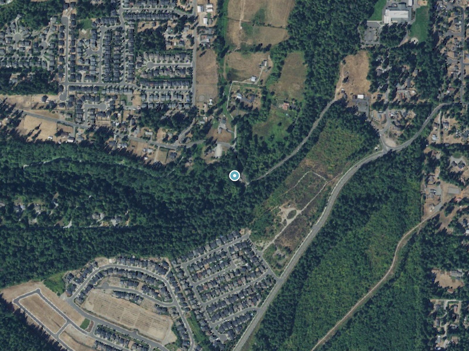
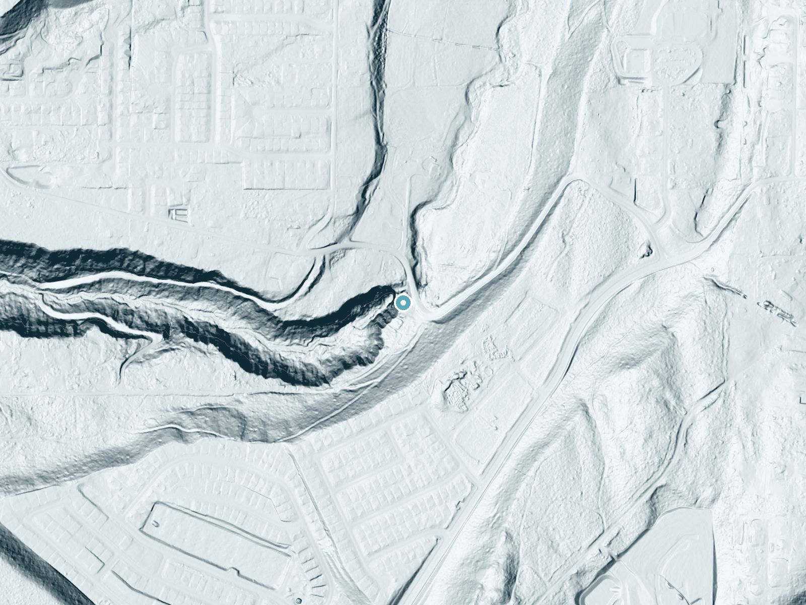
Drag to compare. The dot marks the waterfall. The frame is about a mile across.
- Ground elevation
- 383 feet
- Measured by 1-meter lidar
- Drop at the falls
- About 151 feet
- Change in ground height within ~250 feet of the falls
- Faces
- West
- Glows in afternoon and evening light.
A slice through the lidar ground surface, from above the falls to downstream (heading west).
Elevation data: USGS 3D Elevation Program. Aerial imagery: USGS The National Map. Public domain.
Location & Access
Getting There
Victor Falls is located in Bonney Lake, Washington, and can be accessed via Victor Falls Park. The park is situated off Rhodes Lake Road East. Visitors can follow signage to the small parking area near the falls.
Get Directions on Google MapsParking
There is a small parking area available at Victor Falls Park, but spaces may be limited during peak times.
Elevation
377 feet above sea level
Coordinates
47.149268° N, -122.185950° W
Land Management
Managed by CITY
Visitor Tips & Gear
Arrive early to secure parking, especially on weekends. Bring a camera to capture the beauty of the falls. Be cautious near the edges of the viewing platform, as the terrain can be slippery.
Where to Stay

Homewood Suites By Hilton Puyallup Tacoma

Holiday Inn Express Puyallup by IHG

Buckley Inn

Hotel Murano
Browse vacation cabins and private rentals nearby
Unique outdoor stays — tents, yurts, and treehouses
Rent a campervan or RV for your waterfall road trip
Some links are affiliate links. We may earn a commission at no extra cost to you.
Nearby Hot Springs
Hot springs near Wilkeson, Washington
Lester Hot Springs
This 120-degree spring sits within the City of Tacoma Watershed at 1,582 feet elevation, emerging 72.3 degrees above ambient in...

Mt Rainier Fumaroles
Mount Rainier fumaroles reach 162 degrees at 14,217 feet elevation, emerging 154.8 degrees above ambient at Washington's highes...

Longmire Mineral Springs
Longmire Mineral Springs flows at 77 degrees within Mount Rainier National Park at 2,758 feet elevation, emerging 31.9 degrees ...

Ohanapecosh Hot Springs
Ohanapecosh Hot Springs flows at 122 degrees within Mount Rainier National Park at 1,920 feet elevation, emerging 74.5 degrees ...
Packwood Hot Spring
Packwood Hot Spring flows at 100 degrees at 1,002 feet elevation in the lower Cascade foothills near Morton, emerging 49.8 degr...
Goldmeyer Hot Springs
Goldmeyer Hot Springs emerges at 127 degrees in the central Cascades, producing water 78.9 degrees above ambient temperature at...
Looking for a soak after your hike? Explore more hot springs near Wilkeson, Washington on SoakingSprings.
Explore Washington springsAdditional Information
Nearby Attractions
Nearby attractions include Lake Tapps and Allan Yorke Park, which offer additional recreational opportunities such as picnicking and water activities.
Wildlife
The area around Victor Falls is home to various bird species and small mammals. Visitors may also spot native plants and wildflowers.
Cities near Victor Falls
Writing about Victor Falls? Embed this waterfall on your site for free.