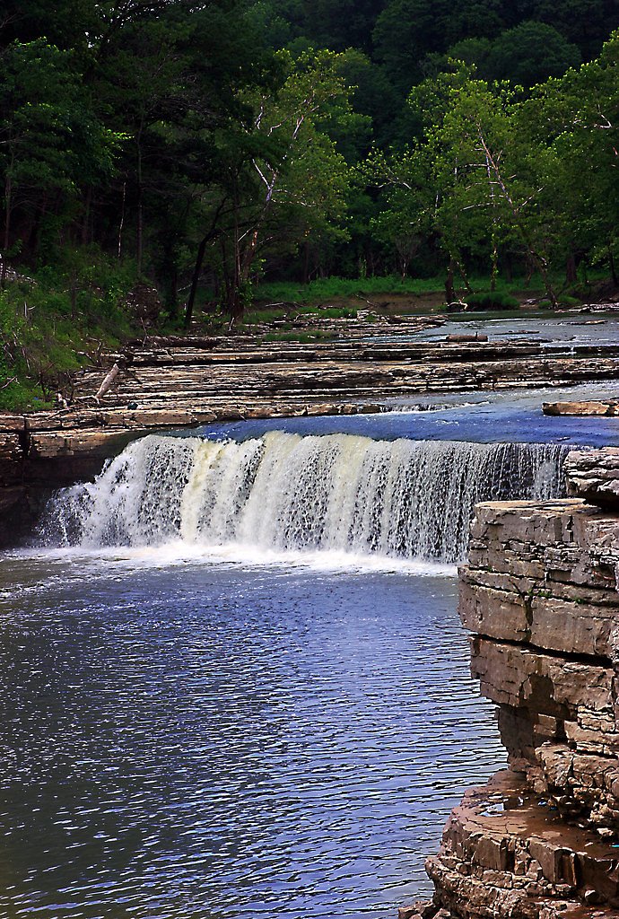
Upper Cataract Falls
Indiana • 20 ft
By Armen Suny · Last verified Mar 2026
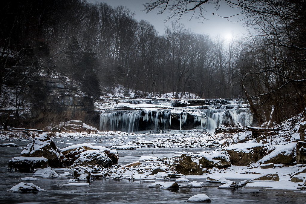
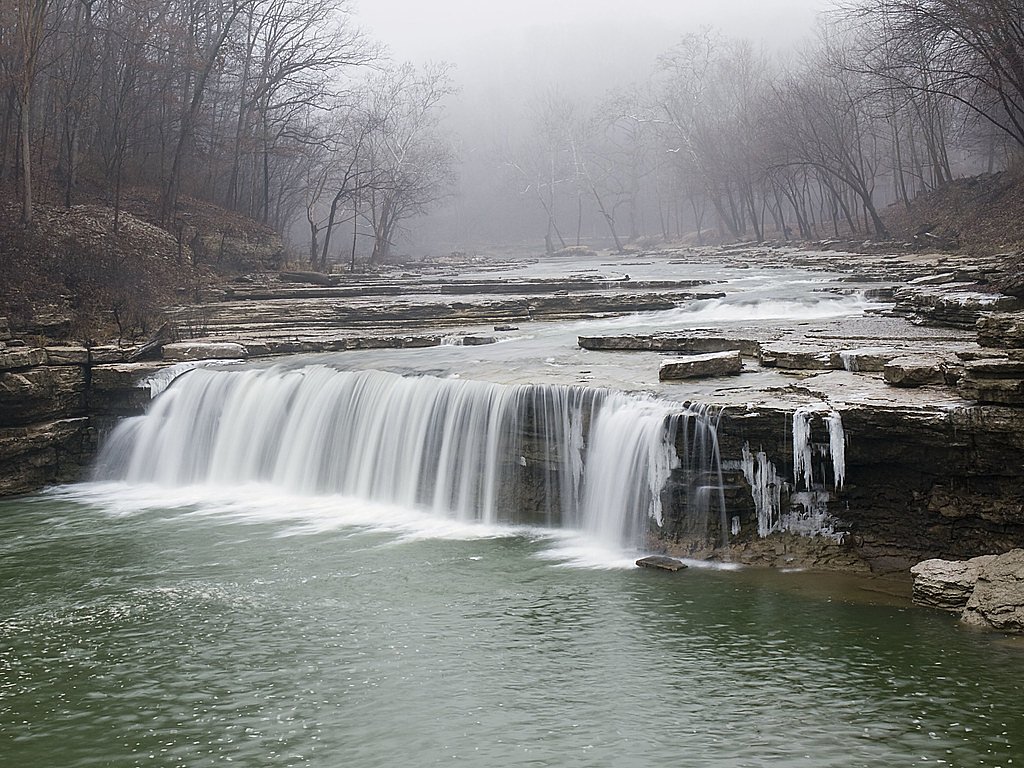
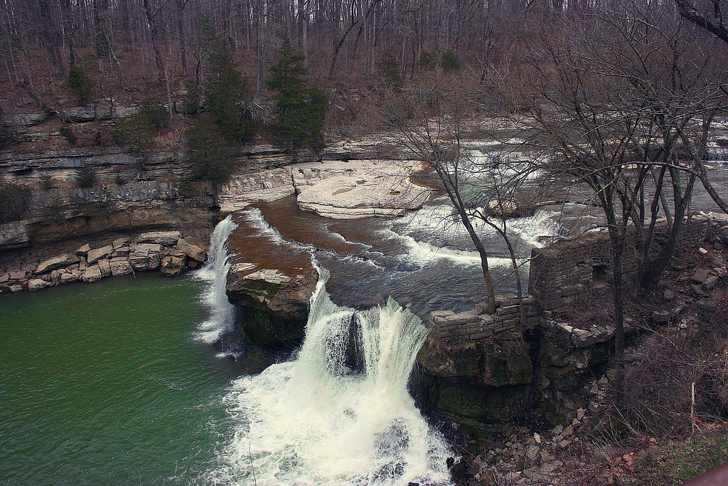
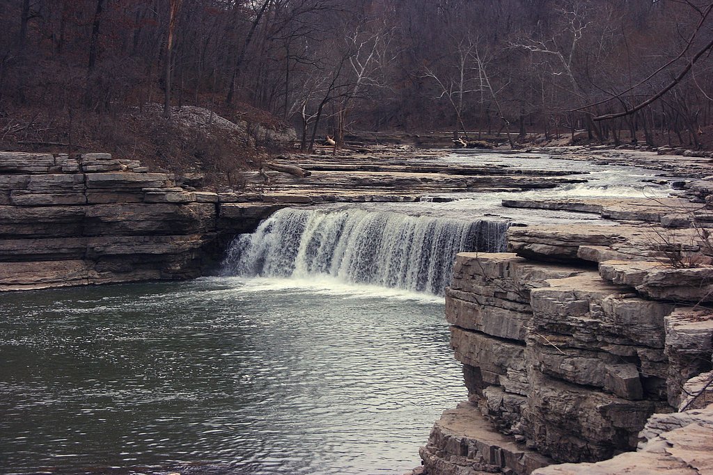

Photo Credits (5)
Difficulty
Easy
Trail Length
0.8 miles
Trail Type
Out And Back
Elevation Gain
100 ft
About Upper Cataract Falls
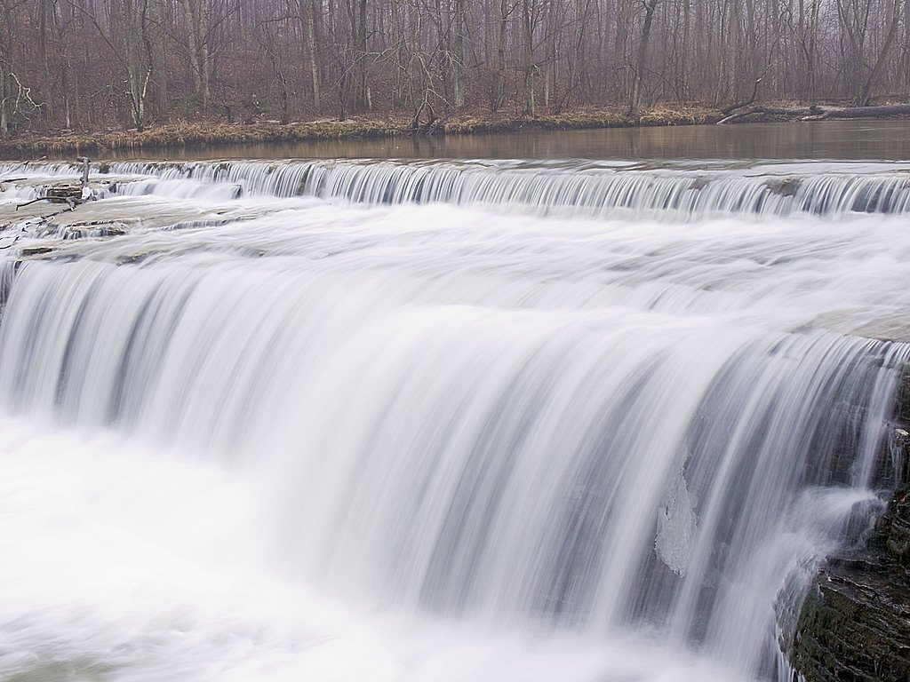
Upper Cataract Falls sits on Mill Creek in northern Owen County and is part of the Cataract Falls system within Lieber State Recreation Area and the Owen‑Putnam State Forest, managed by the SDNR. According to public sources, Cataract Falls is the largest waterfall by volume in Indiana and the system here is made up of two sets of falls separated by about 1 mile; Upper Cataract Falls is one of those series of drops and is listed at roughly 20 feet in height. The falls offer a compact but impressive display of flowing water, making it a popular stop for day hikers and photographers exploring the state recreation area. The setting feels accessible and naturally scenic: the upper cascade is part of the multi‑drop profile that gives Cataract Falls its character, and its location inside state‑managed land makes it straightforward to visit as part of a longer loop through the Lieber SRA or a short outing to the creek. The SDNR manages the site as part of the Owen‑Putnam unit (designation SCA), so expect a managed natural area with basic visitor amenities nearby within the recreation area.
The Setting
Upper Cataract Falls sits at 702 feet within Owen-Putnam State Forest, fed by the Mill Creek, in the foothills of Indiana. The falls drop 20 feet.
Height: 20 feet
Nearby Falls Worth Visiting
Lower Cataract Falls (15 ft) lies 0.6 miles to the northwest.
Trail & Hike Details
The Approach
The easy 0.8-mile out-and-back trail gains 100 feet of elevation on the way to the falls.
Trail Description
The trail to Upper Cataract Falls is a short 0.8‑mile out‑and‑back with about 100 feet of elevation gain and is rated easy. It’s suitable for most visitors and leads directly to the upper series of drops on Mill Creek (the falls themselves are approximately 20 feet high in this section). Trail type: out‑and‑back; length: 0.8 miles; elevation gain: ~100 ft; difficulty: easy; surface/grade/class: not specified in the available trail data.
What to Expect
The falls drop a gentle 20 feet. Dogs are welcome.
Accessibility
The trail is short and relatively flat, but the surface may be uneven. Contact the managing agency for accessibility details.
Frequently Asked Questions
🐶 Are Dogs Allowed at Upper Cataract Falls?
✅ Dogs are allowed
Are There Any Fees or Permits Required?
🤑 Fee: $7.00
🏊 Is There Swimming at Upper Cataract Falls?
❌ Swimming is not allowed
When to Visit
Spring and early summer are the best times to visit, as the water flow is typically strongest during these seasons.
Seasonal Access
The best time to visit is Spring, Summer, and Fall. Winter access may be limited.
Safety Information
The rocks near the falls can be slippery, so exercise caution. Stay on marked trails and avoid getting too close to the edge of the falls.
Current Water Conditions
319 ft³/s
Current discharge — how much water is flowing
Lower than usual for this time of year
6.22 ft
Water depth at gauge
7-Day Discharge Trend
What does this mean for your visit?
Flow is lower than usual for this time of year.
About This Gauge
7-Day Flow Outlook
Based on the USGS gauge MILL CREEK NEAR CATARACT, IN (4 km away).
Today
Low
319 cfs
6/10Tomorrow
Low
296 cfs
6/10Tue
Low
276 cfs
6/10Wed
Low
276 cfs
6/10Thu
Moderate
269 cfs
4/10Fri
Moderate
314 cfs
4/10Sat
Moderate
310 cfs
4/10Best window: Today — low flow, partly sunny (trip score 6/10).
Best time of year: this gauge typically runs highest from late March to mid April, peaking in March.
How we calculate this
This is a transparent outlook, not a precise forecast. We take the waterfall's current flow strength (how it ranks against its historical normal for today, from the nearest USGS stream gauge), carry that ranking forward along the gauge's seasonal curve, and nudge it for forecast rain. Confidence is highest for the next day or two and falls further out. Always check official conditions and your own judgment before visiting — high flows can be dangerous.
Know when to go.
Get a free email alert when waterfalls near Cloverdale hit peak flow. We only send when conditions are worth the trip — no weekly newsletters, no spam.
Weather Forecast
Location & Access
Getting There
Upper Cataract Falls is located in Lieber State Recreation Area, near Cloverdale, Indiana. It is accessible via State Road 42, with clear signage leading to the falls.
Get Directions on Google MapsParking
There is a designated parking area near the falls, which is a short walk from the viewing area.
Elevation
702 feet above sea level
Coordinates
39.434447° N, -86.813089° W
Land Management
Managed by SDNR
Visitor Tips & Gear
Visit after a rainy period for the best water flow. Wear sturdy shoes as the area near the falls can be slippery. Bring a camera to capture the scenic views.
As an Amazon Associate, we earn from qualifying purchases.
For this easy 0.8 miles trail, lightweight trail shoes and a water bottle are usually sufficient. Sun exposure on the trail makes good sun protection a must in summer.

Polarized Sunglasses (Knockaround)
Cuts glare off the water so you actually see the falls — and your photos turn out better too.

Columbia Watertight II Rain Jacket
Packs into its own pocket, seam-sealed, and keeps you dry from spray and surprise rain.

Earth Pak Waterproof Dry Bag
Keeps your phone and gear dry when waterfall mist soaks everything else.

Waterproof Phone Pouch (AiRunTech)
Cheap insurance — take photos right next to the falls without killing your phone.

JOBY GorillaPod Starter Kit
Wraps around railings and rocks for long-exposure waterfall shots — no flat surface needed.

Osprey Daylite Daypack
Light, organized, and just the right size for a day hike — fits water, snacks, and layers.
Where to Stay

Canyon Inn

Country Inn & Suites by Radisson, Indianapolis Airport South, IN

Wingate by Wyndham Indianapolis Airport Plainfield

Red Roof Inn Greencastle South - Cloverdale
Browse vacation cabins and private rentals nearby
Unique outdoor stays — tents, yurts, and treehouses
Rent a campervan or RV for your waterfall road trip
Some links are affiliate links. We may earn a commission at no extra cost to you.
Additional Information
Nearby Attractions
Lower Cataract Falls, Cataract Falls Covered Bridge, Lieber State Recreation Area, Cagles Mill Lake.
Wildlife
The area is home to various bird species, deer, and small mammals. Visitors may also spot turtles and fish in the nearby streams.
Cities near Upper Cataract Falls
Nearby Waterfalls
Writing about Upper Cataract Falls? Embed this waterfall on your site for free.