Photo Credits (1)
Difficulty
Moderate
Trail Length
2.4 miles
Trail Type
Out And Back
Elevation Gain
350 ft
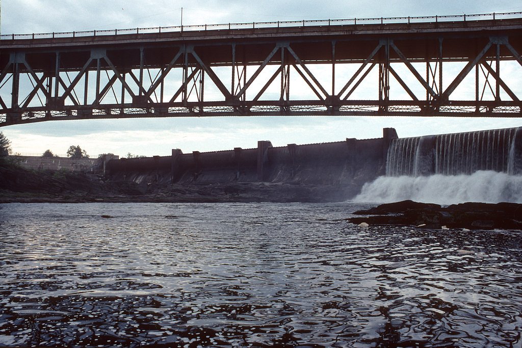
About Turners Falls
Turners Falls sits on the banks of the Connecticut River in the town of Montague, Franklin County, Massachusetts, and though it’s not a classic vertical waterfall, the area’s series of dams and engineered cascades create dramatic riverside flows and a uniquely industrial scenic character. The village of Turners Falls is an unincorporated census-designated place with a 2020 population of 4,512 and serves as Montague’s business district — its name is commonly used as a metonym for the town. The riverfront combines recreational walking opportunities with layers of local history tied to hydroelectric development and river commerce. Visitors find an inviting mix of waterside viewpoints, parkland, and historic sites within easy walking distance of town amenities. The setting is part of the broader Connecticut River corridor and feels like a compact day-out destination: bring a camera for the cascades and a sense of curiosity for the industrial and community history that shaped this village at the heart of the Springfield metropolitan area.
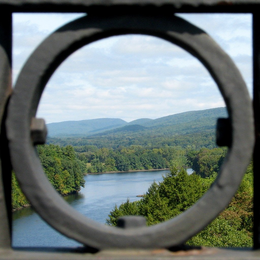
The Setting
Turners Falls sits at 135 feet along the Connecticut River, in the coastal lowlands of Massachusetts.
Trail & Hike Details
The Approach
The moderate 2.4-mile out and back trail gains 350 feet of elevation on the way to the falls.
Trail Description
There is no official USFS trail or Forest Service trail number for Turners Falls; available route data describes a roughly 2.4-mile out-and-back walk with about 350 feet of elevation gain, typically rated moderate in difficulty. Surface, grade, and formal trail class information from the US Forest Service are not available for this route. Expect a short, walkable route suitable for a moderate daytime outing along riverbanks, park paths, and town sidewalks rather than a technical backcountry trail.
What to Expect
Dogs are welcome.
Accessibility
The trail is not wheelchair accessible. Uneven terrain and elevation changes require steady footing.
Frequently Asked Questions
🐶 Are Dogs Allowed at Turners Falls?
✅ Dogs are allowed
Are There Any Fees or Permits Required?
🆖 No fees required
🏊 Is There Swimming at Turners Falls?
❌ Swimming is not allowed
When to Visit
Spring and fall are particularly beautiful times to visit due to the changing foliage and increased water flow. Summer is also popular for outdoor activities.
Seasonal Access
The best time to visit is Spring, Summer, and Fall. Winter access may be limited.
Safety Information
Stay away from restricted areas near the dam and hydroelectric facilities. Be cautious near the river, especially during high water flow. Follow all posted signs and warnings.
Current Water Conditions
6,010 ft³/s
Current discharge — how much water is flowing
About average for this time of year
Based on 59 years of record
8.80 ft
Water depth at gauge
7-Day Discharge Trend
What does this mean for your visit?
Flow is about average for this time of year.
About This Gauge
7-Day Flow Outlook
Based on the USGS gauge CONNECTICUT RIVER AT MONTAGUE CITY, MA (4 km away).
Today
Low
12198 cfs
3/10Tomorrow
Low
15780 cfs
3/10Thu
Low
15840 cfs
3/10Fri
Barely Flowing
12878 cfs
5/10Sat
Low
12330 cfs
3/10Sun
Low
15022 cfs
3/10Mon
Low
14264 cfs
3/10Best window: Fri — barely flowing flow, sunny (trip score 5/10).
Best time of year: this gauge typically runs highest from mid March to late May, peaking in April.
How we calculate this
This is a transparent outlook, not a precise forecast. We take the waterfall's current flow strength (how it ranks against its historical normal for today, from the nearest USGS stream gauge), carry that ranking forward along the gauge's seasonal curve, and nudge it for forecast rain. Confidence is highest for the next day or two and falls further out. Always check official conditions and your own judgment before visiting — high flows can be dangerous.
Know when to go.
Get a free email alert when waterfalls near Turners Falls hit peak flow. We only send when conditions are worth the trip — no weekly newsletters, no spam.
Weather Forecast
Location & Access
Getting There
Turners Falls is located in the town of Montague, Massachusetts. It is easily accessible by car via Route 2 or Route 63. The area is well-marked with signs directing visitors to the Turners Falls Dam and nearby attractions.
Get Directions on Google MapsParking
There is parking available near the Turners Falls Dam and along the main streets of the town. Additional parking may be available at nearby parks or visitor centers.
Hours
Elevation
135 feet above sea level
Coordinates
42.611197° N, -72.552867° W
Visitor Tips & Gear
Wear comfortable shoes if you plan to walk around the area. Bring a camera to capture the scenic views. Check the weather before visiting, as conditions along the river can vary.
As an Amazon Associate, we earn from qualifying purchases.
With 2.4 miles and 350 ft of elevation gain, sturdy boots and trekking poles will help on this moderate trail. Sun exposure on the trail makes good sun protection a must in summer.

Polarized Sunglasses (Knockaround)
Cuts glare off the water so you actually see the falls — and your photos turn out better too.

Columbia Watertight II Rain Jacket
Packs into its own pocket, seam-sealed, and keeps you dry from spray and surprise rain.

Earth Pak Waterproof Dry Bag
Keeps your phone and gear dry when waterfall mist soaks everything else.

Waterproof Phone Pouch (AiRunTech)
Cheap insurance — take photos right next to the falls without killing your phone.

Timberland Euro Sprint Mid Waterproof
Trusted waterproof boot with premium leather and grippy rubber sole — reliable on rocky, wet trails.

TrailBuddy Trekking Poles
Lightweight aluminum, cork grips, and flip-locks that actually hold — a best-seller for good reason.
Where to Stay

Hampton Inn & Suites Greenfield

Red Roof Inn PLUS+ South Deerfield - Amherst

Deerfield Inn

The Inn at Crumpin-Fox
Browse vacation cabins and private rentals nearby
Unique outdoor stays — tents, yurts, and treehouses
Rent a campervan or RV for your waterfall road trip
Some links are affiliate links. We may earn a commission at no extra cost to you.
Nearby Campground
TULLY LAKE RECREATION AREA (MA)
17.3 miles away · 1 sites
Overview The U.S. Army Corps of Engineers invites you to come relax at Tully Lake. There are a variety of outdoor recreation activities for you and you family. Although the dam was built primarily to reduce flood damages on the Millers and Connecticut Rivers, the 1,300-acre reservoir area provides a place for you to get away from it all and connect with nature.Recreation Tully Lake offers many opportunities to enjoy the outdoors. Activities in and around the lake include mountain biking, camping,
Book on Recreation.govNearby Hot Springs
Hot springs near Turners Falls, Massachusetts
Sand Spring
Sand Spring surfaces at 75°F in Williamstown, Massachusetts — one of the few thermal features in New England. At just 670 feet ...

Lebanon Spring
Lebanon Spring discharges at 72°F at 663 feet elevation in Columbia County, flowing 24 degrees above ambient air temperature ju...
Looking for a soak after your hike? Explore more hot springs near Turners Falls, Massachusetts on SoakingSprings.
Explore Massachusetts springsAdditional Information
Nearby Attractions
Nearby attractions include the Great Falls Discovery Center, which offers exhibits on the natural and cultural history of the Connecticut River, and the Montague Bookmill, a historic bookstore and café.
Wildlife
The area is home to various bird species, including bald eagles, as well as fish and other river wildlife.
Cities near Turners Falls
Nearby Waterfalls
Writing about Turners Falls? Embed this waterfall on your site for free.