Tunnel Falls
Oregon • 120 ft
By Armen Suny · Last verified Mar 2026
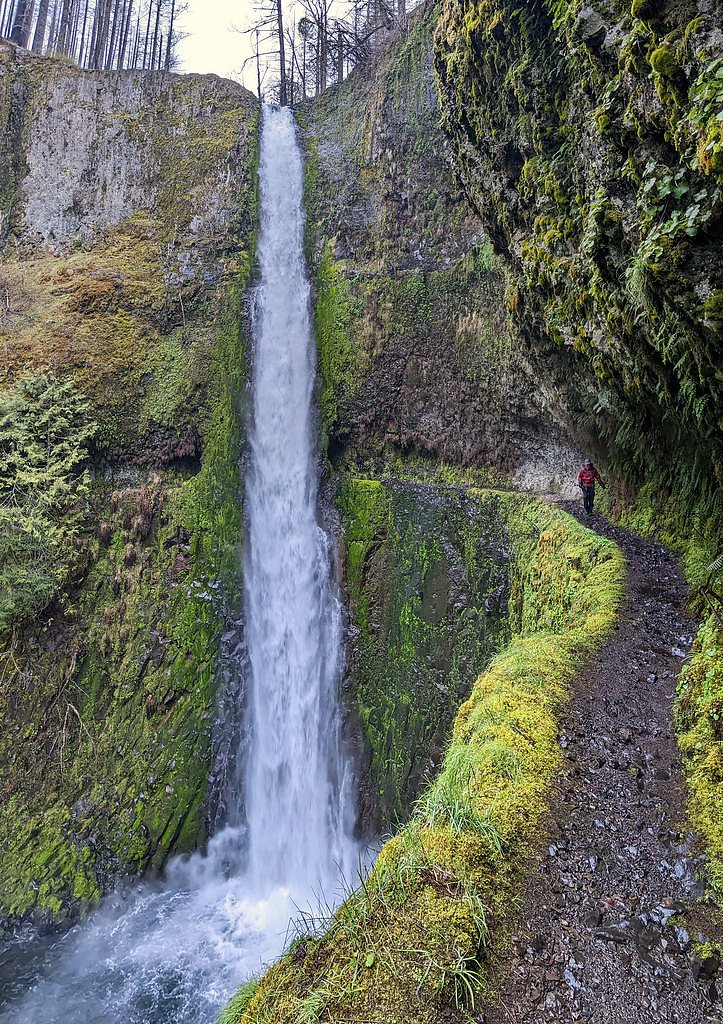
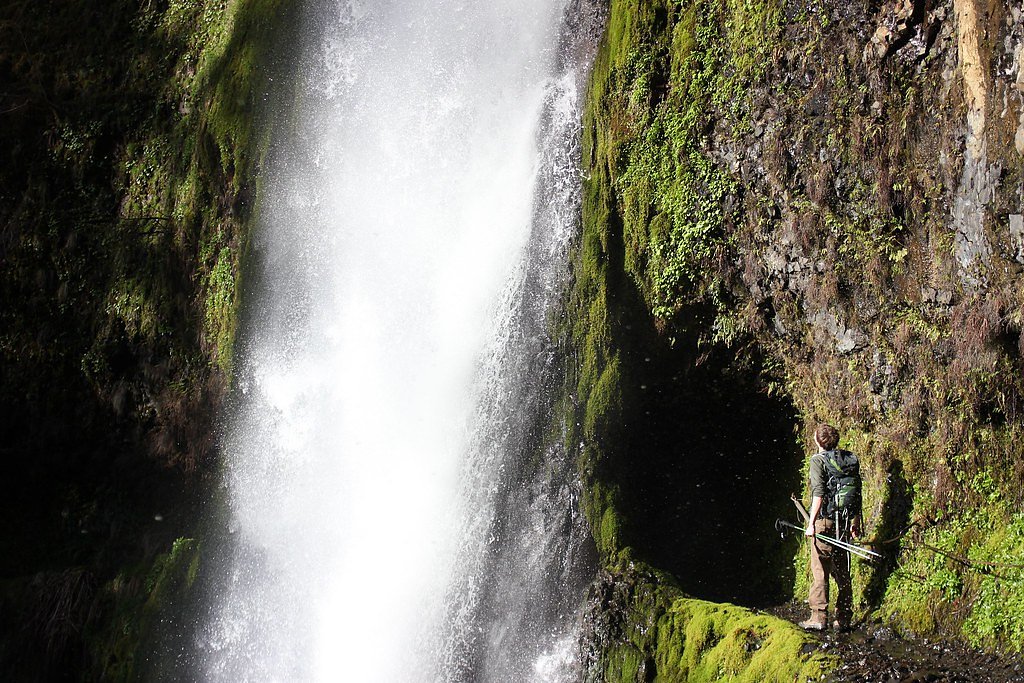

Photo Credits (5)
Difficulty
Hard
Trail Length
12.0 miles
Trail Type
Out And Back
Elevation Gain
1,640 ft
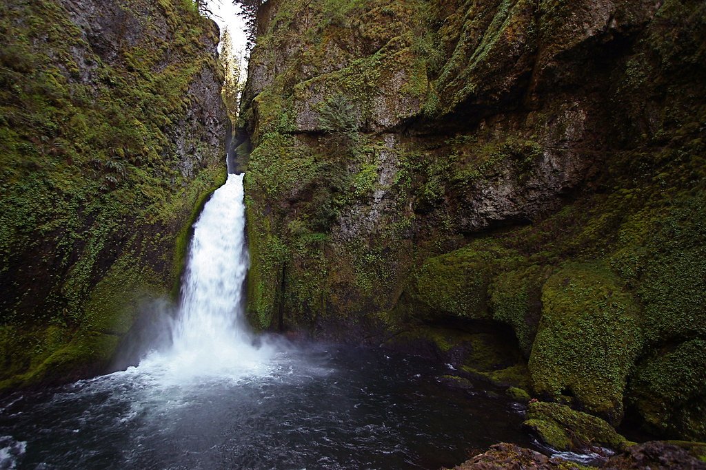
About Tunnel Falls
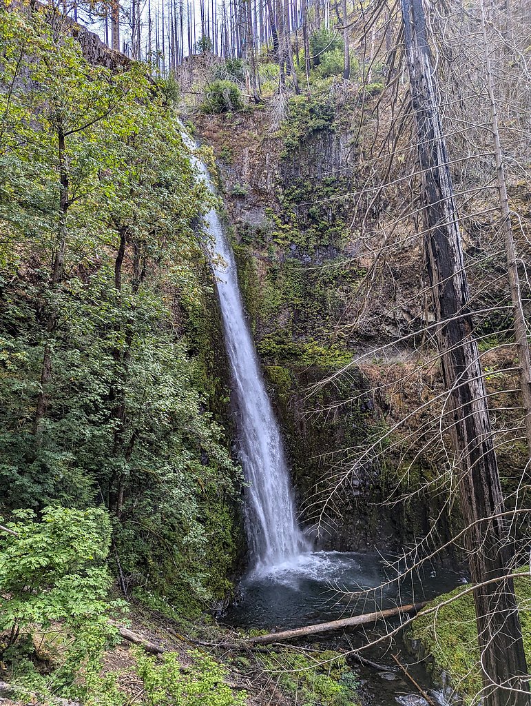
Tunnel Falls is a stunning waterfall located along the Eagle Creek Trail in the Columbia River Gorge, Oregon. The waterfall gets its name from the unique tunnel carved behind it, allowing hikers to pass directly behind the cascading water. It is a popular destination for its dramatic scenery and thrilling trail experience.
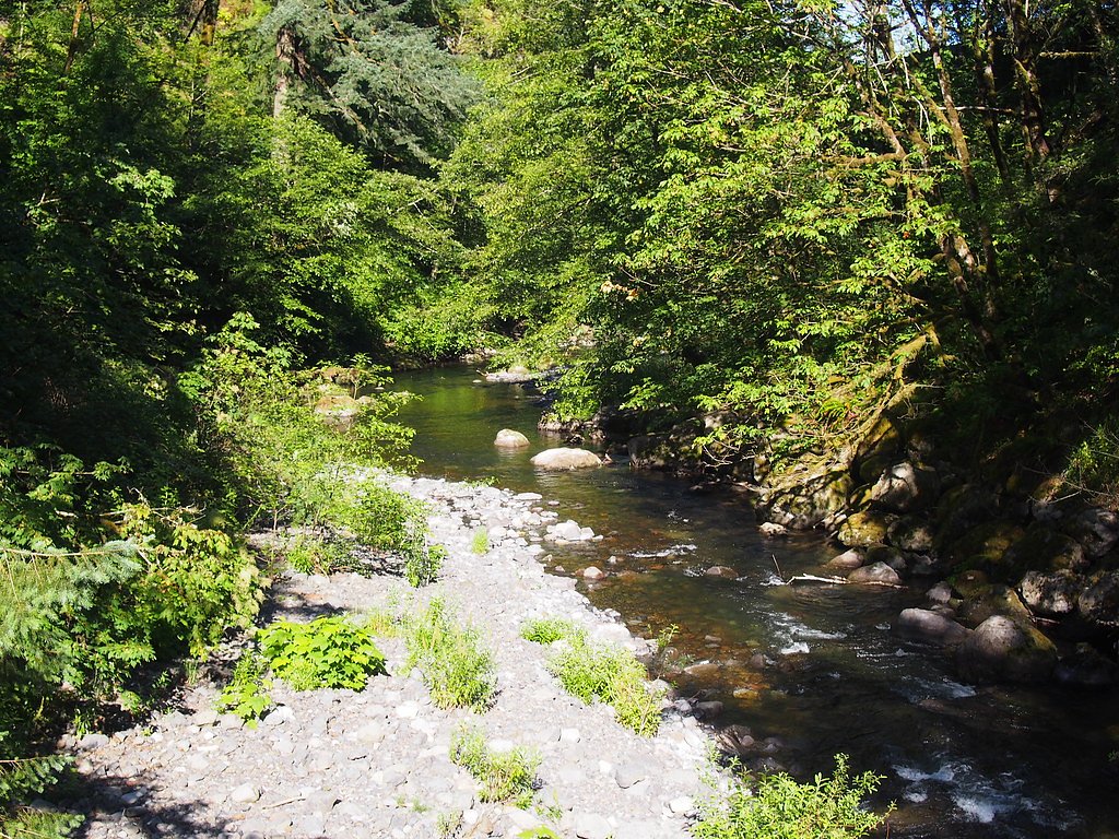
The Setting
Tunnel Falls sits at 1,214 feet within Mt. Hood National Forest, fed by the Bull Run River, in the foothills of Oregon. At 120 feet, it is among the taller waterfalls in Oregon.
Height: 120 feet
Nearby Falls Worth Visiting
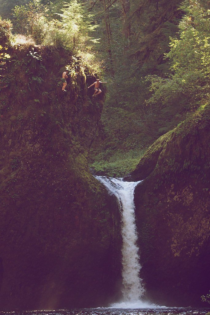
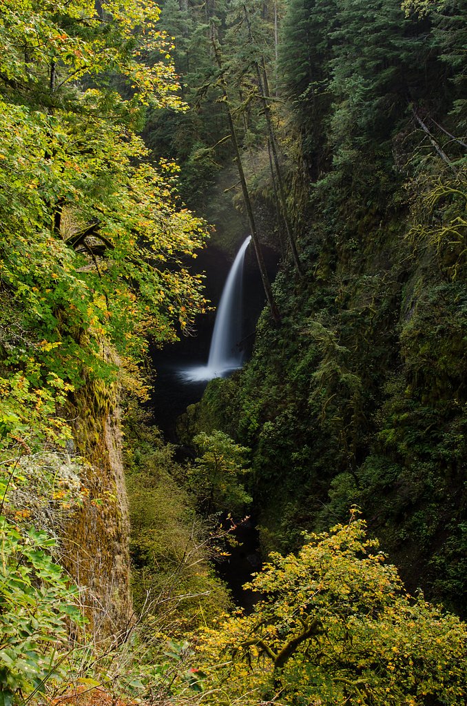
Metlako Falls (101 ft) lies 3.7 miles to the northwest. Also nearby: Wahclella Falls (65 ft, 5.3 mi) and Punch Bowl Falls (35 ft, 3.3 mi).
Trail & Hike Details
The Approach
The hard hike follows Eagle Creek (#440), a 12.0-mile out-and-back trail over natural surface. Expect 1,640 feet of elevation gain with grades of 12-20%. The trail is developed (Class 3).
USFS Trail
EAGLE CREEK #440
Trail Class
Developed
Surface
Avg Grade
USFS Segment
0.65 miTrail Description
The Eagle Creek Trail to Tunnel Falls is a challenging but rewarding hike. The trail features steep drop-offs, narrow paths, and sections with cable handrails for safety. Hikers will pass several other waterfalls along the way, including Punch Bowl Falls, before reaching Tunnel Falls. The tunnel behind the waterfall is carved into the basalt rock, offering a unique perspective of the falls.
What to Expect
The falls cascade 120 feet. Dogs are welcome.
Accessibility
The trail involves steep, uneven terrain with significant elevation change and is not accessible to mobility devices.
Frequently Asked Questions
🐶 Are Dogs Allowed at Tunnel Falls?
✅ Dogs are allowed
Are There Any Fees or Permits Required?
🤑 Fee: $5.00
Permit required
A Northwest Forest Pass or America the Beautiful Pass is required for parking at the trailhead.
🏊 Is There Swimming at Tunnel Falls?
❌ Swimming is not allowed
When to Visit
Spring and early summer are ideal for visiting Tunnel Falls, as the waterfalls are at their fullest due to snowmelt. Fall offers beautiful foliage, while summer provides drier trail conditions. Winter visits may be possible but can be hazardous due to ice and snow.
Seasonal Access
The best time to visit is Spring, Summer, and Fall. Winter access may be limited. Check with Mt. Hood National Forest for seasonal road closures.
Safety Information
Water temperature is currently 44°F — cold enough to cause numbness quickly. Avoid prolonged water contact and use caution near the falls.
The trail has steep drop-offs and narrow paths, so exercise caution, especially in wet or icy conditions. Use the cable handrails where available. Always stay on the trail and avoid getting too close to the edge.
Current Water Conditions
21 ft³/s
Current discharge — how much water is flowing
Lower than usual for this time of year
Based on 33 years of record
1.09 ft
Water depth at gauge
44°F
Very coldExpect numbness within minutes
7-Day Discharge Trend
What does this mean for your visit?
Flow is lower than usual for this time of year. Water temperature is very cold at 44 degrees F, expect numbness within minutes. Mineral content is typical.
Water Quality
Conductance
Dissolved minerals in the water
About This Gauge
This gauge is on a nearby waterway and may not reflect exact conditions at the falls.
7-Day Flow Outlook
Based on the USGS gauge BULL RUN RIVER AT LOWER FLUME NR BRIGHTWOOD, OR (13 km away).
Today
Barely Flowing
21 cfs
4/10Tomorrow
Barely Flowing
23 cfs
3/10Sat
Low
25 cfs
3/10Sun
Low
25 cfs
4/10Mon
Low
24 cfs
4/10Tue
Low
24 cfs
4/10Wed
Low
24 cfs
4/10Best window: Today — barely flowing flow, cloudy (trip score 4/10).
Best time of year: this gauge typically runs highest from late April to mid June, peaking in April.
How we calculate this
This is a transparent outlook, not a precise forecast. We take the waterfall's current flow strength (how it ranks against its historical normal for today, from the nearest USGS stream gauge), carry that ranking forward along the gauge's seasonal curve, and nudge it for forecast rain. Confidence is highest for the next day or two and falls further out. Always check official conditions and your own judgment before visiting — high flows can be dangerous.
Know when to go.
Get a free email alert when waterfalls near Cascade Locks hit peak flow. We only send when conditions are worth the trip — no weekly newsletters, no spam.
Weather Forecast
Location & Access
Getting There
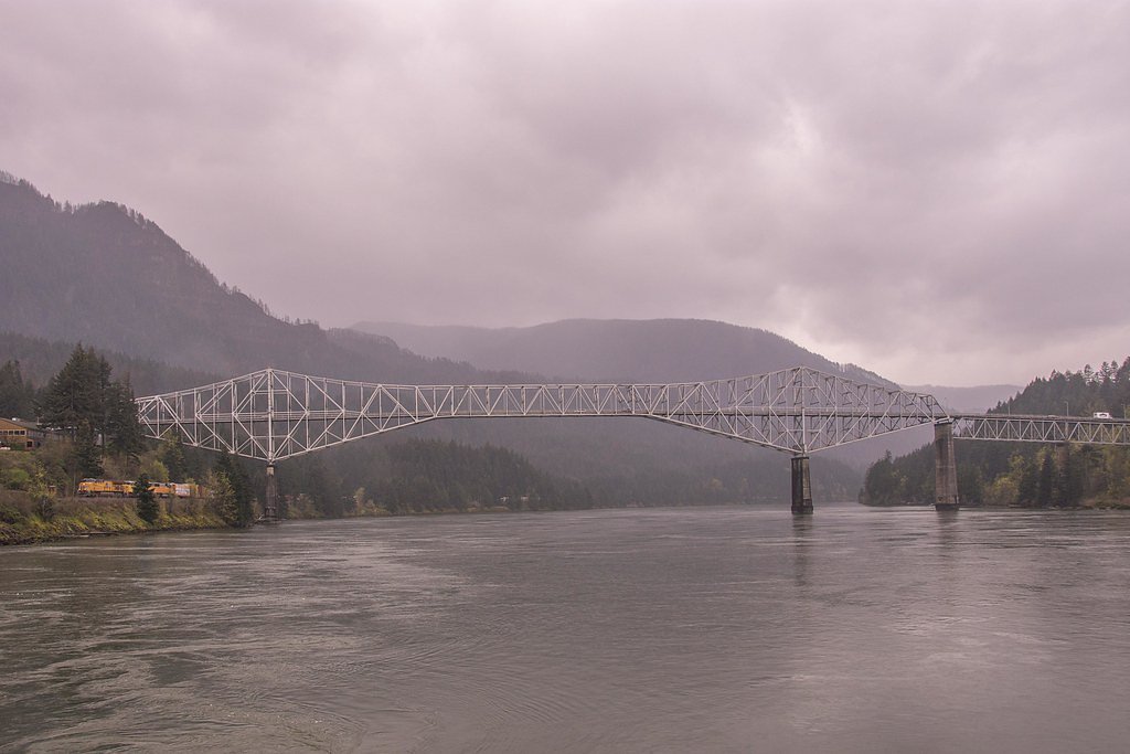
Tunnel Falls is accessed via the Eagle Creek Trailhead, located off Interstate 84 near Cascade Locks, Oregon. The trailhead is well-marked and has a parking area.
Get Directions on Google MapsParking
Parking is available at the Eagle Creek Trailhead, but it can fill up quickly, especially on weekends. Arrive early to secure a spot.
Elevation
1,214 feet above sea level
Coordinates
45.584876° N, -121.851954° W
Land Management
Managed by USFS
Visitor Tips & Gear
Wear sturdy hiking shoes with good traction, and bring plenty of water and snacks. Trekking poles can be helpful for stability on the steep and narrow sections. Arrive early to avoid crowds and secure parking. Be prepared for changing weather conditions.
As an Amazon Associate, we earn from qualifying purchases.
This challenging 12.0 miles trail gains 1,640 ft in elevation — come prepared with proper hiking boots and trekking poles. Sun exposure on the trail makes good sun protection a must in summer.

Sawyer Squeeze Water Filter
The backcountry standard — filters 99.9% of bacteria and weighs just 3 oz.

Polarized Sunglasses (Knockaround)
Cuts glare off the water so you actually see the falls — and your photos turn out better too.

Columbia Watertight II Rain Jacket
Packs into its own pocket, seam-sealed, and keeps you dry from spray and surprise rain.

Earth Pak Waterproof Dry Bag
Keeps your phone and gear dry when waterfall mist soaks everything else.

Waterproof Phone Pouch (AiRunTech)
Cheap insurance — take photos right next to the falls without killing your phone.

Timberland Euro Sprint Mid Waterproof
Trusted waterproof boot with premium leather and grippy rubber sole — reliable on rocky, wet trails.
Where to Stay

Skamania Lodge

Bonneville Hot Springs Resort & Spa

Best Western Plus Columbia River Inn

Carson Hot Springs Resort & Spa
Browse vacation cabins and private rentals nearby
Unique outdoor stays — tents, yurts, and treehouses
Rent a campervan or RV for your waterfall road trip
Some links are affiliate links. We may earn a commission at no extra cost to you.
Nearby Campground
Wahtum Lake Campground
2.9 miles away · 0 sites
Five primitive campsites available with a fire pit and picnic table at each site adjacent to Wahtum Lake located just east of the Mark O. Hatfield Wilderness and multiple hiking opportunties. Trees and shade available.
Book on Recreation.govNearby Hot Springs
Hot springs near Cascade Locks, Oregon
Moffetts (Bonneville) Hot Springs
Moffetts Hot Springs, also called Bonneville Hot Springs, flows at 97 degrees in the Gifford Pinchot National Forest at just 75...
St Martins Hot Springs
St. Martins Hot Springs flows at 120 degrees Fahrenheit at just 432 feet elevation in the Columbia River Gorge near Carson in S...
Rock Creek Hot Springs
Rock Creek Hot Springs emerges in the Columbia River Gorge in Skamania County, Washington, with water documented as 'hot' witho...

Collins Hot Springs
Collins Hot Springs emerges at 122 degrees just 127 feet above sea level in the Columbia River Gorge, producing water 68.4 degr...

Mount Hood Fumaroles
Mount Hood Fumaroles vent at 194°F from the flanks of Oregon's highest peak, among the state's most extreme geothermal features...

Swim Warm Springs
Swim Warm Springs emerges at 79°F within Mount Hood National Forest at 4,063 feet elevation, flowing just 6.9 meters from White...
Looking for a soak after your hike? Explore more hot springs near Cascade Locks, Oregon on SoakingSprings.
Explore Oregon springsAdditional Information
Nearby Attractions
Punch Bowl Falls, Metlako Falls, and the Columbia River Gorge Scenic Area.
Wildlife
The area is home to a variety of wildlife, including birds, deer, and small mammals. Keep an eye out for bald eagles and osprey.
Cities near Tunnel Falls
Nearby Waterfalls
Other waterfalls named Tunnel Falls
1 other waterfall shares this name across the U.S.
Writing about Tunnel Falls? Embed this waterfall on your site for free.