Photo Credits (5)
Difficulty
Moderate
Trail Length
4.0 miles
Trail Type
Out And Back
Elevation Gain
800 ft
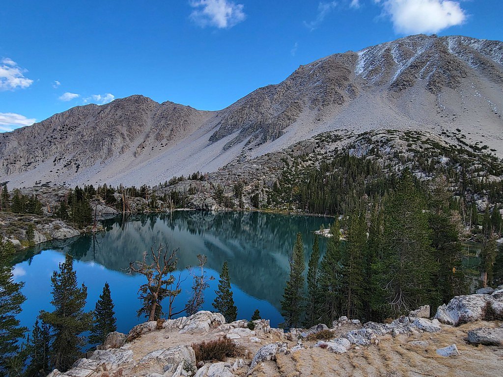
About Triple Falls
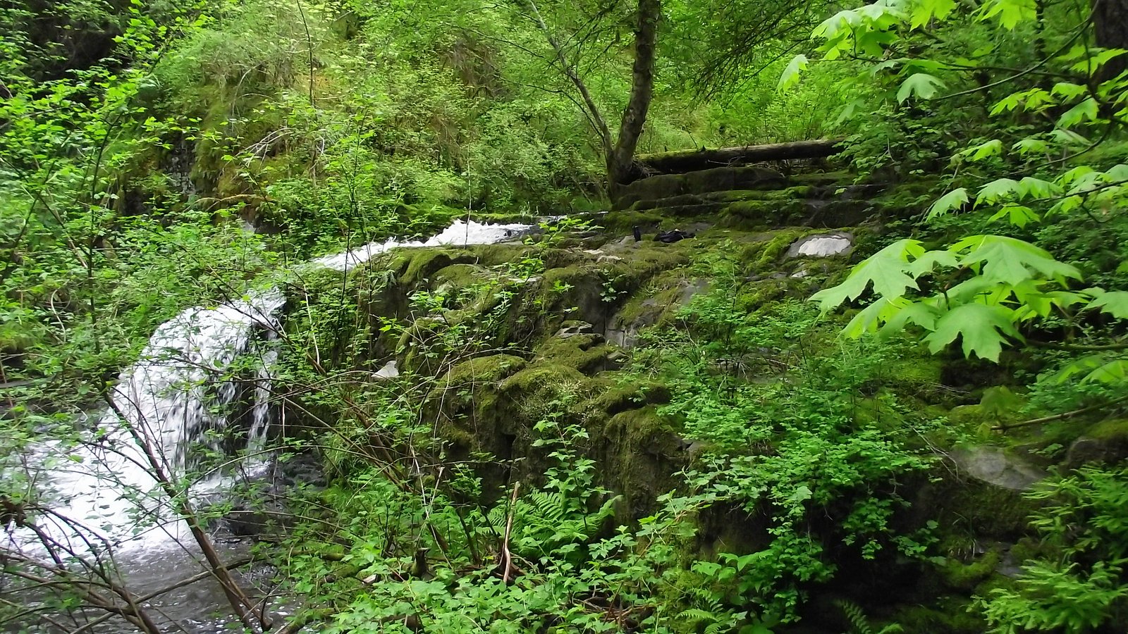
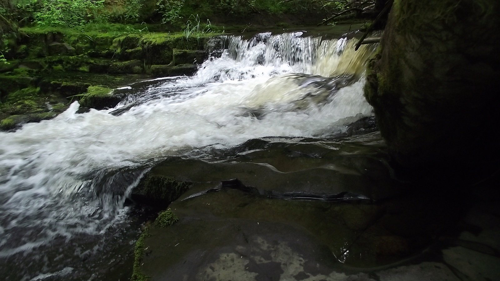
Triple Falls perches in the Eastern Sierra near Big Pine and is managed by the National Park Service as part of Kings Canyon National Park. The cascade splits into three distinct drops framed by rugged Sierra peaks and alpine meadows; fed by snowmelt, the falls are at their most impressive in spring and early summer when runoff is highest. The setting is classic high‑Sierra — stark rock, clear water, and wide mountain views that reward the hike in every season it’s flowing. Note that “Triple Falls” is a name used for several different waterfalls (Wikipedia even lists a Triple Falls in Uvas Canyon County Park in Santa Clara County). This listing refers to the Eastern Sierra Triple Falls near Big Pine, not the Uvas Canyon feature. The approach is a moderately paced outing that climbs into open, rocky terrain and alpine vegetation — plan on seasonal flows, bring layers, and allow extra time for photography and scrambling near the cascades.
The Setting
Triple Falls sits at 8,219 feet within Kings Canyon National Park, in the high alpine of California.
Trail & Hike Details
The Approach
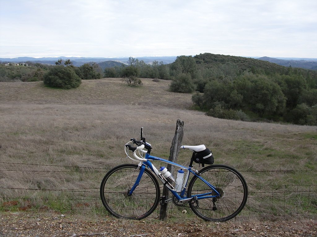
The moderate 4.0-mile out-and-back trail gains 800 feet of elevation on the way to the falls.
Trail Description
The trail to Triple Falls is a 4.0‑mile out‑and‑back with about 800 feet of elevation gain and is rated moderate. The path winds through alpine vegetation and rocky terrain; expect uneven, rocky surfaces and some steeper sections as you gain elevation. Footwear with good traction is recommended, and layers are wise given the elevation. The route provides frequent mountain views and a rewarding finish at the multi-drop cascade; allow time for slower footing on the rockier sections and for lingering at the falls.
What to Expect
Visitors can expect to see three cascading tiers of water, especially during the spring and early summer when snowmelt is at its peak. The area is serene and offers opportunities for photography, picnicking, and enjoying the natural beauty of the Sierra Nevada.
Accessibility
The trail is not wheelchair accessible. Uneven terrain and elevation changes require steady footing.
Frequently Asked Questions
🐶 Are Dogs Allowed at Triple Falls?
❌ Dogs are not allowed
Are There Any Fees or Permits Required?
🆖 No fees required
🏊 Is There Swimming at Triple Falls?
❌ Swimming is not allowed
When to Visit
The best time to visit Triple Falls is during the spring and early summer when the snowmelt ensures a strong flow. Fall can also be a good time to visit for cooler weather and fewer crowds.
Seasonal Access
The best time to visit is Spring, Summer, and Fall. Access roads and trails may close during winter due to snow. Check the National Park Service website for current conditions.
Safety Information
Be cautious of slippery rocks near the falls and stay on marked trails to avoid getting lost. Carry a map or GPS device, as cell service may be limited in the area. Watch for sudden weather changes, especially in the mountains.
Know when to go.
Get a free email alert when waterfalls near Big Pine hit peak flow. We only send when conditions are worth the trip — no weekly newsletters, no spam.
Weather Forecast
Location & Access
Getting There
Triple Falls is located approximately 19.8 miles from Big Pine, California. To reach the falls, visitors typically drive along Highway 395 and then take local roads leading into the Inyo National Forest. The exact trailhead location may vary depending on the route chosen.
Get Directions on Google MapsParking
Parking is available near the trailhead, but spaces may be limited during peak seasons. Visitors are advised to arrive early to secure a spot.
Elevation
8,219 feet above sea level
Coordinates
36.984659° N, -118.555379° W
Land Management
Managed by NPS
Visitor Tips & Gear
Start your hike early in the day to avoid crowds and ensure you have enough time to enjoy the falls. Bring plenty of water, as the trail can be exposed to the sun in some sections. Check trail conditions before heading out, especially during winter or after heavy rains.
This trail sits at 8,219 ft — the air is noticeably thinner
High AltitudeSome visitors experience headaches, fatigue, or shortness of breath at this elevation. Take it slow, stay hydrated, and consider supplemental oxygen if you're coming from a lower altitude.
As an Amazon Associate, we earn from qualifying purchases.

Coppertone Sport SPF 50 Sunscreen
UV intensity jumps ~4% per 1,000 ft — at this elevation you can burn in half the time.

Sun Bum SPF 30 Lip Balm (3-Pack)
Lips have almost no natural UV protection and burn fast in thin, dry mountain air.

Liquid I.V. Electrolyte Packets
You lose moisture ~2x faster at elevation — electrolytes help you absorb water efficiently.

ROCKNIGHT Polarized UV400 Sunglasses
High-altitude glare off rock and water is intense — UV400 lenses block 99%+ of UVA/UVB.

Boost Oxygen 10L Canister (2-Pack)
Portable supplemental oxygen for quick relief from headaches and shortness of breath.

Altitude Rx OxyBoost Complex
Antioxidant formula designed to support your body's natural altitude acclimation.
As an Amazon Associate, we earn from qualifying purchases.
With 4.0 miles and 800 ft of elevation gain, sturdy boots and trekking poles will help on this moderate trail. Sun exposure on the trail makes good sun protection a must in summer.
America the Beautiful Annual Pass
Covers entrance fees at 2,000+ federal recreation sites — required at most National Parks.

Polarized Sunglasses (Knockaround)
Cuts glare off the water so you actually see the falls — and your photos turn out better too.

Columbia Watertight II Rain Jacket
Packs into its own pocket, seam-sealed, and keeps you dry from spray and surprise rain.

Earth Pak Waterproof Dry Bag
Keeps your phone and gear dry when waterfall mist soaks everything else.

Waterproof Phone Pouch (AiRunTech)
Cheap insurance — take photos right next to the falls without killing your phone.

Timberland Euro Sprint Mid Waterproof
Trusted waterproof boot with premium leather and grippy rubber sole — reliable on rocky, wet trails.

TrailBuddy Trekking Poles
Lightweight aluminum, cork grips, and flip-locks that actually hold — a best-seller for good reason.
Where to Stay

Genas's Sierra Inn & Restaurant

Winnedumah Hotel

Bristlecone Motel

Eagle's Nest
Browse vacation cabins and private rentals nearby
Unique outdoor stays — tents, yurts, and treehouses
Rent a campervan or RV for your waterfall road trip
Some links are affiliate links. We may earn a commission at no extra cost to you.
Nearby Campground
UPPER SAGE FLAT
11.8 miles away · 21 sites
Overview Take the family to Upper Sage for a pleasant camping trip along the banks of Big Pine Creek. Here, visitors can experience the beauty of the creek that runs along the base of a narrow canyon. Visitors can swim or fish, in the creek that is stocked annually with trout, or head to a nearby lake for power boating.Recreation Rainbow, brown, brook and alpers trout swim in the stream, enticing anglers. Hikers are fans of the Big Pine Creek Trail, a 1.5-mile footpath that provides access to the
Book on Recreation.govNearby Hot Springs
Hot springs near Big Pine, California
Keough Hot Springs
Keough Hot Springs emerges at 124°F in the Owens Valley near Bishop, situated just seven miles south along US Highway 395. The ...

Unnamed Spring Inyo County 1
This 84-degree thermal spring near Big Pine sits at 4,034 feet in remote Inyo County backcountry, requiring a 1.7-kilometer hik...

Blaney Meadows Hot Springs
Blaney Meadows Hot Springs emerges at 109 degrees Fahrenheit from the Sierra National Forest at 7,676 feet elevation, deliverin...
Kern Hot Spring
Kern Hot Spring emerges at 109°F in Sequoia National Park at 6,908 feet elevation, accessible only via backcountry hiking. Prot...

Mono Hot Springs
Mono Hot Springs emerges at 109°F in the High Sierra's alpine terrain, set at 6,561 feet where thermal water feeds a series of ...

Springs
These 72-degree springs emerge at 6,790 feet elevation on Bureau of Land Management land within Long Valley Caldera, one of Nor...
Looking for a soak after your hike? Explore more hot springs near Big Pine, California on SoakingSprings.
Explore California springsAdditional Information
Nearby Attractions
Nearby attractions include Big Pine Lakes, the Ancient Bristlecone Pine Forest, and Bishop Creek Canyon.
Wildlife
The area is home to a variety of wildlife, including mule deer, birds of prey, and small mammals. Be cautious of bears and always store food properly.
Cities near Triple Falls
Nearby Waterfalls
Other waterfalls named Triple Falls
4 other waterfalls share this name across the U.S.
Writing about Triple Falls? Embed this waterfall on your site for free.