Travertine Falls
Arizona • Grand Canyon National Park
By Armen Suny · Last verified Mar 2026
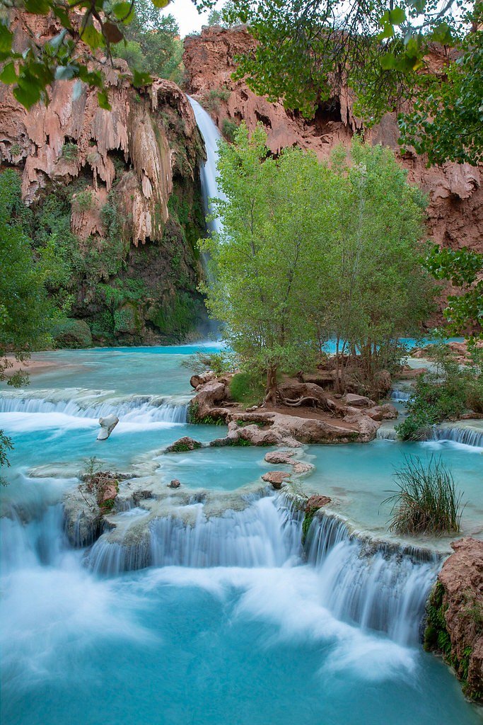
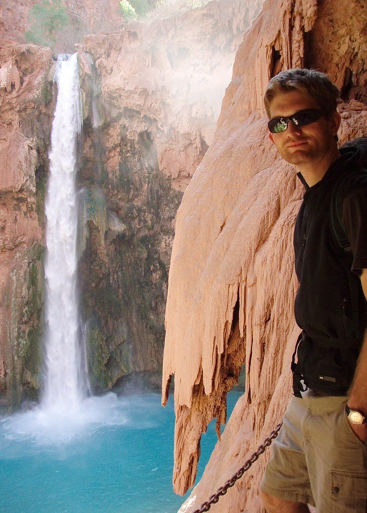
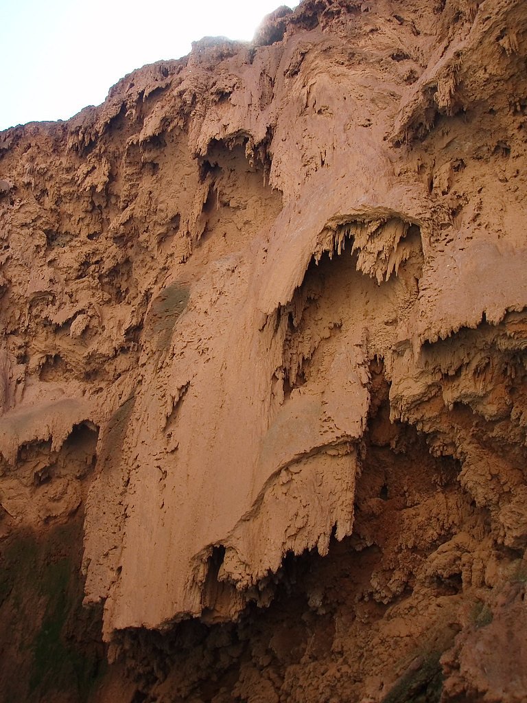
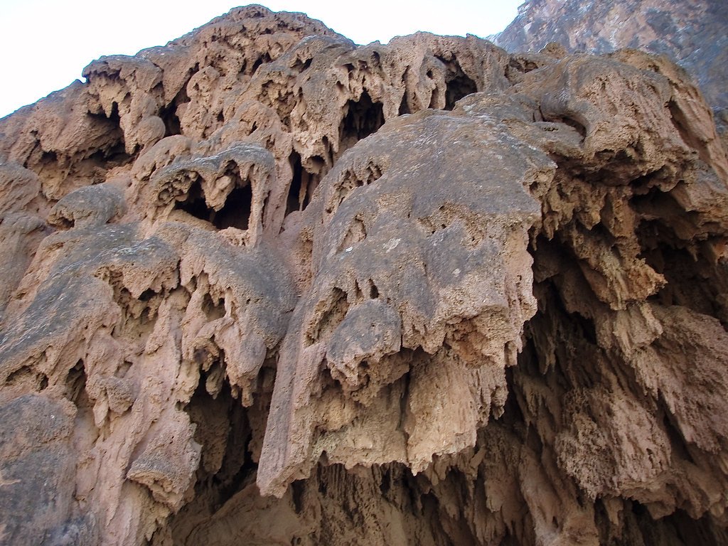
Photo Credits (5)
Difficulty
Moderate
Trail Length
2.4 miles
Trail Type
Out And Back
Elevation Gain
350 ft
About Travertine Falls
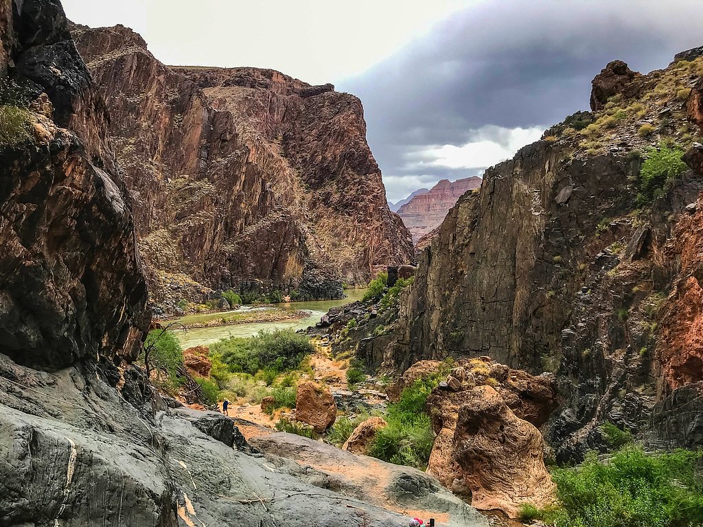
Travertine Falls is a quietly scenic seasonal cascade set among striking travertine rock formations on the Hualapai Indian Reservation. The falls are most photogenic after recent rains when water flows over the pale, textured limestone terraces; during drier stretches flow can be reduced or intermittent. The site is on tribal lands (land owner: DESG; designation: TRIBL) and is managed by tribal authorities (manager: TRIB), and it sits in the broader Grand Canyon National Park region, making it a peaceful complement to the area's more famous rim viewpoints. The approach to the falls rewards a short but engaging hike through desert scrub and shaded riparian pockets. The out-and-back route covers approximately 2.4 miles with about 350 feet of elevation gain and is generally rated moderate in difficulty — an inviting option for hikers who want a relatively brief outing with photographic rewards and unique geology rather than a long backcountry commitment.
The Setting
Travertine Falls sits at 1,358 feet within Grand Canyon National Park, fed by the Diamond Creek, in the foothills of Arizona.
Trail & Hike Details
The Approach
The moderate 2.4-mile out-and-back trail gains 350 feet of elevation on the way to the falls.
Trail Description
The trail to Travertine Falls is an out-and-back route of roughly 2.4 miles with about 350 feet of cumulative elevation gain, rated moderate. The tread is primarily natural and unpaved, winding through desert landscape with occasional shaded stretches; it can be uneven in places, so sturdy footwear is recommended. Expect some short, steady climbs rather than technical scrambling, and plan visits after recent rain for the best waterfall flow.
What to Expect
Dogs are welcome.
Accessibility
The trail is not wheelchair accessible. Uneven terrain and elevation changes require steady footing.
Frequently Asked Questions
🐶 Are Dogs Allowed at Travertine Falls?
✅ Dogs are allowed
Are There Any Fees or Permits Required?
🤑 Fee: $8.00
🏊 Is There Swimming at Travertine Falls?
❌ Swimming is not allowed
When to Visit
The best time to visit is after recent rainfall, typically in spring or after summer monsoon rains.
Seasonal Access
The best time to visit is Spring, Summer, Fall, and Winter. Watch for flash flood warnings during monsoon season (July through September). Check with Grand Canyon National Park for current conditions.
Safety Information
Be cautious of slippery rocks near the waterfall. Watch for snakes and other wildlife. Carry sufficient water, especially during hot weather, and avoid hiking during extreme heat.
Current Water Conditions
1 ft³/s
Current discharge — how much water is flowing
Much lower than usual for this time of year
Based on 33 years of record
7.45 ft
Water depth at gauge
7-Day Discharge Trend
What does this mean for your visit?
Flow is well below normal for this time of year, so the waterfall may be a trickle.
About This Gauge
7-Day Flow Outlook
Based on the USGS gauge DIAMOND CREEK NEAR PEACH SPRINGS, AZ (7 km away).
Today
Low
1 cfs
6/10Tomorrow
Low
1 cfs
6/10Sun
Low
1 cfs
6/10Mon
Low
1 cfs
6/10Tue
Low
1 cfs
6/10Wed
Low
1 cfs
6/10Thu
Low
1 cfs
6/10Best window: Today — low flow, sunny (trip score 6/10).
Best time of year: this gauge typically runs highest from late December to early April, peaking in February.
How we calculate this
This is a transparent outlook, not a precise forecast. We take the waterfall's current flow strength (how it ranks against its historical normal for today, from the nearest USGS stream gauge), carry that ranking forward along the gauge's seasonal curve, and nudge it for forecast rain. Confidence is highest for the next day or two and falls further out. Always check official conditions and your own judgment before visiting — high flows can be dangerous.
Know when to go.
Get a free email alert when waterfalls near Peach Springs hit peak flow. We only send when conditions are worth the trip — no weekly newsletters, no spam.
Weather Forecast
Location & Access
Getting There
Travertine Falls is located near Payson, Arizona, within the Tonto National Forest. Access to the falls typically involves driving on dirt roads, so a high-clearance vehicle may be recommended. Exact directions should be verified before visiting.
Get Directions on Google MapsParking
Parking is available near the trailhead, but spaces may be limited. Visitors should plan to arrive early, especially during weekends or peak seasons.
Elevation
1,358 feet above sea level
Coordinates
35.755908° N, -113.447964° W
Land Management
Managed by TRIB
Visitor Tips & Gear
Visit after recent rainfall for the best chance to see the waterfall flowing. Bring plenty of water, as the trail is exposed to the sun in many areas. Arrive early to secure parking and avoid crowds.
As an Amazon Associate, we earn from qualifying purchases.
With 2.4 miles and 350 ft of elevation gain, sturdy boots and trekking poles will help on this moderate trail. Icy conditions are common in winter — traction cleats are a smart addition.

Columbia Watertight II Rain Jacket
Packs into its own pocket, seam-sealed, and keeps you dry from spray and surprise rain.

Polarized Sunglasses (Knockaround)
Cuts glare off the water so you actually see the falls — and your photos turn out better too.

Earth Pak Waterproof Dry Bag
Keeps your phone and gear dry when waterfall mist soaks everything else.

Waterproof Phone Pouch (AiRunTech)
Cheap insurance — take photos right next to the falls without killing your phone.

Timberland Euro Sprint Mid Waterproof
Trusted waterproof boot with premium leather and grippy rubber sole — reliable on rocky, wet trails.

TrailBuddy Trekking Poles
Lightweight aluminum, cork grips, and flip-locks that actually hold — a best-seller for good reason.
Where to Stay


Browse vacation cabins and private rentals nearby
Unique outdoor stays — tents, yurts, and treehouses
Rent a campervan or RV for your waterfall road trip
Some links are affiliate links. We may earn a commission at no extra cost to you.
Nearby Hot Springs
Hot springs near Peach Springs, Arizona
Pumpkin Spring
Pumpkin Spring emerges as a mineralized thermal feature in the Grand Canyon's depths, located on the Hualapai Indian Reservatio...
Casa Grande Spring
Casa Grande Spring emerges at 72 degrees Fahrenheit in the high desert transition zone where Great Basin and Mojave influences ...

Lava Warm Springs
Lava Warm Springs flows at 90°F on the Hualapai Indian Reservation in Mohave County near Peach Springs, emerging 20 degrees war...
Trout Creek Spring
Trout Creek Spring flows at 81°F in Mohave County's canyon country near Peach Springs, running 22 degrees warmer than the regio...
Frost Mine Spring
Frost Mine Spring flows at 70 degrees Fahrenheit on BLM public lands in Mohave County near Kingman at 4,270 feet elevation, eme...

Unnamed Spring Mohave County
This unnamed 73-degree spring flows on Bureau of Land Management lands in Mohave County near Kingman, reaching 13.4 degrees abo...
Looking for a soak after your hike? Explore more hot springs near Peach Springs, Arizona on SoakingSprings.
Explore Arizona springsAdditional Information
Nearby Attractions
Other attractions in the Tonto National Forest include Tonto Natural Bridge State Park and the Mogollon Rim.
Wildlife
The area is home to various desert wildlife, including birds, lizards, and small mammals. Visitors should be cautious of snakes, especially during warmer months.
Cities near Travertine Falls
Other waterfalls named Travertine Falls
1 other waterfall shares this name across the U.S.
Writing about Travertine Falls? Embed this waterfall on your site for free.