tíkem Falls
By Armen Suny · Last verified May 2026
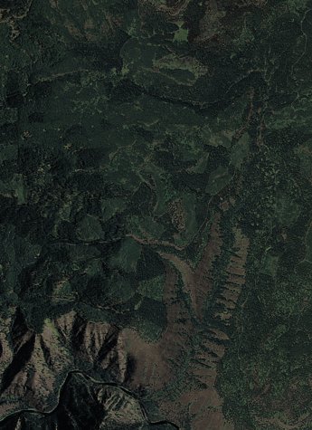
Photo Credits (2)
Difficulty
Moderate
Trail Length
2.4 miles
Trail Type
Out And Back
Elevation Gain
350 ft
About tíkem Falls
Tíkem Falls is a quiet, scenic waterfall tucked into northeastern Oregon and nestled within the Umatilla National Forest. Managed by the U.S. Forest Service, the site is a favorite for hikers seeking a peaceful break from busier recreation areas—an inviting spot to enjoy forested surroundings and the sound of falling water. Because it sits on National Forest land, the falls often feel remote and less-crowded, making it a good choice for a reflective day hike. The approach to Tíkem Falls is a moderate outing that rewards a modest effort with pleasant forest views. The route covers roughly 2.4 miles with about 350 feet of elevation gain on an out-and-back alignment; seasonal conditions can affect access, so check with the Umatilla National Forest ranger district for current trail status before you go.
The Setting
tíkem Falls sits at 3,629 feet within Umatilla National Forest, fed by the Grande Ronde River, in the mountains of Oregon.
Trail & Hike Details
The Approach
The moderate 2.4-mile out-and-back trail gains 350 feet of elevation on the way to the falls.
Trail Description
This route is an out-and-back trail listed at 2.4 miles with approximately 350 feet of elevation gain and is rated moderate. USFS trail surface, grade, and technical class are not published for this specific route, so expect the possibility of variable footing and seasonal changes in conditions. Hikers should come prepared with sturdy footwear, layered clothing, and current information from the Umatilla National Forest ranger district before heading out.
What to Expect
Visitors can expect a tranquil natural setting with the sound of cascading water and surrounding forested areas. The waterfall may be seasonal, with flow depending on recent rainfall.
Accessibility
The trail is not wheelchair accessible. Uneven terrain and elevation changes require steady footing.
Frequently Asked Questions
🐶 Are Dogs Allowed at tíkem Falls?
❌ Dogs are not allowed
Are There Any Fees or Permits Required?
🆖 No fees required
🏊 Is There Swimming at tíkem Falls?
❌ Swimming is not allowed
When to Visit
Spring and early summer are typically the best times to visit, as the waterfall is likely to have the most water flow during these seasons.
Seasonal Access
The best time to visit is Spring, Summer, and Fall. Winter access may be limited. Check with Umatilla National Forest for seasonal road closures.
Safety Information
Visitors should be cautious of slippery rocks, uneven terrain, and potential wildlife encounters. Always stay on marked trails and avoid venturing too close to the waterfall.
Current Water Conditions
1,140 ft³/s
Current discharge — how much water is flowing
Much lower than usual for this time of year
Based on 81 years of record
4.63 ft
Water depth at gauge
7-Day Discharge Trend
What does this mean for your visit?
Flow is well below normal for this time of year, so the waterfall may be a trickle.
About This Gauge
This gauge is on a nearby waterway and may not reflect exact conditions at the falls.
7-Day Flow Outlook
Based on the USGS gauge GRANDE RONDE RIVER AT TROY, OR (17 km away).
Today
Barely Flowing
1140 cfs
5/10Tomorrow
Low
1208 cfs
4/10Sat
Low
1231 cfs
4/10Sun
Low
1162 cfs
4/10Mon
Low
1083 cfs
4/10Tue
Barely Flowing
991 cfs
5/10Wed
Barely Flowing
915 cfs
5/10Best window: Today — barely flowing flow, partly sunny (trip score 5/10).
Best time of year: this gauge typically runs highest from late March to late June, peaking in May.
How we calculate this
This is a transparent outlook, not a precise forecast. We take the waterfall's current flow strength (how it ranks against its historical normal for today, from the nearest USGS stream gauge), carry that ranking forward along the gauge's seasonal curve, and nudge it for forecast rain. Confidence is highest for the next day or two and falls further out. Always check official conditions and your own judgment before visiting — high flows can be dangerous.
Know when to go.
Get a free email alert when waterfalls near Wallowa hit peak flow. We only send when conditions are worth the trip — no weekly newsletters, no spam.
Weather Forecast
Location & Access
Getting There
The exact location and directions to Tíkem Falls are not widely documented. Visitors are advised to consult local resources or trail guides for accurate directions.
Get Directions on Google MapsParking
Parking availability is unclear. Visitors should prepare for limited parking options and consider carpooling if visiting with a group.
Elevation
3,629 feet above sea level
Coordinates
45.902057° N, -117.660871° W
Land Management
Managed by USFS
Visitor Tips & Gear
Bring sturdy footwear and be prepared for potentially uneven terrain. Check weather conditions before visiting, as trails may become slippery after rain.
As an Amazon Associate, we earn from qualifying purchases.
With 2.4 miles and 350 ft of elevation gain, sturdy boots and trekking poles will help on this moderate trail. Sun exposure on the trail makes good sun protection a must in summer.

Polarized Sunglasses (Knockaround)
Cuts glare off the water so you actually see the falls — and your photos turn out better too.

Columbia Watertight II Rain Jacket
Packs into its own pocket, seam-sealed, and keeps you dry from spray and surprise rain.

Earth Pak Waterproof Dry Bag
Keeps your phone and gear dry when waterfall mist soaks everything else.

Waterproof Phone Pouch (AiRunTech)
Cheap insurance — take photos right next to the falls without killing your phone.

Timberland Euro Sprint Mid Waterproof
Trusted waterproof boot with premium leather and grippy rubber sole — reliable on rocky, wet trails.

TrailBuddy Trekking Poles
Lightweight aluminum, cork grips, and flip-locks that actually hold — a best-seller for good reason.
Where to Stay
Browse vacation cabins and private rentals nearby
Unique outdoor stays — tents, yurts, and treehouses
Rent a campervan or RV for your waterfall road trip
Some links are affiliate links. We may earn a commission at no extra cost to you.
Nearby Campground
FRY MEADOWS GUARD STATION
11.5 miles away · 1 sites
Overview Fry Meadows Guard Station offers the peaceful solitude of a remote nature-lover's paradise just south of the Wenaha-Tucannon Wilderness and west of the Grande Ronde Wild and Scenic River. The surrounding area is steeped with native history and culture as it was once home to the Nez Perce, Umatilla, Walla Walla and Cayuse Indians. This site was originally established as a ranger station before 1908, part of the former Wenaha National Forest. The existing cabin was constructed in 1935 by t
Book on Recreation.govNearby Hot Springs
Hot springs near Wallowa, Oregon
Bingham Springs
Bingham Springs flows at 93°F in the Blue Mountains of Umatilla County, requiring an 830-foot walk from Bingham Road near Milto...
Unnamed Spring Union County
A warm spring at 2,702 feet elevation near Elgin in Union County, Oregon, classified as 'W' in historical records without speci...

Cook Creek Hot Spring
Cook Creek Hot Spring flows at 97 degrees Fahrenheit in the Wallowa National Forest, accessible only by a 3.5-mile hike from Co...

Warm Spring
Warm Spring flows at 85°F at 2,953 feet in Union County near the town of Union, creating a 36.7-degree differential above ambie...
Union Station Hot Springs
Union Station Hot Springs emerges near the town of Union in the Grande Ronde Valley at 2,728 feet elevation, 44 meters from Hot...

Hot Lake Springs
Hot Lake Springs emerges at 176°F in Union County near the town of Union, creating one of Oregon's hottest thermal features 44 ...
Looking for a soak after your hike? Explore more hot springs near Wallowa, Oregon on SoakingSprings.
Explore Oregon springsAdditional Information
Nearby Attractions
Nearby attractions are not well-documented, but the surrounding area may offer additional hiking trails and natural features.
Wildlife
The area may be home to typical Oregon wildlife, including birds, deer, and small mammals. Visitors should be cautious of potential encounters with wildlife.
Cities near tíkem Falls
Writing about tíkem Falls? Embed this waterfall on your site for free.