Ti'lomikh Falls
By Armen Suny · Last verified Mar 2026
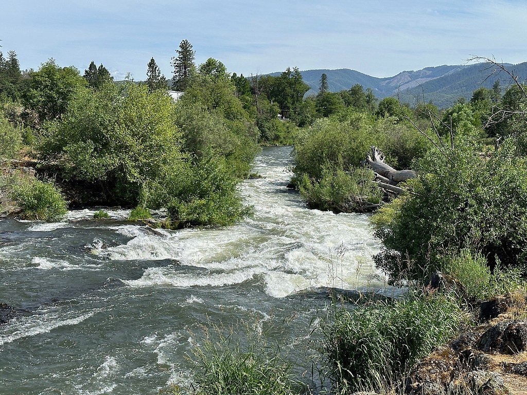
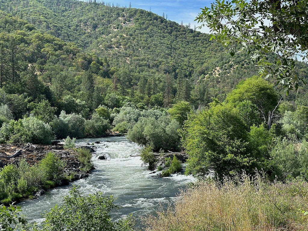
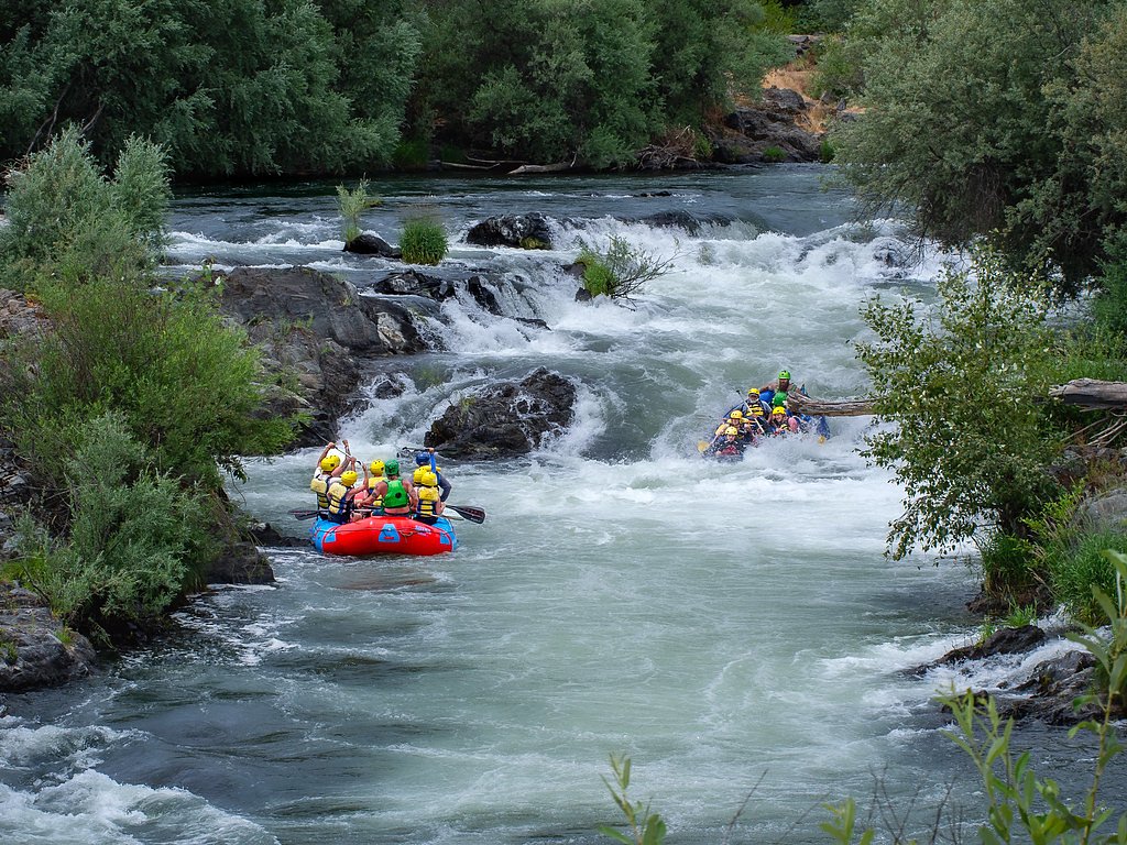
Photo Credits (5)
Difficulty
Moderate
Trail Length
2.4 miles
Trail Type
Out And Back
Elevation Gain
350 ft
About Ti'lomikh Falls
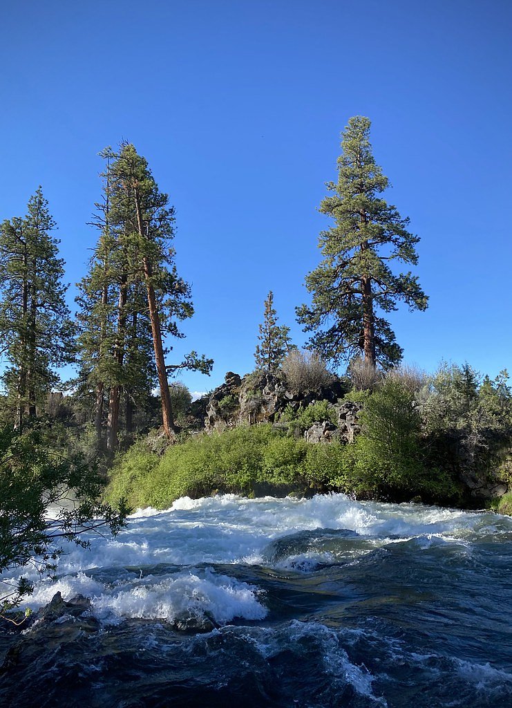
Ti'lomikh Falls, also known as Gold Ray Falls, is a culturally significant waterfall located on the Rogue River in southern Oregon. It holds deep historical and spiritual importance to the Takelma people, the Indigenous inhabitants of the region. The falls are not particularly tall but are known for their scenic beauty and the surrounding river environment.
The Setting
Ti'lomikh Falls sits at 1,073 feet within Rogue River, fed by the Rogue River, in the foothills of Oregon.
Trail & Hike Details
The Approach
The moderate 2.4-mile out-and-back trail gains 350 feet of elevation on the way to the falls.
Trail Description
There is no established hiking trail specifically leading to Ti'lomikh Falls. Visitors typically view the falls from the riverbank or nearby access points. The area may involve walking on uneven terrain or along informal paths.
What to Expect
Visitors can expect to see a series of rapids and cascades along the Rogue River, with the falls being a prominent feature. The surrounding area is lush and scenic, offering opportunities for photography and quiet reflection. The site is also significant for its cultural and historical importance to the Takelma people.
Accessibility
The trail is not wheelchair accessible. Uneven terrain and elevation changes require steady footing.
Frequently Asked Questions
🐶 Are Dogs Allowed at Ti'lomikh Falls?
❌ Dogs are not allowed
Are There Any Fees or Permits Required?
🆖 No fees required
🏊 Is There Swimming at Ti'lomikh Falls?
❌ Swimming is not allowed
When to Visit
Spring and early summer are ideal times to visit, as the water flow is typically higher due to snowmelt. However, the falls can be visited year-round.
Seasonal Access
The best time to visit is Spring, Summer, Fall, and Winter.
Safety Information
Exercise caution near the river, as the currents can be strong and the rocks slippery. Always supervise children and avoid venturing too close to the water's edge.
Current Water Conditions
1,660 ft³/s
Current discharge — how much water is flowing
Lower than usual for this time of year
Based on 120 years of record
1.42 ft
Water depth at gauge
62°F
CoolRefreshing for swimming
7-Day Discharge Trend
What does this mean for your visit?
Flow is lower than usual for this time of year. Water temperature is a refreshing 62 degrees F, good for a quick swim.
About This Gauge
7-Day Flow Outlook
Based on the USGS gauge ROGUE RIVER AT RAYGOLD NEAR CENTRAL POINT, OR (5 km away).
Today
Barely Flowing
1804 cfs
3/10Tomorrow
Low
1954 cfs
3/10Sun
Barely Flowing
1703 cfs
5/10Mon
Barely Flowing
1570 cfs
5/10Tue
Barely Flowing
1506 cfs
5/10Wed
Barely Flowing
1463 cfs
5/10Thu
Barely Flowing
1572 cfs
3/10Best window: Sun — barely flowing flow, mostly sunny (trip score 5/10).
Best time of year: this gauge typically runs highest from early March to late May, peaking in April.
How we calculate this
This is a transparent outlook, not a precise forecast. We take the waterfall's current flow strength (how it ranks against its historical normal for today, from the nearest USGS stream gauge), carry that ranking forward along the gauge's seasonal curve, and nudge it for forecast rain. Confidence is highest for the next day or two and falls further out. Always check official conditions and your own judgment before visiting — high flows can be dangerous.
Know when to go.
Get a free email alert when waterfalls near Gold Hill hit peak flow. We only send when conditions are worth the trip — no weekly newsletters, no spam.
Weather Forecast
Location & Access
Getting There
Ti'lomikh Falls is located near Gold Hill, Oregon, along the Rogue River. It can be accessed via local roads, and the closest major highway is Interstate 5. Visitors typically park near the Gold Hill Whitewater Center or nearby pullouts along the river.
Get Directions on Google MapsParking
Parking is available near the Gold Hill Whitewater Center, but spaces may be limited during peak times. Visitors should check for any posted restrictions.
Elevation
1,073 feet above sea level
Coordinates
42.443285° N, -123.043098° W
Land Management
Managed by BLM
Visitor Tips & Gear
Wear sturdy shoes if you plan to explore the riverbank, as the terrain can be uneven. Bring water and sun protection, especially during summer months. Respect the cultural significance of the site and avoid disturbing the natural environment.
As an Amazon Associate, we earn from qualifying purchases.
With 2.4 miles and 350 ft of elevation gain, sturdy boots and trekking poles will help on this moderate trail. Icy conditions are common in winter — traction cleats are a smart addition.

Columbia Watertight II Rain Jacket
Packs into its own pocket, seam-sealed, and keeps you dry from spray and surprise rain.

Polarized Sunglasses (Knockaround)
Cuts glare off the water so you actually see the falls — and your photos turn out better too.

Earth Pak Waterproof Dry Bag
Keeps your phone and gear dry when waterfall mist soaks everything else.

Waterproof Phone Pouch (AiRunTech)
Cheap insurance — take photos right next to the falls without killing your phone.

Timberland Euro Sprint Mid Waterproof
Trusted waterproof boot with premium leather and grippy rubber sole — reliable on rocky, wet trails.

TrailBuddy Trekking Poles
Lightweight aluminum, cork grips, and flip-locks that actually hold — a best-seller for good reason.
Where to Stay

Holiday Inn Express Hotel & Suites Medford-Central Point by IHG

Rogue Regency Inn Medford Airport

Ramada by Wyndham Medford Airport North

WoodSpring Suites Medford near I-5
Browse vacation cabins and private rentals nearby
Unique outdoor stays — tents, yurts, and treehouses
Rent a campervan or RV for your waterfall road trip
Some links are affiliate links. We may earn a commission at no extra cost to you.
Nearby Campground
Elderberry Flat Campground
15.4 miles away · 0 sites
Elderberry Flat Campground provides 11 campsites along the tranquil and beautiful West Fork of Evans Creek, a tributary to the famous Rogue River. There is a paved road that provides easy access to the campground which is typically open from late May to September. The area offers a variety of recreation activities including camping, biking, hiking, hunting, OHV riding, picnicking, swimming, and wildlife viewing. The campground provides multiple access points to the creek to enjoy the cool water o
Book on Recreation.govNearby Hot Springs
Hot springs near Gold Hill, Oregon
Jackson Hot Springs
Jackson Hot Springs registers 95°F with highly alkaline chemistry, posting pH 9.3 in sodium-dominated waters containing 95 mg/L...
Bogus Soda Springs
Bogus Soda Springs flows at 76°F from Siskiyou County's volcanic landscape at 2,801 feet elevation. The name suggests early ske...

Annie Spring
Annie Spring flows at 77°F within Crater Lake National Park at 5,983 feet elevation, discharging 1.71 cubic feet per second at ...
Klamath Hot Spring
Klamath Hot Spring discharges at 156°F just 27 feet from the nearest road near Montague in Siskiyou County, making it extraordi...
Looking for a soak after your hike? Explore more hot springs near Gold Hill, Oregon on SoakingSprings.
Explore Oregon springsAdditional Information
Nearby Attractions
Nearby attractions include the Gold Hill Whitewater Center, Table Rocks, and the town of Gold Hill. The Rogue River itself offers opportunities for rafting, kayaking, and fishing.
Wildlife
The area around Ti'lomikh Falls is home to a variety of wildlife, including birds, fish, and small mammals. Bald eagles and ospreys are commonly seen along the Rogue River.
Cities near Ti'lomikh Falls
Nearby Waterfalls
Writing about Ti'lomikh Falls? Embed this waterfall on your site for free.