

Photo Credits (5)
Difficulty
Moderate
Trail Length
2.4 miles
Trail Type
Out And Back
Elevation Gain
350 ft
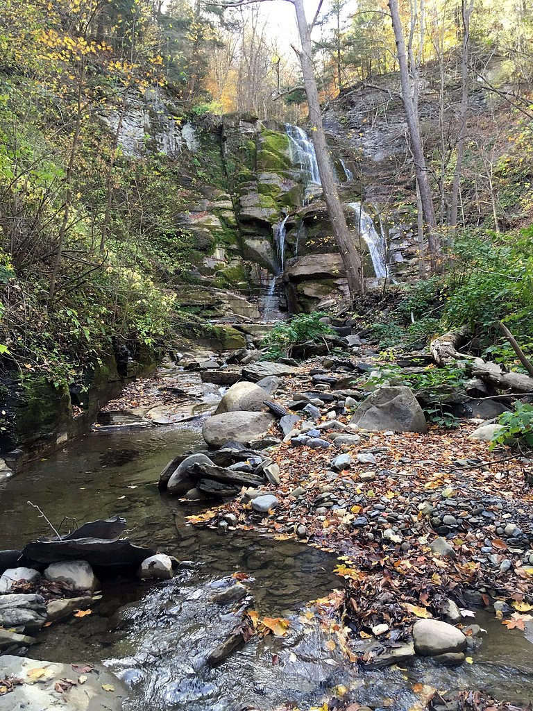
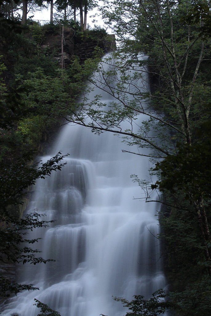
About The Cascades
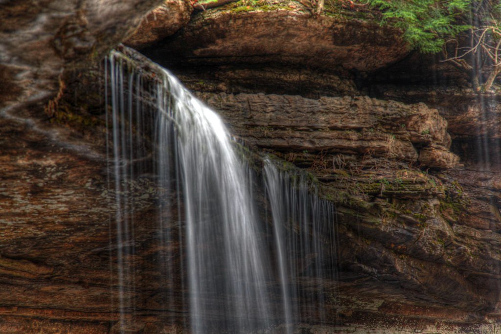
The Cascades is a picturesque waterfall located in the Adirondack region of New York. It is a popular spot for nature enthusiasts and photographers due to its serene surroundings and cascading water over rocky terrain. The waterfall is part of a larger natural area, offering opportunities for hiking and exploration.
The Setting
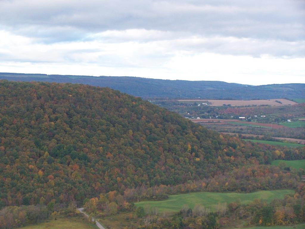
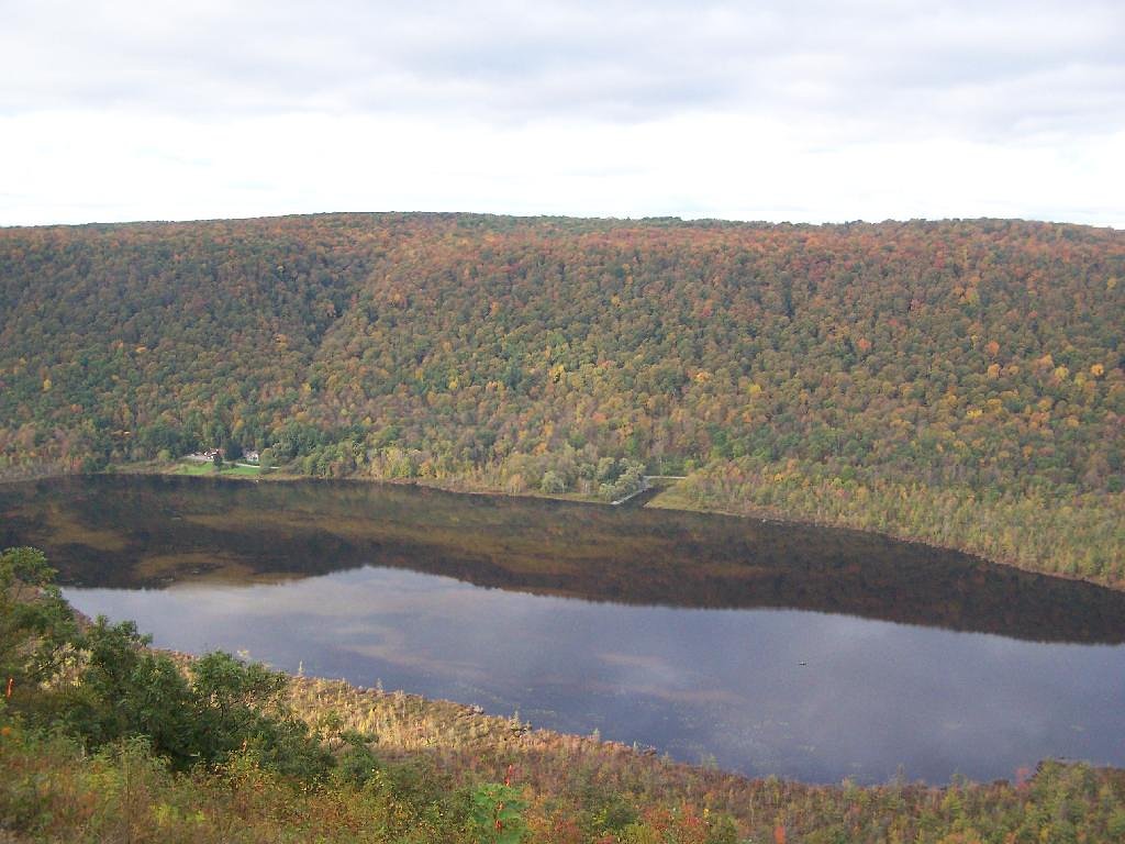
The Cascades sits at 1,220 feet along the Onondaga Creek, in the foothills of New York.
Nearby Falls Worth Visiting
Pratts Falls (137 ft) lies 5.9 miles to the northeast. Also nearby: Tinker Falls (50 ft, 5.6 mi) and Brickyard Falls (20 ft, 9.4 mi).
Trail & Hike Details
The Approach
The moderate 2.4-mile out-and-back trail gains 350 feet of elevation on the way to the falls.
Trail Description
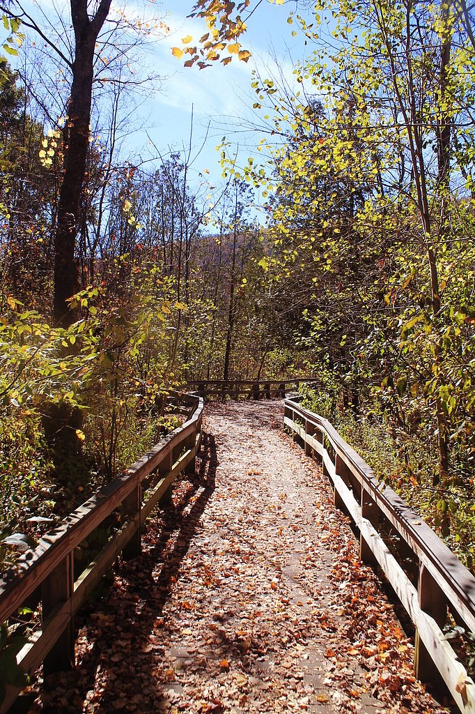
The trail to The Cascades is short and relatively flat, making it suitable for most visitors. It follows a well-trodden path through a wooded area, leading directly to the waterfall. The trail may be muddy or slippery after rain, so proper footwear is recommended.
What to Expect
Dogs are welcome.
Accessibility
The trail is not wheelchair accessible. Uneven terrain and elevation changes require steady footing.
Frequently Asked Questions
🐶 Are Dogs Allowed at The Cascades?
✅ Dogs are allowed
Are There Any Fees or Permits Required?
🆖 No fees required
🏊 Is There Swimming at The Cascades?
❌ Swimming is not allowed
When to Visit
Spring and early summer are ideal for visiting, as the waterfall flow is strongest due to snowmelt and rainfall.
Seasonal Access
The best time to visit is Spring, Summer, and Fall. Winter access may be limited.
Safety Information
The rocks near the waterfall can be slippery. Exercise caution when approaching the water. Be prepared for changing weather conditions in the Adirondacks.
Current Water Conditions
65 ft³/s
Current discharge — how much water is flowing
About average for this time of year
Based on 74 years of record
1.96 ft
Water depth at gauge
7-Day Discharge Trend
What does this mean for your visit?
Flow is about average for this time of year.
About This Gauge
This gauge is on a nearby waterway and may not reflect exact conditions at the falls.
7-Day Flow Outlook
Based on the USGS gauge ONONDAGA CREEK AT DORWIN AVENUE, SYRACUSE NY (15 km away).
Today
Moderate
74 cfs
4/10Tomorrow
Low
65 cfs
6/10Fri
Moderate
71 cfs
4/10Sat
Moderate
74 cfs
4/10Sun
Moderate
71 cfs
4/10Mon
Moderate
69 cfs
5/10Tue
Moderate
67 cfs
5/10Best window: Tomorrow — low flow, sunny (trip score 6/10).
Best time of year: this gauge typically runs highest from late February to mid May, peaking in April.
How we calculate this
This is a transparent outlook, not a precise forecast. We take the waterfall's current flow strength (how it ranks against its historical normal for today, from the nearest USGS stream gauge), carry that ranking forward along the gauge's seasonal curve, and nudge it for forecast rain. Confidence is highest for the next day or two and falls further out. Always check official conditions and your own judgment before visiting — high flows can be dangerous.
Know when to go.
Get a free email alert when waterfalls near Nedrow hit peak flow. We only send when conditions are worth the trip — no weekly newsletters, no spam.
Weather Forecast
Location & Access
Getting There
The Cascades is located near Keene Valley in the Adirondack Mountains. It is accessible via Route 73, with a small pull-off area for parking nearby.
Get Directions on Google MapsParking
Limited roadside parking is available along Route 73. Arrive early during peak seasons to secure a spot.
Elevation
1,220 feet above sea level
Coordinates
42.861734° N, -76.062979° W
Visitor Tips & Gear
Visit early in the morning or on weekdays to avoid crowds. Wear sturdy shoes, as the trail can be muddy. Bring a camera to capture the scenic beauty.
As an Amazon Associate, we earn from qualifying purchases.
With 2.4 miles and 350 ft of elevation gain, sturdy boots and trekking poles will help on this moderate trail. Sun exposure on the trail makes good sun protection a must in summer.

Polarized Sunglasses (Knockaround)
Cuts glare off the water so you actually see the falls — and your photos turn out better too.

Columbia Watertight II Rain Jacket
Packs into its own pocket, seam-sealed, and keeps you dry from spray and surprise rain.

Earth Pak Waterproof Dry Bag
Keeps your phone and gear dry when waterfall mist soaks everything else.

Waterproof Phone Pouch (AiRunTech)
Cheap insurance — take photos right next to the falls without killing your phone.

Timberland Euro Sprint Mid Waterproof
Trusted waterproof boot with premium leather and grippy rubber sole — reliable on rocky, wet trails.

TrailBuddy Trekking Poles
Lightweight aluminum, cork grips, and flip-locks that actually hold — a best-seller for good reason.
Where to Stay

Westcott Suite Apartments

Comfort Inn & Suites Syracuse-Carrier Circle

Holiday Inn Express Syracuse-Fairgrounds by IHG

Collegian Hotel & Suites, Trademark Collection by Wyndham
Browse vacation cabins and private rentals nearby
Unique outdoor stays — tents, yurts, and treehouses
Rent a campervan or RV for your waterfall road trip
Some links are affiliate links. We may earn a commission at no extra cost to you.
Additional Information
Nearby Attractions
Other nearby attractions include Roaring Brook Falls, Chapel Pond, and the High Peaks hiking trails.
Wildlife
The area is home to various wildlife, including birds, deer, and small mammals. Be cautious of ticks during warmer months.
Cities near The Cascades
Nearby Waterfalls

Other waterfalls named The Cascades
3 other waterfalls share this name across the U.S.
Writing about The Cascades? Embed this waterfall on your site for free.