Photo Credits (5)
Difficulty
Moderate
Trail Length
2.0 miles
Trail Type
Out And Back
Elevation Gain
300 ft
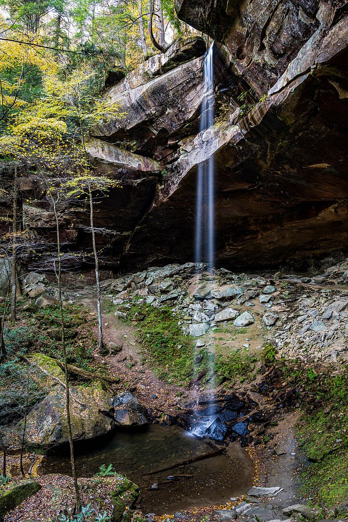
About The Big Falls
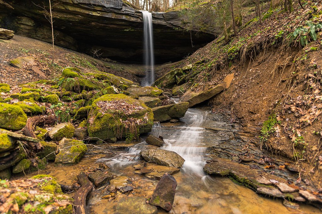
The Big Falls is a scenic waterfall in Kentucky prized for its wooded setting and peaceful cascade. The approach rewards hikers with close-up views of the falls and a quiet atmosphere that makes it popular with weekend hikers and nature lovers. The site sits within the Fort Knox land unit — a military (MIL) property owned by DESG and managed by the U.S. Department of Defense — so plan ahead and confirm access before you go. The hike to the falls is a moderate out-and-back route of about 2.0 miles round-trip with roughly 300 feet of elevation gain. The trail threads through forested terrain with dirt and rocky tread that can get muddy or slippery after rain; it’s generally well-marked and offers pleasant viewpoints on your way to the waterfall, which is the highlight of the outing.
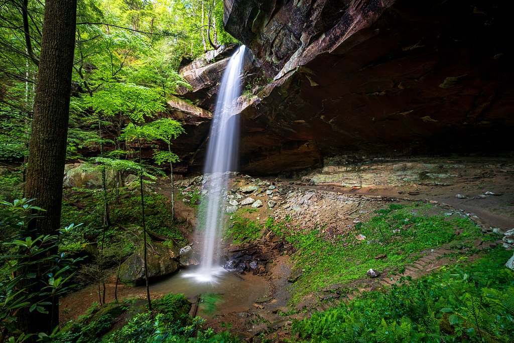
The Setting
The Big Falls sits at 499 feet within Fort Knox, fed by the Pond Creek, in the coastal lowlands of Kentucky.
Trail & Hike Details
The Approach
The moderate 2.0-mile out-and-back trail gains 300 feet of elevation on the way to the falls.
Trail Description
Distance: 2.0 miles (out-and-back). Elevation gain: ~300 feet. Difficulty: moderate. The trail surface alternates between dirt and rocky sections and is well-marked for most of the route. Expect a steady, moderate grade as you climb toward the falls; the tread can become muddy and slippery after wet weather, so sturdy footwear with good traction is recommended. This non-technical hike is straightforward and leads directly to the waterfall viewpoint — check Fort Knox/DOD access rules before setting out.
What to Expect
Dogs are welcome.
Accessibility
The trail is not wheelchair accessible. Uneven terrain and elevation changes require steady footing.
Frequently Asked Questions
🐶 Are Dogs Allowed at The Big Falls?
✅ Dogs are allowed
Are There Any Fees or Permits Required?
🆖 No fees required
🏊 Is There Swimming at The Big Falls?
❌ Swimming is not allowed
When to Visit
Spring and early summer are the best times to visit, as the waterfall is likely to have a stronger flow due to seasonal rainfall.
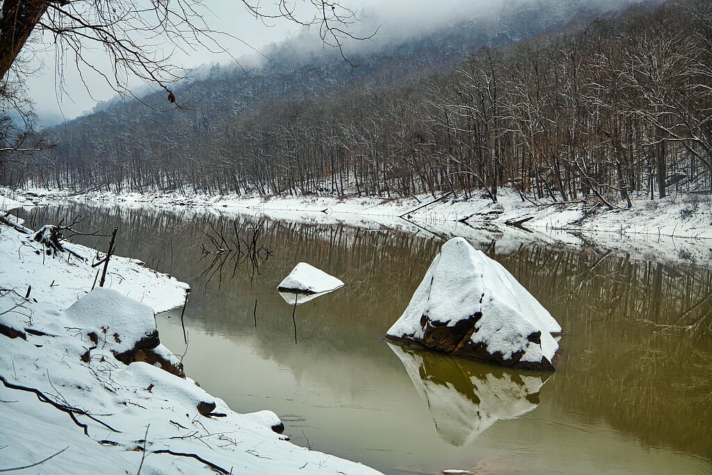
Seasonal Access
The best time to visit is Spring, Summer, and Fall. Winter access may be limited.
Safety Information
Visitors should exercise caution on the trail, especially near the waterfall, as rocks can be slippery. Be prepared for changing weather conditions and carry a map or GPS device. Cell service may be limited in the area.
Current Water Conditions
39 ft³/s
Current discharge — how much water is flowing
About average for this time of year
Based on 27 years of record
4.59 ft
Water depth at gauge
77°F
ComfortablePleasant for swimming
7-Day Discharge Trend
What does this mean for your visit?
Flow is about average for this time of year. The water is a comfortable 77 degrees F, pleasant for swimming. Expect adequate dissolved oxygen levels. PH is normal at 8.0 and mineral content is moderate.
Water Quality
Dissolved Oxygen
GoodAdequate oxygen levels
pH
NormalWithin healthy range (6.5-8.5)
Conductance
Dissolved minerals in the water
About This Gauge
This gauge is on a nearby waterway and may not reflect exact conditions at the falls.
7-Day Flow Outlook
Based on the USGS gauge POND CREEK AT PENDLETON ROAD NEAR LOUISVILLE, KY (22 km away).
Today
Barely Flowing
39 cfs
4/10Tomorrow
Barely Flowing
29 cfs
4/10Sat
Barely Flowing
73 cfs
4/10Sun
Barely Flowing
52 cfs
4/10Mon
Barely Flowing
54 cfs
4/10Tue
Barely Flowing
36 cfs
4/10Wed
Barely Flowing
31 cfs
4/10Best window: Today — barely flowing flow (trip score 4/10).
Best time of year: this gauge typically runs highest from mid February to late March, peaking in May.
How we calculate this
This is a transparent outlook, not a precise forecast. We take the waterfall's current flow strength (how it ranks against its historical normal for today, from the nearest USGS stream gauge), carry that ranking forward along the gauge's seasonal curve, and nudge it for forecast rain. Confidence is highest for the next day or two and falls further out. Always check official conditions and your own judgment before visiting — high flows can be dangerous.
Know when to go.
Get a free email alert when waterfalls near Fort Knox hit peak flow. We only send when conditions are worth the trip — no weekly newsletters, no spam.
Weather Forecast
Location & Access
Getting There
The Big Falls is located within a forested area in Kentucky. Access typically involves driving to a nearby parking area and hiking to the falls. Specific directions may vary depending on the trailhead used.
Get Directions on Google MapsParking
Parking is available near the trailhead, but spaces may be limited during peak seasons. Visitors are advised to arrive early to secure a spot.
Elevation
499 feet above sea level
Coordinates
37.899766° N, -86.025068° W
Land Management
Managed by DOD
Visitor Tips & Gear
Wear sturdy hiking shoes, especially after rain, as the trail can be slippery. Bring water and snacks, and consider visiting early in the day to avoid crowds. Check weather conditions before heading out.
As an Amazon Associate, we earn from qualifying purchases.
With 2.0 miles and 300 ft of elevation gain, sturdy boots and trekking poles will help on this moderate trail. Sun exposure on the trail makes good sun protection a must in summer.

Polarized Sunglasses (Knockaround)
Cuts glare off the water so you actually see the falls — and your photos turn out better too.

Columbia Watertight II Rain Jacket
Packs into its own pocket, seam-sealed, and keeps you dry from spray and surprise rain.

Earth Pak Waterproof Dry Bag
Keeps your phone and gear dry when waterfall mist soaks everything else.

Waterproof Phone Pouch (AiRunTech)
Cheap insurance — take photos right next to the falls without killing your phone.

Timberland Euro Sprint Mid Waterproof
Trusted waterproof boot with premium leather and grippy rubber sole — reliable on rocky, wet trails.

TrailBuddy Trekking Poles
Lightweight aluminum, cork grips, and flip-locks that actually hold — a best-seller for good reason.
Where to Stay

Golden Manor Inn & Suites

Greenfield Inn & Suites Elizabethtown, KY I65 Exit 94

Quality Inn & Suites Brandenburg - Fort Knox

Country Inn & Suites Etown
Browse vacation cabins and private rentals nearby
Unique outdoor stays — tents, yurts, and treehouses
Rent a campervan or RV for your waterfall road trip
Some links are affiliate links. We may earn a commission at no extra cost to you.
Additional Information
Nearby Attractions
Nearby attractions may include other hiking trails, scenic overlooks, and local parks. Visitors can explore the surrounding area for additional outdoor activities.
Wildlife
The area is home to a variety of wildlife, including birds, deer, and small mammals. Visitors should be cautious and respectful of the natural habitat.
Cities near The Big Falls
Writing about The Big Falls? Embed this waterfall on your site for free.