Photo Credits (4)
Difficulty
Moderate
Trail Length
2.4 miles
Trail Type
Out And Back
Elevation Gain
350 ft
About Tappan Falls
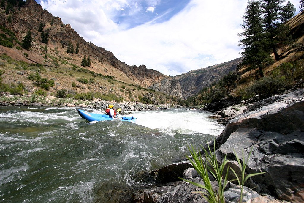
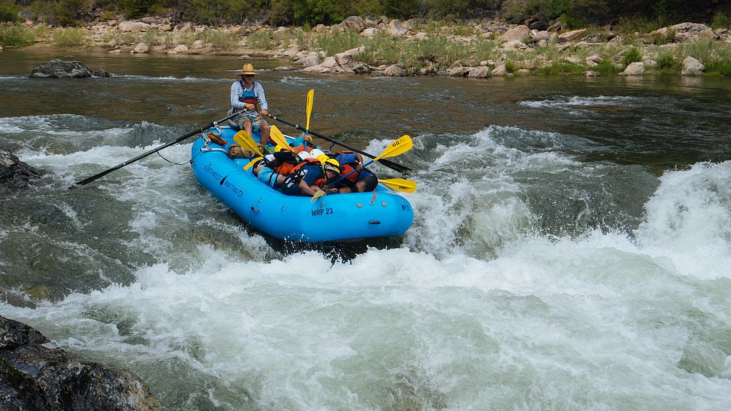
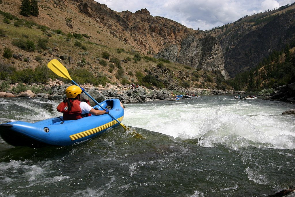
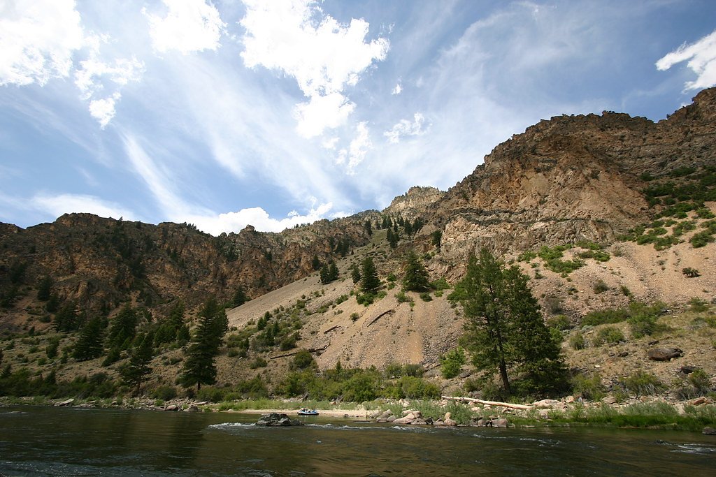
Tappan Falls is a scenic cascade on the Middle Fork of the Salmon River, tucked inside the Challis National Forest and managed by the U.S. Forest Service. The falls are a favorite waypoint for river rafters and paddlers exploring the remote Salmon River corridor; from the water you get the best close-up views of the drop and the rugged canyon walls that surround it. While the falls sit on public National Forest land, there isn’t a formally maintained spur trail from the river to the base, so most visitors arrive by boat.
The Setting
Tappan Falls sits at 3,819 feet within Challis National Forest, fed by the Mf Salmon River, in the mountains of Idaho.
Trail & Hike Details
The Approach
The moderate hike follows Macarte Ridge (#4097), a 2.4-mile out-and-back trail over natural surface. Expect 350 feet of elevation gain. The trail is moderately developed (Class 2).
USFS Trail
MACARTE RIDGE #4097
Trail Class
Moderately Developed
Surface
USFS Segment
6.02 miTrail Description
Overland access to Tappan Falls is limited, but hikers can approach the general area via the USFS Macarte Ridge Trail (Trail #4097). The official Macarte Ridge route is recorded as Class 2 on USFS maps with a native-material tread and a GIS length of about 6.02 miles. A commonly used hiking approach to viewpoints near the falls is roughly a 2.4-mile out-and-back with about 350 feet of elevation gain (moderate difficulty); the native-surface route averages an approximate 2.8% grade. Note that there is no widely maintained, signed trail that leads directly to the waterfall’s base, so expect simple cross-country sections and route-finding if you leave the established tread.
What to Expect
Visitors can expect to see a series of rapids and a small waterfall along the river. The area is surrounded by rugged wilderness, offering a remote and serene experience.
Accessibility
The trail is not wheelchair accessible. Uneven terrain and elevation changes require steady footing.
Frequently Asked Questions
🐶 Are Dogs Allowed at Tappan Falls?
❌ Dogs are not allowed
Are There Any Fees or Permits Required?
🤑 Fees are required
Permit required
A permit is required to raft the Middle Fork of the Salmon River. Permits are managed by the U.S. Forest Service and must be obtained in advance.
🏊 Is There Swimming at Tappan Falls?
❌ Swimming is not allowed
When to Visit
The best time to visit is during the rafting season, typically from late spring to early fall, when water levels are suitable for river travel.
Seasonal Access
The best time to visit is Spring, Summer, and Fall. Winter access may be limited. Check with Challis National Forest for seasonal road closures.
Safety Information
The area around Tappan Falls can be hazardous due to strong river currents and slippery rocks. Visitors should exercise caution and follow safety guidelines provided by their rafting outfitter.
Current Water Conditions
Based on a USGS gauge 16.9 miles away
2,140 ft³/s
Current discharge — how much water is flowing
About average for this time of year
Based on 36 years of record
3.01 ft
Water depth at gauge
7-Day Discharge Trend
What does this mean for your visit?
Flow is about average for this time of year.
About This Gauge
This gauge is on a regional waterway. Conditions at the falls may differ, especially after local rain.
7-Day Flow Outlook
Based on the USGS gauge MF SALMON RIVER AT MF LODGE NR YELLOW PINE ID (27 km away).
Today
Roaring
2279 cfs
6/10Tomorrow
Roaring
2227 cfs
6/10Tue
Roaring
2235 cfs
6/10Wed
Roaring
2190 cfs
6/10Thu
Roaring
1856 cfs
9/10Fri
Roaring
1914 cfs
6/10Sat
Roaring
1736 cfs
9/10Best window: Thu — roaring flow, mostly sunny (trip score 9/10).
Best time of year: this gauge typically runs highest from mid April to mid July, peaking in May.
How we calculate this
This is a transparent outlook, not a precise forecast. We take the waterfall's current flow strength (how it ranks against its historical normal for today, from the nearest USGS stream gauge), carry that ranking forward along the gauge's seasonal curve, and nudge it for forecast rain. Confidence is highest for the next day or two and falls further out. Always check official conditions and your own judgment before visiting — high flows can be dangerous.
Know when to go.
Get a free email alert when waterfalls near Yellow Pine hit peak flow. We only send when conditions are worth the trip — no weekly newsletters, no spam.
Weather Forecast
Location & Access
Getting There
Tappan Falls is most commonly accessed via rafting trips along the Middle Fork of the Salmon River. There is no direct road access to the falls, and it is typically visited as part of multi-day river expeditions.
Get Directions on Google MapsParking
There is no parking available as the falls are only accessible by river.
Elevation
3,819 feet above sea level
Coordinates
44.878889° N, -114.749444° W
Land Management
Managed by USFS
Visitor Tips & Gear
Plan your visit as part of a guided rafting trip to ensure safe access to the falls. Be prepared for remote conditions and pack accordingly.
As an Amazon Associate, we earn from qualifying purchases.
With 2.4 miles and 350 ft of elevation gain, sturdy boots and trekking poles will help on this moderate trail. Sun exposure on the trail makes good sun protection a must in summer.

Polarized Sunglasses (Knockaround)
Cuts glare off the water so you actually see the falls — and your photos turn out better too.

Columbia Watertight II Rain Jacket
Packs into its own pocket, seam-sealed, and keeps you dry from spray and surprise rain.

Earth Pak Waterproof Dry Bag
Keeps your phone and gear dry when waterfall mist soaks everything else.

Waterproof Phone Pouch (AiRunTech)
Cheap insurance — take photos right next to the falls without killing your phone.

Timberland Euro Sprint Mid Waterproof
Trusted waterproof boot with premium leather and grippy rubber sole — reliable on rocky, wet trails.

TrailBuddy Trekking Poles
Lightweight aluminum, cork grips, and flip-locks that actually hold — a best-seller for good reason.
Where to Stay
Browse vacation cabins and private rentals nearby
Unique outdoor stays — tents, yurts, and treehouses
Rent a campervan or RV for your waterfall road trip
Some links are affiliate links. We may earn a commission at no extra cost to you.
Nearby Campground
YELLOWJACKET GUARD STATION
15.3 miles away · 1 sites
Overview Yellowjacket Guard Station is a historic Forest Service Ranger Station and Work Center. Originally constructed in 1925 and remodeled in 1934 by the Civilian Conservation Corps, the structure is eligible for listing on the National Register of Historic Places. Recreation Hikers, horseback riders, mountain bikers and off-road enthusiasts will find many trails in the surrounding area. Hunting is also a popular activity. Click here for an Idaho OHV safety messageFacilities The spacious guard
Book on Recreation.govNearby Hot Springs
Hot springs near Yellow Pine, Idaho
Hospital Hot Spring
Hospital Hot Spring flows at 115°F deep in the Boise National Forest backcountry, requiring a genuine hike of over two miles fr...
Mormon Ranch Warm Spring
Mormon Ranch Warm Spring requires a three-mile hike into Idaho's Salmon National Forest, rewarding backcountry travelers with 1...

Lower Loon Creek Hot Spring
Lower Loon Creek Hot Spring emerges at 120 degrees Fahrenheit along Loon Creek in the Challis National Forest, one of central I...
Forge Creek Hot Springs
Forge Creek Hot Springs requires a committed 3.6-mile hike from the nearest road to reach its source at 5,920 feet in the Salmo...
Cox Hot Springs
Cox Hot Springs requires a 2.7-mile hike into Boise National Forest to reach, making it one of the more committed outings among...
Owen Cabin Hot Spring
Owen Cabin Hot Spring demands a five-mile backcountry hike to reach 133°F waters at 5,080 feet in Challis National Forest, Cust...
Looking for a soak after your hike? Explore more hot springs near Yellow Pine, Idaho on SoakingSprings.
Explore Idaho springsAdditional Information
Nearby Attractions
The Middle Fork of the Salmon River offers numerous rapids, hot springs, and scenic campsites.
Wildlife
The area is home to a variety of wildlife, including deer, elk, black bears, and numerous bird species.
Cities near Tappan Falls
Writing about Tappan Falls? Embed this waterfall on your site for free.