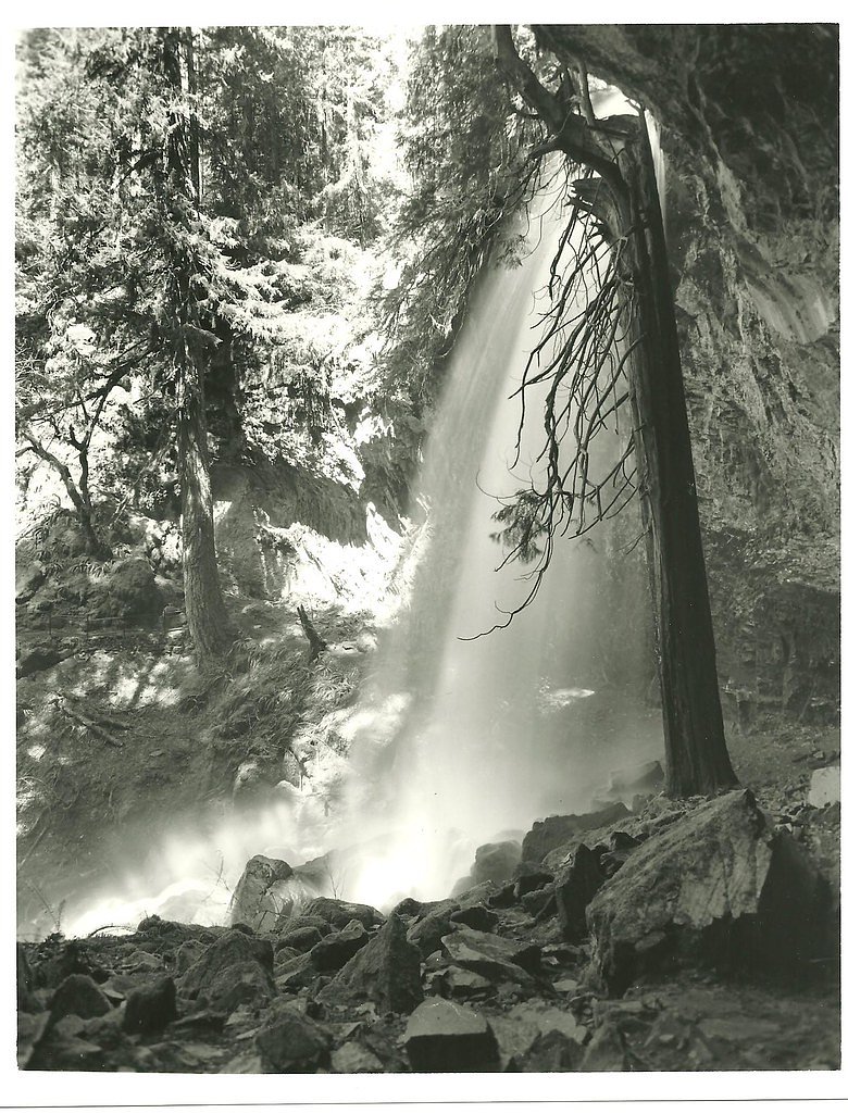
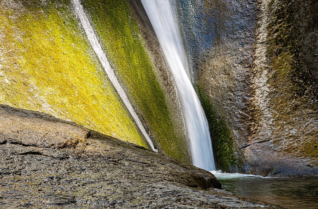
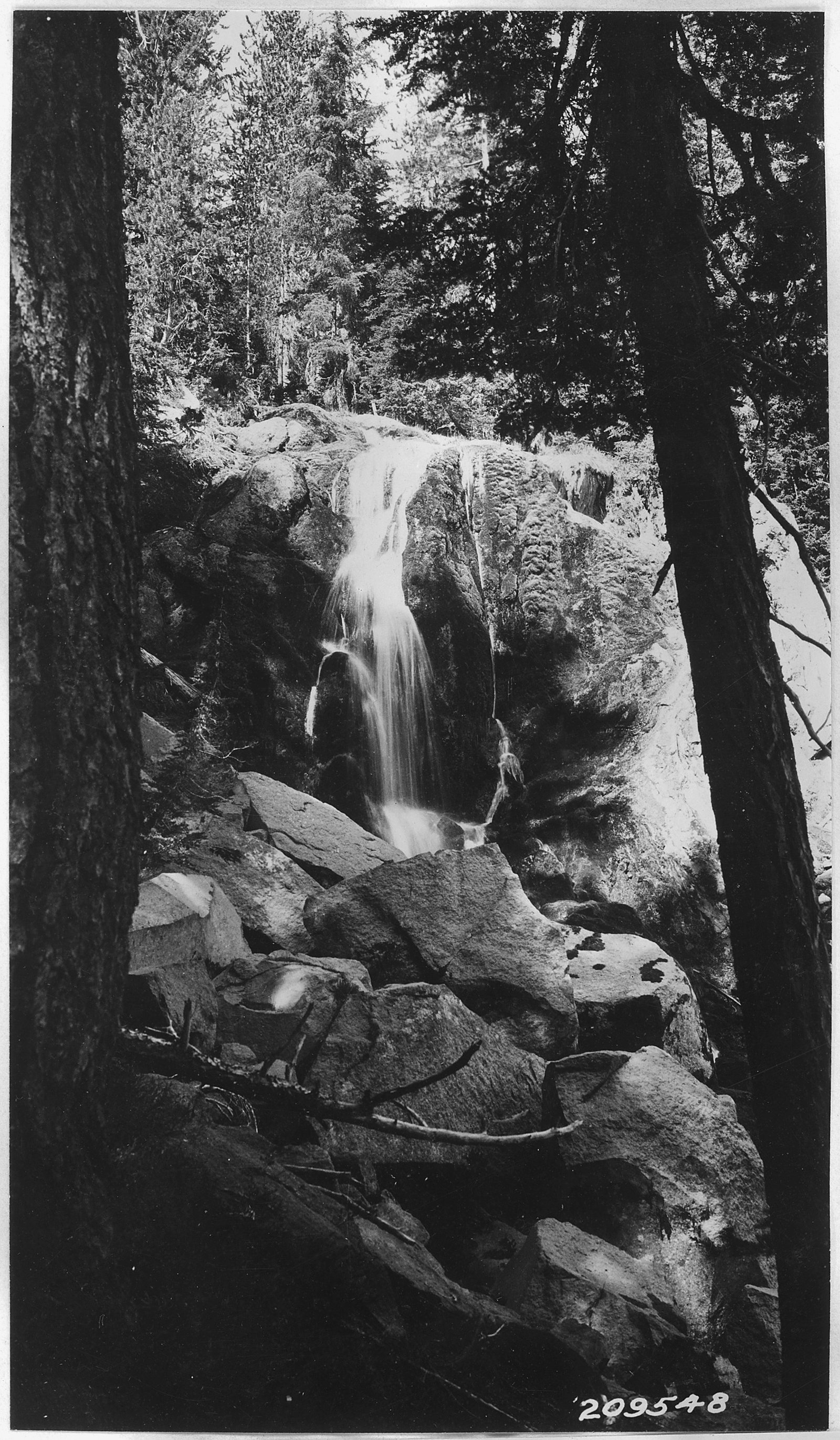
Susan Creek Falls
Oregon • 50 ft
By Armen Suny · Last verified Mar 2026
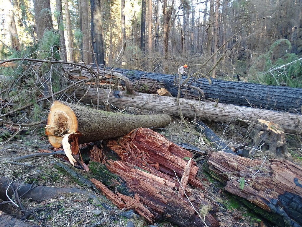

Photo Credits (5)
Difficulty
Easy
Trail Length
1.5 miles
Trail Type
Out And Back
Elevation Gain
200 ft
About Susan Creek Falls
Susan Creek Falls is a 50-foot cascade tucked into the Umpqua National Forest in Douglas County, Oregon. Nestled among towering Douglas-fir and a lush fern understory, the falls offer an accessible, scenic reward for a short hike and are a popular spot for photographers and families. The area is part of a cascade-rich corridor on the North Umpqua River; nearby Emile and Grotto Falls sit roughly two to five miles away, making this stretch ideal for sampling several waterfalls in a single outing (Wikipedia).
The Setting
Susan Creek Falls sits at 2,103 feet along the Rock Creek, in the hills of Oregon. The falls drop 50 feet.
Height: 50 feet
Nearby Falls Worth Visiting
Hemlock Falls (90 ft) lies 11.6 miles to the southeast. Also nearby: Wolf Creek Falls (75 ft, 8.4 mi) and Grotto Falls (25 ft, 6.8 mi).
Trail & Hike Details
The Approach
The easy 1.5-mile out-and-back trail gains 200 feet of elevation on the way to the falls.
Trail Description
This is an easy, out-and-back hike of about 1.5 miles with roughly 200 feet of elevation gain, managed within Umpqua National Forest. The well-maintained, family-friendly path follows a gentle grade through Douglas-fir and fern forest; a wooden bridge crosses Susan Creek near the waterfall and provides an excellent viewing spot of the 50-foot drop. Susan Creek Campground is about 4.03 km from the trailhead for those planning to camp nearby—expect short, mostly gentle climbs and watch for wet or slippery rock near the creek.
What to Expect
The falls drop 50 feet. Dogs are welcome.
Accessibility
The trail is not wheelchair accessible. Uneven terrain and elevation changes require steady footing.
Frequently Asked Questions
🐶 Are Dogs Allowed at Susan Creek Falls?
✅ Dogs are allowed
Are There Any Fees or Permits Required?
🆖 No fees required
🏊 Is There Swimming at Susan Creek Falls?
❌ Swimming is not allowed
When to Visit
Spring is the best time to visit, as the waterfall is at its fullest due to snowmelt. However, the trail is accessible and enjoyable year-round.
Seasonal Access
The best time to visit is Spring, Summer, Fall, and Winter.
Safety Information
Be cautious of slippery rocks near the waterfall, especially after rain. Stay on the designated trail to avoid damaging the environment or getting lost.
Current Water Conditions
33 ft³/s
Current discharge — how much water is flowing
Much lower than usual for this time of year
Based on 21 years of record
1.46 ft
Water depth at gauge
67°F
CoolRefreshing for swimming
7-Day Discharge Trend
What does this mean for your visit?
Flow is well below normal for this time of year, so the waterfall may be a trickle. Water temperature is a refreshing 67 degrees F, good for a quick swim.
About This Gauge
This gauge is on a nearby waterway and may not reflect exact conditions at the falls.
7-Day Flow Outlook
Based on the USGS gauge ROCK CREEK NEAR GLIDE, OR (8 km away).
Today
Low
38 cfs
3/10Tomorrow
Moderate
40 cfs
4/10Sun
Low
37 cfs
4/10Mon
Barely Flowing
33 cfs
5/10Tue
Low
33 cfs
4/10Wed
Barely Flowing
32 cfs
5/10Thu
Low
32 cfs
4/10Best window: Mon — barely flowing flow, partly sunny (trip score 5/10).
Best time of year: this gauge typically runs highest from mid March to early April, peaking in January.
How we calculate this
This is a transparent outlook, not a precise forecast. We take the waterfall's current flow strength (how it ranks against its historical normal for today, from the nearest USGS stream gauge), carry that ranking forward along the gauge's seasonal curve, and nudge it for forecast rain. Confidence is highest for the next day or two and falls further out. Always check official conditions and your own judgment before visiting — high flows can be dangerous.
Know when to go.
Get a free email alert when waterfalls near Glide hit peak flow. We only send when conditions are worth the trip — no weekly newsletters, no spam.
Weather Forecast
Location & Access
Getting There
Susan Creek Falls is located off Highway 138, also known as the Rogue-Umpqua Scenic Byway. The trailhead is well-marked and situated near the Susan Creek Campground.
Get Directions on Google MapsParking
There is a designated parking area at the trailhead, which can accommodate several vehicles. Parking is free, but it may fill up during peak seasons.
Elevation
2,103 feet above sea level
Coordinates
43.332910° N, -122.893239° W
Visitor Tips & Gear
Wear sturdy, waterproof shoes, especially during the rainy season. Arrive early to secure parking, as the lot can fill up quickly. Bring a camera to capture the scenic beauty of the falls and surrounding forest.
As an Amazon Associate, we earn from qualifying purchases.
This easy 1.5 miles hike is straightforward — comfortable trail shoes and plenty of water should do. Icy conditions are common in winter — traction cleats are a smart addition.

Columbia Watertight II Rain Jacket
Packs into its own pocket, seam-sealed, and keeps you dry from spray and surprise rain.

Polarized Sunglasses (Knockaround)
Cuts glare off the water so you actually see the falls — and your photos turn out better too.

Earth Pak Waterproof Dry Bag
Keeps your phone and gear dry when waterfall mist soaks everything else.

Waterproof Phone Pouch (AiRunTech)
Cheap insurance — take photos right next to the falls without killing your phone.

Kahtoola MICROspikes
Cult-favorite traction cleats that grip ice and wet rock — essential for winter waterfall hikes.

JOBY GorillaPod Starter Kit
Wraps around railings and rocks for long-exposure waterfall shots — no flat surface needed.
Where to Stay

Umpqua's Last Resort - Wilderness Cabins, RV Park & Glamping

The Lodge at Roseburg

BEST WESTERN PLUS Hartford Lodge

Riverfront Inn Roseburg
Browse vacation cabins and private rentals nearby
Unique outdoor stays — tents, yurts, and treehouses
Rent a campervan or RV for your waterfall road trip
Some links are affiliate links. We may earn a commission at no extra cost to you.
Nearby Campground
Susan Creek Campground
2.5 miles away · 29 sites
Overview Susan Creek Campground is well known for its beautiful setting along the emerald-green waters of the North Umpqua Wild and Scenic River. Nestled under the canopy of a mature forest, the campsites are surrounded by trees up to seven feet in diameter. It is a short drive from the Umpqua National Forest, which boasts incredible glacial-cut mountain slopes across 984,602 acres of forest. The campground features 29 campsites, all sites are reservation only until further notice.Reservations ca
Book on Recreation.govNearby Hot Springs
Hot springs near Glide, Oregon

Umpqua Hot Springs
Umpqua Hot Springs flows at 117°F from multiple geothermal sources along the North Umpqua River in Lane County, forming cascadi...
Kitson Hot Springs
Kitson Hot Springs flows at 109°F within Willamette National Forest at 1,664 feet elevation, positioned just 17 meters from For...

Mccredie Springs
McCredie Springs flows at 163°F along Salt Creek in the Willamette National Forest, creating one of western Oregon's most popul...
Wall Creek Warm Springs
Wall Creek Warm Springs flows at 106°F deep within Willamette National Forest at 2,362 feet elevation on the western Cascades s...

Annie Spring
Annie Spring flows at 77°F within Crater Lake National Park at 5,983 feet elevation, discharging 1.71 cubic feet per second at ...
Looking for a soak after your hike? Explore more hot springs near Glide, Oregon on SoakingSprings.
Explore Oregon springsAdditional Information
Nearby Attractions
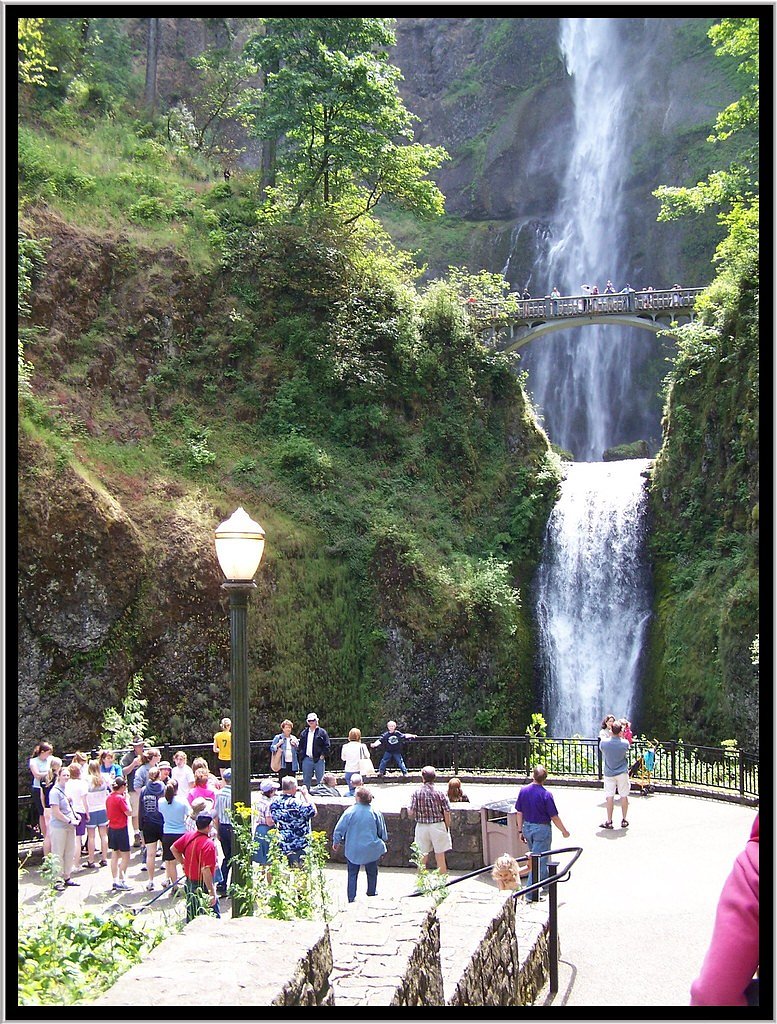
Nearby attractions include Toketee Falls, Watson Falls, and the Umpqua Hot Springs, all located along the Rogue-Umpqua Scenic Byway.
Wildlife
The area is home to a variety of wildlife, including birds, deer, and small mammals. Keep an eye out for banana slugs and other forest creatures along the trail.
Cities near Susan Creek Falls
Nearby Waterfalls
Writing about Susan Creek Falls? Embed this waterfall on your site for free.