Photo Credits (1)
Difficulty
Moderate
Trail Length
2.4 miles
Trail Type
Out And Back
Elevation Gain
350 ft
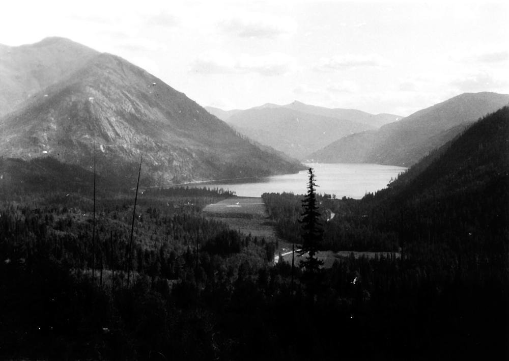
About Sullivan Falls
Sullivan Falls sits on the Sullivan River in Sullivan, Maine, offering a peaceful, picture-postcard cascade that draws locals and day visitors looking for a quiet nature escape. The falls are best appreciated up close, where the rushing water and wooded surroundings create a scenic spot for photography, a short picnic, or a restorative stop during a coastal Maine outing. Access to the falls is achieved via a modest hike: the commonly used approach is a 2.4-mile out-and-back route with approximately 350 feet of elevation gain and a moderate difficulty rating. The tread can be uneven and portions of the route are faint or unmarked, so bring sturdy footwear and basic route-finding sense. There are limited developed facilities at the site; the nearest maintained campground is Schoodic Woods Campground, about 19.6 km away.
Trail & Hike Details
The Approach
The moderate 2.4-mile out-and-back trail gains 350 feet of elevation on the way to the falls.
Trail Description
Length: 2.4 miles round-trip (out-and-back). Elevation gain: about 350 feet. Difficulty: Moderate. Trail type: out-and-back. Surface and official USFS trail class/number are not available for this route; hikers should expect uneven footing and sections that may be faint or unmarked, requiring basic navigation and stable footwear.
What to Expect
Visitors can expect a serene natural setting with cascading waters and a peaceful atmosphere. The area may be surrounded by forested landscapes and is ideal for photography or quiet reflection.
Accessibility
The trail is not wheelchair accessible. Uneven terrain and elevation changes require steady footing.
Frequently Asked Questions
🐶 Are Dogs Allowed at Sullivan Falls?
❌ Dogs are not allowed
Are There Any Fees or Permits Required?
🆖 No fees required
🏊 Is There Swimming at Sullivan Falls?
❌ Swimming is not allowed
When to Visit
Spring and early summer are ideal for visiting Sullivan Falls, as water flow is typically higher due to snowmelt and rainfall.
Seasonal Access
The best time to visit is Spring, Summer, and Fall. Winter access may be limited.
Safety Information
Exercise caution near the water, as rocks can be slippery. Be aware of changing water levels, especially after heavy rain.
Current Water Conditions
1 ft³/s
Current discharge — how much water is flowing
About average for this time of year
Based on 20 years of record
1.68 ft
Water depth at gauge
7-Day Discharge Trend
What does this mean for your visit?
Flow is about average for this time of year.
About This Gauge
This gauge is on a nearby waterway and may not reflect exact conditions at the falls.
7-Day Flow Outlook
Based on the USGS gauge Otter Creek near Bar Harbor, Maine (21 km away).
Today
Moderate
1 cfs
6/10Tomorrow
Moderate
2 cfs
6/10Mon
Moderate
2 cfs
8/10Tue
Moderate
2 cfs
6/10Wed
Moderate
1 cfs
6/10Thu
Moderate
1 cfs
6/10Fri
Moderate
1 cfs
6/10Best window: Mon — moderate flow, patchy fog then sunny (trip score 8/10).
Best time of year: this gauge typically runs highest from early March to late April, peaking in April.
How we calculate this
This is a transparent outlook, not a precise forecast. We take the waterfall's current flow strength (how it ranks against its historical normal for today, from the nearest USGS stream gauge), carry that ranking forward along the gauge's seasonal curve, and nudge it for forecast rain. Confidence is highest for the next day or two and falls further out. Always check official conditions and your own judgment before visiting — high flows can be dangerous.
Know when to go.
Get a free email alert when waterfalls near Northeast Harbor hit peak flow. We only send when conditions are worth the trip — no weekly newsletters, no spam.
Weather Forecast
Location & Access
Getting There
Sullivan Falls is located near the town of Sullivan, Maine. It can be accessed via local roads, and visitors should use GPS or local maps for precise directions.
Get Directions on Google MapsParking
There is limited parking available near the falls. Visitors should plan to park along the roadside or in designated areas if available.
Elevation
0 feet above sea level
Coordinates
44.520633° N, -68.220848° W
Visitor Tips & Gear
Wear sturdy footwear as the terrain may be uneven. Bring insect repellent during warmer months and check weather conditions before visiting.
As an Amazon Associate, we earn from qualifying purchases.
With 2.4 miles and 350 ft of elevation gain, sturdy boots and trekking poles will help on this moderate trail. Sun exposure on the trail makes good sun protection a must in summer.

Polarized Sunglasses (Knockaround)
Cuts glare off the water so you actually see the falls — and your photos turn out better too.

Columbia Watertight II Rain Jacket
Packs into its own pocket, seam-sealed, and keeps you dry from spray and surprise rain.

Earth Pak Waterproof Dry Bag
Keeps your phone and gear dry when waterfall mist soaks everything else.

Waterproof Phone Pouch (AiRunTech)
Cheap insurance — take photos right next to the falls without killing your phone.

Timberland Euro Sprint Mid Waterproof
Trusted waterproof boot with premium leather and grippy rubber sole — reliable on rocky, wet trails.

TrailBuddy Trekking Poles
Lightweight aluminum, cork grips, and flip-locks that actually hold — a best-seller for good reason.
Where to Stay

Acadia Inn

Atlantic Oceanside Hotel & Conference Center

Oceanfront Hancock Cottage

Holiday Inn Bar Harbor Regency Hotel by IHG
Browse vacation cabins and private rentals nearby
Unique outdoor stays — tents, yurts, and treehouses
Rent a campervan or RV for your waterfall road trip
Some links are affiliate links. We may earn a commission at no extra cost to you.
Nearby Campground
Schoodic Woods Campground
12.2 miles away · 94 sites
Overview For Schoodic Woods campsites, 90 percent of campsites are released six months in advance on the first of each month at 10 am EST. The remaining 10 percent are released at 10 am 14 days ahead of a desired arrival date on a rolling basis. For example, if you plan to arrive on May 24, you can make an online reservation starting at 10 am EST Dec 1 from the first release or starting at 10 am EST on May 10 from the second release. All campsite reservations must be made through recreation.gov.
Book on Recreation.govAdditional Information
Nearby Attractions
Acadia National Park is located nearby and offers additional hiking and scenic opportunities.
Wildlife
The area may feature local wildlife such as birds, deer, and small mammals. Visitors should respect the natural habitat.
Cities near Sullivan Falls
Other waterfalls named Sullivan Falls
1 other waterfall shares this name across the U.S.
Writing about Sullivan Falls? Embed this waterfall on your site for free.