Stoney Pitcher Falls
By Armen Suny · Last verified Oct 2026
LiDAR & 3D terrainDifficulty
Easy
Trail Length
1.0 miles
About Stoney Pitcher Falls
Stoney Pitcher Falls is a tucked-away cascade in New York that rewards visitors with a peaceful, wooded setting away from busier parkland. This lesser-known spot is perfect for hikers and photographers seeking a quiet stretch of nature — the falls themselves offer a scenic finale to a short but satisfying outing. Camping isn’t right at the trailhead; the nearest developed campground is Onoville Marina Park, roughly 40.1 km away, so most visitors make this an easy day trip. Bring sensible footwear for uneven footing and expect a tranquil, low-traffic experience.
Trail & Hike Details
Trail Description
Difficulty: moderate. The route travels through wooded terrain with some uneven and natural surfaces; sections can be rooted and rocky, so basic hiking experience and stable footwear are recommended. The trail is an out-and-back with straightforward navigation and a steady but not extreme climb to the falls.
What to Expect
Visitors can expect a tranquil waterfall surrounded by lush greenery. The area is ideal for photography and enjoying the sounds of nature.
Accessibility
The trail is not wheelchair accessible. Uneven terrain and elevation changes require steady footing.
Frequently Asked Questions
🐶 Are Dogs Allowed at Stoney Pitcher Falls?
❌ Dogs are not allowed
Are There Any Fees or Permits Required?
🆖 No fees required
🏊 Is There Swimming at Stoney Pitcher Falls?
❌ Swimming is not allowed
When to Visit
Spring and early summer are ideal for visiting, as the waterfall flow is typically strongest during these seasons.
Seasonal Access
The best time to visit is Spring, Summer, and Fall. Winter access may be limited.
Safety Information
Be cautious of slippery rocks near the waterfall and avoid getting too close to the edge. Check weather conditions before visiting, as trails may become muddy or hazardous after rain.
Current Water Conditions
These readings come from the USGS gauge on Allegheny River, 12.7 miles away, not on Stoney Pitcher Falls's own stream. Use them as a sign of whether the area is running wet or dry.
360 ft³/s
Current discharge — how much water is flowing
Lower than usual for this time of year
Based on 123 years of record
2.76 ft
Water depth at gauge
7-Day Discharge Trend
What does this mean for your visit?
Flow is lower than usual for this time of year.
About This Gauge
This gauge is on a nearby waterway and may not reflect exact conditions at the falls.
7-Day Flow Outlook
Based on the USGS gauge ALLEGHENY RIVER AT SALAMANCA NY (20 km away).
Today
Barely Flowing
360 cfs
5/10Tomorrow
Barely Flowing
388 cfs
4/10Sat
Barely Flowing
387 cfs
4/10Sun
Barely Flowing
424 cfs
5/10Mon
Barely Flowing
461 cfs
5/10Tue
Barely Flowing
470 cfs
5/10Wed
Barely Flowing
504 cfs
3/10Best window: Today — barely flowing flow, sunny (trip score 5/10).
Best time of year: this gauge typically runs highest from late February to early May, peaking in April.
How we calculate this
This is a transparent outlook, not a precise forecast. We take the waterfall's current flow strength (how it ranks against its historical normal for today, from the nearest USGS stream gauge), carry that ranking forward along the gauge's seasonal curve, and nudge it for forecast rain. Confidence is highest for the next day or two and falls further out. Always check official conditions and your own judgment before visiting — high flows can be dangerous.
Know when to go.
Get a free email alert when waterfalls near Cattaraugus hit peak flow. We only send when conditions are worth the trip — no weekly newsletters, no spam.
Weather Forecast
The Terrain, Seen by LiDAR
Aircraft-mounted lasers measured this ground to within inches. Trees and buildings are digitally stripped away, leaving the bare shape of the land the water has carved.
1-meter lidar measures about 81 feet of drop in the ground within a few hundred feet of Stoney Pitcher Falls. Elevation at the pin is about 1,575 feet.
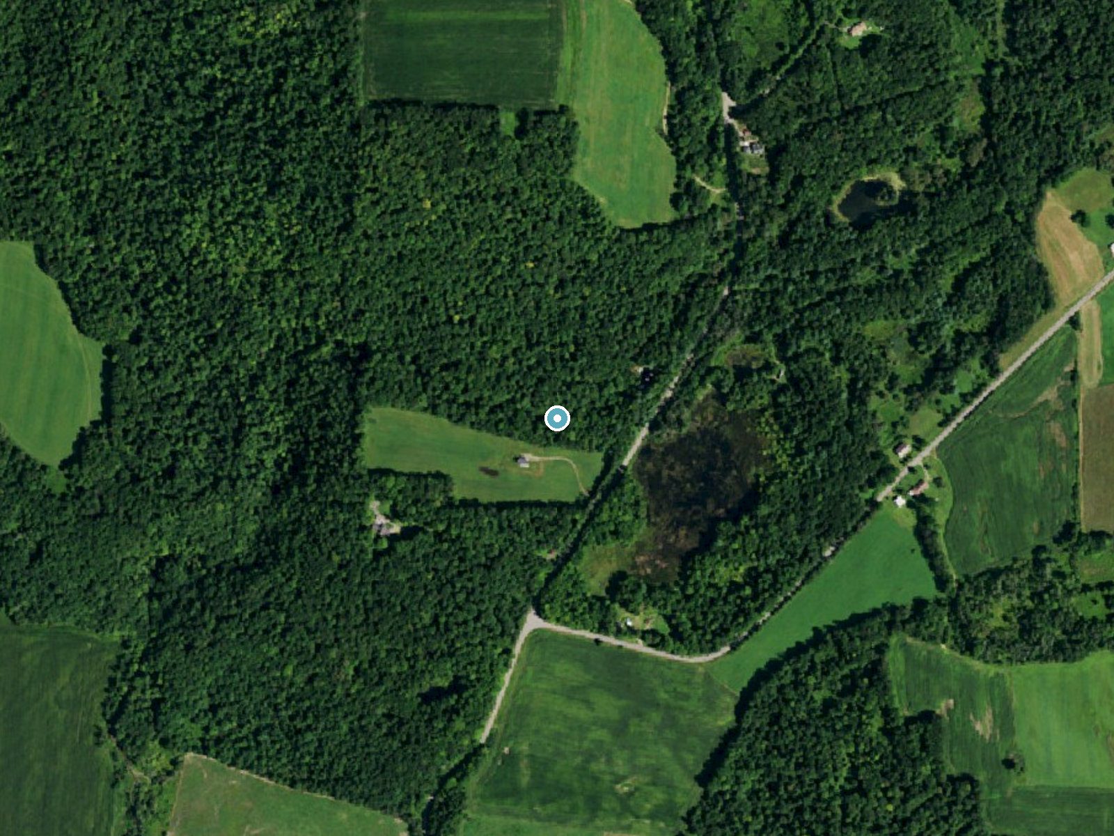
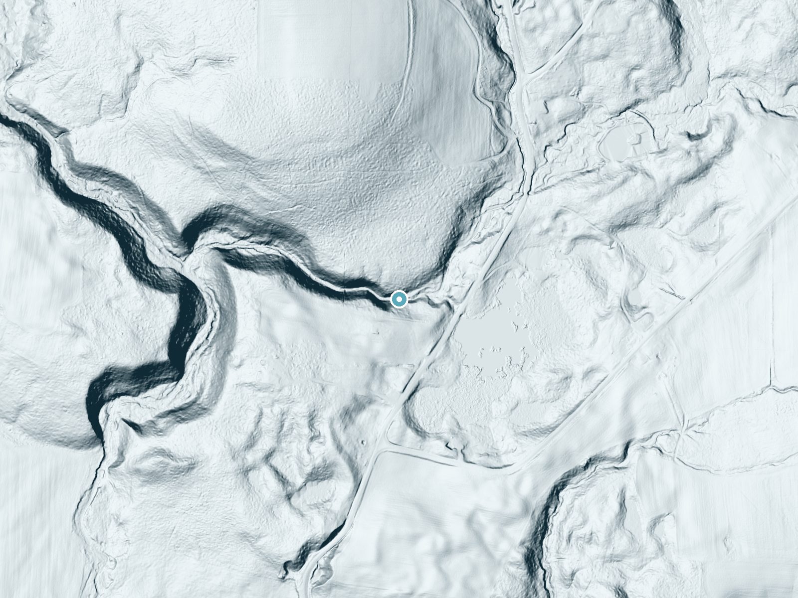
Drag to compare. The dot marks the waterfall. The frame is about a mile across.
- Ground elevation
- 1,575 feet
- Measured by 1-meter lidar
- Drop at the falls
- About 81 feet
- Change in ground height within ~250 feet of the falls
Elevation data: USGS 3D Elevation Program. Aerial imagery: USGS The National Map. Public domain.
Location & Access
Getting There
Stoney Pitcher Falls is located within the Catskill region of New York. Access may require navigating local roads and potentially a short hike, depending on the chosen route.
Get Directions on Google MapsParking
Parking availability is unclear, but visitors may need to park along nearby roads or at designated trailheads.
Elevation
1,572 feet above sea level
Coordinates
42.340341° N, -78.722530° W
Visitor Tips & Gear
Wear sturdy footwear as the trail may be uneven or muddy, especially after rain. Bring water and a camera to capture the scenic views.
Where to Stay

Timberline Lodge, Downtown Ellicottville - Near Ski Resort

Seneca Allegany Resort & Casino

Magnificent Chalet Sweeping Views and Hot Tub

Luxurious 3-Bedroom Townhouse Walk to Village
Browse vacation cabins and private rentals nearby
Unique outdoor stays — tents, yurts, and treehouses
Rent a campervan or RV for your waterfall road trip
Some links are affiliate links. We may earn a commission at no extra cost to you.
Nearby Campground
Onoville Marina Park
24.9 miles away · 0 sites
This recreation area is part of Allegheny Reservoir
Book on Recreation.govAdditional Information
Nearby Attractions
The Catskill Mountains offer numerous hiking trails, scenic viewpoints, and other waterfalls to explore.
Wildlife
The area is home to various bird species, deer, and other small wildlife. Be mindful of your surroundings.
Cities near Stoney Pitcher Falls
Writing about Stoney Pitcher Falls? Embed this waterfall on your site for free.