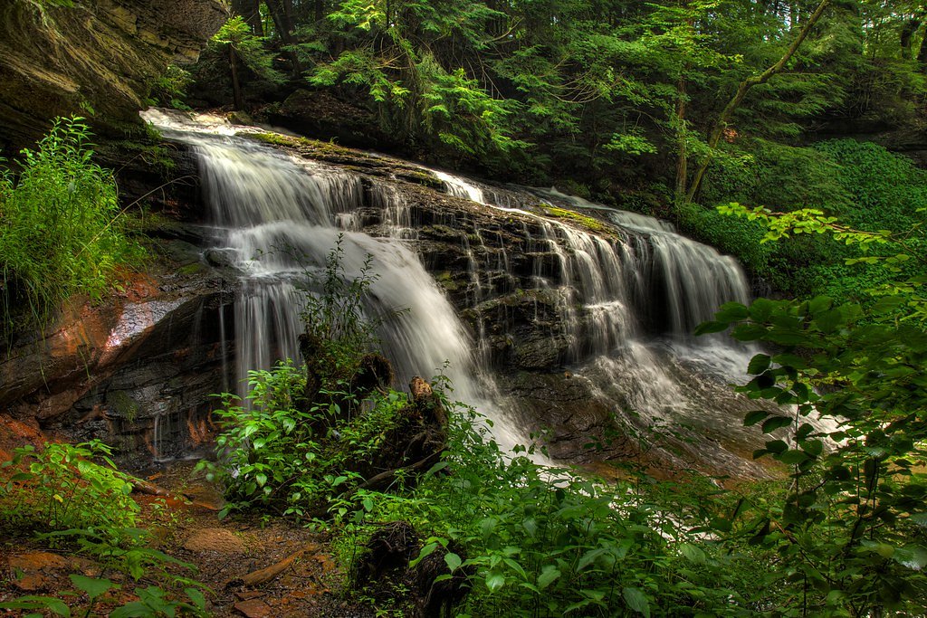
Springfield Falls
Pennsylvania • 20 ft
By Armen Suny · Last verified Mar 2026
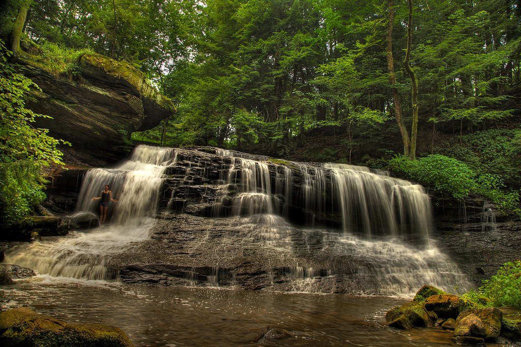
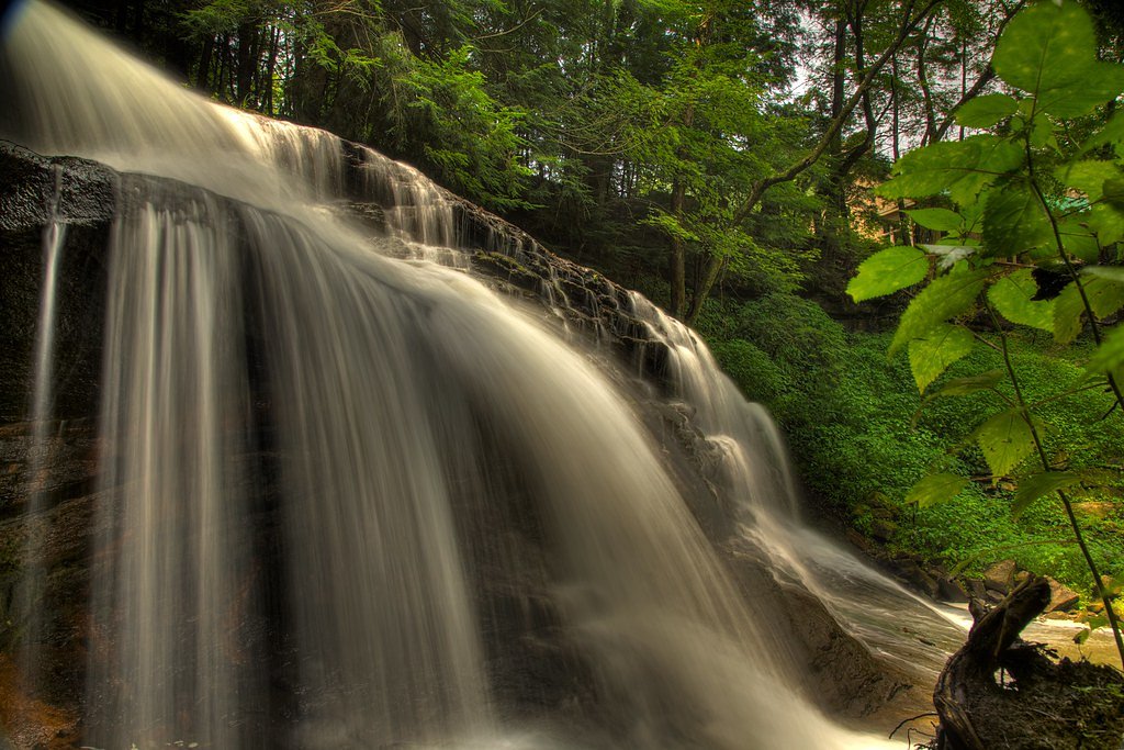
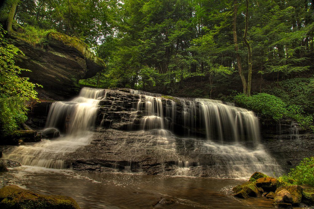
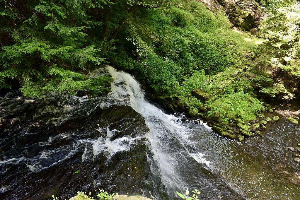

Photo Credits (5)
Difficulty
Moderate
Trail Length
2.4 miles
Trail Type
Out And Back
Elevation Gain
350 ft
About Springfield Falls
Springfield Falls tumbles about 20 feet along Hunters Run in western Pennsylvania, tucked into the northern portion of State Game Lands #284. Hunters Run is a tributary to Neshannock Creek, and the falls mark a scenic spot where the stream approaches that larger waterway. The surrounding watershed is roughly 60% forested and 32% agricultural, so the cascade is framed by a mix of wooded canopy and open fields that make spring greens and autumn colors particularly striking for photographers and day hikers alike. The setting feels intimate but rugged — a popular local destination for those who enjoy short outings into nature. While there isn’t a developed campground within 10 km, the nearest developed camping and day-use facilities at Shenango Lake (Clark Picnic Shelter) are about 23.6 km away, so most visitors treat Springfield Falls as a half-day or day-trip stop from nearby towns.
The Setting
Springfield Falls sits at 1,165 feet along the Muddy Creek, in the foothills of Pennsylvania. The falls drop 20 feet.
Height: 20 feet
Trail & Hike Details
The Approach
The moderate 2.4-mile out-and-back trail gains 350 feet of elevation on the way to the falls.
Trail Description
The trail to Springfield Falls is an out-and-back of approximately 2.4 miles round trip with about 350 feet of elevation gain; difficulty is rated moderate. The route follows natural footpaths through mixed forest and open areas within State Game Lands #284 and leads directly to a viewing area for the 20-foot cascade. Terrain can be uneven and may include roots, rocks, and short, steeper pitches—sturdy footwear and steady footing are recommended for the descent to the streamside viewing spots.
What to Expect
The falls drop a gentle 20 feet. Dogs are welcome.
Accessibility
The trail is not wheelchair accessible. Uneven terrain and elevation changes require steady footing.
Frequently Asked Questions
🐶 Are Dogs Allowed at Springfield Falls?
✅ Dogs are allowed
Are There Any Fees or Permits Required?
🆖 No fees required
🏊 Is There Swimming at Springfield Falls?
❌ Swimming is not allowed
When to Visit
Spring and fall are the best times to visit due to the vibrant foliage and higher water flow. Summer is also pleasant, but the water flow may be lower.
Seasonal Access
The best time to visit is Spring, Summer, and Fall. Winter access may be limited.
Safety Information
The rocks near the falls can be slippery, especially after rain. Exercise caution and avoid climbing on wet or unstable surfaces. Be mindful of traffic when parking along the roadside.
Current Water Conditions
15 ft³/s
Current discharge — how much water is flowing
About average for this time of year
Based on 57 years of record
1.61 ft
Water depth at gauge
7-Day Discharge Trend
What does this mean for your visit?
Flow is about average for this time of year.
About This Gauge
This gauge is on a nearby waterway and may not reflect exact conditions at the falls.
7-Day Flow Outlook
Based on the USGS gauge Muddy Creek near Portersville, PA (21 km away).
Today
Moderate
16 cfs
8/10Tomorrow
Moderate
17 cfs
8/10Fri
Moderate
19 cfs
4/10Sat
Moderate
20 cfs
6/10Sun
Moderate
19 cfs
6/10Mon
Moderate
18 cfs
6/10Tue
Moderate
17 cfs
6/10Best window: Today — moderate flow, sunny (trip score 8/10).
Best time of year: this gauge typically runs highest from mid December to mid January, peaking in April.
How we calculate this
This is a transparent outlook, not a precise forecast. We take the waterfall's current flow strength (how it ranks against its historical normal for today, from the nearest USGS stream gauge), carry that ranking forward along the gauge's seasonal curve, and nudge it for forecast rain. Confidence is highest for the next day or two and falls further out. Always check official conditions and your own judgment before visiting — high flows can be dangerous.
Know when to go.
Get a free email alert when waterfalls near Volant hit peak flow. We only send when conditions are worth the trip — no weekly newsletters, no spam.
Weather Forecast
Location & Access
Getting There
Springfield Falls is located near the town of Mercer, Pennsylvania. It can be accessed via Leesburg Station Road, with a short walk from the roadside to the falls.
Get Directions on Google MapsParking
There is limited roadside parking available near the falls. Visitors should park carefully to avoid obstructing traffic.
Elevation
1,165 feet above sea level
Coordinates
41.142282° N, -80.217840° W
Visitor Tips & Gear
Visit early in the day or on weekdays to avoid crowds. Wear sturdy shoes as the path can be uneven. Bring a camera to capture the scenic views.
As an Amazon Associate, we earn from qualifying purchases.
With 2.4 miles and 350 ft of elevation gain, sturdy boots and trekking poles will help on this moderate trail. Sun exposure on the trail makes good sun protection a must in summer.

Polarized Sunglasses (Knockaround)
Cuts glare off the water so you actually see the falls — and your photos turn out better too.

Columbia Watertight II Rain Jacket
Packs into its own pocket, seam-sealed, and keeps you dry from spray and surprise rain.

Earth Pak Waterproof Dry Bag
Keeps your phone and gear dry when waterfall mist soaks everything else.

Waterproof Phone Pouch (AiRunTech)
Cheap insurance — take photos right next to the falls without killing your phone.

Timberland Euro Sprint Mid Waterproof
Trusted waterproof boot with premium leather and grippy rubber sole — reliable on rocky, wet trails.

TrailBuddy Trekking Poles
Lightweight aluminum, cork grips, and flip-locks that actually hold — a best-seller for good reason.
Where to Stay

Wingate by Wyndham Grove City

Super 8 by Wyndham Grove City

Holiday Inn Express Grove City - Premium Outlet Mall by IHG

Quality Inn & Suites Grove City-Outlet Mall
Browse vacation cabins and private rentals nearby
Unique outdoor stays — tents, yurts, and treehouses
Rent a campervan or RV for your waterfall road trip
Some links are affiliate links. We may earn a commission at no extra cost to you.
Nearby Campground
Shenango Lake Clark Picnic Shelter
14.6 miles away · 1 sites
Overview Situated within the suburban Shenango Valley, Shenango Lake provides an attractive setting where visitors can spend the day picnicking, camping, fishing, boating, or enjoying nature's beauty at one of the lake's many recreation areas. The Clark Recreation Day Use Area is located just off of Route 18 on Route 258 in Clark, PA, and provides one covered group picnic shelter (Clark Shelter) with electric as well as access to the lake to go fishing and boating. Recreation Come explore and enj
Book on Recreation.govAdditional Information
Nearby Attractions
Nearby attractions include McConnells Mill State Park and Moraine State Park, both offering additional hiking and outdoor activities.
Wildlife
The area around Springfield Falls is home to various bird species, small mammals, and occasional deer sightings.
Cities near Springfield Falls
Writing about Springfield Falls? Embed this waterfall on your site for free.