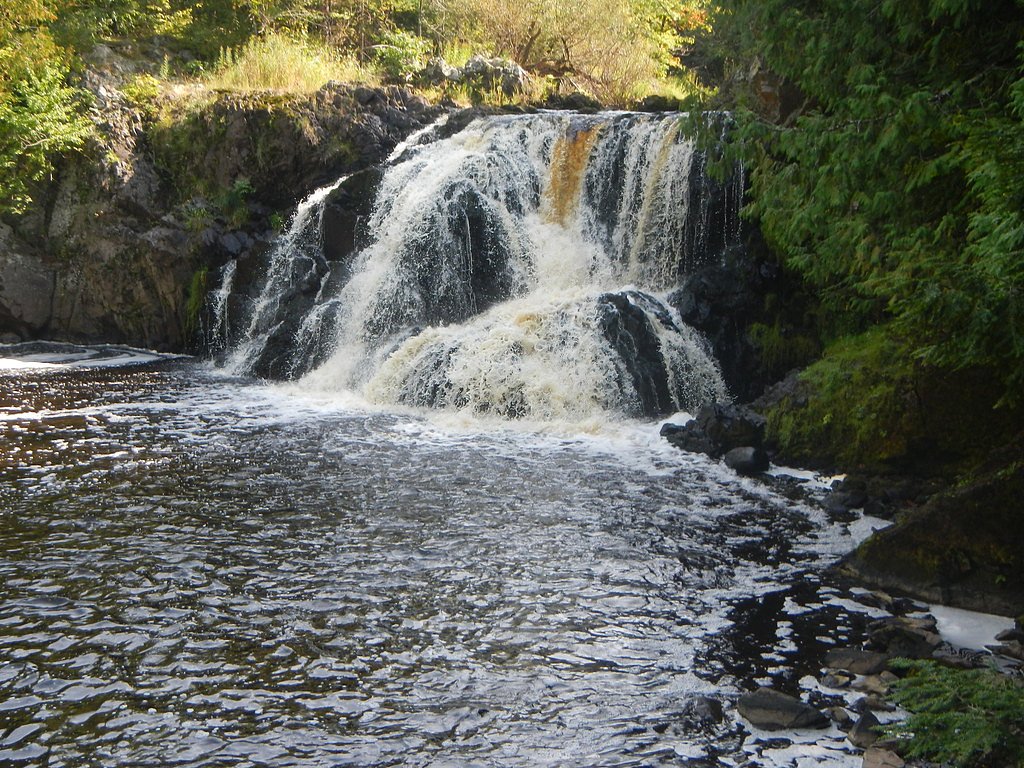
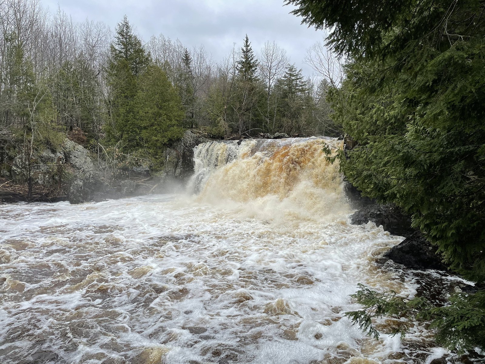
Spring Camp Falls
By Armen Suny · Last verified Mar 2026
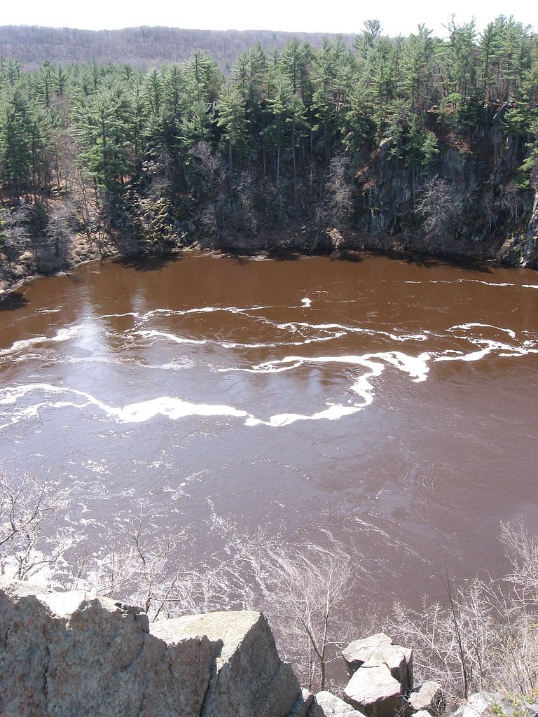
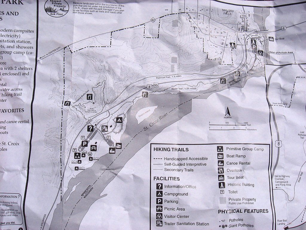
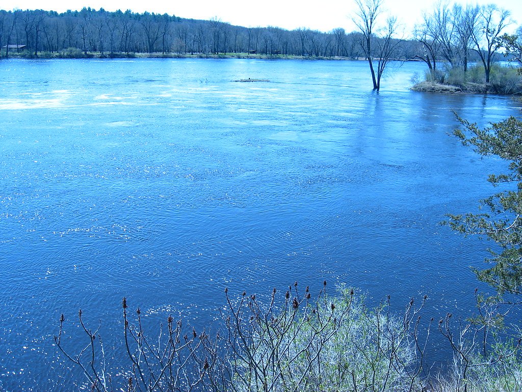
Photo Credits (5)
Difficulty
Moderate
Trail Length
2.4 miles
Trail Type
Out And Back
Elevation Gain
350 ft
About Spring Camp Falls
Spring Camp Falls is a quiet, lesser-known waterfall tucked into Iron County Forest in northern Wisconsin. The cascade and its mossy, tree-lined gorge offer a peaceful setting for photographers and hikers looking to escape crowded parks. The site lies on county-managed land (designation: LCA) and retains a tucked-away, natural feel that rewards those who make the short trip. The approach to the falls follows a 2.4-mile out-and-back route with about 350 feet of elevation gain, making it a moderate hike suitable for steady walkers who want a short day outing. Expect a serene woodland experience rather than developed visitor facilities—the county manages the area to preserve its forest character, so plan accordingly and pack out what you bring in.
The Setting
Spring Camp Falls sits at 1,552 feet within Iron County Forest, fed by the Potato River, in the hills of Wisconsin.
Trail & Hike Details
The Approach
The moderate 2.4-mile out-and-back trail gains 350 feet of elevation on the way to the falls.
Trail Description
This is a 2.4-mile out-and-back trail with roughly 350 feet of cumulative elevation gain; the route is rated moderate. The footpath travels through forested terrain on county-managed Iron County Forest land (designation: LCA) and is primarily a natural single-track tread with roots, occasional rocks, and short pitches of incline. Sturdy footwear and basic trail navigation are recommended; the trail leads directly to viewing spots above and beside the falls before returning the same way.
What to Expect
Dogs are welcome.
Accessibility
The trail is not wheelchair accessible. Uneven terrain and elevation changes require steady footing.
Frequently Asked Questions
🐶 Are Dogs Allowed at Spring Camp Falls?
✅ Dogs are allowed
Are There Any Fees or Permits Required?
🆖 No fees required
🏊 Is There Swimming at Spring Camp Falls?
❌ Swimming is not allowed
When to Visit
Spring and early summer are ideal for visiting, as the water flow is typically strongest during these seasons.
Seasonal Access
The best time to visit is Spring, Summer, and Fall. Winter access may be limited.
Safety Information
Visitors should exercise caution near the waterfall, as rocks can be slippery. Be prepared for changing weather conditions and carry a map or GPS device.
Current Water Conditions
Based on a USGS gauge 15.1 miles away
16 ft³/s
Current discharge — how much water is flowing
Much lower than usual for this time of year
8.18 ft
Water depth at gauge
7-Day Discharge Trend
What does this mean for your visit?
Flow is well below normal for this time of year, so the waterfall may be a trickle.
About This Gauge
This gauge is on a regional waterway. Conditions at the falls may differ, especially after local rain.
7-Day Flow Outlook
Based on the USGS gauge POTATO RIVER AT GURNEY, WI (24 km away).
Today
Low
18 cfs
3/10Tomorrow
Low
19 cfs
3/10Tue
Low
19 cfs
3/10Wed
Low
19 cfs
3/10Thu
Low
19 cfs
3/10Fri
Low
19 cfs
3/10Sat
Low
18 cfs
4/10Best window: Sat — low flow, chance rain showers (trip score 4/10).
How we calculate this
This is a transparent outlook, not a precise forecast. We take the waterfall's current flow strength (how it ranks against its historical normal for today, from the nearest USGS stream gauge), carry that ranking forward along the gauge's seasonal curve, and nudge it for forecast rain. Confidence is highest for the next day or two and falls further out. Always check official conditions and your own judgment before visiting — high flows can be dangerous.
Know when to go.
Get a free email alert when waterfalls near Montreal hit peak flow. We only send when conditions are worth the trip — no weekly newsletters, no spam.
Weather Forecast
Location & Access
Getting There
Spring Camp Falls is located in northern Wisconsin, near the town of Iron River. Access typically involves driving on forest roads, which may be unpaved. Visitors should check local maps or GPS for precise directions.
Get Directions on Google MapsParking
Parking is available near the trailhead, but it may be limited. Visitors should plan accordingly, especially during peak seasons.
Elevation
1,552 feet above sea level
Coordinates
46.347726° N, -90.239342° W
Land Management
Managed by CNTY
Visitor Tips & Gear
Visit during spring or after rainfall for the best water flow. Bring bug spray during summer months as mosquitoes can be prevalent. Wear sturdy shoes as the trail may be uneven.
As an Amazon Associate, we earn from qualifying purchases.
With 2.4 miles and 350 ft of elevation gain, sturdy boots and trekking poles will help on this moderate trail. Sun exposure on the trail makes good sun protection a must in summer.

Polarized Sunglasses (Knockaround)
Cuts glare off the water so you actually see the falls — and your photos turn out better too.

Columbia Watertight II Rain Jacket
Packs into its own pocket, seam-sealed, and keeps you dry from spray and surprise rain.

Earth Pak Waterproof Dry Bag
Keeps your phone and gear dry when waterfall mist soaks everything else.

Waterproof Phone Pouch (AiRunTech)
Cheap insurance — take photos right next to the falls without killing your phone.

Timberland Euro Sprint Mid Waterproof
Trusted waterproof boot with premium leather and grippy rubber sole — reliable on rocky, wet trails.

TrailBuddy Trekking Poles
Lightweight aluminum, cork grips, and flip-locks that actually hold — a best-seller for good reason.
Where to Stay

Snow Otter Haus - 2

Quality Inn Ironwood

Snow Otter Haus - 1

Great Northern Hotel
Browse vacation cabins and private rentals nearby
Unique outdoor stays — tents, yurts, and treehouses
Rent a campervan or RV for your waterfall road trip
Some links are affiliate links. We may earn a commission at no extra cost to you.
Nearby Campground
Great Divide District
21.9 miles away · 0 sites
The Great Divide Ranger District offers a variety of different activities to those seeking recreational opportunities. Many different campgrounds, lakes, rivers, and hiking trails are available and maintained for your enjoyment. Come visit today!
Book on Recreation.govAdditional Information
Nearby Attractions
Nearby attractions include the Chequamegon-Nicolet National Forest and other small waterfalls in the area.
Wildlife
The area is home to various wildlife, including deer, birds, and small mammals. Visitors should be cautious of ticks during warmer months.
Cities near Spring Camp Falls
Nearby Waterfalls
Writing about Spring Camp Falls? Embed this waterfall on your site for free.