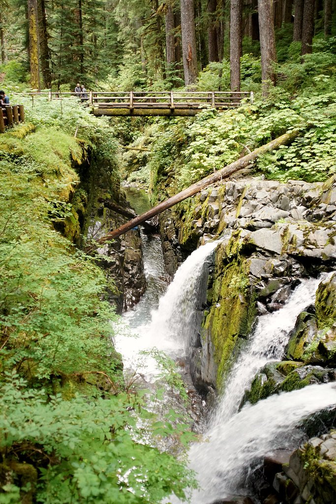
Sol Duc Falls
Washington • Olympic National Park
By Armen Suny · Last verified Mar 2026
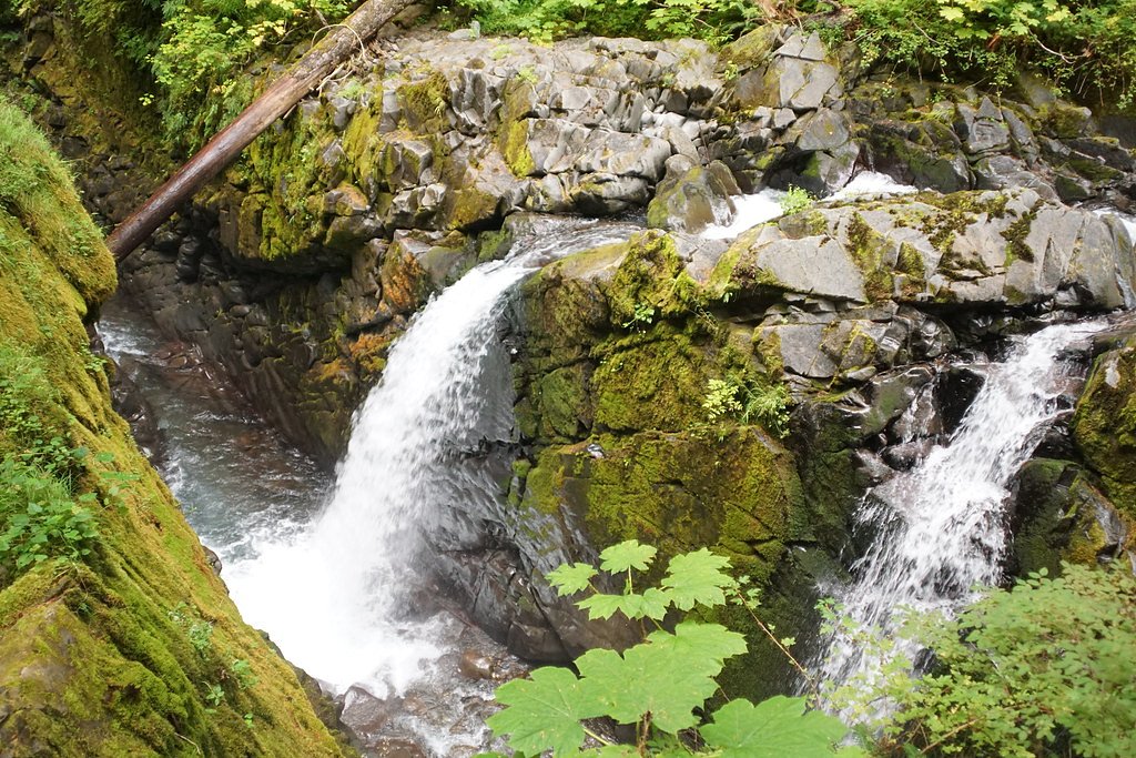
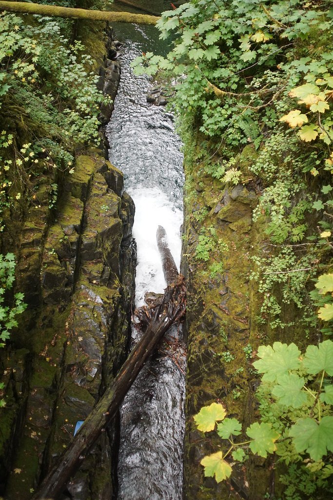

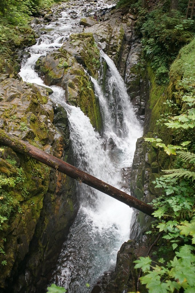

Photo Credits (5)
Difficulty
Easy
Trail Length
1.6 miles
Trail Type
Out And Back
Elevation Gain
200 ft
About Sol Duc Falls
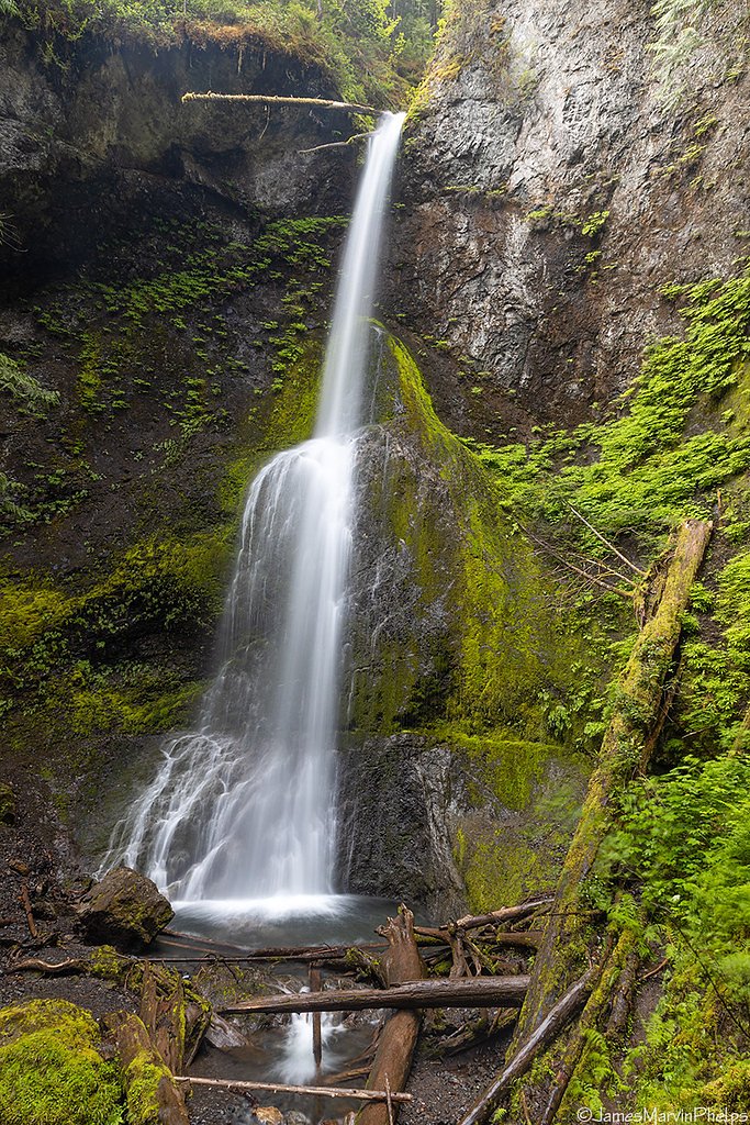
Sol Duc Falls is a stunning three-pronged waterfall located in Olympic National Park, Washington. It is one of the most iconic waterfalls in the park, surrounded by lush temperate rainforest and moss-covered trees. The falls cascade into a narrow gorge, creating a picturesque and serene setting.
The Setting
Sol Duc Falls sits at 1,952 feet within Olympic National Park, fed by the Elwha River, in the hills of Washington.
Trail & Hike Details
The Approach
The easy 1.6-mile out-and-back trail gains 200 feet of elevation on the way to the falls.
Trail Description
The trail to Sol Duc Falls is a well-maintained, relatively flat path through old-growth forest. It features towering trees, ferns, and moss-covered logs, creating a magical atmosphere. The trail ends at a wooden bridge that offers a perfect view of the falls.
What to Expect
Visitors can expect a short, scenic hike through a lush rainforest to a breathtaking waterfall. The trail is family-friendly and suitable for most fitness levels. The falls are particularly impressive in spring when water flow is at its peak.
Accessibility
The trail is not wheelchair accessible. Uneven terrain and elevation changes require steady footing.
Frequently Asked Questions
🐶 Are Dogs Allowed at Sol Duc Falls?
❌ Dogs are not allowed
Are There Any Fees or Permits Required?
🤑 Fee: $30.00
🏊 Is There Swimming at Sol Duc Falls?
❌ Swimming is not allowed
When to Visit
Spring and early summer are the best times to visit, as the waterfall is most powerful due to snowmelt. Fall offers beautiful foliage, while winter may bring snow, making access more challenging.
Seasonal Access
The best time to visit is Spring, Summer, and Fall. Winter access may be limited. Check with Olympic National Park for current conditions.
Safety Information
Stay on designated trails and avoid getting too close to the edge of the gorge. The area can be slippery, especially after rain. Be prepared for changing weather conditions.
Current Water Conditions
574 ft³/s
Current discharge — how much water is flowing
Much lower than usual for this time of year
Based on 111 years of record
9.64 ft
Water depth at gauge
7-Day Discharge Trend
What does this mean for your visit?
Flow is well below normal for this time of year, so the waterfall may be a trickle.
About This Gauge
This gauge is on a nearby waterway and may not reflect exact conditions at the falls.
7-Day Flow Outlook
Based on the USGS gauge ELWHA RIVER AT MCDONALD BR NEAR PORT ANGELES, WA (21 km away).
Today
Moderate
620 cfs
5/10Tomorrow
Moderate
578 cfs
8/10Mon
Moderate
540 cfs
8/10Tue
Moderate
540 cfs
8/10Wed
Moderate
560 cfs
5/10Thu
Moderate
598 cfs
5/10Fri
Moderate
578 cfs
5/10Best window: Tomorrow — moderate flow, mostly sunny (trip score 8/10).
Best time of year: this gauge typically runs highest from early May to early July, peaking in June.
How we calculate this
This is a transparent outlook, not a precise forecast. We take the waterfall's current flow strength (how it ranks against its historical normal for today, from the nearest USGS stream gauge), carry that ranking forward along the gauge's seasonal curve, and nudge it for forecast rain. Confidence is highest for the next day or two and falls further out. Always check official conditions and your own judgment before visiting — high flows can be dangerous.
Know when to go.
Get a free email alert when waterfalls near Port Angeles hit peak flow. We only send when conditions are worth the trip — no weekly newsletters, no spam.
Weather Forecast
Location & Access
Getting There
Sol Duc Falls is located in Olympic National Park. From Port Angeles, take Highway 101 west for about 30 miles, then turn onto Sol Duc Hot Springs Road and follow it for approximately 14 miles to the trailhead.
Get Directions on Google MapsParking
Parking is available at the Sol Duc Falls Trailhead. The lot can fill up during peak seasons, so arriving early is recommended.
Elevation
1,952 feet above sea level
Coordinates
47.950642° N, -123.815197° W
Land Management
Managed by NPS
Visitor Tips & Gear
Arrive early during summer months to secure parking. Bring a rain jacket, as the area is often damp. Consider visiting in the morning for fewer crowds and better lighting for photography.
As an Amazon Associate, we earn from qualifying purchases.
This easy 1.6 miles hike is straightforward — comfortable trail shoes and plenty of water should do. Sun exposure on the trail makes good sun protection a must in summer.

Polarized Sunglasses (Knockaround)
Cuts glare off the water so you actually see the falls — and your photos turn out better too.

Columbia Watertight II Rain Jacket
Packs into its own pocket, seam-sealed, and keeps you dry from spray and surprise rain.

Earth Pak Waterproof Dry Bag
Keeps your phone and gear dry when waterfall mist soaks everything else.

Waterproof Phone Pouch (AiRunTech)
Cheap insurance — take photos right next to the falls without killing your phone.

JOBY GorillaPod Starter Kit
Wraps around railings and rocks for long-exposure waterfall shots — no flat surface needed.

Osprey Daylite Daypack
Light, organized, and just the right size for a day hike — fits water, snacks, and layers.
Where to Stay

Sol Duc Hot Springs Resort

Woodland Inns

Forks Cedar House

Forks Fir House
Browse vacation cabins and private rentals nearby
Unique outdoor stays — tents, yurts, and treehouses
Rent a campervan or RV for your waterfall road trip
Some links are affiliate links. We may earn a commission at no extra cost to you.
Nearby Campground
SOL DUC HOT SPRINGS RESORT CAMPGROUND
2.3 miles away · 97 sites
Overview For up to date pool schedule information, please visit our website here. Pool access fees are $19 for adults, $15 for children ages 4-12 and $15 for seniors over 62 years old per session. Towel rentals are $5. You may bring your own towel. Lockers are available, but locks are not provided. Located along the Sol Duc River, Sol Duc Hot Springs Resort Campground is on the "edge of the backcountry in the heart of the Olympic National Park" with hot spring pools and access to many hiking trai
Book on Recreation.govNearby Hot Springs
Hot springs near Port Angeles, Washington

Sol Duc Hot Springs
Sol Duc Hot Springs flows at 122 degrees Fahrenheit in Olympic National Park with permanently protected Class 1 status under Na...

Olympic Hot Springs
Olympic Hot Springs flows at 118 degrees within Olympic National Park at 2,000 feet elevation, emerging 72 degrees above ambien...
Looking for a soak after your hike? Explore more hot springs near Port Angeles, Washington on SoakingSprings.
Explore Washington springsAdditional Information
Nearby Attractions
Nearby attractions include Sol Duc Hot Springs Resort, the Lover's Lane Loop Trail, and the Hoh Rainforest.
Wildlife
Visitors may encounter deer, birds, and small mammals. Be cautious of bears and cougars, which are present in the park.
Cities near Sol Duc Falls
Nearby Waterfalls
Writing about Sol Duc Falls? Embed this waterfall on your site for free.