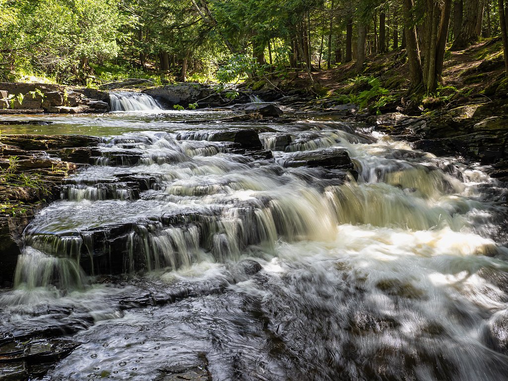
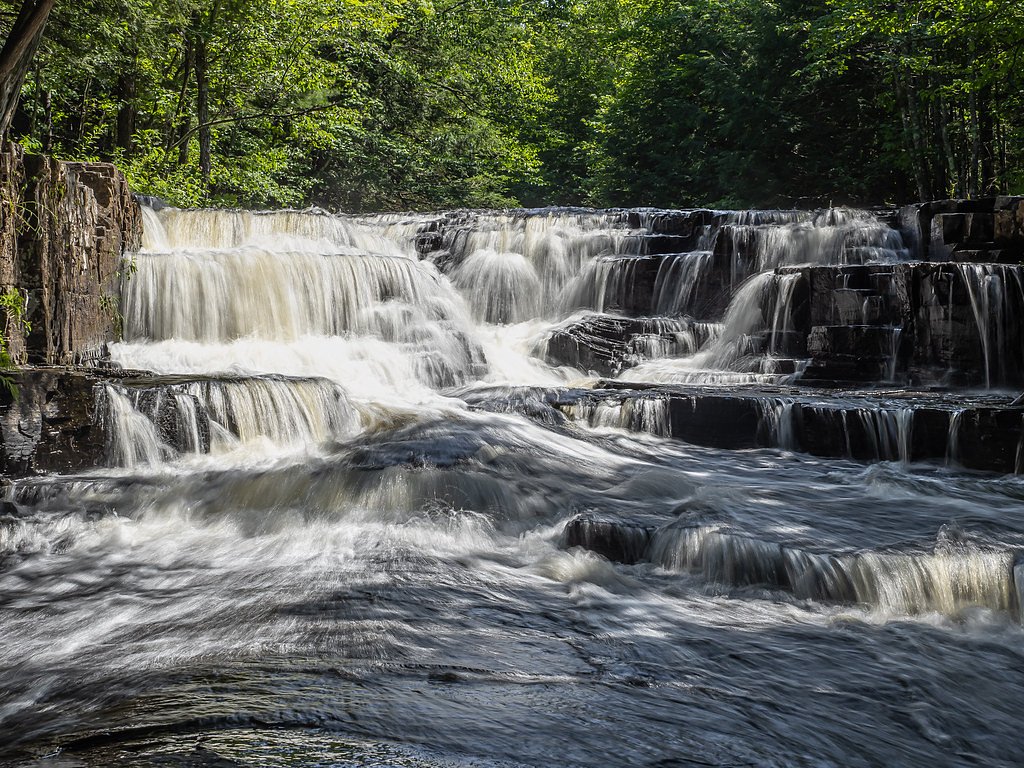
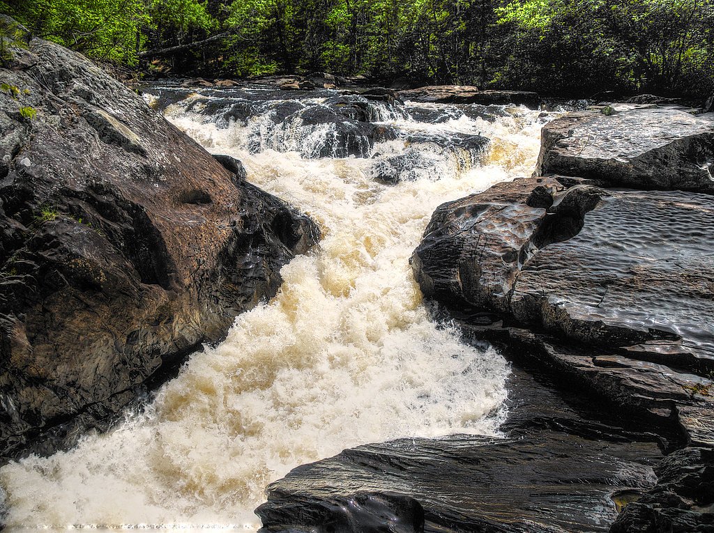
Slate River Falls
By Armen Suny · Last verified Mar 2026


Photo Credits (5)
Difficulty
Moderate
Trail Length
2.4 miles
Trail Type
Out And Back
Elevation Gain
350 ft
About Slate River Falls
Slate River Falls is a scenic cascade along the Slate River in Michigan’s Upper Peninsula, set amid dense northern hardwoods and mossy outcrops. The falls tumble in a series of drops that reward photographers and day-hikers alike with changing vantage points and lush forest surrounds. The site sits within the Slate River Forest Reserve, a PCON-designated property managed by an NGO, which helps protect the watershed and maintain the natural character of the area.
The Setting
Slate River Falls sits at 732 feet within Slate River Forest Reserve, fed by the Silver River, in the foothills of Michigan.
Trail & Hike Details
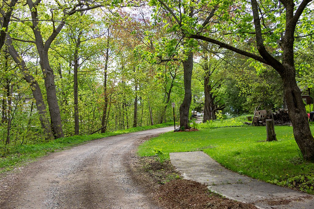
The Approach
The moderate 2.4-mile out-and-back trail gains 350 feet of elevation on the way to the falls.
Trail Description
The approach to Slate River Falls is a moderate out-and-back hike of about 2.4 miles round trip with roughly 350 feet of elevation gain. The trail is rated moderate; surface and formal USFS trail-class data are not provided, and the path can be uneven or muddy—especially after rain—so sturdy footwear is recommended. Expect a mostly forested route that climbs gently in places and rewards you with multiple viewpoints of the cascades.
What to Expect
Dogs are welcome.
Accessibility
The trail is not wheelchair accessible. Uneven terrain and elevation changes require steady footing.
Frequently Asked Questions
🐶 Are Dogs Allowed at Slate River Falls?
✅ Dogs are allowed
Are There Any Fees or Permits Required?
🆖 No fees required
🏊 Is There Swimming at Slate River Falls?
❌ Swimming is not allowed
When to Visit
Spring and early summer are the best times to visit due to higher water levels.
Seasonal Access
The best time to visit is Spring, Summer, and Fall. Winter access may be limited.
Safety Information
Exercise caution near the falls as rocks can be slippery. Be prepared for changing weather conditions, especially in spring and fall.
Current Water Conditions
95 ft³/s
Current discharge — how much water is flowing
Higher than usual for this time of year
Based on 24 years of record
7.01 ft
Water depth at gauge
7-Day Discharge Trend
What does this mean for your visit?
The water is flowing higher than usual for this time of year.
About This Gauge
7-Day Flow Outlook
Based on the USGS gauge SILVER RIVER NEAR L'ANSE, MI (6 km away).
Today
Moderate
95 cfs
9/10Tomorrow
Moderate
92 cfs
9/10Mon
Strong
122 cfs
7/10Tue
Strong
136 cfs
7/10Wed
Strong
108 cfs
7/10Thu
Strong
98 cfs
7/10Fri
Strong
98 cfs
7/10Best window: Today — moderate flow, sunny (trip score 9/10).
Best time of year: this gauge typically runs highest from mid March to late May, peaking in April.
How we calculate this
This is a transparent outlook, not a precise forecast. We take the waterfall's current flow strength (how it ranks against its historical normal for today, from the nearest USGS stream gauge), carry that ranking forward along the gauge's seasonal curve, and nudge it for forecast rain. Confidence is highest for the next day or two and falls further out. Always check official conditions and your own judgment before visiting — high flows can be dangerous.
Know when to go.
Get a free email alert when waterfalls near Skanee hit peak flow. We only send when conditions are worth the trip — no weekly newsletters, no spam.
Weather Forecast
Location & Access
Getting There
Slate River Falls is located near L'Anse, Michigan. To access the falls, visitors typically drive along Skanee Road and then take a series of unpaved forest roads. The final approach may require a short hike along a trail.
Get Directions on Google MapsParking
Parking is available near the trailhead, but it may be limited and located on unpaved surfaces.
Elevation
732 feet above sea level
Coordinates
46.830485° N, -88.251515° W
Land Management
Managed by NGO
Visitor Tips & Gear
Visit during spring or after heavy rainfall for the best water flow. Bring bug spray during summer months as mosquitoes can be prevalent. Be cautious of slippery rocks near the falls.
As an Amazon Associate, we earn from qualifying purchases.
With 2.4 miles and 350 ft of elevation gain, sturdy boots and trekking poles will help on this moderate trail. Sun exposure on the trail makes good sun protection a must in summer.

Polarized Sunglasses (Knockaround)
Cuts glare off the water so you actually see the falls — and your photos turn out better too.

Columbia Watertight II Rain Jacket
Packs into its own pocket, seam-sealed, and keeps you dry from spray and surprise rain.

Earth Pak Waterproof Dry Bag
Keeps your phone and gear dry when waterfall mist soaks everything else.

Waterproof Phone Pouch (AiRunTech)
Cheap insurance — take photos right next to the falls without killing your phone.

Timberland Euro Sprint Mid Waterproof
Trusted waterproof boot with premium leather and grippy rubber sole — reliable on rocky, wet trails.

TrailBuddy Trekking Poles
Lightweight aluminum, cork grips, and flip-locks that actually hold — a best-seller for good reason.
Where to Stay

Independence Stay Hotel and Long term suites

Trailside Furnished Apartment

AC4 Northwoods Getaway w Jetted Tub

UP Escape in the Pines
Browse vacation cabins and private rentals nearby
Unique outdoor stays — tents, yurts, and treehouses
Rent a campervan or RV for your waterfall road trip
Some links are affiliate links. We may earn a commission at no extra cost to you.
Additional Information
Nearby Attractions
Other nearby attractions include Canyon Falls and the town of L'Anse, which offers dining and lodging options.
Wildlife
The area is home to a variety of wildlife, including birds, deer, and small mammals. Be cautious of ticks during warmer months.
Cities near Slate River Falls
Nearby Waterfalls
Writing about Slate River Falls? Embed this waterfall on your site for free.