
Skalkaho Falls
By Armen Suny · Last verified Mar 2026
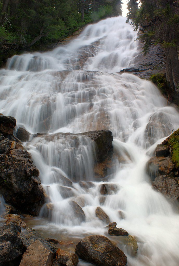
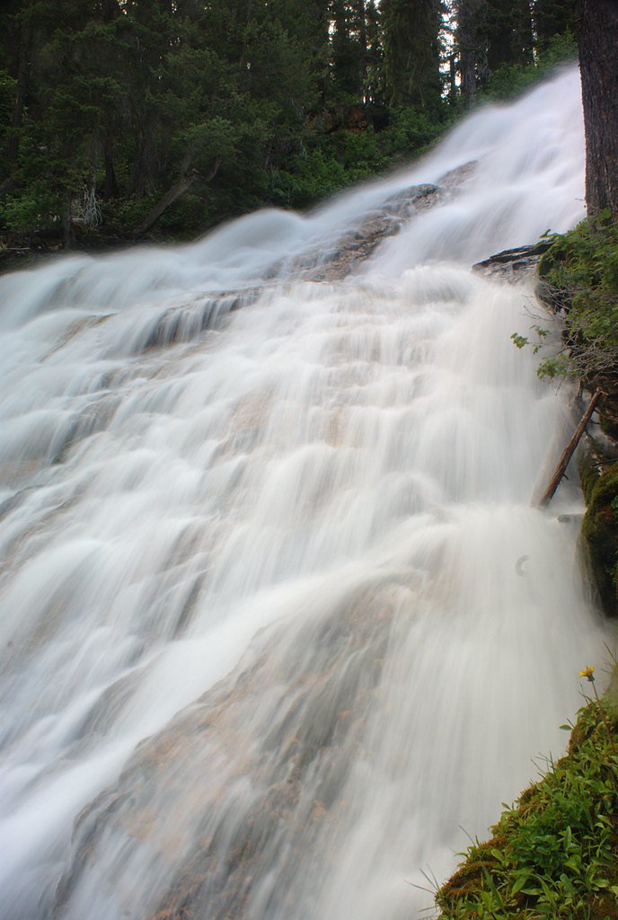
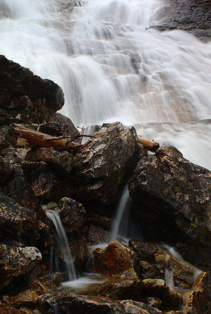
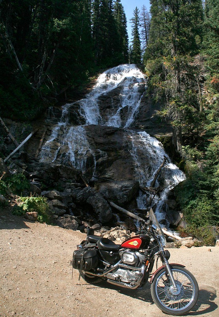

Photo Credits (5)
Difficulty
Drive Up
Trail Length
0.1 miles
Trail Type
Out And Back
Elevation Gain
50 ft
About Skalkaho Falls
Skalkaho Falls tumbles beneath the Skalkaho Highway (Montana Highway 38) in the Sapphire Mountains and is one of western Montana’s most photographed roadside cascades. Nestled within the Bitterroot National Forest and managed by the U.S. Forest Service, the falls are easily reached from the highway and reward drivers and day-trippers with a broad, photogenic drop framed by steep, forested rock. The location makes for an ideal quick stop on the scenic Skalkaho Highway, popular with anglers, photographers and people exploring the Sapphire Range. While no lengthy hike is required to enjoy the falls, the area is served by the USFS SKALKAHO-LITTLE BURNT FORK (Trail #149). According to Forest Service data, that trail is classified as a Class 2 route on native surface with typical grades of 12–20% and GIS-recorded length of about 2.15 miles, continuing beyond the roadside viewpoint for those who wish to explore deeper into the National Forest. If you want to camp nearby, Gird Point Campground lies about 8.47 km (under 10 km) from the falls, making overnight stays and dawn/dusk photo sessions convenient.
The Setting
Skalkaho Falls sits at 6,227 feet within Bitterroot National Forest, fed by the Middle Fork Rock Cr, in the high mountains of Montana.
Trail & Hike Details
The Approach
No hiking required. Skalkaho Falls is accessible by vehicle with a roadside viewing area.
USFS Trail
SKALKAHO-LITTLE BURNT FORK #149
Trail Class
Moderately Developed
Surface
Avg Grade
USFS Segment
2.15 miTrail Description
Viewing Skalkaho Falls requires only a short roadside approach: a roughly 0.1-mile out-and-back spur with about 50 feet of elevation gain from the parking area to the base/viewpoint, rated as a drive_up difficulty for most visitors. The short viewing path follows native material (NAT) surface and, per USFS trail data, connects with the longer SKALKAHO-LITTLE BURNT FORK (Trail #149). Trail #149 is listed as Class 2 with a typical grade of 12–20% and a GIS-recorded length of approximately 2.15 miles, so hikers wanting a longer walk beyond the falls can continue on the established USFS route.
What to Expect
Dogs are welcome.
Accessibility
This waterfall is viewable from a vehicle-accessible area. No hiking is required.
Frequently Asked Questions
🐶 Are Dogs Allowed at Skalkaho Falls?
✅ Dogs are allowed
Are There Any Fees or Permits Required?
🆖 No fees required
🏊 Is There Swimming at Skalkaho Falls?
❌ Swimming is not allowed
When to Visit
The best time to visit Skalkaho Falls is in the late spring or early summer when the water flow is at its peak due to snowmelt.
Seasonal Access
The best time to visit is Spring, Summer, and Fall. Access roads and trails may close during winter due to snow. Check with Bitterroot National Forest for seasonal road closures.
Safety Information
Be cautious when parking along the highway, as traffic can be fast-moving. The rocks near the falls can be slippery, so avoid climbing or venturing too close to the water.
Current Water Conditions
Based on a USGS gauge 16.3 miles away
177 ft³/s
Current discharge — how much water is flowing
Lower than usual for this time of year
Based on 87 years of record
2.11 ft
Water depth at gauge
7-Day Discharge Trend
What does this mean for your visit?
Flow is lower than usual for this time of year.
About This Gauge
This gauge is on a regional waterway. Conditions at the falls may differ, especially after local rain.
7-Day Flow Outlook
Based on the USGS gauge Middle Fork Rock Cr nr Philipsburg MT (26 km away).
Today
Moderate
202 cfs
4/10Tomorrow
Moderate
199 cfs
5/10Mon
Moderate
193 cfs
4/10Tue
Moderate
188 cfs
4/10Wed
Moderate
172 cfs
4/10Thu
Moderate
165 cfs
4/10Fri
Moderate
164 cfs
4/10Best window: Tomorrow — moderate flow, rain and snow (trip score 5/10).
Best time of year: this gauge typically runs highest from late April to late July, peaking in June.
How we calculate this
This is a transparent outlook, not a precise forecast. We take the waterfall's current flow strength (how it ranks against its historical normal for today, from the nearest USGS stream gauge), carry that ranking forward along the gauge's seasonal curve, and nudge it for forecast rain. Confidence is highest for the next day or two and falls further out. Always check official conditions and your own judgment before visiting — high flows can be dangerous.
Know when to go.
Get a free email alert when waterfalls near Hamilton hit peak flow. We only send when conditions are worth the trip — no weekly newsletters, no spam.
Weather Forecast
Location & Access
Getting There
Skalkaho Falls is located along the Skalkaho Highway, which connects the towns of Hamilton and Philipsburg in Montana. The falls are easily visible from the road, making them accessible without requiring a hike.
Get Directions on Google MapsParking
There is a small pullout area near the falls where visitors can park their vehicles. Parking may be limited during peak seasons.
Elevation
6,227 feet above sea level
Coordinates
46.257422° N, -113.826475° W
Land Management
Managed by USFS
Visitor Tips & Gear
Visit early in the day to avoid crowds, especially during the summer months. Be cautious when parking along the highway, as the area can be busy with passing vehicles.
This trail sits at 6,227 ft above sea level
Elevated TrailUV radiation is roughly 25% stronger at this elevation than at sea level, and the dry air accelerates dehydration. Extra sun protection and fluids go a long way.
As an Amazon Associate, we earn from qualifying purchases.

Coppertone Sport SPF 50 Sunscreen
UV intensity jumps ~4% per 1,000 ft — at this elevation you can burn in half the time.

Sun Bum SPF 30 Lip Balm (3-Pack)
Lips have almost no natural UV protection and burn fast in thin, dry mountain air.

Liquid I.V. Electrolyte Packets
You lose moisture ~2x faster at elevation — electrolytes help you absorb water efficiently.

ROCKNIGHT Polarized UV400 Sunglasses
High-altitude glare off rock and water is intense — UV400 lenses block 99%+ of UVA/UVB.
As an Amazon Associate, we earn from qualifying purchases.
For this easy 0.1 miles trail, lightweight trail shoes and a water bottle are usually sufficient. Sun exposure on the trail makes good sun protection a must in summer.

Polarized Sunglasses (Knockaround)
Cuts glare off the water so you actually see the falls — and your photos turn out better too.

Columbia Watertight II Rain Jacket
Packs into its own pocket, seam-sealed, and keeps you dry from spray and surprise rain.

Earth Pak Waterproof Dry Bag
Keeps your phone and gear dry when waterfall mist soaks everything else.

Waterproof Phone Pouch (AiRunTech)
Cheap insurance — take photos right next to the falls without killing your phone.

JOBY GorillaPod Starter Kit
Wraps around railings and rocks for long-exposure waterfall shots — no flat surface needed.

OR Sombriolet Sun Hat
UPF 50+ sun protection with vents so your head doesn't cook on exposed trail sections.
Where to Stay

SkyWater Cabins

Quality Inn Hamilton Bitterroot Valley

City Center Motel

Peaceful Vacation Getaway, Private Yard, Hot Tub, 360 Views, Cozy Cottage in the heart of the Bitterroot Valley, Sage Cottage 406
Browse vacation cabins and private rentals nearby
Unique outdoor stays — tents, yurts, and treehouses
Rent a campervan or RV for your waterfall road trip
Some links are affiliate links. We may earn a commission at no extra cost to you.
Nearby Campground
GIRD POINT
5.3 miles away · 1 sites
Overview The Gird Point Lookout offers a unique chance to camp on top of a mountain peak in a rustic, old-time setting. It sits high above the valley and provides panoramic views of three surrounding mountain ranges. Comfortably equipped, the lookout tower provides almost everything anyone would need to enjoy a variety of recreational opportunities available in the mountains of western Montana. Recreation A variety of hiking and mountain biking trails are available in the area, as well as some of
Book on Recreation.govNearby Hot Springs
Hot springs near Hamilton, Montana

Sleeping Child Hot Springs
Sleeping Child Hot Springs emerges at 122 degrees Fahrenheit within the Bitterroot National Forest, managed by the US Forest Se...
Medicine Hot Springs
Medicine Hot Springs delivers 117°F water on Bitterroot National Forest land in Ravalli County, Montana, with alkaline chemistr...
Gallogly Spring
Gallogly Spring discharges at 100°F on the Bitterroot National Forest in Ravalli County, Montana, at 5,728 feet elevation. The ...
Nimrod Springs
Nimrod Springs flows at 70°F with hard, sulfate-rich water carrying 323 mg/L sulfate and 137 mg/L calcium at near-neutral pH 7....
Prospector Hot Springs
Prospector Hot Springs lies more than six miles from the nearest road in the backcountry near the Selway-Bitterroot Wilderness,...
Deerlodge Prison Ranch Springs
Deerlodge Prison Ranch Springs flows at 79°F on the grounds of the Deer Lodge State Prison Ranch, a state conservation area in ...
Looking for a soak after your hike? Explore more hot springs near Hamilton, Montana on SoakingSprings.
Explore Montana springsAdditional Information
Nearby Attractions
Nearby attractions include the town of Philipsburg, known for its historic charm and sapphire mining, and the Bitterroot Valley, which offers hiking and outdoor recreation opportunities.
Wildlife
The area around Skalkaho Falls is home to various wildlife, including deer, elk, and birds. Visitors should be cautious of bears and carry bear spray if exploring nearby areas.
Cities near Skalkaho Falls
Writing about Skalkaho Falls? Embed this waterfall on your site for free.