
Photo Credits (5)
Difficulty
Moderate
Trail Length
2.4 miles
Trail Type
Out And Back
Elevation Gain
350 ft
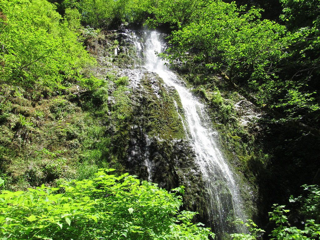
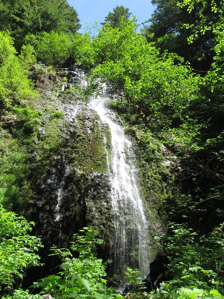
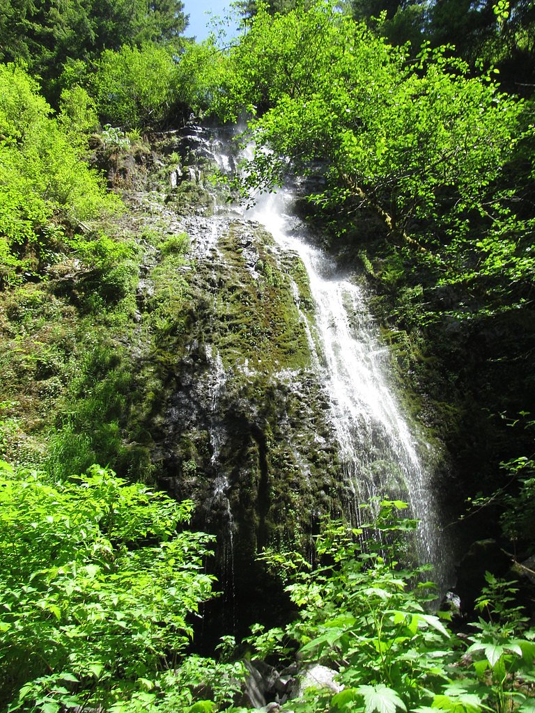
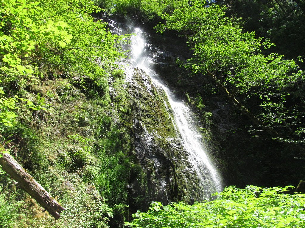
About Siuslaw Falls
Siuslaw Falls sits along the Siuslaw River in Lane County, Oregon, tucked into the small, county-managed Siuslaw Falls Park. The falls are a broad, cascading ribbon set in a quiet, forested stretch of the river that makes for an easy-to-enjoy nature stop — a pleasant spot for photographers and anyone looking for a calm riverside outing. Because the site is managed by the county, access is straightforward from the park’s roadside parking and trailhead. Visitors will find the setting to be peaceful and wooded, with the falls framed by riparian forest. While the waterfall itself invites a short linger, the approach follows a modestly uphill forest trail that rewards hikers with river views and a tranquil sense of being away from the busier recreation sites along the Oregon coast. Pack water and rain-appropriate footwear during wetter months, as sections of the approach can be muddy or uneven after rain.
The Setting
Siuslaw Falls sits at 574 feet within Siuslaw Falls Park, fed by the Siuslaw River, in the foothills of Oregon.
Trail & Hike Details
The Approach
The moderate 2.4-mile out-and-back trail gains 350 feet of elevation on the way to the falls.
Trail Description
The route to Siuslaw Falls is an out-and-back trail of 2.4 miles with about 350 feet of elevation gain and is generally rated moderate. The trail begins at the Siuslaw Falls Park roadside parking area and follows a mostly natural forest tread; hikers should expect some uneven footing and brief steeper pitches. Plan on sturdy shoes and allow extra time in wet seasons when sections can be slick. The trail’s moderate grade and manageable distance make it a good half-day option for most hikers.
What to Expect
Swimming is permitted. Dogs are welcome.
Accessibility
The trail is not wheelchair accessible. Uneven terrain and elevation changes require steady footing.
Frequently Asked Questions
🐶 Are Dogs Allowed at Siuslaw Falls?
✅ Dogs are allowed
Are There Any Fees or Permits Required?
🆖 No fees required
🏊 Is There Swimming at Siuslaw Falls?
✅ Swimming is allowed
When to Visit
Spring and early summer are the best times to visit, as the water flow is typically strongest during these seasons.
Seasonal Access
The best time to visit is Spring, Summer, and Fall. Winter access may be limited.
Safety Information
Be cautious near the water, as rocks can be slippery. Avoid visiting during heavy rainfall or high water conditions, as the river may become dangerous. Always supervise children and pets near the water.
Current Water Conditions
31 ft³/s
Current discharge — how much water is flowing
Lower than usual for this time of year
10.02 ft
Water depth at gauge
68°F
CoolRefreshing for swimming
7-Day Discharge Trend
What does this mean for your visit?
Flow is lower than usual for this time of year. Water temperature is a refreshing 68 degrees F, good for a quick swim.
About This Gauge
This gauge is on a nearby waterway and may not reflect exact conditions at the falls.
7-Day Flow Outlook
Based on the USGS gauge SIUSLAW RIVER NEAR ALMA, OR (21 km away).
Today
Moderate
34 cfs
5/10Tomorrow
Moderate
37 cfs
4/10Mon
Moderate
36 cfs
5/10Tue
Low
32 cfs
6/10Wed
Low
31 cfs
6/10Thu
Low
31 cfs
6/10Fri
Moderate
34 cfs
5/10Best window: Tue — low flow, partly sunny (trip score 6/10).
How we calculate this
This is a transparent outlook, not a precise forecast. We take the waterfall's current flow strength (how it ranks against its historical normal for today, from the nearest USGS stream gauge), carry that ranking forward along the gauge's seasonal curve, and nudge it for forecast rain. Confidence is highest for the next day or two and falls further out. Always check official conditions and your own judgment before visiting — high flows can be dangerous.
Know when to go.
Get a free email alert when waterfalls near Veneta hit peak flow. We only send when conditions are worth the trip — no weekly newsletters, no spam.
Weather Forecast
Location & Access
Getting There
Siuslaw Falls is located near Lorane, Oregon. From Eugene, take Territorial Highway south to Lorane, then follow Siuslaw River Road west for approximately 10 miles. The falls are accessible via a short walk from the road.
Get Directions on Google MapsParking
There is limited roadside parking available near the falls. Visitors should park carefully to avoid blocking the road.
Elevation
574 feet above sea level
Coordinates
43.853732° N, -123.364539° W
Land Management
Managed by CNTY
Visitor Tips & Gear
Visit during spring or early summer for the best water flow. Bring sturdy shoes if visiting during wet weather, as the path may be slippery. Be cautious near the water, as rocks can be slick.
As an Amazon Associate, we earn from qualifying purchases.
With 2.4 miles and 350 ft of elevation gain, sturdy boots and trekking poles will help on this moderate trail. Sun exposure on the trail makes good sun protection a must in summer.

Polarized Sunglasses (Knockaround)
Cuts glare off the water so you actually see the falls — and your photos turn out better too.

Columbia Watertight II Rain Jacket
Packs into its own pocket, seam-sealed, and keeps you dry from spray and surprise rain.

Earth Pak Waterproof Dry Bag
Keeps your phone and gear dry when waterfall mist soaks everything else.

Waterproof Phone Pouch (AiRunTech)
Cheap insurance — take photos right next to the falls without killing your phone.

Timberland Euro Sprint Mid Waterproof
Trusted waterproof boot with premium leather and grippy rubber sole — reliable on rocky, wet trails.

TrailBuddy Trekking Poles
Lightweight aluminum, cork grips, and flip-locks that actually hold — a best-seller for good reason.
Where to Stay

Valley River Inn

Downtown Inn

Forest Gallery- Mid-Century Modern With City Views

Best Western New Oregon Motel
Browse vacation cabins and private rentals nearby
Unique outdoor stays — tents, yurts, and treehouses
Rent a campervan or RV for your waterfall road trip
Some links are affiliate links. We may earn a commission at no extra cost to you.
Nearby Campground
Clay Creek Recreation Site
10.7 miles away · 23 sites
Overview Overnight camping is closed until further notice. Day-use recreation areas remain open for public use.Reserve a campsite at Clay Creek on recreation.gov or pay when you arrive for non-reserved campsites using the Recreation.gov Mobile App. You must download before you reach the site since there is no cell reception in the drainage. Clay Creek Recreation Site is nestled in the Coast Range of Oregon between Eugene and the Oregon coast at an elevation of 436-492 feet. Located at the conflu
Book on Recreation.govNearby Hot Springs
Hot springs near Veneta, Oregon
Kitson Hot Springs
Kitson Hot Springs flows at 109°F within Willamette National Forest at 1,664 feet elevation, positioned just 17 meters from For...

Umpqua Hot Springs
Umpqua Hot Springs flows at 117°F from multiple geothermal sources along the North Umpqua River in Lane County, forming cascadi...
Looking for a soak after your hike? Explore more hot springs near Veneta, Oregon on SoakingSprings.
Explore Oregon springsAdditional Information
Nearby Attractions
Nearby attractions include King Estate Winery and the small town of Lorane, which offers a few local shops and dining options.
Wildlife
The area around Siuslaw Falls is home to various bird species, deer, and other small wildlife. Keep an eye out for native flora and fauna.
Cities near Siuslaw Falls
Writing about Siuslaw Falls? Embed this waterfall on your site for free.