Silverthread Falls
Pennsylvania • 80 ft
By Armen Suny · Last verified Sep 2026
LiDAR & 3D terrain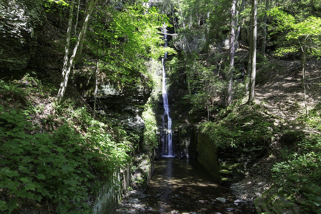
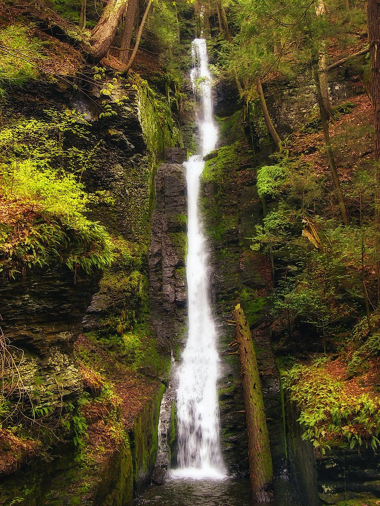
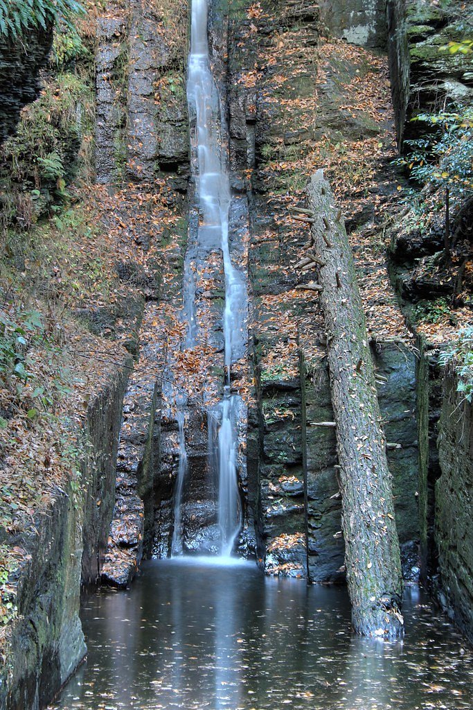

Photo Credits (5)
Difficulty
Easy
Trail Length
0.3 miles
Trail Type
Out And Back
About Silverthread Falls
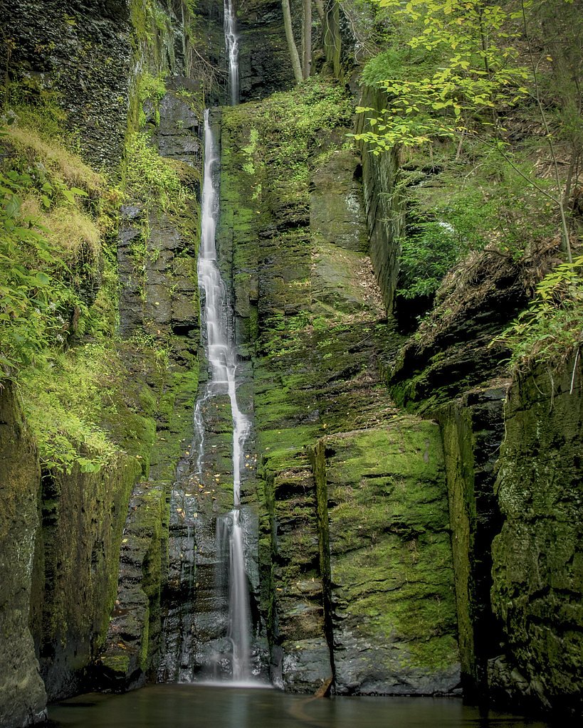
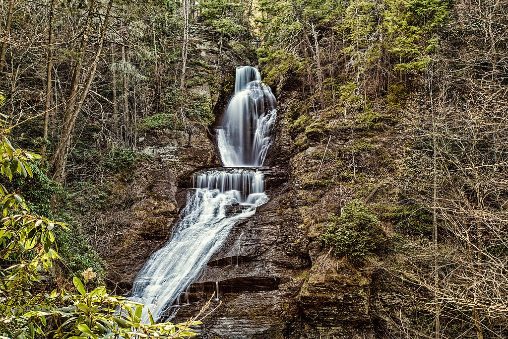
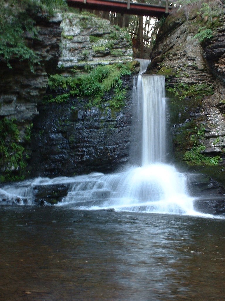
Silverthread Falls is a narrow, ribbon-like waterfall located in the Delaware Water Gap National Recreation Area in Pennsylvania. It is known for its unique, slender cascade that drops gracefully through a mossy rock crevice.
The Setting
Silverthread Falls sits at 666 feet within Delaware Water Gap National Recreation Area, fed by the Little Bush Kill, in the foothills of Pennsylvania. The falls drop 80 feet.
Height: 80 feet
Nearby Falls Worth Visiting
Raymondskill Falls, the tallest waterfall in Pennsylvania at 150 feet, lies 4.6 miles to the northeast. Also nearby: Dingmans Falls (130 ft, 0.3 mi) and Fulmer Falls (56 ft, 1.6 mi).
Trail & Hike Details
Trail Description
The trail to Silverthread Falls is a short, flat, and well-maintained boardwalk that is wheelchair accessible. It passes through a lush forest and leads directly to a viewing platform for the falls.
What to Expect
The falls cascade 80 feet. Dogs are welcome.
Accessibility
The trail is short and relatively flat, but the surface may be uneven. Contact the managing agency for accessibility details.
Frequently Asked Questions
🐶 Are Dogs Allowed at Silverthread Falls?
✅ Dogs are allowed
Are There Any Fees or Permits Required?
🆖 No fees required
🏊 Is There Swimming at Silverthread Falls?
❌ Swimming is not allowed
When to Visit
Spring and early summer are the best times to visit, as the waterfall flow is typically strongest due to snowmelt and seasonal rains.
Seasonal Access
The best time to visit is Spring, Summer, and Fall. Winter access may be limited. Check the National Park Service website for current conditions.
Safety Information
Stay on the designated boardwalk and viewing platform to avoid slippery or unstable surfaces. Be cautious of wet conditions, especially after rain.
Current Water Conditions
7 ft³/s
Current discharge — how much water is flowing
About average for this time of year
Based on 19 years of record
4.65 ft
Water depth at gauge
7-Day Discharge Trend
What does this mean for your visit?
Flow is about average for this time of year.
About This Gauge
This gauge is on a nearby waterway and may not reflect exact conditions at the falls.
7-Day Flow Outlook
Based on the USGS gauge Little Bush Kill at Edgemere, PA (10 km away).
Today
Strong
7 cfs
9/10Tomorrow
Strong
23 cfs
9/10Thu
Strong
25 cfs
9/10Fri
Strong
21 cfs
10/10Sat
Roaring
19 cfs
6/10Sun
Roaring
18 cfs
6/10Mon
Roaring
13 cfs
6/10Best window: Fri — strong flow, mostly sunny (trip score 10/10).
Best time of year: this gauge typically runs highest from early March to mid April, peaking in April.
How we calculate this
This is a transparent outlook, not a precise forecast. We take the waterfall's current flow strength (how it ranks against its historical normal for today, from the nearest USGS stream gauge), carry that ranking forward along the gauge's seasonal curve, and nudge it for forecast rain. Confidence is highest for the next day or two and falls further out. Always check official conditions and your own judgment before visiting — high flows can be dangerous.
Know when to go.
Get a free email alert when waterfalls near Birchwood Lakes hit peak flow. We only send when conditions are worth the trip — no weekly newsletters, no spam.
Weather Forecast
The Terrain, Seen by LiDAR
Aircraft-mounted lasers measured this ground to within inches. Trees and buildings are digitally stripped away, leaving the bare shape of the land the water has carved.
1-meter lidar measures about 207 feet of descent through Silverthread Falls, a steep tiered drop rather than a single free fall. That is more than the listed 80 feet because the gorge keeps dropping below the falls themselves. The brink sits at about 658 feet above sea level.
The ground changes about 38 feet in the 500 feet above the falls and 146 feet in the 500 feet below. Facing southwest, the falls sit in full sun for most of the day, best photographed early or late.
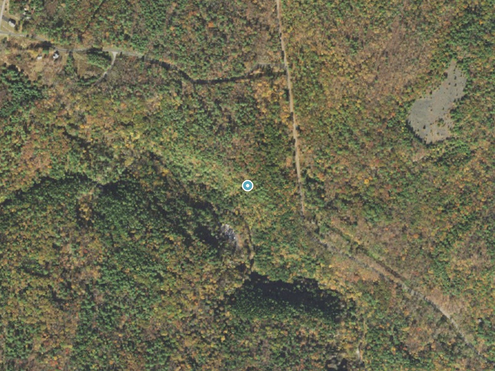
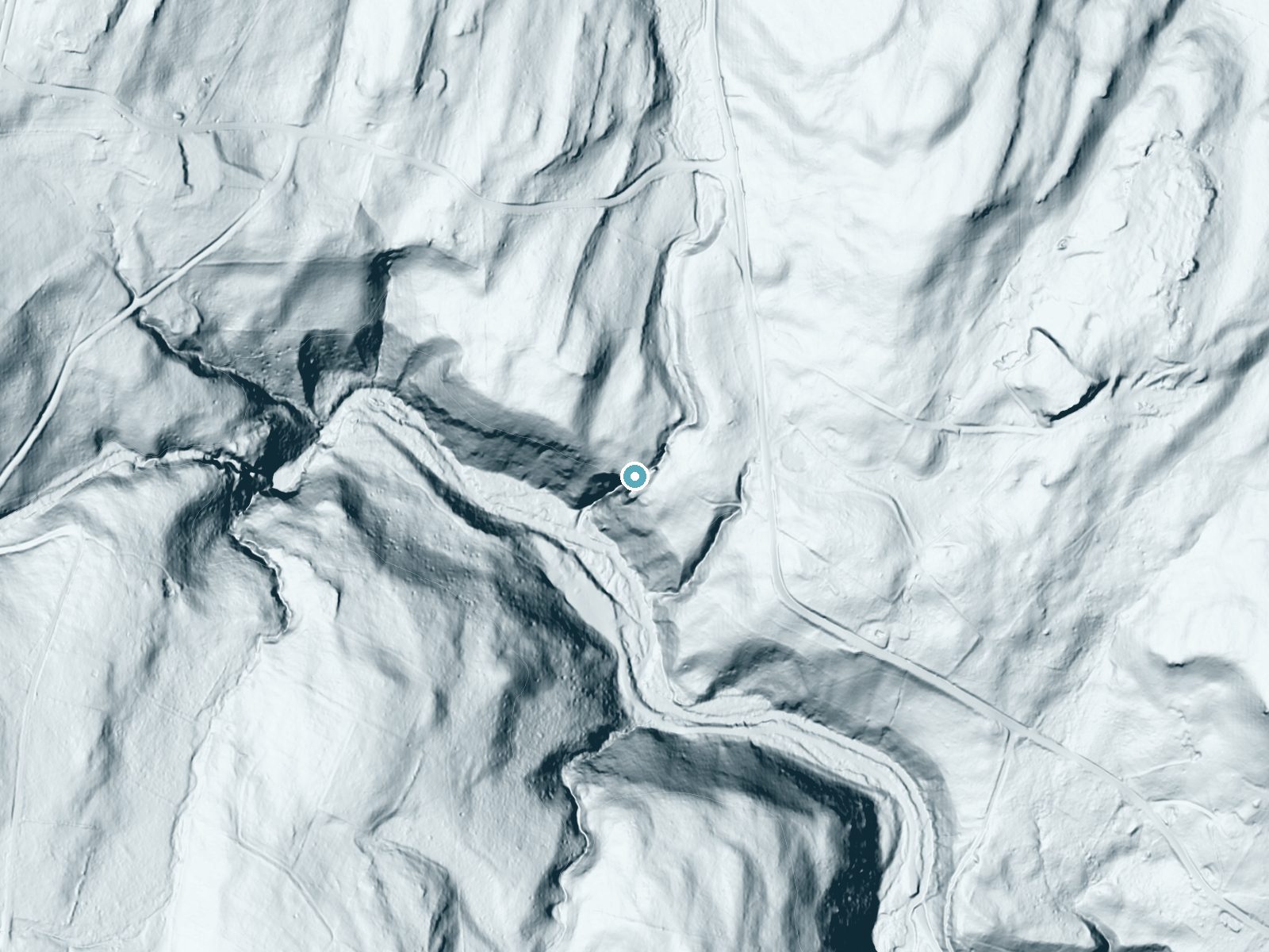
Drag to compare. The dot marks the waterfall. The frame is about a mile across.
- Ground elevation
- 658 feet
- Measured by 1-meter lidar
- Drop at the falls
- About 207 feet
- Change in ground height within ~250 feet of the falls
- Faces
- Southwest
- Sunlit most of the day. Go early or late for softer light.
A slice through the lidar ground surface, from above the falls to downstream (heading southwest).
Elevation data: USGS 3D Elevation Program. Aerial imagery: USGS The National Map. Public domain.
Location & Access
Getting There
Silverthread Falls is located near Dingmans Falls in the Delaware Water Gap National Recreation Area. It is accessible via the Dingmans Falls Visitor Center, which is located off Johnny Bee Road.
Get Directions on Google MapsParking
Parking is available at the Dingmans Falls Visitor Center. The parking area is paved and typically has ample space, though it can fill up during peak seasons.
Elevation
666 feet above sea level
Coordinates
41.230650° N, -74.886558° W
Land Management
Managed by NPS
Visitor Tips & Gear
Visit early in the morning or on weekdays to avoid crowds. Wear comfortable walking shoes, and bring a camera to capture the beauty of the falls. Be mindful of slippery surfaces near the viewing platform, especially after rain.
Where to Stay
Pocono Mountain Villas MOD Collection by Sonesta

Holiday Inn Express Hotel & Suites Newton Sparta by IHG
Serenity Falls - Stylish 4Bdr Mountain Retreat, Hot Tub, Pool
Lakeside, Dock, Hot Tub, Kayaks, Arcade, Playset
Browse vacation cabins and private rentals nearby
Unique outdoor stays — tents, yurts, and treehouses
Rent a campervan or RV for your waterfall road trip
Some links are affiliate links. We may earn a commission at no extra cost to you.
Nearby Campground
Alosa Campsites
11.2 miles away · 6 sites
Overview The Alosa Campsites are boat-in only sites located on the west (Pennsylvanian) shore of the Delaware River near Bushkill, Pennsylvania. The side of the river with the campsites will be on your right while traveling downstream. This section of the river offers unspoiled views, excellent boating, fishing, and birding opportunities within the Delaware Water Gap National Recreation Area and the Middle Delaware National Scenic and Recreational River. These reservation-only campsites are avail
Book on Recreation.govAdditional Information
Nearby Attractions
Dingmans Falls, which is located just a short walk from Silverthread Falls, is another must-see waterfall in the area. The Delaware Water Gap National Recreation Area also offers hiking, fishing, and scenic drives.
Wildlife
The area is home to a variety of wildlife, including deer, birds, and small mammals. Keep an eye out for native plants and wildflowers along the trail.
Cities near Silverthread Falls
Nearby Waterfalls
Writing about Silverthread Falls? Embed this waterfall on your site for free.