Shoal Creek Falls
By Armen Suny · Last verified Mar 2026
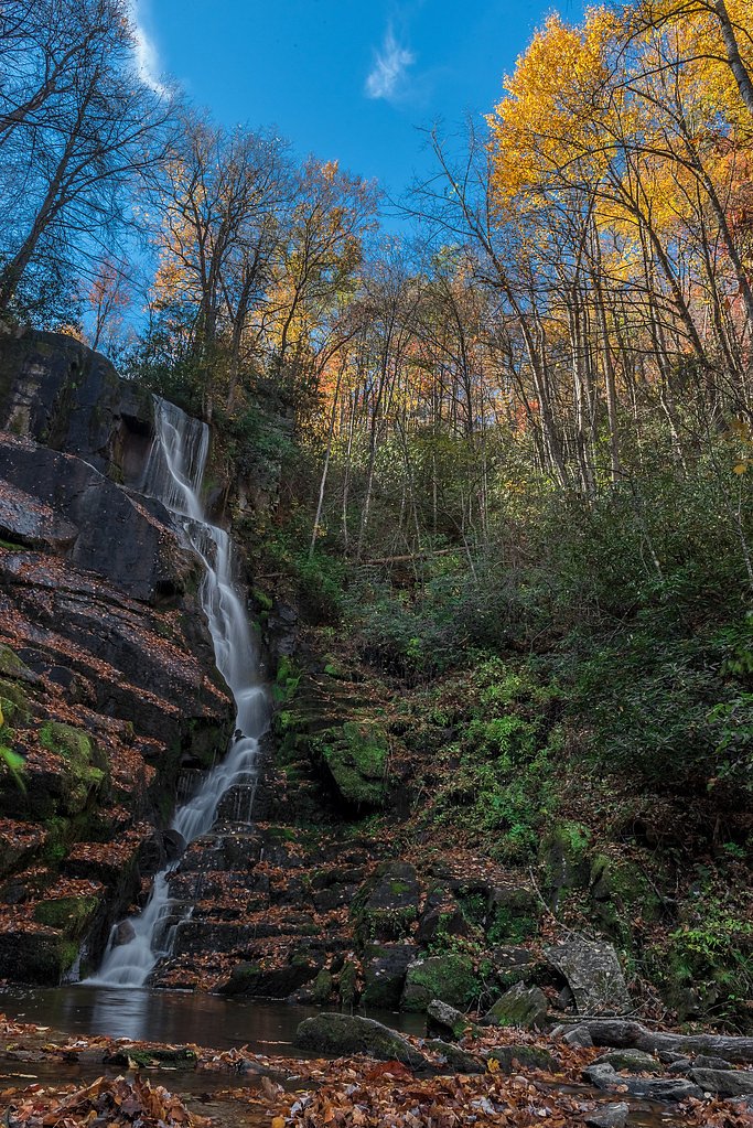
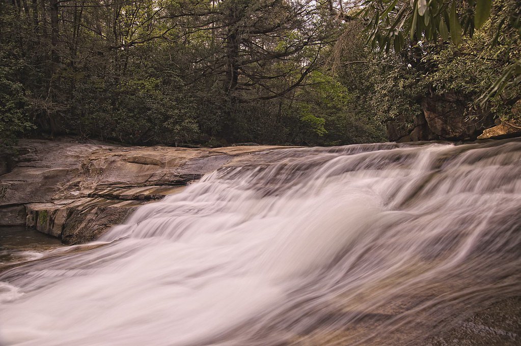
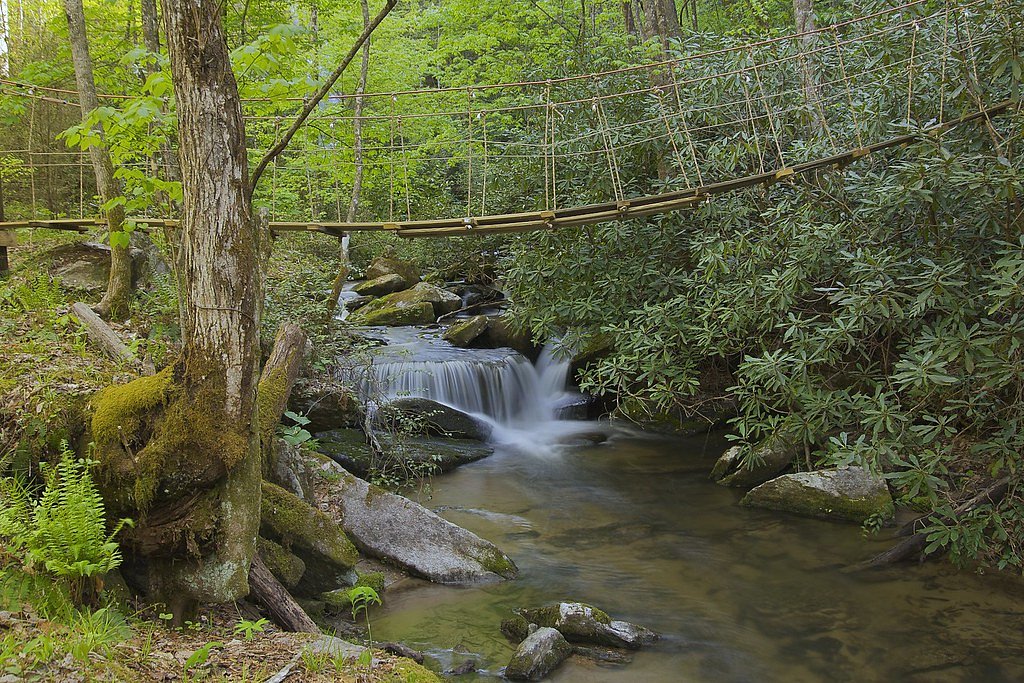
Photo Credits (4)
Difficulty
Moderate
Trail Length
2.4 miles
Trail Type
Out And Back
Elevation Gain
350 ft
About Shoal Creek Falls
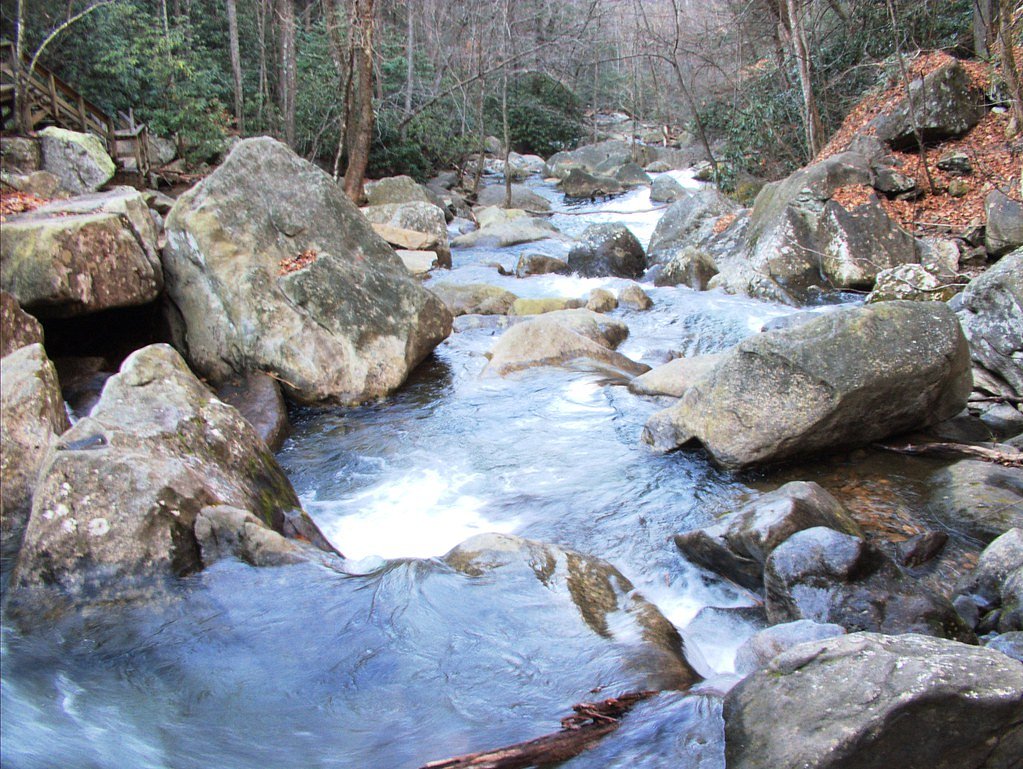
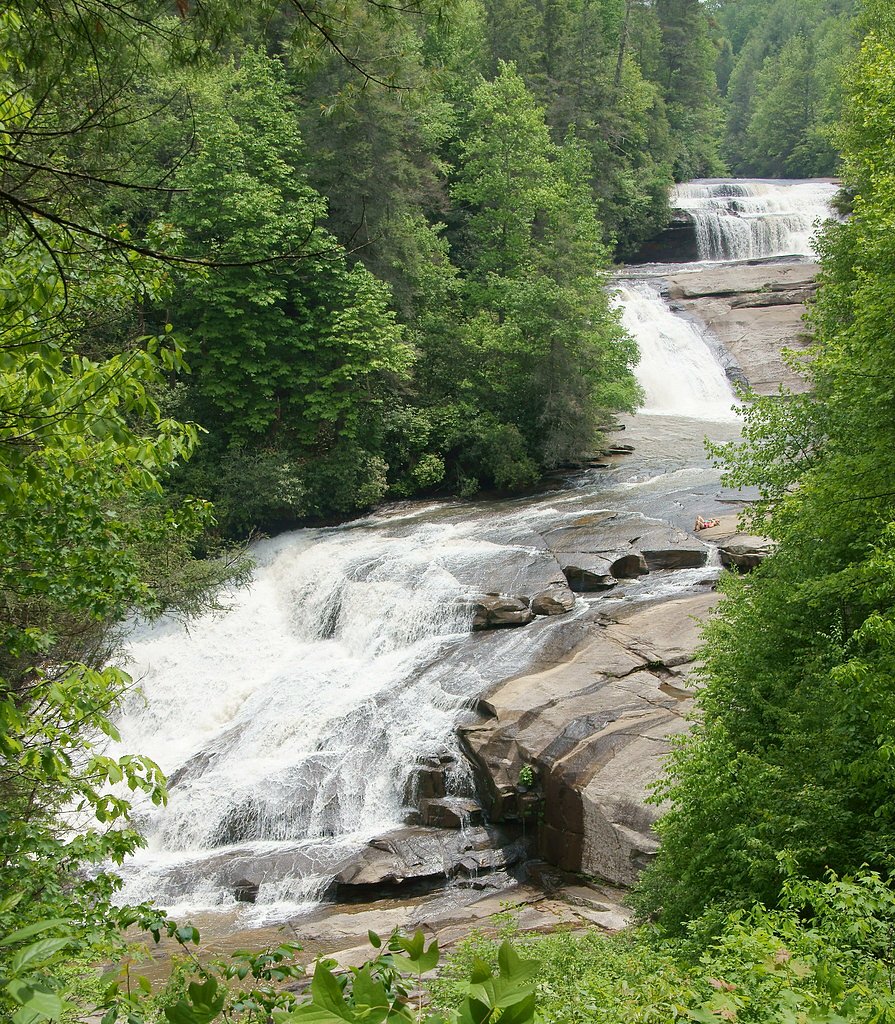
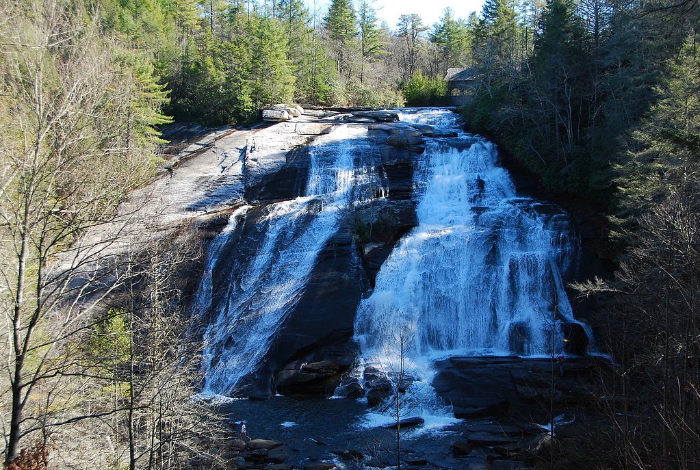
Shoal Creek Falls is a small, picturesque waterfall tucked into the forests of North Carolina, offering a peaceful stop for hikers and nature lovers. The falls are a quieter destination—perfect for photography or a tranquil break away from busier sites—and are reached via a moderate out-and-back hike of 2.4 miles that climbs roughly 350 feet. The trail’s moderate rating and manageable distance make Shoal Creek Falls a good choice for hikers looking for a short day outing with a bit of uphill. Expect a leafy, forested approach and the kind of solitude that comes from visiting a lesser-known cascade; bring sturdy shoes and plan for potentially muddy footing after rain.
The Setting
Shoal Creek Falls sits at 2,270 feet along the French Broad River, in the hills of North Carolina.
Nearby Falls Worth Visiting
Triple Falls (125 ft) lies 2.4 miles to the southwest. Also nearby: High Falls (125 ft, 2.7 mi) and Bridal Veil Falls (120 ft, 3.9 mi).
Trail & Hike Details
The Approach
The moderate 2.4-mile out-and-back trail gains 350 feet of elevation on the way to the falls.
Trail Description
The route to Shoal Creek Falls is a 2.4-mile out-and-back with about 350 feet of elevation gain and is rated moderate. The trail winds through forested terrain and may include uneven footing and muddy sections, especially after rain. The grade is generally steady rather than technical, making it accessible to most hikers with moderate fitness—allow extra time when the trail is wet or slippery.
What to Expect
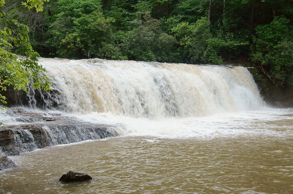
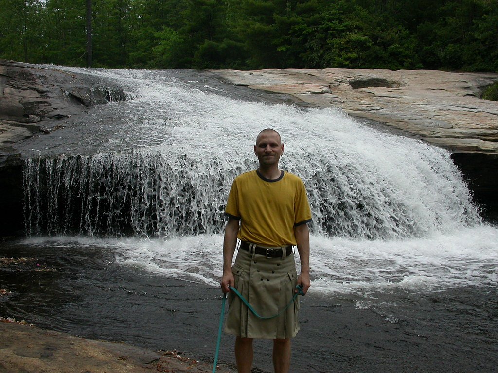
Visitors can expect a peaceful setting with a small waterfall cascading over rocks into a shallow pool. The area is surrounded by dense forest, providing a tranquil atmosphere.
Accessibility
The trail is not wheelchair accessible. Uneven terrain and elevation changes require steady footing.
Frequently Asked Questions
🐶 Are Dogs Allowed at Shoal Creek Falls?
❌ Dogs are not allowed
Are There Any Fees or Permits Required?
🆖 No fees required
🏊 Is There Swimming at Shoal Creek Falls?
❌ Swimming is not allowed
When to Visit
Spring and fall are ideal for visiting due to pleasant weather and vibrant foliage. Summer is also a good time, but the trail may be more crowded.
Seasonal Access
The best time to visit is Spring, Summer, and Fall. Winter access may be limited.
Safety Information
Visitors should be cautious of slippery rocks near the waterfall and avoid climbing on them. Check weather conditions before visiting, as the trail may become hazardous after heavy rain.
Current Water Conditions
347 ft³/s
Current discharge — how much water is flowing
Much lower than usual for this time of year
Based on 105 years of record
5.13 ft
Water depth at gauge
7-Day Discharge Trend
What does this mean for your visit?
Flow is well below normal for this time of year, so the waterfall may be a trickle.
About This Gauge
This gauge is on a nearby waterway and may not reflect exact conditions at the falls.
7-Day Flow Outlook
Based on the USGS gauge FRENCH BROAD RIVER AT BLANTYRE, NC (8 km away).
Today
Low
396 cfs
3/10Tomorrow
Moderate
414 cfs
4/10Wed
Moderate
402 cfs
4/10Thu
Moderate
408 cfs
4/10Fri
Moderate
394 cfs
4/10Sat
Moderate
378 cfs
4/10Sun
Moderate
377 cfs
4/10Best window: Tomorrow — moderate flow, sunny then slight chance showers and thunderstorms (trip score 4/10).
Best time of year: this gauge typically runs highest from mid February to late April, peaking in March.
How we calculate this
This is a transparent outlook, not a precise forecast. We take the waterfall's current flow strength (how it ranks against its historical normal for today, from the nearest USGS stream gauge), carry that ranking forward along the gauge's seasonal curve, and nudge it for forecast rain. Confidence is highest for the next day or two and falls further out. Always check official conditions and your own judgment before visiting — high flows can be dangerous.
Know when to go.
Get a free email alert when waterfalls near Etowah hit peak flow. We only send when conditions are worth the trip — no weekly newsletters, no spam.
Weather Forecast
Location & Access
Getting There
Shoal Creek Falls is located in a remote area of North Carolina. Access may require driving on unpaved roads, and visitors should use GPS coordinates or detailed maps to locate the trailhead.
Get Directions on Google MapsParking
Parking availability is limited and may consist of roadside pull-offs or small gravel lots near the trailhead.
Elevation
2,270 feet above sea level
Coordinates
35.229283° N, -82.595678° W
Visitor Tips & Gear
Wear sturdy shoes as the trail may be muddy or uneven. Bring insect repellent during warmer months, and consider visiting early in the day to avoid crowds.
As an Amazon Associate, we earn from qualifying purchases.
With 2.4 miles and 350 ft of elevation gain, sturdy boots and trekking poles will help on this moderate trail. Sun exposure on the trail makes good sun protection a must in summer.

Polarized Sunglasses (Knockaround)
Cuts glare off the water so you actually see the falls — and your photos turn out better too.

Columbia Watertight II Rain Jacket
Packs into its own pocket, seam-sealed, and keeps you dry from spray and surprise rain.

Earth Pak Waterproof Dry Bag
Keeps your phone and gear dry when waterfall mist soaks everything else.

Waterproof Phone Pouch (AiRunTech)
Cheap insurance — take photos right next to the falls without killing your phone.

Timberland Euro Sprint Mid Waterproof
Trusted waterproof boot with premium leather and grippy rubber sole — reliable on rocky, wet trails.

TrailBuddy Trekking Poles
Lightweight aluminum, cork grips, and flip-locks that actually hold — a best-seller for good reason.
Where to Stay

Comfort Inn & Suites Brevard North

Hampton Inn Brevard

Holiday Inn Express - Brevard by IHG

Oscar’s Hendo Retreat
Browse vacation cabins and private rentals nearby
Unique outdoor stays — tents, yurts, and treehouses
Rent a campervan or RV for your waterfall road trip
Some links are affiliate links. We may earn a commission at no extra cost to you.
Nearby Campground
SYCAMORE FLATS PICNIC SHELTER
7.2 miles away · 1 sites
Overview Sycamore Flats Picnic Shelter is located along the Davidson River on the Pisgah National Forest. This picnic area was named for the sycamore trees which line the banks of the river.The shelter is available on a first come, first served basis from mid-November to April 15th. Reservations are available April 16th through mid-November. Some amenities may not be available during the off-season. This is a popular destination with limited parking, please plan accordingly.Recreation Sycamore Fl
Book on Recreation.govNearby Hot Springs
Hot springs near Etowah, North Carolina

Looking for a soak after your hike? Explore more hot springs near Etowah, North Carolina on SoakingSprings.
Explore North Carolina springsAdditional Information
Nearby Attractions
Other waterfalls and hiking trails in the area may be worth exploring, but specific details are not widely documented.
Wildlife
The area is home to various bird species, small mammals, and insects. Visitors should be cautious of ticks and other pests.
Cities near Shoal Creek Falls
Nearby Waterfalls
Other waterfalls named Shoal Creek Falls
1 other waterfall shares this name across the U.S.
Writing about Shoal Creek Falls? Embed this waterfall on your site for free.